National Register of Historic Places listings in Franklin County, Maine

Last updated

Location of Franklin County in Maine Map of Maine highlighting Franklin County.svg
Location of Franklin County in Maine

This is a list of the National Register of Historic Places listings in Franklin County, Maine.

Contents

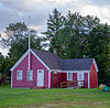
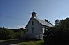
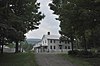
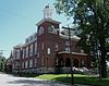
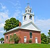
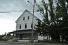
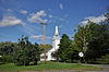
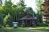
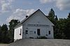
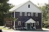
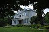
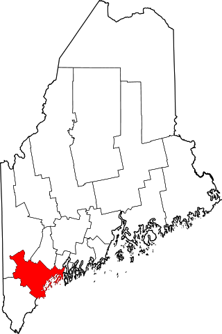
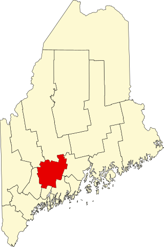
This is intended to be a complete list of the properties and districts on the National Register of Historic Places in Franklin County, Maine, United States. Latitude and longitude coordinates are provided for many National Register properties and districts; these locations may be seen together in a map. [1]

There are 47 properties and districts listed on the National Register in the county. Two properties were once listed, but have been removed.


    This National Park Service list is complete through NPS recent listings posted December 16, 2022. [2]

Map all coordinates using: OpenStreetMap  
Download coordinates as: KML
Contents: Counties in Maine  
Androscoggin - Aroostook - Cumberland - Franklin - Hancock - Kennebec - Knox - Lincoln - Oxford - Penobscot - Piscataquis - Sagadahoc - Somerset - Waldo - Washington - York

Current listings

[3] Name on the Register [4] ImageDate listed [5] Location City or townDescription
1 Arnold Trail to Quebec
Arnold Trail to Quebec EustisME ArnoldExpeditionMarker.jpg
Arnold Trail to Quebec
October 1, 1969
(#69000018)
Along the Kennebec River, through Wayman and Flagstaff lakes along the Dead River and Chain of Ponds to Quebec
44°40′49″N69°59′18″W / 44.6803°N 69.9883°W / 44.6803; -69.9883 (Arnold Trail to Quebec)
Coburn Gore Extends through Franklin, Kennebec, Sagadahoc, and Somerset counties
2 Barn on Lot 8, Range G
Barn on Lot 8, Range G Barn on Lot 8, Range G, Freeman Plantation, Maine.jpg
Barn on Lot 8, Range G
August 24, 2011
(#11000581)
816 Foster Hill Rd.
44°51′29″N70°13′20″W / 44.8581°N 70.2222°W / 44.8581; -70.2222 (Barn on Lot 8, Range G)
Freeman Township
3 Bass Boarding House
Bass Boarding House WiltonME BassBoardingHouse.jpg
Bass Boarding House
April 7, 1988
(#88000396)
Canal St.
44°35′12″N70°13′58″W / 44.5867°N 70.2328°W / 44.5867; -70.2328 (Bass Boarding House)
Wilton Now the Wilton Farm and Home Museum.
4 Ora Blanchard House
Ora Blanchard House StrattonME OraBlanchardHouse.jpg
Ora Blanchard House
January 15, 1980
(#80000215)
Main St.
45°08′32″N70°26′42″W / 45.1422°N 70.445°W / 45.1422; -70.445 (Ora Blanchard House)
Stratton
5 John G. Coburn Farm
John G. Coburn Farm CarthageME JohnGCoburnFarm.jpg
John G. Coburn Farm
April 11, 2002
(#02000347)
434 Carthage Road (Route 162), just north of the Webb River
44°37′36″N70°28′36″W / 44.6267°N 70.4767°W / 44.6267; -70.4767 (John G. Coburn Farm)
Carthage Mis-listed as "John G. Coburn", on River Road.
6 Coplin Plantation Schoolhouse
Coplin Plantation Schoolhouse CoplinME 1866Schoolhouse.jpg
Coplin Plantation Schoolhouse
September 11, 1997
(#97001132)
State Route 16 approximately 4.5 miles southwest of its junction with State Route 27
45°05′32″N70°29′55″W / 45.0922°N 70.4986°W / 45.0922; -70.4986 (Coplin Plantation Schoolhouse)
Coplin Plantation
7 Cutler Memorial Library
Cutler Memorial Library FarmingtonME CutlerMemorialLibrary.jpg
Cutler Memorial Library
November 2, 1973
(#73000104)
Academy and High Sts.
44°40′09″N70°08′55″W / 44.6692°N 70.1486°W / 44.6692; -70.1486 (Cutler Memorial Library)
Farmington
8 Farmington Historic District
Farmington Historic District Downtown Farmington 7.JPG
Farmington Historic District
January 20, 1995
(#94001551)
Roughly bounded by High, Academy, Anson, and Grove Sts.
44°40′14″N70°08′58″W / 44.6706°N 70.1494°W / 44.6706; -70.1494 (Farmington Historic District)
Farmington Boundary decrease (listed 4/27/2010)
9 First Congregational Church, United Church of Christ
First Congregational Church, United Church of Christ First Congregational UCC Church Farmington ME.jpg
First Congregational Church, United Church of Christ
July 25, 1974
(#74000149)
235 Main St.
44°40′04″N70°09′00″W / 44.6678°N 70.15°W / 44.6678; -70.15 (First Congregational Church, United Church of Christ)
Farmington
10 Franklin County Courthouse
Franklin County Courthouse Franklin-County-Courthouse.jpg
Franklin County Courthouse
October 6, 1983
(#83003641)
Main and Anson Sts.
44°40′17″N70°09′08″W / 44.6714°N 70.1522°W / 44.6714; -70.1522 (Franklin County Courthouse)
Farmington
11 Free Will Baptist Meetinghouse
Free Will Baptist Meetinghouse FarmingtonME FormerFreeWillBaptistChurch.jpg
Free Will Baptist Meetinghouse
August 28, 1973
(#73000264)
219 Main St.
44°40′08″N70°09′03″W / 44.6689°N 70.1508°W / 44.6689; -70.1508 (Free Will Baptist Meetinghouse)
Farmington Now a garage.
12 Goodspeed Memorial Library
Goodspeed Memorial Library WiltonME GoodspeedLibrary.jpg
Goodspeed Memorial Library
January 5, 1989
(#88003019)
104 Main St.
44°35′16″N70°13′51″W / 44.5878°N 70.2308°W / 44.5878; -70.2308 (Goodspeed Memorial Library)
Wilton
13 Greenacre
Greenacre FarmingtonME Greenacre.jpg
Greenacre
October 29, 1982
(#82000422)
17 Court St.
44°40′24″N70°08′53″W / 44.6733°N 70.1481°W / 44.6733; -70.1481 (Greenacre)
Farmington
14 Isabel and Chester Greenwood House
Isabel and Chester Greenwood House FarmingtonME ChesterGreenwoodHouse.jpg
Isabel and Chester Greenwood House
July 12, 1978
(#78000160)
112 Hill Street
44°39′39″N70°08′52″W / 44.6608°N 70.1478°W / 44.6608; -70.1478 (Isabel and Chester Greenwood House)
Farmington
15 The Herbert
The Herbert KingfieldME HerbertGrandHotel.jpg
The Herbert
March 26, 2018
(#100002226)
246 Main St.
44°57′31″N70°09′16″W / 44.9587°N 70.1545°W / 44.9587; -70.1545 (The Herbert)
Kingfield
16 Holmes-Crafts Homestead
Holmes-Crafts Homestead JayME HolmesCraftHomestead.jpg
Holmes-Crafts Homestead
April 26, 1973
(#73000105)
Old N. Jay Rd. on State Route 4
44°31′08″N70°13′28″W / 44.5189°N 70.2244°W / 44.5189; -70.2244 (Holmes-Crafts Homestead)
North Jay Owned by the local historical society.
17 Frank Hutchins House
Frank Hutchins House KingfieldME FrankHutchinsHouse.jpg
Frank Hutchins House
December 29, 1986
(#86003532)
High St.
44°57′27″N70°09′17″W / 44.9576°N 70.1546°W / 44.9576; -70.1546 (Frank Hutchins House)
Kingfield Home to the local historical society.
18 Jay-Niles Memorial Library
Jay-Niles Memorial Library JayME JayNilesMemorialLibrary.jpg
Jay-Niles Memorial Library
March 13, 1987
(#87000414)
State Route 4
44°32′53″N70°14′17″W / 44.5481°N 70.2381°W / 44.5481; -70.2381 (Jay-Niles Memorial Library)
North Jay
19 Little Red Schoolhouse
Little Red Schoolhouse Little Red Schoolhouse Farmington ME.jpg
Little Red Schoolhouse
February 23, 1972
(#72000070)
Franklin Agricultural Society Fairgrounds [6]
44°39′46″N70°08′23″W / 44.6627°N 70.1398°W / 44.6627; -70.1398 (Little Red Schoolhouse)
Farmington Originally on Wilton Road; moved to fairgrounds in 2007.
20 Madrid Village Schoolhouse
Madrid Village Schoolhouse MadridME VillageSchoolhouse.jpg
Madrid Village Schoolhouse
December 14, 1995
(#95001460)
Western side of Reeds Mills Rd., 0.05 miles north of its junction with State Route 4
44°51′53″N70°27′45″W / 44.8647°N 70.4625°W / 44.8647; -70.4625 (Madrid Village Schoolhouse)
Madrid
21 Maine Woods Office
Maine Woods Office PhillipsME CommunityHouse.jpg
Maine Woods Office
November 10, 1980
(#80000216)
Main St.
44°49′27″N70°20′55″W / 44.824167°N 70.348611°W / 44.824167; -70.348611 (Maine Woods Office)
Phillips Now the Phillips Community House.
22 McCleary Farm
McCleary Farm StrongME McClearyFarm.jpg
McCleary Farm
April 7, 1989
(#89000253)
S. Strong Rd.
44°45′50″N70°12′34″W / 44.763889°N 70.209444°W / 44.763889; -70.209444 (McCleary Farm)
Strong
23 Merrill Hall
Merrill Hall Merrill Hall Farmington.jpg
Merrill Hall
January 23, 1980
(#80000217)
Maine and Academy Sts.
44°40′09″N70°08′58″W / 44.669167°N 70.149444°W / 44.669167; -70.149444 (Merrill Hall)
Farmington
24 Morrill Homestead April 12, 2022
(#100007580)
17 Lucy Knowles Rd.
44°37′08″N70°04′33″W / 44.6190°N 70.0758°W / 44.6190; -70.0758 (Morrill Homestead)
Chesterville
25 New Sharon Congregational Church
New Sharon Congregational Church New Sharon Congregational Church.jpg
New Sharon Congregational Church
June 20, 1985
(#85001261)
State Route 134
44°38′10″N70°00′50″W / 44.636111°N 70.013889°W / 44.636111; -70.013889 (New Sharon Congregational Church)
New Sharon
26 Nordica Homestead
Nordica Homestead FarmingtonME NordicaHomestead.jpg
Nordica Homestead
December 23, 1969
(#69000006)
North of Farmington on Holly Rd. off State Route 27
44°41′42″N70°08′43″W / 44.695°N 70.145278°W / 44.695; -70.145278 (Nordica Homestead)
Farmington Now a museum.
27 North Jay Grange Store
North Jay Grange Store JayME NorthJayGrangeStore.jpg
North Jay Grange Store
October 23, 1974
(#74000150)
State Route 17
44°33′15″N70°14′09″W / 44.554167°N 70.235833°W / 44.554167; -70.235833 (North Jay Grange Store)
North Jay
28 William F. Norton House
William F. Norton House KingfieldME WilliamFNortonHouse.jpg
William F. Norton House
July 8, 1982
(#82000741)
1 Stanley Ave.
44°57′39″N70°09′06″W / 44.960833°N 70.151667°W / 44.960833; -70.151667 (William F. Norton House)
Kingfield
29 Old Union Meetinghouse
Old Union Meetinghouse FarmingtonME OldUnionMeetinghouse.jpg
Old Union Meetinghouse
October 30, 1973
(#73000106)
U.S. Route 2
44°37′26″N70°04′40″W / 44.623889°N 70.077778°W / 44.623889; -70.077778 (Old Union Meetinghouse)
Farmington
30 Oquossoc Log Church
Oquossoc Log Church RangeleyME OquossocLogChurch.jpg
Oquossoc Log Church
July 19, 1984
(#84001368)
State Route 4
44°58′00″N70°46′14″W / 44.966667°N 70.770556°W / 44.966667; -70.770556 (Oquossoc Log Church)
Rangeley
31 Orgone Energy Observatory
Orgone Energy Observatory Reich Museum.jpg
Orgone Energy Observatory
January 29, 1999
(#98001602)
Western side of Dodge Pond Rd., 0.65 miles north of the junction of State Routes 4/16
44°58′54″N70°43′05″W / 44.981667°N 70.718056°W / 44.981667; -70.718056 (Orgone Energy Observatory)
Rangeley Now the William/Wilhelm Reich Museum.
32 Phillips High School March 23, 2021
(#100006335)
96 Main St.
44°49′27″N70°20′39″W / 44.8243°N 70.3443°W / 44.8243; -70.3443 (Phillips High School)
Phillips
33 Porter-Bell-Brackley Estate
Porter-Bell-Brackley Estate StrongME PorterBellBrackleyEstate.jpg
Porter-Bell-Brackley Estate
November 10, 1980
(#80000218)
Lower Main St.
44°48′16″N70°13′14″W / 44.804444°N 70.220556°W / 44.804444; -70.220556 (Porter-Bell-Brackley Estate)
Strong
34 Hiram Ramsdell House
Hiram Ramsdell House Hiram Ramsdell House.jpg
Hiram Ramsdell House
December 4, 1973
(#73000107)
High and Perham Sts.
44°40′17″N70°08′59″W / 44.671389°N 70.149722°W / 44.671389; -70.149722 (Hiram Ramsdell House)
Farmington
35 Rangeley Tavern
Rangeley Tavern RangeleyME RangeleyInn.jpg
Rangeley Tavern
March 22, 2018
(#100002227)
2443 Main St.
44°57′49″N70°38′27″W / 44.963606°N 70.640832°W / 44.963606; -70.640832 (Rangeley Tavern)
Rangeley
36 Rangeley Trust Company Building
Rangeley Trust Company Building RangeleyME TrustCompany.jpg
Rangeley Trust Company Building
July 13, 1989
(#89000846)
Main St.
44°57′50″N70°38′32″W / 44.963889°N 70.642222°W / 44.963889; -70.642222 (Rangeley Trust Company Building)
Rangeley Now the local historical society museum.
37 Rangeley Public Library
Rangeley Public Library RangeleyME PublicLibrary.jpg
Rangeley Public Library
July 12, 1978
(#78000161)
Lake St.
44°57′53″N70°38′38″W / 44.964722°N 70.643889°W / 44.964722; -70.643889 (Rangeley Public Library)
Rangeley
38 Salem Town House (Former)
Salem Town House (Former) SalemME FormerSalemTownHouse.jpg
Salem Town House (Former)
August 5, 2005
(#05000795)
State Route 142
44°54′05″N70°16′35″W / 44.901389°N 70.276389°W / 44.901389; -70.276389 (Salem Town House (Former))
Salem
39 Temple Intervale School
Temple Intervale School Temple Historical Society.jpg
Temple Intervale School
February 8, 1985
(#85000240)
Temple Intervale
44°41′54″N70°14′45″W / 44.698333°N 70.245833°W / 44.698333; -70.245833 (Temple Intervale School)
Temple
40 Thompson's Bridge
Thompson's Bridge IndustryME ThompsonsBridge 1.jpg
Thompson's Bridge
March 22, 1991
(#91000321)
Over Thompson's Creek off the northern side of State Route 43 at the Franklin-Somerset county line
44°43′36″N70°00′25″W / 44.726667°N 70.006944°W / 44.726667; -70.006944 (Thompson's Bridge)
Allen's Mills
41 Tufts House
Tufts House FarmingtonME TuftsHouse.jpg
Tufts House
May 8, 1979
(#79000130)
Southeast of Farmington on U.S. Route 2
44°38′10″N70°05′35″W / 44.636111°N 70.093056°W / 44.636111; -70.093056 (Tufts House)
Farmington
42 Union Church
Union Church Phillips ME Union Church.jpg
Union Church
July 13, 1989
(#89000844)
Main and Pleasant Sts.
44°49′24″N70°20′23″W / 44.823333°N 70.339722°W / 44.823333; -70.339722 (Union Church)
Phillips
43 Upper Dallas School
Upper Dallas School DallasME UpperDallasSchool.jpg
Upper Dallas School
February 9, 1990
(#89002345)
Saddleback Rd.
44°57′55″N70°36′08″W / 44.965278°N 70.602222°W / 44.965278; -70.602222 (Upper Dallas School)
Dallas Plantation
44 U.S. Inspection Station-Coburn Gore, Maine
U.S. Inspection Station-Coburn Gore, Maine US border station at Coburn Gore 1932.jpg
U.S. Inspection Station-Coburn Gore, Maine
September 10, 2014
(#14000558)
ME 27
45°22′43″N70°48′25″W / 45.3785°N 70.8070°W / 45.3785; -70.8070 (U.S. Inspection Station-Coburn Gore, Maine)
Coburn Gore
45 Weld Town Hall
Weld Town Hall Weld Town Hall.jpg
Weld Town Hall
June 27, 2007
(#07000597)
17 School St.
44°41′51″N70°25′12″W / 44.6975°N 70.42°W / 44.6975; -70.42 (Weld Town Hall)
Weld
46 Capt. Joel Whitney House
Capt. Joel Whitney House PhillipsME HistoricalSociety.jpg
Capt. Joel Whitney House
April 22, 2003
(#03000293)
8 Pleasant St.
44°49′22″N70°20′24″W / 44.822778°N 70.34°W / 44.822778; -70.34 (Capt. Joel Whitney House)
Phillips Home to the Phillips Historical Society.
47 Amos G. Winter House
Amos G. Winter House KingfieldME AmosGWinterHouse.jpg
Amos G. Winter House
May 3, 1976
(#76000191)
Winter's Hill off State Route 27
44°57′33″N70°09′37″W / 44.959167°N 70.160278°W / 44.959167; -70.160278 (Amos G. Winter House)
Kingfield

Former listings

[3] Name on the RegisterImageDate listedDate removedLocationCity or townDescription
1 Jacob Abbott House
Jacob Abbott House Jacob Abbott House, Farmington, ME.jpg
Jacob Abbott House
November 26, 1973
(#73000103)
April 27, 2010 State Route 27
44°39′56″N70°08′52″W / 44.6656°N 70.1478°W / 44.6656; -70.1478 (Jacob Abbott House)
Farmington
2 New Sharon Bridge
New Sharon Bridge New Sharon Bridge.jpg
New Sharon Bridge
September 24, 1999
(#99001189)
July 14, 2015South of U.S. Route 2 over the Sandy River
44°38′16″N70°00′56″W / 44.637778°N 70.015556°W / 44.637778; -70.015556 (New Sharon Bridge)
New Sharon Demolished on February 27, 2014. [7]

See also

Related Research Articles

<span class="mw-page-title-main">National Register of Historic Places listings in Franklin County, Massachusetts</span>

This is a list of the National Register of Historic Places listings in Franklin County, Massachusetts.

<span class="mw-page-title-main">National Register of Historic Places listings in Cumberland County, Maine</span>

This is a list of the National Register of Historic Places listings in Cumberland County, Maine.

<span class="mw-page-title-main">National Register of Historic Places listings in Franklin County, Pennsylvania</span>

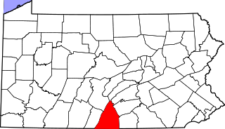
This is a list of the National Register of Historic Places listings in Franklin County, Pennsylvania.

<span class="mw-page-title-main">National Register of Historic Places listings in Franklin County, Florida</span>

This is a list of the National Register of Historic Places listings in Franklin County, Florida.

<span class="mw-page-title-main">National Register of Historic Places listings in Isle of Wight County, Virginia</span>

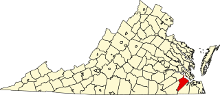
This is a list of the National Register of Historic Places listings in Isle of Wight County, Virginia.

<span class="mw-page-title-main">National Register of Historic Places listings in Franklin County, Iowa</span>

This is a list of the National Register of Historic Places listings in Franklin County, Iowa.

<span class="mw-page-title-main">National Register of Historic Places listings in Waldo County, Maine</span>

This is a list of the National Register of Historic Places listings in Waldo County, Maine.

<span class="mw-page-title-main">National Register of Historic Places listings in Kennebec County, Maine</span>

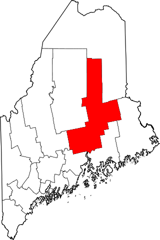
This is a list of the National Register of Historic Places listings in Kennebec County, Maine.

<span class="mw-page-title-main">National Register of Historic Places listings in Piscataquis County, Maine</span>

This is a list of the National Register of Historic Places listings in Piscataquis County, Maine.

<span class="mw-page-title-main">National Register of Historic Places listings in Sagadahoc County, Maine</span>

This is a list of the National Register of Historic Places listings in Sagadahoc County, Maine.

<span class="mw-page-title-main">National Register of Historic Places listings in Oxford County, Maine</span>

This is a list of the National Register of Historic Places listings in Oxford County, Maine.

<span class="mw-page-title-main">National Register of Historic Places listings in Somerset County, Maine</span>

This is a list of the National Register of Historic Places listings in Somerset County, Maine.

<span class="mw-page-title-main">National Register of Historic Places listings in Knox County, Maine</span>

This is a list of the National Register of Historic Places listings in Knox County, Maine.

<span class="mw-page-title-main">National Register of Historic Places listings in Lincoln County, Maine</span>

This is a list of the National Register of Historic Places listings in Lincoln County, Maine.

<span class="mw-page-title-main">National Register of Historic Places listings in Penobscot County, Maine</span>

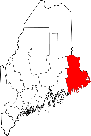
This is a list of properties on the National Register of Historic Places in Penobscot County, Maine.

<span class="mw-page-title-main">National Register of Historic Places listings in Washington County, Maine</span>

This is a list of the National Register of Historic Places listings in Washington County, Maine.

<span class="mw-page-title-main">National Register of Historic Places listings in Franklin County, Idaho</span>

This is a list of the National Register of Historic Places listings in Franklin County, Idaho.

<span class="mw-page-title-main">National Register of Historic Places listings in Franklin County, North Carolina</span>

This list includes properties and districts listed on the National Register of Historic Places in Franklin County, North Carolina. Click the "Map of all coordinates" link to the right to view an online map of all properties and districts with latitude and longitude coordinates in the table below.

<span class="mw-page-title-main">National Register of Historic Places listings in Franklin County, Indiana</span>

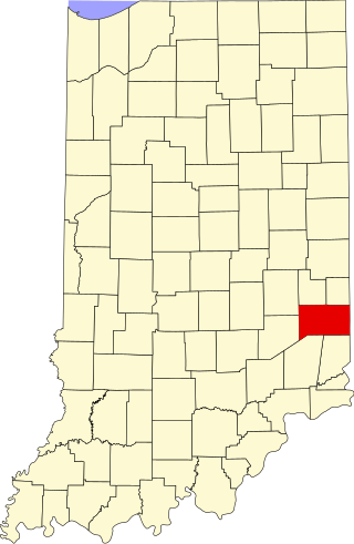
This is a list of the National Register of Historic Places listings in Franklin County, Indiana.

<span class="mw-page-title-main">National Register of Historic Places listings in Franklin County, Missouri</span>

This is a list of the National Register of Historic Places listings in Franklin County, Missouri.

References

  1. The latitude and longitude information provided in this table was derived originally from the National Register Information System, which has been found to be fairly accurate for about 99% of listings. Some locations in this table may have been corrected to current GPS standards.
  2. National Park Service, United States Department of the Interior, "National Register of Historic Places: Weekly List Actions", retrieved December 16, 2022.
  3. 1 2 Numbers represent an alphabetical ordering by significant words. Various colorings, defined here, differentiate National Historic Landmarks and historic districts from other NRHP buildings, structures, sites or objects.
  4. "National Register Information System". National Register of Historic Places . National Park Service. April 24, 2008.
  5. The eight-digit number below each date is the number assigned to each location in the National Register Information System database, which can be viewed by clicking the number.
  6. "Farmington: Franklin County's Shiretown - Education".
  7. "New Sharon Bridge comes down with dynamite and jackhammer". Sun Journal (Lewiston, Maine) . February 28, 2014. p. B 2. Retrieved July 6, 2022 via Newspapers.com.