
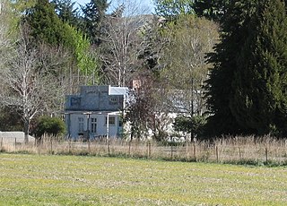
Tapanui is a small town in West Otago in New Zealand's South Island, close to the boundary with Southland region. A forestry town, it lies between the foot of the Blue Mountains and the Pomahaka River. Deer stalking and trout fishing are popular pastimes of the area. For almost a hundred years, the town was serviced by the Tapanui Branch railway line, which despite its name never actually terminated in Tapanui. This line was formally opened in late 1880 and closed after being damaged by severe flooding in the region in October 1978. State Highway 90, which links State Highway 1 at McNab, near Gore, to State Highway 8 at Raes Junction, passes through Tapanui. The town is home to Blue Mountain College, which takes students up to year 13.
West Otago is the local name given to part of the region of Otago, New Zealand, lying close to the border with Southland. It is administratively connected to South Otago, but is geographically separated from it by a range of hills known as the Blue Mountains. The largest settlements in West Otago are Tapanui and Heriot, and other localities within the area include Moa Flat, Edievale, Merino Downs, and Waikoikoi. The area described as West Otago is sometimes extended to include Lawrence and Beaumont. The ghost town of Kelso also lies within West Otago. Other notable features of the area include Conical Hill and Landslip Hill, the latter being a major fossil-bearing formation.

Lumsden is a town in Southland, New Zealand. Lying in a gap in the surrounding hills, it is the location of a major junction halfway along the north-south road from Queenstown to Invercargill, where it is crossed by the east-west road from Gore to Te Anau. The town had a population of 405 at the 2013 census.
The Waikaka Branch was a branch line railway of the Main South Line that ran through agricultural and gold-mining country in Southland, New Zealand. It was constructed in 1907 and 1908, and was operated by the New Zealand Railways Department until its closure in 1962.
The Tapanui Branch was a railway line located near the border of the regions of Southland and Otago, New Zealand. Although the name suggests that it terminated in Tapanui, its furthest terminus was actually in Edievale. Construction of the line began in 1878 with the first section opened in 1880, and it operated until 1978, when it was destroyed by flooding from the Pomahaka River.
Balfour is a small town located in the Southland region of New Zealand. According to the 2001 New Zealand census, it has a usually resident population of 135, unchanged from the previous census in 1996.
Otago was a New Zealand parliamentary electorate first created for the 1978 election, which was replaced by the Waitaki electorate and Clutha-Southland electorates for the 2008 election. Its last representative was Jacqui Dean of the National Party.
Landslip Hill is located on the boundary of Southland and Otago, in the South Island of New Zealand, between Tapanui and Pukerau. It is a debris flow feature associated with the Manuherikia Group of fluvial quartz sandstones. Geologists have described the fossil-bearing rocks as forming part of a sequence of "siliclastic fluvial deltaic sands, conglomerates and silty clays".

State Highway 8 is one of New Zealand's eight national highways. It forms an anticlockwise loop through the southern scenic regions of the Mackenzie Basin and Central Otago, starting and terminating in junctions with State Highway 1. Distances are measured from north to south.
State Highway 93 is a New Zealand State Highway connecting the Southland township of Mataura with the Western Otago town of Clinton. This provides a slightly quicker route between the cities of Dunedin and Invercargill, as it bypasses the town of Gore. It is roughly 43.2 km long.
Heriot is a small settlement in West Otago, in the South Island of New Zealand. It is located 20 kilometres southwest of Raes Junction and 15 kilometres north of Tapanui.
Riversdale is a small town in the Southland region of New Zealand. The population of Riversdale in the 2006 Census was 393, an increase of 30 people, or 8.3%, since the 2001 Census.

State Highway 87 is a state highway in New Zealand servicing the Taieri Plains and the Strath-Taieri Valley in Otago, connecting Mosgiel to Kyeburn on the eastern flank of the Maniototo Plains.
Parawa is a locality in Southland, New Zealand, on State Highway 6, 5 km SW of Athol and immediately north of Mid Dome mountain. Its name is a corruption of Paiherewao, what Maori called the mountain. In the 19th century, several versions of the name were used, including Parrawa and Parrowa.

Eyre Creek is a locality in Southland, New Zealand, situated to the north-east of the Five Rivers Plain. It lies on State Highway 6, 18 km north of Lumsden. On its northern side is the Jollies Hill Pass, commonly known as the Jollies, which skirts the western flank of the Mid Dome.
Christina McDonald was a New Zealand nurse. She served with the Royal New Zealand Navy in World War II and was Director of Nursing Services for the New Zealand Army, Navy and Air Force from 1958 to 1964.


