
Paihia is the main tourist town in the Bay of Islands in the far north of the North Island of New Zealand. It is 60 kilometres north of Whangarei, located close to the historic towns of Russell and Kerikeri. Missionary Henry Williams named the mission station Marsden's Vale and eventually the Paihia became the accepted name of the settlement.

State Highway 6 is a major New Zealand state highway. It extends from the northeastern corner of the South Island across the top of the island, then down the length of the island, initially along the West Coast and then across the Southern Alps through inland Otago and finally across the Southland Plains to the island's south coast. Distances are measured from north to south.

State Highway 2 runs north–south through eastern parts of the North Island of New Zealand from the outskirts of Auckland to Wellington. It runs via Tauranga in the Bay of Plenty, Gisborne, and Napier and Hastings in Hawke's Bay. It is the second-longest highway in the North Island, after State Highway 1, which runs the length of both of the country's main islands.
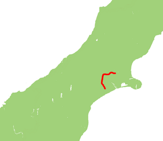
Taumarere is a locality in the Bay of Islands in Northland, New Zealand. State Highway 11 runs through the area. The Kawakawa River runs through Taumarere into the Bay of Islands. The town of Kawakawa is 3 km to the southwest. Paihia is 14 km to the north.
State Highway 21 (SH 21) is a short 6.7 kilometre stretch of highway in the North Island of New Zealand. It links State Highway 1, Waikato Expressway at Tamahere and State Highway 3 at Ohaupo. Its main destination is Hamilton Airport and Mystery Creek, where the National Agricultural Fieldays are held.
State Highway 77 is a state highway in New Zealand going through the inland parts of Central and Mid Canterbury between the towns of Ashburton and Darfield via the Rakaia Gorge. It is wholly single carriageway with two one-lane bridges at the Rakaia and Selwyn Rivers. One set of traffic lights is found in Ashburton marking the southern terminus of the highway.
State Highway 84 (SH 84) is a South Island state highway in New Zealand. It connects the holiday resort town of Wanaka to State Highway 6, the main north-south highway servicing the western part of the South Island.

State Highway 57 is a New Zealand state highway, linking State Highway 1 north of Ohau to State Highway 3 east of Ashhurst, via Levin, Shannon, Massey University and the southern suburbs of Palmerston North. The highway connects State Highway 1 traffic coming north from Wellington to the city of Palmerston North, and further to the Manawatu Gorge, allowing passage to the eastern side of the North Island and to the twin cities of Napier and Hastings. The highway is classified by the NZTA as a national strategic road.

State Highway 60 is a state highway servicing the far northwest of the South Island of New Zealand. Running between the settlements of Richmond and Collingwood, it is 116 kilometres (72 mi) long and lies entirely within the Tasman District. It is the northernmost highway in the South Island and is a popular tourist route, servicing Motueka, Abel Tasman National Park, Golden Bay, and Farewell Spit.
State Highway 28 (SH 28) is a New Zealand state highway in the Waikato region. The highway was gazetted in 1997 as a faster route for traffic travelling between SH 1 and SH 29 towards the Port of Tauranga. Prior to the formation of SH 28 the quickest route, only if using state highways, was via Tirau and SH 27. There are no towns on this route and due to the highway being mapped to existing rural roads there are several places were motorists need to give way to traffic from other roads.
State Highway 35 (SH 35) is a New Zealand state highway on the East Coast of the North Island. It is the main highway that services the East Cape of New Zealand as well as many other rural towns such as Hicks Bay, Ruatoria, Tolaga Bay, and the city of Gisborne.
State Highway 25 is a North Island state highway in New Zealand that loops around the Coromandel Peninsula. It is a major route for holidaymakers and tourists which has access to some of New Zealand's most idyllic beach holiday spots. The summer period around Christmas and New Year's Eve is a particularly busy period for the highway. The road is very scenic, but also windy in many parts as well as single carriage on the entire route, and is prone to accidents. It is New Zealand's third longest two-digit state highway, after SH 35 and SH 94. It is part of the Pacific Coast Highway.
State Highway 39 (SH 39) is a New Zealand state highway that forms a western bypass of the city of Hamilton. Gazetted in 1999, it is a generally quicker route to get between Auckland and New Plymouth as well as connecting to the Waitomo Caves, just south of the SH 39 southern terminus. The southernmost 14 km section has a concurrency with SH 31, as this highway has existed for much longer.
State Highway 47 (SH 47) is a New Zealand state highway in the central North Island. It provides a link from SH 4 at National Park to SH 41 at Tokaanu just west of Turangi.
State Highway 24 (SH 24) is a New Zealand state highway in the Waikato region. The highway was gazetted in 1997 and forms a short cut between the Piako District and SH 29 towards the Port of Tauranga.
State Highway 15 (SH 15) is a New Zealand state highway in the Northland region of the North Island. It is 126.5 km long and provides an alternative route to SH 1 between the Kaikohe and Whangarei areas; a spur also links SH 1 with the Marsden Point Oil Refinery and Northport.
State Highway 36 (SH 36) is a New Zealand state highway in the Bay of Plenty region in the North Island. It is one of two state highways that form a north-south connection between the cities of Tauranga and Rotorua, SH 36 being the most westerly of the two. It was identified as a quicker route to access the two cities and extensive work was done to upgrade the rural route to state highway quality.
State Highway 46 (SH 46) is a New Zealand state highway in the central North Island.


