
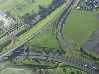
Texas State Highway 130 (SH 130), also known as the Pickle Parkway, is a highway from Interstate 35 (I-35) in San Antonio along I-410 and I-10 to east of Seguin, then north as tollway from there to I-35 north of Georgetown. SH 130 runs in a 91-mile (146 km) corridor east and south of Austin. The route parallels I-35 and is intended to relieve the Interstate's traffic volume through the San Antonio–Austin corridor by serving as an alternate route.
State Highway 20, also known as the Southwestern Motorway, is a New Zealand state highway linking State Highway 1 at Manukau City Centre with State Highway 16 in Point Chevalier, via Mangere and Onehunga. Along with its spurs, State Highway 20A and 20B, the state highway serves Auckland Airport, the country's largest, therefore making State Highway 20 a key arterial route connecting the airport to the wider Auckland region and most of the upper North Island. The route also forms the southern part of the Western Ring Route, a 48 kilometres (30 mi) motorway route bypassing central Auckland. It is the only New Zealand State Highway that is entirely motorway.

The Southern Scenic Route is a tourist highway in New Zealand linking Queenstown, Fiordland, Te Anau and the iconic Milford Road to Dunedin via, Riverton, Invercargill and The Catlins. An Australian travel magazine labelled it "one of the world's great undiscovered drives" in 2008.
State Highway 44 (SH 44) is a New Zealand state highway. At 5.2 km it is one of the shortest highways on the network. Its entire length is within the New Plymouth city area.
State Highway 73 is a major east-west South Island state highway in New Zealand connecting Christchurch on the east coast with Cass/Hokitika via the Southern Alps. It is mostly two lane, with some single-lane bridges north of Springfield but is mostly dual carriageway in Christchurch. The fourth and fifth-highest points of New Zealand's state highway network are on this road at Porters Pass and Arthur's Pass respectively.
State Highway 74 is a state highway in New Zealand servicing the eastern suburbs of Christchurch. Mostly two-lane, it is composed of limited-access expressways, with part of the highway as the Christchurch-Lyttelton Motorway, and connects the city to its port town of Lyttelton.
State Highway 77 is a state highway in New Zealand going through the inland parts of Central and Mid Canterbury between the towns of Ashburton and Darfield via the Rakaia Gorge. It is wholly single carriageway with two one-lane bridges at the Rakaia and Selwyn Rivers. One set of traffic lights is found in Ashburton marking the southern terminus of the highway.

State Highway 57 is a New Zealand state highway, linking State Highway 1 north of Ohau to State Highway 3 east of Ashhurst, via Levin, Shannon, Massey University and the southern suburbs of Palmerston North. The highway connects State Highway 1 traffic coming north from Wellington to the city of Palmerston North, and further to the Manawatu Gorge, allowing passage to the eastern side of the North Island and to the twin cities of Napier and Hastings. The highway is classified by the NZTA as a national strategic road.
State Highway 35 (SH 35) is a New Zealand state highway on the East Coast of the North Island. It is the main highway that services the East Cape of New Zealand as well as many other rural towns such as Hicks Bay, Ruatoria, Tolaga Bay, and the city of Gisborne.
State Highway 25 is a North Island state highway in New Zealand that loops around the Coromandel Peninsula. It is a major route for holidaymakers and tourists which has access to some of New Zealand's most idyllic beach holiday spots. The summer period around Christmas and New Year's Eve is a particularly busy period for the highway. The road is very scenic, but also windy in many parts as well as single carriage on the entire route, and is prone to accidents. It is New Zealand's third longest two-digit state highway, after SH 35 and SH 94. It is part of the Pacific Coast Highway.
State Highway 39 (SH 39) is a New Zealand state highway that forms a western bypass of the city of Hamilton. Gazetted in 1999, it is a generally quicker route to get between Auckland and New Plymouth as well as connecting to the Waitomo Caves, just south of the SH 39 southern terminus. The southernmost 14 km section has a concurrency with SH 31, as this highway has existed for much longer.
State Highway 24 (SH 24) is a New Zealand state highway in the Waikato region. The highway was gazetted in 1997 and forms a short cut between the Piako District and SH 29 towards the Port of Tauranga.
State Highway 15 (SH 15) is a New Zealand state highway in the Northland region of the North Island. It is 126.5 km long and provides an alternative route to SH 1 between the Kaikohe and Whangarei areas; a spur also links SH 1 with the Marsden Point Oil Refinery and Northport.
State Highway 36 (SH 36) is a New Zealand state highway in the Bay of Plenty region in the North Island. It is one of two state highways that form a north-south connection between the cities of Tauranga and Rotorua, SH 36 being the most westerly of the two. It was identified as a quicker route to access the two cities and extensive work was done to upgrade the rural route to state highway quality.
State Highway 46 (SH 46) is a New Zealand state highway in the central North Island.


