New Zealand State Highway 98

Last updated

State Highway 98 NZ.svg

State Highway 98
Route information
Maintained by NZ Transport Agency
Length 21.5 km (13.4 mi)
Major junctions
West end North Road State Highway 6 NZ.svg Southern scenic route NZ marker.jpg , Winton Lorneville Highway State Highway 6 NZ.svg and Wallacetown Lorneville Highway State Highway 99 NZ.svg Southern scenic route NZ marker.jpg at Lorneville
East end Edendale Woodlands Highway State Highway 1 NZ.svg at Dacre
Location
Primary
destinations
Rakahouka
Highway system
State Highway 97 NZ.svg SH 97 SH 99 State Highway 99 NZ.svg

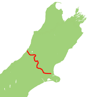
State Highway 98 is a New Zealand State Highway connecting the settlements of Lorneville (on State Highway 6 just north of Invercargill) and Dacre (on State Highway 1) in the Southland region. Also known as Lorne Dacre Road, the highway was gazetted in 1997 and provides an indirect northern bypass of the city of Invercargill. The road is very flat and passes through primarily prime agricultural land. One locality, Rakahouka, lies halfway along the route. [1]

Lorneville is a small settlement on the northern outskirts of Invercargill, in Southland, New Zealand. It is located on New Zealand State Highway 6, at the junction with State Highways 98 and 99, and is thus also on the Southern Scenic Route.

New Zealand State Highway 6 road in New Zealand

State Highway 6 is a major New Zealand state highway. It extends from the northeastern corner of the South Island across the top of the island, then down the length of the island, initially along the West Coast and then across the Southern Alps through inland Otago and finally across the Southland Plains to the island's south coast. Distances are measured from north to south.

Invercargill Place in South Island, New Zealand

Invercargill is the southernmost and westernmost city in New Zealand, and one of the southernmost cities in the world. It is the commercial centre of the Southland region. The city lies in the heart of the wide expanse of the Southland Plains on the Oreti or New River some 18 km north of Bluff, which is the southernmost town in the South Island. It sits amid rich farmland that is bordered by large areas of conservation land and marine reserves, including Fiordland National Park covering the south-west corner of the South Island and the Catlins coastal region.

Contents

Beyond Lorneville, SH 98 is renumbered as State Highway 99 and becomes part of the Southern Scenic Route as it continues towards Wallacetown and Riverton.

New Zealand State Highway 99 road in New Zealand

State Highway 99 is a New Zealand state highway which runs along the southern coastline of the South Island connecting the settlements of Clifden and Lorneville, near Invercargill, via the major town of Riverton in the Southland region. The road is important both as a freight route, especially for logging and agricultural purposes, and as a tourist route; the entire length of the highway is part of the Southern Scenic Route as it provides access to southern parts of Fiordland National Park.

Southern Scenic Route road in New Zealand

The Southern Scenic Route is a tourist highway in New Zealand linking Queenstown, Fiordland, Te Anau and the iconic Milford Road to Dunedin via, Riverton, Invercargill and The Catlins. An Australian travel magazine labelled it "one of the world's great undiscovered drives" in 2008.

Wallacetown is a small town in Southland, in the South Island of New Zealand. It has a population of about 400. Wallacetown is to the west of Invercargill, on high ground between the Makarewa and Oreti rivers, near the Oreti's estuary. Both rivers are popular for trout and whitebait fishing. It is considered to be a satellite town of Invercargill.

See also

Related Research Articles

Dacre, New Zealand human settlement in New Zealand

Dacre is the name of a small town in the South Island of New Zealand. It is situated on the Southland Plains between Invercargill and Edendale on State Highway 1. In Dacre, SH 1 is met by New Zealand State Highway 98, which runs west to Makarewa via Rakahouka. Nearby villages include Mabel Bush to the northwest and Woodlands to the southeast. Dacre is 25 km north east of Invercargill, the closest city. The Main South Line railway passes just to the south of Dacre. It is a dairy farming community, that currently has a community hall and a small engine garage.

Rakahouka human settlement in New Zealand

Rakahouka is a community in the Southland Region of New Zealand's South Island. It is located in a fertile farming area on the Southland Plains just south of the Makarewa River. The nearest major city, Invercargill, is approximately 15 km to the southwest, and nearby villages include Grove Bush and Mabel Bush to the north, Woodlands to the southeast, and Myross Bush and Roslyn Bush to the southwest.

Woodlands is a locality in the Southland region of New Zealand's South Island on the banks of the Waihopai River. It is northeast of Invercargill between Dacre and Longbush. Other nearby settlements are Rakahouka to the northwest and Rimu and Waituna to the south.

Roslyn Bush is a lightly populated locality on the northeastern outskirts of the city of Invercargill in the Southland Region of New Zealand's South Island. Other nearby settlements include Makarewa to the west, Myross Bush to the southwest, Kennington to the south, Longbush and Woodlands to the east, and Rakahouka to the northeast.

State Highway 93 is a New Zealand State Highway connecting the Southland township of Mataura with the Western Otago town of Clinton. This provides a slightly quicker route between the cities of Dunedin and Invercargill, as it bypasses the town of Gore. It is roughly 43.2 km long.

New Zealand State Highway 73 road in New Zealand

State Highway 73 is a major east-west South Island state highway in New Zealand connecting Christchurch on the east coast with Cass/Hokitika via the Southern Alps. It is mostly two lane, with some single-lane bridges north of Springfield but is mostly dual carriageway in Christchurch. The fourth and fifth-highest points of New Zealand's state highway network are on this road at Porters Pass and Arthur's Pass respectively.

New Zealand State Highway 95 road in New Zealand

State Highway 95 is a New Zealand state highway connecting the town of Manapouri with Te Anau at State Highway 94. The highway is a major tourist road and skirts the eastern border of Fiordland National Park between Lake Te Anau and Lake Manapouri. Despite affording views of the scenic mountain ranges of Fiordland, the road itself is largely flat and passes through agricultural land. The entire length of the road lies on the Southern Scenic Route between Queenstown and Dunedin via Invercargill.

The Dawson Farm aerodrome was located at Myross Bush, New Zealand, northeast of the southern city of Invercargill. As the name suggests, the airfield was created by a local farming family for the eventual development into Invercargill's first public aerodrome in 1929. Local aviation enthusiasts as well as national aviation personalities such as George Bolt were visitors, bringing the still rare sight of aircraft into the region. At the time it was located a considerable distance from the town centre and city officials opted for a closer site, building a new airport on reclaimed land in the New River estuary in 1939, now today's Invercargill Airport. This was to encourage commercial services.

Secondary Highway 513, commonly referred to as Highway 513, was a provincially maintained secondary highway in the Canadian province of Ontario. Located within Renfrew County, the highway travelled northward from Highway 132 at Dacre along Scotch Bush Road, turning eastward on what is now Renfrew County Road 22, and ending a short distance to the east before reaching Douglas.

State Highway 37 (SH 37) is a New Zealand state highway in the Waikato/Waitomo region of the North Island. Gazetted in 1997, it exists as a small spur from SH 3 to the Waitomo Caves, one of New Zealand's best-known tourist attractions. It was gazetted as a new state highway designation in 1997.

State Highway 28 (SH 28) is a New Zealand state highway in the Waikato region. The highway was gazetted in 1997 as a faster route for traffic travelling between SH 1 and SH 29 towards the Port of Tauranga. Prior to the formation of SH 28 the quickest route, only if using state highways, was via Tirau and SH 27. There are no towns on this route and due to the highway being mapped to existing rural roads there are several places were motorists need to give way to traffic from other roads.

State Highway 35 (SH 35) is a New Zealand state highway on the East Coast of the North Island. It is the main highway that services the East Cape of New Zealand as well as many other rural towns such as Hicks Bay, Ruatoria, Tolaga Bay, and the city of Gisborne.

State Highway 15 (SH 15) is a New Zealand state highway in the Northland region of the North Island. It is 126.5 km long and provides an alternative route to SH 1 between the Kaikohe and Whangarei areas; a spur also links SH 1 with the Marsden Point Oil Refinery and Northport.

State Highway 36 (SH 36) is a New Zealand state highway in the Bay of Plenty region in the North Island. It is one of two state highways that form a north-south connection between the cities of Tauranga and Rotorua, SH 36 being the most westerly of the two. It was identified as a quicker route to access the two cities and extensive work was done to upgrade the rural route to state highway quality.

State Highway 46 (SH 46) is a New Zealand state highway in the central North Island.

References

  1. "Revoking Sections of State Highways Declaring New Sections of State Highway". New Zealand Gazette. 26 June 1997. Retrieved 5 July 2016.