
State Highway 1 is the longest and most significant road in the New Zealand road network, running the length of both main islands. It appears on road maps as SH 1 and on road signs as a white number 1 on a red shield, but it has the official designations SH 1N in the North Island, SH 1S in the South Island.
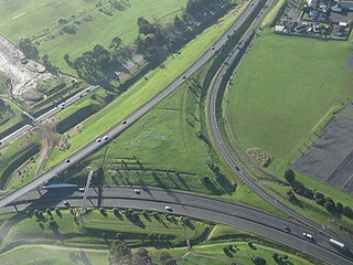
State Highway 20, also known as the Southwestern Motorway, is a New Zealand state highway linking State Highway 1 at Manukau City Centre with State Highway 16 in Point Chevalier, via Mangere and Onehunga. Along with its spurs, State Highway 20A and 20B, the state highway serves Auckland Airport, the country's largest, therefore making State Highway 20 a key arterial route connecting the airport to the wider Auckland region and most of the upper North Island. The route also forms the southern part of the Western Ring Route, a 48 kilometres (30 mi) motorway route bypassing central Auckland. It is the only New Zealand State Highway that is entirely motorway.

State Highway 16 is a New Zealand state highway linking central Auckland with Wellsford, via Auckland's Northwestern Motorway, Helensville and Kaukapakapa. It provides an alternative to State Highway 1 for traffic travelling between Auckland and parts of Northland from Wellsford northwards.
State Highway 88 is a New Zealand State Highway connecting the city centre of Dunedin with Port Chalmers, which is the location of Dunedin's main port facilities and home of one of New Zealand's major container terminals. It is roughly 12 km long.
State Highway 76 (SH 76) is a state highway in Christchurch, New Zealand. This highway was gazetted in 2012 after stage 1 of the Christchurch Southern Motorway was completed. Beforehand, much of SH 76 was part of SH 73 and included the former two-lane Christchurch Arterial Motorway, which was upgraded to four lanes. SH 76 includes the entire length of the Christchurch Southern Motorway and forms the most direct route from the south of Christchurch to the city centre and Lyttelton.
State Highway 50 (SH 50) is a New Zealand state highway that runs through the Hawke's Bay Region.
State Highway 22 (SH 22) is a New Zealand state highway just south of Auckland. It connects the town of Pukekohe to the Auckland Southern Motorway.
State Highway 32 (SH 32) is a New Zealand state highway in the Central North Island. It forms part of a western traverse of Lake Taupo and a less busy alternative to SH 1, avoiding Taupo.
State Highway 28 (SH 28) is a New Zealand state highway in the Waikato region. The highway was gazetted in 1997 as a faster route for traffic travelling between SH 1 and SH 29 towards the Port of Tauranga. Prior to the formation of SH 28 the quickest route, only if using state highways, was via Tirau and SH 27. There are no towns on this route and due to the highway being mapped to existing rural roads there are several places were motorists need to give way to traffic from other roads.
State Highway 25 is a North Island state highway in New Zealand that loops around the Coromandel Peninsula. It is a major route for holidaymakers and tourists which has access to some of New Zealand's most idyllic beach holiday spots. The summer period around Christmas and New Year's Eve is a particularly busy period for the highway. The road is very scenic, but also windy in many parts as well as single carriage on the entire route, and is prone to accidents. It is New Zealand's third longest two-digit state highway, after SH 35 and SH 94. It is part of the Pacific Coast Highway.
State Highway 47 (SH 47) is a New Zealand state highway in the central North Island. It provides a link from SH 4 at National Park to SH 41 at Tokaanu just west of Turangi.
State Highway 54 (SH 54) is a New Zealand state highway in the Manawatu district in the North Island. It runs from SH 3 at Newbury to SH 1 near Hunterville. This highway connects the Manawatu agricultural town of Feilding as well as forming an alternative route to travel from the Central North Island volcanic plateau to the city of Palmerston North.
State Highway 24 (SH 24) is a New Zealand state highway in the Waikato region. The highway was gazetted in 1997 and forms a short cut between the Piako District and SH 29 towards the Port of Tauranga.
State Highway 15 (SH 15) is a New Zealand state highway in the Northland region of the North Island. It is 126.5 km long and provides an alternative route to SH 1 between the Kaikohe and Whangarei areas; a spur also links SH 1 with the Marsden Point Oil Refinery and Northport.
State Highway 31 (SH 31) is a New Zealand state highway in the Waikato region. It provides a link to the harbour town of Kawhia on the west coast of the North Island.
State Highway 33 (SH 33) is a New Zealand state highway in the Bay of Plenty in the North Island. It is one of two state highways that form a north-south connection between the cities of Tauranga and Rotorua, SH 33 being the most easterly of the two.
State Highway 36 (SH 36) is a New Zealand state highway in the Bay of Plenty region in the North Island. It is one of two state highways that form a north-south connection between the cities of Tauranga and Rotorua, SH 36 being the most westerly of the two. It was identified as a quicker route to access the two cities and extensive work was done to upgrade the rural route to state highway quality.
State Highway 46 (SH 46) is a New Zealand state highway in the central North Island.


