The New Zealand state highway network is the major national highway network in New Zealand. Nearly 100 roads in the North and South Islands are state highways. All state highways are administered by the NZ Transport Agency.

State Highway 1 is the longest and most significant road in the New Zealand road network, running the length of both main islands. It appears on road maps as SH 1 and on road signs as a white number 1 on a red shield, but it has the official designations SH 1N in the North Island, SH 1S in the South Island.
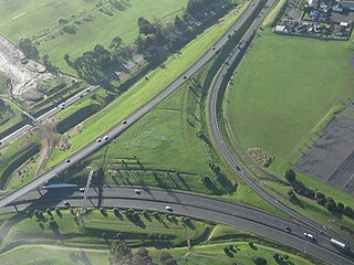
State Highway 20, also known as the Southwestern Motorway, is a New Zealand state highway linking State Highway 1 at Manukau City Centre with State Highway 16 in Point Chevalier, via Mangere and Onehunga. Along with its spurs, State Highway 20A and 20B, the state highway serves Auckland Airport, the country's largest, therefore making State Highway 20 a key arterial route connecting the airport to the wider Auckland region and most of the upper North Island. The route also forms the southern part of the Western Ring Route, a 48 kilometres (30 mi) motorway route bypassing central Auckland. It is the only New Zealand State Highway that is entirely motorway.

State Highway 30 (SH 30) is a New Zealand state highway, linking the Waikato and Bay of Plenty towns of Te Kuiti, Mangakino, Rotorua, and Whakatane.

State Highway 26 (SH 26) is a state highway in the North Island of New Zealand, linking Hamilton with the Coromandel Peninsula. It starts in the Hamilton suburb of Hillcrest, and travels 96 kilometres to Kopu, 6 kilometres south of Thames. It passes through Morrinsville, Te Aroha and Paeroa.

State Highway 38 is a road in the North Island of New Zealand that starts from SH 5 near Waiotapu, and ends at Wairoa, where it connects to SH 2. It is the shortest connection from the central North Island (Rotorua) to the East Coast (Gisborne), but it is not often used as such. Large parts of the road are narrow and winding, and about 74 kilometres (46 mi) is unsealed. Travel on this highway takes roughly four hours.
State Highway 73 is a major east-west South Island state highway in New Zealand connecting Christchurch on the east coast with Cass/Hokitika via the Southern Alps. It is mostly two lane, with some single-lane bridges north of Springfield but is mostly dual carriageway in Christchurch. The fourth and fifth-highest points of New Zealand's state highway network are on this road at Porters Pass and Arthur's Pass respectively.
State Highway 84 (SH 84) is a South Island state highway in New Zealand. It connects the holiday resort town of Wanaka to State Highway 6, the main north-south highway servicing the western part of the South Island.

State Highway 57 is a New Zealand state highway, linking State Highway 1 north of Ohau to State Highway 3 east of Ashhurst, via Levin, Shannon, Massey University and the southern suburbs of Palmerston North. The highway connects State Highway 1 traffic coming north from Wellington to the city of Palmerston North, and further to the Manawatu Gorge, allowing passage to the eastern side of the North Island and to the twin cities of Napier and Hastings. The highway is classified by the NZTA as a national strategic road.
State Highway 79 (SH 79) is a New Zealand state highway connecting the South Canterbury communities of Rangitata, Geraldine, and Fairlie. Starting at State Highway 1 the highway is 61 kilometres in length and runs in a general east-west direction. 6.3 km of the highway through Geraldine runs concurrently with the Inland Scenic Route, formerly State Highway 72. The road is a two-lane single carriageway, with a one-lane bridge crossing the Orari River.
State Highway 86 is a New Zealand State Highway connecting the city of Dunedin's airport to State Highway 1 and the city itself. It is one of the more recent highways, gazetted in 2003. It is a two-lane single carriageway.
State Highway 97 (SH 97) is a New Zealand State Highway connecting the settlements of Five Rivers and Mossburn in the Southland region. The highway was gazetted in 2004 to reflect the increasing amount of traffic between the tourist destinations of Queenstown and Fiordland National Park and provides a bypass of the town of Lumsden, where SH 6 and 94 intersect.
State Highway 98 is a New Zealand State Highway connecting the settlements of Lorneville and Dacre in the Southland region. Also known as Lorne Dacre Road, the highway was gazetted in 1997 and provides an indirect northern bypass of the city of Invercargill. The road is very flat and passes through primarily prime agricultural land. One locality, Rakahouka, lies halfway along the route.
State Highway 22 (SH 22) is a New Zealand state highway just south of Auckland. It connects the town of Pukekohe to the Auckland Southern Motorway.
State Highway 35 (SH 35) is a New Zealand state highway on the East Coast of the North Island. It is the main highway that services the East Cape of New Zealand as well as many other rural towns such as Hicks Bay, Ruatoria, Tolaga Bay, and the city of Gisborne.
State Highway 39 (SH 39) is a New Zealand state highway that forms a western bypass of the city of Hamilton. Gazetted in 1999, it is a generally quicker route to get between Auckland and New Plymouth as well as connecting to the Waitomo Caves, just south of the SH 39 southern terminus. The southernmost 14 km section has a concurrency with SH 31, as this highway has existed for much longer.
State Highway 47 (SH 47) is a New Zealand state highway in the central North Island. It provides a link from SH 4 at National Park to SH 41 at Tokaanu just west of Turangi.
State Highway 54 (SH 54) is a New Zealand state highway in the Manawatu district in the North Island. It runs from SH 3 at Newbury to SH 1 near Hunterville. This highway connects the Manawatu agricultural town of Feilding as well as forming an alternative route to travel from the Central North Island volcanic plateau to the city of Palmerston North.
State Highway 15 (SH 15) is a New Zealand state highway in the Northland region of the North Island. It is 126.5 km long and provides an alternative route to SH 1 between the Kaikohe and Whangarei areas; a spur also links SH 1 with the Marsden Point Oil Refinery and Northport.

