
State Highway 1 is the longest and most significant road in the New Zealand road network, running the length of both main islands. It appears on road maps as SH 1 and on road signs as a white number 1 on a red shield, but it has the official designations SH 1N in the North Island, SH 1S in the South Island.
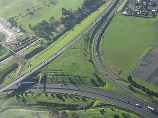
State Highway 20, also known as the Southwestern Motorway, is a New Zealand state highway linking State Highway 1 at Manukau City Centre with State Highway 16 in Point Chevalier, via Mangere and Onehunga. Along with its spurs, State Highway 20A and 20B, the state highway serves Auckland Airport, the country's largest, therefore making State Highway 20 a key arterial route connecting the airport to the wider Auckland region and most of the upper North Island. The route also forms the southern part of the Western Ring Route, a 48 kilometres (30 mi) motorway route bypassing central Auckland. It is the only New Zealand State Highway that is entirely motorway.
State Highway 21 (SH 21) is a short 6.7 kilometre stretch of highway in the North Island of New Zealand. It links State Highway 1, Waikato Expressway at Tamahere and State Highway 3 at Ohaupo. Its main destination is Hamilton Airport and Mystery Creek, where the National Agricultural Fieldays are held.

State Highway 94 is a New Zealand state highway connecting the large Southland town of Gore with one of New Zealand's most popular destinations, Milford Sound. It also passes the significant townships of Lumsden and Te Anau as well going through the Homer Tunnel. The road also goes through Fiordland and crosses the Main Divide of the Southern Alps.
State Highway 73 is a major east-west South Island state highway in New Zealand connecting Christchurch on the east coast with Cass/Hokitika via the Southern Alps. It is mostly two lane, with some single-lane bridges north of Springfield but is mostly dual carriageway in Christchurch. The fourth and fifth-highest points of New Zealand's state highway network are on this road at Porters Pass and Arthur's Pass respectively.
State Highway 17 was the designation for a 32-kilometre stretch of highway in northern Auckland in the North Island of New Zealand from December 1999 to October 2012. It is now designated Urban Route 31 and consists of the Hibiscus Coast Highway, Dairy Flat Highway and Albany Expressway. It linked State Highway 1 at Puhoi in the north with SH 1 at Albany in the south. Its main destinations were the towns of Waiwera, Orewa, Red Beach, Whangaparaoa, Silverdale, Dairy Flat and the suburb of Albany. Prior to its inception as SH 17, the road was part of SH 1, and was redesignated as SH 17 as the Northern Motorway was extended northwards and took over the designation of SH 1.
State Highway 48 (SH 48) is one of New Zealand's shortest State Highways. It provides access to Whakapapa Skifield on the slopes of Mount Ruapehu. It is roughly 7 km long and, with the exception of the junction with SH 47, it lies entirely within Tongariro National Park. SH 48 includes the highest point of the state highway network, 1153m above sea level.
State Highway 97 (SH 97) is a New Zealand State Highway connecting the settlements of Five Rivers and Mossburn in the Southland region. The highway was gazetted in 2004 to reflect the increasing amount of traffic between the tourist destinations of Queenstown and Fiordland National Park and provides a bypass of the town of Lumsden, where SH 6 and 94 intersect.

State Highway 29 (SH 29) is a New Zealand state highway that travels over the Kaimai Ranges linking the Bay of Plenty and Waikato regions. For most of its length, SH 29 is a two-lane single carriageway with occasional passing lanes and slow vehicle bays. 5 km of it near its eastern terminus is part of the Takitimu Drive Toll Road.
State Highway 76 (SH 76) is a state highway in Christchurch, New Zealand. This highway was gazetted in 2012 after stage 1 of the Christchurch Southern Motorway was completed. Beforehand, much of SH 76 was part of SH 73 and included the former two-lane Christchurch Arterial Motorway, which was upgraded to four lanes. SH 76 includes the entire length of the Christchurch Southern Motorway and forms the most direct route from the south of Christchurch to the city centre and Lyttelton.
State Highway 22 (SH 22) is a New Zealand state highway just south of Auckland. It connects the town of Pukekohe to the Auckland Southern Motorway.
State Highway 25 is a North Island state highway in New Zealand that loops around the Coromandel Peninsula. It is a major route for holidaymakers and tourists which has access to some of New Zealand's most idyllic beach holiday spots. The summer period around Christmas and New Year's Eve is a particularly busy period for the highway. The road is very scenic, but also windy in many parts as well as single carriage on the entire route, and is prone to accidents. It is New Zealand's third longest two-digit state highway, after SH 35 and SH 94. It is part of the Pacific Coast Highway.
State Highway 23 (SH 23) is a New Zealand state highway that connects the towns of Raglan and Hamilton.
State Highway 15 (SH 15) is a New Zealand state highway in the Northland region of the North Island. It is 126.5 km long and provides an alternative route to SH 1 between the Kaikohe and Whangarei areas; a spur also links SH 1 with the Marsden Point Oil Refinery and Northport.
State Highway 36 (SH 36) is a New Zealand state highway in the Bay of Plenty region in the North Island. It is one of two state highways that form a north-south connection between the cities of Tauranga and Rotorua, SH 36 being the most westerly of the two. It was identified as a quicker route to access the two cities and extensive work was done to upgrade the rural route to state highway quality.
The Inland Kaikoura Road, formerly designated State Highway 70, is a provincial highway in the South Island of New Zealand that runs from just south of Kaikoura to just north of Culverden via Waiau and Rotherham. White shields are used to signify this highway. It forms part of the Alpine Pacific Triangle tourist route. It also serves as an alternative inland route in cases where SH 1 is closed near the South Kaikoura coast. Following the 2016 Kaikoura earthquake, all roads into Kaikoura were closed including Route 70; it was the first road connection to Kaikoura to reopen in mid-December.


