
State Highway 1 is the longest and most significant road in the New Zealand road network, running the length of both main islands. It appears on road maps as SH 1 and on road signs as a white number 1 on a red shield, but it has the official designations SH 1N in the North Island, SH 1S in the South Island.
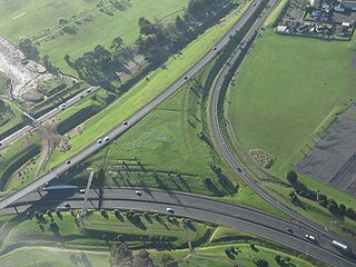
State Highway 20, also known as the Southwestern Motorway, is a New Zealand state highway linking State Highway 1 at Manukau City Centre with State Highway 16 in Point Chevalier, via Mangere and Onehunga. Along with its spurs, State Highway 20A and 20B, the state highway serves Auckland Airport, the country's largest, therefore making State Highway 20 a key arterial route connecting the airport to the wider Auckland region and most of the upper North Island. The route also forms the southern part of the Western Ring Route, a 48 kilometres (30 mi) motorway route bypassing central Auckland. It is the only New Zealand State Highway that is entirely motorway.

State Highway 3 (SH 3) is one of New Zealand's eight national state highways. It serves the west coast of the country's North Island and forms a link between State Highway 1 and State Highway 2. Distances are measured from north to south.

State Highway 4 is the shortest of New Zealand's eight national highways. It runs north-south across rugged hill country, forming a short cut between two points on State Highway 3 thereby avoiding Taranaki and the coasts of the North and South Taranaki Bights. Distances are measured from north to south.

State Highway 2 runs north–south through eastern parts of the North Island of New Zealand from the outskirts of Auckland to Wellington. It runs via Tauranga in the Bay of Plenty, Gisborne, and Napier and Hastings in Hawke's Bay. It is the second-longest highway in the North Island, after State Highway 1, which runs the length of both of the country's main islands.
The Waikato Expressway is a dual carriageway section of State Highway 1 in the Waikato region of the North Island of New Zealand that is being constructed in stages. It forms part of the link between Auckland and Hamilton. When completed it will stretch 116 km (72 mi) and be 6 km (3.7 mi) shorter than the roads it replaced.
State Highway 21 (SH 21) is a short 6.7 kilometre stretch of highway in the North Island of New Zealand. It links State Highway 1, Waikato Expressway at Tamahere and State Highway 3 at Ohaupo. Its main destination is Hamilton Airport and Mystery Creek, where the National Agricultural Fieldays are held.

The Northwestern Cycleway is a 12 km mostly off-road cycle route connecting the Auckland CBD in Auckland City with Henderson, Waitakere City in New Zealand. For most of its length, it runs alongside the Northwestern Motorway.

State Highway 38 is a road in the North Island of New Zealand that starts from SH 5 near Waiotapu, and ends at Wairoa, where it connects to SH 2. It is the shortest connection from the central North Island (Rotorua) to the East Coast (Gisborne), but it is not often used as such. Large parts of the road are narrow and winding, and about 74 kilometres (46 mi) is unsealed. Travel on this highway takes roughly four hours.
State Highway 62 is a state highway servicing the northeastern parts of the South Island of New Zealand. Located entirely within the wine-producing Marlborough region of New Zealand, SH 62 provides a northern bypass of Blenheim, connecting the towns of Spring Creek with Renwick via the locality of Rapaura.

State Highway 29 (SH 29) is a New Zealand state highway that travels over the Kaimai Ranges linking the Bay of Plenty and Waikato regions. For most of its length, SH 29 is a two-lane single carriageway with occasional passing lanes and slow vehicle bays. 5 km of it near its eastern terminus is part of the Takitimu Drive Toll Road.
State Highway 76 (SH 76) is a state highway in Christchurch, New Zealand. This highway was gazetted in 2012 after stage 1 of the Christchurch Southern Motorway was completed. Beforehand, much of SH 76 was part of SH 73 and included the former two-lane Christchurch Arterial Motorway, which was upgraded to four lanes. SH 76 includes the entire length of the Christchurch Southern Motorway and forms the most direct route from the south of Christchurch to the city centre and Lyttelton.
The Western Corridor is a road in Christchurch, New Zealand which connects the suburb of Belfast, New Zealand in the north to Hornby in the south and connects the Canterbury region to Christchurch Airport. Most of the traffic on the corridor heads to the city, the airport, Belfast or Hornby, while 15% of traffic travels further north or south.
State Highway 58 is a New Zealand state highway in the Wellington Region linking the Hutt Valley to Porirua.
State Highway 25 is a North Island state highway in New Zealand that loops around the Coromandel Peninsula. It is a major route for holidaymakers and tourists which has access to some of New Zealand's most idyllic beach holiday spots. The summer period around Christmas and New Year's Eve is a particularly busy period for the highway. The road is very scenic, but also windy in many parts as well as single carriage on the entire route, and is prone to accidents. It is New Zealand's third longest two-digit state highway, after SH 35 and SH 94. It is part of the Pacific Coast Highway.
State Highway 39 (SH 39) is a New Zealand state highway that forms a western bypass of the city of Hamilton. Gazetted in 1999, it is a generally quicker route to get between Auckland and New Plymouth as well as connecting to the Waitomo Caves, just south of the SH 39 southern terminus. The southernmost 14 km section has a concurrency with SH 31, as this highway has existed for much longer.
State Highway 23 (SH 23) is a New Zealand state highway that connects the towns of Raglan and Hamilton.
State Highway 15 (SH 15) is a New Zealand state highway in the Northland region of the North Island. It is 126.5 km long and provides an alternative route to SH 1 between the Kaikohe and Whangarei areas; a spur also links SH 1 with the Marsden Point Oil Refinery and Northport.


