New Zealand State Highway 57

Last updated

State Highway 57 NZ.svg

State Highway 57
NZ-SH57 map.png
Route information
Maintained by NZ Transport Agency
Length65 km (40 mi)
Major junctions
Southwest end State Highway 1 NZ.svg SH 1 near Ohau
  State Highway 56 NZ.svg SH 56 at Makerua
Northeast end State Highway 3 NZ.svg SH 3 near Ashhurst
Location
Towns Levin, Shannon, Palmerston North
Highway system
State Highway 56 NZ.svg SH 56 SH 58 State Highway 58 NZ.svg

State Highway 57 is a New Zealand state highway, linking State Highway 1 north of Ohau to State Highway 3 east of Ashhurst, via Levin, Shannon, Massey University and the southern suburbs of Palmerston North. The highway connects State Highway 1 traffic coming north from Wellington to the city of Palmerston North, and further to the Manawatu Gorge, allowing passage to the eastern side of the North Island and to the twin cities of Napier and Hastings. The highway is classified by the NZTA as a national strategic road. [1]

Contents

State Highway 57 broadly follows the route of the North Island Main Trunk railway line to Linton, then follows the route of the Manawatu River for the remainder of its length. For its entire length, the highway is single carriageway with occasional passing lanes and at-grade intersections.

Route

State Highway 57 starts south of Levin, 2 km north of the locality of Ohau. The highway immediately crosses the North Island Main Trunk at level, before heading eastwards on Kimberley Road for two kilometres. SH 57 then turns sharply left onto Arapaepae Road and heads northwards, bypassing and forming the eastern boundary of Levin.

SH 57 proceeds straight to Ihakara, before gently winding its way over Laws Hill to the southeastern corner of the town of Shannon. The highway S-bends through the town, ending up running parallel to the North Island Main Trunk as it exits the town. SH 57 runs straight parallel to the NIMT for five kilometres to Makerua, where the highway meets SH 56 the only state highway met by SH 57 other than at its termini.

The highway moves its route away from the railway line, meandering to the east slightly and crossing the many branches of the Tokomaru River, a tributary to the Manawatu River. SH 57 then passes through Tokomaru, then briefly runs parallel to the NIMT again for the last time before the NIMT crosses the Manawatu River to Palmerston North.

SH 57 continues in a northeasterly direction through the locality of Linton, then proceeds to the Linton Military Camp, passing south of the actual camp itself. West of the military camp, SH 57 intersects with Tennant Drive, which takes traffic off the highway for the city of Palmerston North. As the connection from Tennant Drive to SH 57 southbound is given priority, SH 57 itself turns right onto Old West Road, passing south of the campus of Massey University, to Summerhill.

At Summerhill, SH 57 turns right onto Aokautere Drive, while the road to the left proceeds into Palmerston North. The highway passes north of the International Pacific College and through the outlying Palmerston North suburb of Summerhill. Much of Summerhill has only been developed since the late 1990s, so most of the suburb has been built with State Highway 57 as the arterial route. Leaving Summerhill, the road meets up with the Manawatu River and follows it general route for the remainder of the highways length.

At Aokautere, the highway intersects with the northern end of the Pahiatua Track, a local route over the northern foothills of the Tararua Ranges to the town of Pahiatua. This road is heavily trafficked in the event of the closure of the Manawatu Gorge due to slips. State Highway 57 between Aokautere and Ashhurst is then used to take traffic from State Highway 3 to the Pahiatua Track.

From Aokautere, the highway proceeds straight on the southern banks of the Manawatu River to the western end of the Manawatu Gorge. Two kilometres southeast of the town of Ashhurst, and one kilometre from the western end of the Manawatu Gorge, State Highway 57 meets State Highway 3 and terminates.

History

SH 57 once started in central Levin, turning right off SH 1 Oxford Street into Queen Street East, then turning left onto Arapaepae Road. The route was later moved 4 km south to Kimberley Road, avoiding Levin.

The 19 km section of SH 57 between the Tennant Drive intersection and State Highway 3 at Ashhurst was once designated SH 57A. SH 57 itself used to follow Tennant Drive around the northern side of the Massey University campus, then cross over the Manawatu River on the Fitzherbert Bridge into Palmerston North. It followed Fitzherbert Avenue as far as Ferguson Street, where it terminated onto SH 56 which at the time connected to SH 3 via Ferguson Street and Princess Street. For a short time, SH 57 was then shifted further west, diverting onto Opiki Road terminating at Tiakitahuna with SH 56 (and covering part of the route SH 56 now occupies), and SH 57A was revoked. In 1997, SH 56 and 57 were significantly changed with SH 57 reverting to its former designation, but instead bypassing Palmerston North and taking the route of the former SH 57A to Ashhurst, a distance of 38.5 km. [2]

Major Junctions

Territorial authority LocationkmjctDestinationsNotes
Horowhenua District Ohau0 New Zealand road sign R2-2.svg State Highway 1 NZ.svg SH 1 south— Wellington
State Highway 1 NZ.svg SH 1 north — Levin, Taupo
SH 57 begins
2 New Zealand PW-9.1 (left).svg Kimberley Road
Arapaepae Road
Levin6 New Zealand PW-9.svg Queen Street East — Levin
Shannon20 New Zealand PW-10 (right).svg Plimmer Terrace
Makerua26 New Zealand PW-11 (left).svg State Highway 56 NZ.svg SH 56 — Palmerston North (Alternative Route)
Tokomaru36 New Zealand PW-11 (left).svg Tane Road
Palmerston North City
Linton Military Camp46 New Zealand road sign R2-2.svg Tennant Drive — Palmerston NorthFormer SH 57 route to central Palmerston North
Summerhill50 New Zealand road sign R2-2.svg Summerhill Drive — Palmerston North
Aokautere54 New Zealand PW-11 (right).svg Pahiatua Track — Pahiatua
Ashhurst65 New Zealand road sign R2-2.svg State Highway 3 NZ.svg SH 3 west — Ashhurst, Palmerston North
State Highway 3 NZ.svg SH 3 eastWoodville, Napier
SH 57 ends

See also

Related Research Articles

Pahiatua Place in Manawatu-Wanganui, New Zealand

Pahiatua is a rural service town in the south-eastern North Island of New Zealand with an urban and rural population of over 4,000. It is between Masterton and Woodville on State Highway 2 and the Wairarapa Line railway, 60 kilometres (37 mi) north of Masterton and 30 kilometres (19 mi) east of Palmerston North. It is usually regarded as being in the Northern Wairarapa. However, for local government purposes it is in the Tararua District part of the Manawatu-Wanganui Region; which encompasses Eketahuna, Pahiatua, Woodvillle and Dannevirke.

Palmerston North City in North Island, New Zealand

Palmerston North is a city in the North Island of New Zealand and the seat of the Manawatu-Wanganui region. Located in the eastern Manawatu Plains, the city is near the north bank of the Manawatu River, 35 km (22 mi) from the river's mouth, and 12 km (7 mi) from the end of the Manawatu Gorge, about 140 km (87 mi) north of the capital, Wellington. Palmerston North is the country's seventh-largest city and eighth-largest urban area, with an urban population of 86,600.

Manawatū-Whanganui Region of New Zealand in North Island

Manawatū-Whanganui[manawaˈtʉː ˈʔwaŋanʉi]) is a region in the lower half of the North Island of New Zealand, whose main population centres are the cities of Palmerston North and Whanganui. It is administered by the Manawatū-Whanganui Regional Council, which operates under the name Horizons Regional Council.

Horowhenua District Territorial authority in Manawatu-Wanganui, New Zealand

Horowhenua District is a local government district on the west coast of the North Island of New Zealand. It forms part of the Manawatu-Wanganui Region. Its name roughly means shaking or rippling earth.

Manawatu Gorge

The Manawatu Gorge runs for 6-9 km between the Ruahine and Tararua Ranges in the south part of the North Island of New Zealand, linking the Manawatu and Hawke's Bay regions. It lies to the northeast of Palmerston North. Its western end is near the small town of Ashhurst and its eastern end is close to the town of Woodville.

Woodville, New Zealand Place in Manawatu-Wanganui, New Zealand

Woodville, previously known as The Junction is a small town in the southern North Island of New Zealand, 75 km north of Masterton and 25 km east of Palmerston North. The 2013 census showed that 1401 people reside in Woodville.

Ashhurst Place in Manawatu-Wanganui Region, New Zealand

Ashhurst is a small town in the Manawatu-Wanganui region of New Zealand's North Island.

Manawatu Plains

Some of the most fertile land in the southwestern North Island of New Zealand is on the floodplains of the Manawatu and Rangitikei Rivers, in an area known as the Manawatu Plains.

Linton, New Zealand suburb of Palmerston North, New Zealand

Linton is a suburb of Palmerston North, situated 11km south-west of the city.

New Zealand State Highway 1 road in New Zealand

State Highway 1 is the longest and most significant road in the New Zealand road network, running the length of both main islands. It appears on road maps as SH 1 and on road signs as a white number 1 on a red shield, but it has the official designations SH 1N in the North Island, SH 1S in the South Island.

Ashhurst-Fitzherbert is a constituent ward of Palmerston North, Manawatu-Wanganui, New Zealand. The ward is made up of the suburbs of Turitea, Massey University, Linton and Aokautere. Ashhurst-Fitzherbert is the largest ward in area in the city of Palmerston North.

Aokautere is a suburb of Palmerston North, Manawatu-Wanganui, New Zealand. It is situated in the cliffs on the south banks of the Manawatu River.

Turitea is a suburb of Palmerston North in the Manawatu-Wanganui region of New Zealand. Turitea is located on the southern side of the Manawatu River, past Massey University. Turitea is also a suburb in the Waikato region of New Zealand.

Milson, New Zealand Suburb of Palmerston North in Manawatu-Wanganui Region, New Zealand

Milson is a suburb of Palmerston North, Manawatu-Wanganui, New Zealand. The suburb is located to the north of the city, beyond the North Island Main Trunk Rail.

New Zealand State Highway 3 road in New Zealand

State Highway 3 (SH 3) is one of New Zealand's eight national state highways. It serves the west coast of the country's North Island and forms a link between State Highway 1 and State Highway 2. Distances are measured from north to south.

Pahiatua railway station railway station

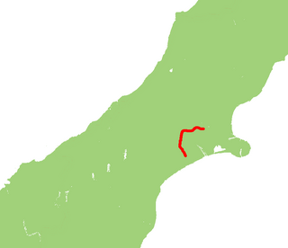
Pahiatua railway station is on the Wairarapa Line in New Zealand’s North Island. It was opened in May 1897, shortly before the line was opened to Woodville in December of that year. The station is 1.7 kilometres (1.1 mi) from Pahiatua, in contrast to the original plans for the railway line to run through the town.

New Zealand State Highway 77 road in New Zealand

State Highway 77 is a state highway in New Zealand going through the inland parts of Central and Mid Canterbury between the towns of Ashburton and Darfield via the Rakaia Gorge. It is wholly single carriageway with two one-lane bridges at the Rakaia and Selwyn Rivers. One set of traffic lights is found in Ashburton marking the southern terminus of the highway.

Wellington and Manawatu Railway Company railway company in New Zealand

The Wellington and Manawatu Railway Company was a private railway company that built, owned and operated the Wellington-Manawatu railway line between Thorndon in Wellington, the capital of New Zealand, and Longburn, near Palmerston North in the Manawatu, between 1881 and 1908, when it was acquired by the New Zealand Government Railways. Its successful operation in private ownership was unusual for early railways in New Zealand.

Hotel Coachman is a Palmerston North Accommodation provider. One of the first sources of accommodation in Palmerston North, built by the MacPherson Family in 1979 and originally called The Coachman. Hotel Coachman now owned by Leonie Hapeta, Bull, and McLean Families is a Palmerston North Icon. The building is made of South Island shiest stone and has a boutique look and feel. It has been the host to numerous politicians, celebrities, conferences, and sports teams.

State Highway 54 (SH 54) is a New Zealand state highway in the Manawatu district in the North Island. It runs from SH 3 at Newbury to SH 1 near Hunterville. This highway connects the Manawatu agricultural town of Feilding as well as forming an alternative route to travel from the Central North Island volcanic plateau to the city of Palmerston North.

References

  1. "One Network Road Classification: North Island State Highways" (PDF). New Zealand Transport Agency. Retrieved 2 February 2016.
  2. "Revoking Sections of State Highways Declaring New Sections of State Highway". New Zealand Gazette. 26 June 1997. Retrieved 5 July 2016.