New Zealand State Highway 18

Last updated

State Highway 18 NZ.svg

State Highway 18
Route information
Maintained by NZ Transport Agency
Length14 km (9 mi)
Major junctions
North-east endState Highway 1 NZ.svg SH 1 Northern Motorway, Meadowwood, North Shore
South-west endState Highway 16 NZ.svg SH 16 Northwestern Motorway, West Harbour, Waitakere
Location
Primary
destinations
Greenhithe, Hobsonville
Highway system
State Highway 17 NZ.svg SH 17 SH 20 State Highway 20 NZ.svg
The former route of State Highway 18, in 2010, was a mostly rural highway. This route is now designated Urban route 32. Hobsonville, Rural Scenes Giving Way.jpg
The former route of State Highway 18, in 2010, was a mostly rural highway. This route is now designated Urban route 32.
The Hobsonville section of the Upper Harbour Motorway, looking west from the Trig Road Interchange Upper Harbour Motorway at Trig Road Interchange.jpg
The Hobsonville section of the Upper Harbour Motorway, looking west from the Trig Road Interchange

State Highway 18 (SH 18) is a state highway that runs between the Auckland Northern Motorway (SH 1) on the North Shore and the Northwestern Motorway (SH 16) in Waitakere in Auckland, New Zealand. The Upper Harbour Motorway forms most of its length as of 2016 (the exception being a two-kilometre stretch at the north-eastern end). SH 18 forms the northern part of the Western Ring Route, which continues from Waitakere south-east to Manukau.

The New Zealand state highway network is the major national highway network in New Zealand. Nearly 100 roads in the North and South Islands are state highways. All state highways are administered by the NZ Transport Agency.

Auckland Northern Motorway road in New Zealand

The Auckland Northern Motorway in the Auckland Region of New Zealand links central Auckland City and Puhoi in the former Rodney District via the Hibiscus Coast and North Shore. It is part of State Highway 1.

Northwestern Motorway road in New Zealand

The Northwestern Motorway, part of State Highway 16 (SH16), is the major western route and secondary northern route out of Auckland in New Zealand. Twenty-one kilometres in length, the motorway runs from Stanley St in Parnell through the Central Motorway Junction, and west through urban Auckland and Waitakere before continuing northwest and terminating outside of Kumeu. Its western terminus is at Brigham Creek Road in Whenuapai. A large part of it forms the middle section of the Western Ring Route.

Contents

Route

SH 18 begins at the Auckland Northern Motorway, as a dual carriageway road, heading west on Upper Harbour Highway, after two kilometres becoming a motorway at the Albany Highway interchange. This four-lane section of motorway opened in December 2007, and bypassed the single carriageway Upper Harbour Drive. The motorway heads south-west, crossing the upper reaches of the Waitematā Harbour over the Upper Harbour Bridge. At Squadron Drive, the highway extends onto a new section of motorway, which opened in August 2011, bypassing Hobsonville Road. [1] This road cuts across in a southwestern direction across farmland to Westgate, where it turns southward and merges with the Northwestern Motorway (SH 16) southbound. Motorists wishing to travel north onto SH 16 can cut across by taking the Brigham Creek Road or Trig Road exits.

Waitematā Harbour harbour in Auckland

Waitematā Harbour is the main access by sea to Auckland, New Zealand. For this reason it is often referred to as Auckland Harbour, despite the fact that it is one of two harbours adjoining the city. The harbour forms the northern and eastern coasts of the Auckland isthmus and is crossed by the Auckland Harbour Bridge. It is matched on the southern side of the city by the shallower waters of the Manukau Harbour.

Upper Harbour Bridge bridge in New Zealand

The Upper Harbour Bridge is a motorway bridge in west Auckland, New Zealand. It is technically two bridges, spanning an upper reach of the Waitematā Harbour, and connecting Hobsonville and Greenhithe. It is an important connection for State Highway 18, and became even more important as a component of the Western Ring Route when the route was completed on 2 July 2017.

New Zealand State Highway 16 road in New Zealand

State Highway 16 is a New Zealand state highway linking central Auckland with Wellsford, via Auckland's Northwestern Motorway, Helensville and Kaukapakapa. It provides an alternative to State Highway 1 for traffic travelling between Auckland and parts of Northland from Wellsford northwards.

Interchanges

Territorial authority Locationkm # DestinationsNotes
Auckland – Upper Harbour Local BoardUnsworth Heights0.0State Highway 1 NZ.svg SH 1 south (Northern Motorway) – AucklandSH 18 begins.
State Highway 1 NZ.svg SH 1 north (Northern Motorway) – Whangarei
Caribbean Drive
Paul Matthews Drive
Unsworth DriveWestbound exit only
2.42Route 26 Albany HighwayUpper Harbour Motorway begins.
Greenhithe4.34Greenhithe RoadEastbound exit and westbound entrance
6.26Tauhinu RoadWestbound exit and eastbound entrance
7.4 Upper Harbour Bridge over Waitematā Harbour
Hobsonville8Squadron DriveWestbound exit and eastbound entrance
9Brigham Creek Road – Whenuapai, Helensvilleto State Highway 16 NZ.svg north
10Trig RoadWestbound exit and eastbound entrance
Auckland – Henderson-Massey Local BoardWestgate11Route 32 Hobsonville RoadWestbound exit and eastbound entrance
State Highway 16 NZ.svg SH 16 south (Northwestern Motorway) – Waitakere, AucklandSH 18 ends.
Upper Harbour Motorway ends.
1.000 mi = 1.609 km; 1.000 km = 0.621 mi

Former route

SH 18 formerly ran along the Coatesville Riverhead Highway, further north than its current position. This route is now designated as Auckland Urban Route 28.

Auckland urban route network Wikimedia list article

The Auckland urban route network consists of strategic and primary arterial roads across the Auckland Region of New Zealand. Urban routes are signposted with white shields. To avoid conflict with state highway numbering, there are no urban routes numbered 1, 2, 16, 18, 20, or 22.

Cycleway

The route of the new motorway from Upper Harbour Bridge to Westgate was originally to receive a cycleway as well, but although the land was set aside, there is no timetable for the construction of the route. [1]

See also

Related Research Articles

Pacific Highway (Australia) highway in New South Wales and Queensland

The Pacific Highway is a 790-kilometre-long (490 mi) national highway and major transport route along the central east coast of Australia, with the majority of it being part of Australia's national route 1.

The Central Motorway Junction or CMJ, is the intersection of State Highways 1 and 16, just south of the central business district of Auckland. A multilevel structure, it has been described as a "fiendishly complicated, multi-layered puzzle of concrete, steel and asphalt". Carrying around 200,000 vehicles a day, it is one of the busiest stretches of road in New Zealand.

Transport in Auckland, New Zealand's largest city, is defined by factors that include the shape of the Auckland isthmus, the suburban character of much of the urban area, a history of focusing investment on roading projects rather than public transport, and high car-ownership rates.

The Terrace Tunnel takes the Wellington Urban Motorway (SH1) under The Terrace in central Wellington, New Zealand. Opened in 1978, it is 460 metres in length.

Auckland Southern Motorway road in New Zealand

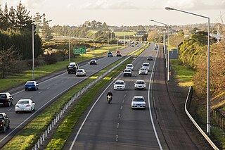
The Auckland Southern Motorway is the major route south out of the Auckland Region of New Zealand. It is part of State Highway 1.

New Zealand State Highway 20 road in New Zealand

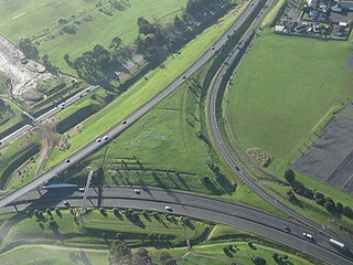
State Highway 20, also known as the Southwestern Motorway, is a New Zealand state highway linking State Highway 1 at Manukau City Centre with State Highway 16 in Point Chevalier, via Mangere and Onehunga. Along with its spurs, State Highway 20A and 20B, the state highway serves Auckland Airport, the country's largest, therefore making State Highway 20 a key arterial route connecting the airport to the wider Auckland region and most of the upper North Island. The route also forms the southern part of the Western Ring Route, a 48 kilometres (30 mi) motorway route bypassing central Auckland. It is the only New Zealand State Highway that is entirely motorway.

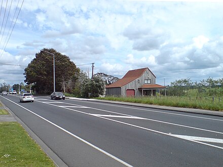
Hobsonville is a rural suburban district in the Auckland Region in the North Island of New Zealand. The area was administered by Waitakere City Council until the council was amalgamated into Auckland Council in 2010.

Dunedin Southern Motorway road in New Zealand

The Dunedin Southern Motorway is the main arterial route south from the South Island city of Dunedin, part of New Zealand's State Highway 1. It is one of the world's southernmost motorways.

New Zealand State Highway 2 road in New Zealand

State Highway 2 runs north–south through eastern parts of the North Island of New Zealand from the outskirts of Auckland to Wellington. It runs via Tauranga in the Bay of Plenty, Gisborne, and Napier and Hastings in Hawke's Bay. It is the second-longest highway in the North Island, after State Highway 1, which runs the length of both of the country's main islands.

The Waikato Expressway is a dual carriageway section of State Highway 1 in the Waikato region of the North Island of New Zealand that is being constructed in stages. It forms part of the link between Auckland and Hamilton. When completed it will stretch 116 km (72 mi) and be 6 km (3.7 mi) shorter than the roads it replaced.

The Hutt Expressway is a 3-4 lane divided highway running from the Wellington Urban Motorway at the Ngauranga, past Lower Hutt and central Upper Hutt, to the intersection with Fergusson Drive in Maoribank in north-eastern Upper Hutt. State Highway 2 officially continues north of Maoribank to Te Marua, Kaitoke, and over the Rimutaka Hill to Wairarapa, but this section is two lanes undivided and is covered in the main State Highway 2 article. The names Hutt Expressway and Hutt Motorway are not official, and actually refers to three different roads: Hutt Road from the Ngauranga Interchange to the Petone Overbridge, Western Hutt Road from the Petone Overbridge to the Silverstream Bridge, and River Road from Silverstream Bridge to Maoribank.

Northwestern Cycleway

The Northwestern Cycleway is a 12 km mostly off-road cycle route connecting the Auckland CBD in Auckland City with Henderson, Waitakere City in New Zealand. For most of its length, it runs alongside the Northwestern Motorway.

The Western Ring Route is a motorway system being constructed in Auckland, New Zealand. It currently runs along the entire Southwestern Motorway, most of the Northwestern Motorway, the entire Upper Harbour Motorway, and the entire Upper Harbour Highway. When the Upper Harbour Highway is upgraded to motorway status, the route will surpass the Southern Motorway to become the longest motorway in New Zealand at 48 kilometres in length. It runs through Manukau, Waitakere, and the North Shore, bypassing the Auckland city centre and thus providing a second motorway route through the Auckland isthmus.

State Highway 74 is a state highway in New Zealand servicing the eastern suburbs of Christchurch. Mostly two-lane, it is composed of limited-access expressways, with part of the highway as the Christchurch-Lyttelton Motorway, and connects the city to its port town of Lyttelton.

New Zealand State Highway 57 road in New Zealand

State Highway 57 is a New Zealand state highway, linking State Highway 1 north of Ohau to State Highway 3 east of Ashhurst, via Levin, Shannon, Massey University and the southern suburbs of Palmerston North. The highway connects State Highway 1 traffic coming north from Wellington to the city of Palmerston North, and further to the Manawatu Gorge, allowing passage to the eastern side of the North Island and to the twin cities of Napier and Hastings. The highway is classified by the NZTA as a national strategic road.

References

  1. 1 2 "Pedestrians to hit new motorway". Auckland Now. 3 August 2011. Retrieved 27 September 2011.