
State Highway 1 is the longest and most significant road in the New Zealand road network, running the length of both main islands. It appears on road maps as SH 1 and on road signs as a white number 1 on a red shield, but it has the official designations SH 1N in the North Island, SH 1S in the South Island.
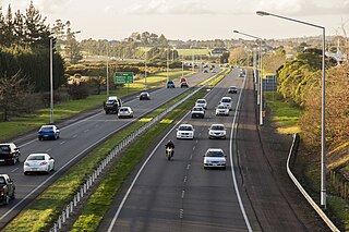
The Auckland Southern Motorway is the major route south out of the Auckland Region of New Zealand. It is part of State Highway 1.

Taupiri is a small township of about 450 people on the eastern bank of the Waikato River in the Waikato District of New Zealand. It is overlooked by Taupiri mountain, the sacred burial ground for the Waikato tribes of the Māori people, located just to the north.

State Highway 7 is a major New Zealand state highway. One of the eight national highways, it crosses the Southern Alps to link the West Coast Region with Canterbury and to form a link between the South Island's two longest highways, State Highway 1 and State Highway 6. Distances are measured from east to west with the major junction list going from east to west.

State Highway 5 is the second shortest of New Zealand's eight national highways. It extends from SH 1 at Tirau, on the plains of the Waikato River, to SH 2, close to the Hawke Bay coast at Bay View, 10 km north of Napier. Distances are measured from north to south.

State Highway 3 (SH 3) is one of New Zealand's eight national state highways. It serves the west coast of the country's North Island and forms a link between State Highway 1 and State Highway 2. Distances are measured from north to south.

State Highway 30 (SH 30) is a New Zealand state highway, linking the Waikato and Bay of Plenty towns of Te Kuiti, Mangakino, Rotorua, and Whakatane.
State Highway 21 (SH 21) is a short 6.7 kilometre stretch of highway in the North Island of New Zealand. It links State Highway 1, Waikato Expressway at Tamahere and State Highway 3 at Ohaupo. Its main destination is Hamilton Airport and Mystery Creek, where the National Agricultural Fieldays are held.
State Highway 17 was the designation for a 32-kilometre stretch of highway in northern Auckland in the North Island of New Zealand from December 1999 to October 2012. It is now designated Urban Route 31 and consists of the Hibiscus Coast Highway, Dairy Flat Highway and Albany Expressway. It linked State Highway 1 at Puhoi in the north with SH 1 at Albany in the south. Its main destinations were the towns of Waiwera, Orewa, Red Beach, Whangaparaoa, Silverdale, Dairy Flat and the suburb of Albany. Prior to its inception as SH 17, the road was part of SH 1, and was redesignated as SH 17 as the Northern Motorway was extended northwards and took over the designation of SH 1.
State Highway 50 (SH 50) is a New Zealand state highway that runs through the Hawke's Bay Region.
State Highway 32 (SH 32) is a New Zealand state highway in the Central North Island. It forms part of a western traverse of Lake Taupo and a less busy alternative to SH 1, avoiding Taupo.
State Highway 37 (SH 37) is a New Zealand state highway in the Waikato/Waitomo region of the North Island. Gazetted in 1997, it exists as a small spur from SH 3 to the Waitomo Caves, one of New Zealand's best-known tourist attractions. It was gazetted as a new state highway designation in 1997.
State Highway 28 (SH 28) is a New Zealand state highway in the Waikato region. The highway was gazetted in 1997 as a faster route for traffic travelling between SH 1 and SH 29 towards the Port of Tauranga. Prior to the formation of SH 28 the quickest route, only if using state highways, was via Tirau and SH 27. There are no towns on this route and due to the highway being mapped to existing rural roads there are several places were motorists need to give way to traffic from other roads.
State Highway 39 (SH 39) is a New Zealand state highway that forms a western bypass of the city of Hamilton. Gazetted in 1999, it is a generally quicker route to get between Auckland and New Plymouth as well as connecting to the Waitomo Caves, just south of the SH 39 southern terminus. The southernmost 14 km section has a concurrency with SH 31, as this highway has existed for much longer.
State Highway 23 (SH 23) is a New Zealand state highway that connects the towns of Raglan and Hamilton.
State Highway 24 (SH 24) is a New Zealand state highway in the Waikato region. The highway was gazetted in 1997 and forms a short cut between the Piako District and SH 29 towards the Port of Tauranga.
State Highway 31 (SH 31) is a New Zealand state highway in the Waikato region. It provides a link to the harbour town of Kawhia on the west coast of the North Island.


