Pike Township, St. Louis County, Minnesota

Last updated

Pike Township, Minnesota
Pike River.jpg
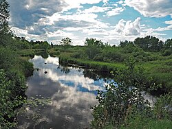
The Pike River in Pike River Township
USA Minnesota location map.svg
Red pog.svg
Pike Township, Minnesota
Location within the state of Minnesota
Usa edcp location map.svg
Red pog.svg
Pike Township, Minnesota
Pike Township, Minnesota (the United States)
Coordinates: 47°39′27″N92°22′46″W / 47.65750°N 92.37944°W / 47.65750; -92.37944
Country United States
State Minnesota
County Saint Louis
Area
  Total33.6 sq mi (87.1 km2)
  Land33.6 sq mi (87.0 km2)
  Water0.0 sq mi (0.1 km2)
Elevation
1,470 ft (448 m)
Population
 (2010)
  Total417
  Density12/sq mi (4.8/km2)
Time zone UTC-6 (Central (CST))
  Summer (DST) UTC-5 (CDT)
FIPS code 27-50830 [1]
GNIS feature ID0665294 [2]

Pike Township is a township in Saint Louis County, Minnesota, United States. The population was 417 at the 2010 census. [3]

Contents

State Highway 169 (MN 169) and Saint Louis County Highway 21 (CR 21) are two of the main routes in the township. MN 169 runs north–south, and CR 21 runs east–west. Other routes include Taylor Road.

The town is named for the Pike River, which is in turn named for the fish. [4]

Geography

According to the United States Census Bureau, the township has a total area of 33.6 square miles (87 km2); 0.04 square miles (0.10 km2), or 0.09%, is water.

The Pike River flows through the northeast portion of Pike Township, and the Pike River also flows through the southern portion of the township.

Adjacent townships, cities, and communities

The following are adjacent to Pike Township :

Demographics

At the 2000 census there were 492 people, 194 households, and 142 families living in the township. The population density was 14.6 people per square mile (5.7/km2). There were 217 housing units at an average density of 6.5/sq mi (2.5/km2). The racial makeup of the township was 98.37% White, 0.81% Native American, 0.41% Asian, 0.41% from other races. Hispanic or Latino of any race were 0.41%. [1]

Of the 194 households 29.9% had children under the age of 18 living with them, 65.5% were married couples living together, 4.1% had a female householder with no husband present, and 26.3% were non-families. 22.7% of households were one person and 4.6% were one person aged 65 or older. The average household size was 2.54 and the average family size was 2.97.

The age distribution was 25.4% under the age of 18, 6.1% from 18 to 24, 25.4% from 25 to 44, 34.6% from 45 to 64, and 8.5% 65 or older. The median age was 42 years. For every 100 females, there were 111.2 males. For every 100 females age 18 and over, there were 118.5 males.

The median household income was $41,346 and the median family income was $44,500. Males had a median income of $38,333 versus $22,375 for females. The per capita income for the township was $19,701. About 5.6% of families and 8.1% of the population were below the poverty line, including 13.7% of those under age 18 and 5.4% of those age 65 or over.

Related Research Articles

Angora Township is a township in Saint Louis County, Minnesota, United States. The population was 249 at the 2010 census. Angora Township was named after Angora, in Turkey.

Balkan Township is a township in Saint Louis County, Minnesota, United States. The township was named after the Balkan Mountains. The population was 832 at the 2010 census.

Beatty Township is a township in Saint Louis County, Minnesota, United States. Beatty Township bears the name of a family of pioneer settlers. The population was 372 at the 2010 census.

<span class="mw-page-title-main">Biwabik Township, St. Louis County, Minnesota</span> Township in Minnesota, United States

Biwabik Township is a township in Saint Louis County, Minnesota, United States. Biwabik is a name derived from the Ojibwe language meaning "iron". The population was 804 at the 2010 census.

Breitung Township is a township in Saint Louis County, Minnesota, United States. The population was 605 at the 2010 census.

Duluth Township is a township in Saint Louis County, Minnesota, United States. The population was 1,941 at the 2010 census.

Eagles Nest Township is a township in Saint Louis County, Minnesota, United States. The population was 242 at the 2010 census.

Ellsburg Township is a township in Saint Louis County, Minnesota, United States. The population was 219 at the 2010 census.

<span class="mw-page-title-main">Embarrass Township, St. Louis County, Minnesota</span> Township in Minnesota, United States

Embarrass Township is a township in Saint Louis County, Minnesota, United States. The population was 607 at the 2010 census.

Fayal Township is an urban township in Saint Louis County, Minnesota, United States. The population was 1,809 at the 2010 census.

French Township is a township in Saint Louis County, Minnesota, United States. The population was 567 at the 2010 census.

Kugler Township is a township in Saint Louis County, Minnesota, United States. The population was 175 at the 2010 census.

Linden Grove Township is a township in Saint Louis County, Minnesota, United States. The population was 145 at the 2010 census.

Morse Township is a township in Saint Louis County, Minnesota, United States. The population was 1,213 at the 2010 census.

Sandy Township is a township in Saint Louis County, Minnesota, United States. The population was 356 at the 2010 census.

Sturgeon Township is a township in Saint Louis County, Minnesota, United States. The population was 140 at the 2010 census.

Vermilion Lake Township is a township in Saint Louis County, Minnesota, United States. The population was 278 at the 2010 census.

White Township is an urban township in Saint Louis County, Minnesota, United States. The population was 3,229 at the 2010 census.

Wuori Township is a township in Saint Louis County, Minnesota, United States. The population was 572 at the 2010 census.

Kabetogama Township is a township in Saint Louis County, Minnesota, United States. The population was 135 at the 2010 census. A portion of the township is located within the Kabetogama State Forest.

References

  1. 1 2 "U.S. Census website". United States Census Bureau . Retrieved January 31, 2008.
  2. "US Board on Geographic Names". United States Geological Survey. October 25, 2007. Retrieved January 31, 2008.
  3. "Race, Hispanic or Latino, Age, and Housing Occupancy: 2010 Census Redistricting Data (Public Law 94-171) Summary File (QT-PL), Pike township, St. Louis County, Minnesota". United States Census Bureau . Retrieved October 26, 2011.
  4. Upham, Warren (1920). Minnesota geographic names; their origin and historic significance. Minnesota Historical Society. p. 488 via Archive.org.