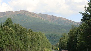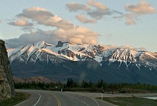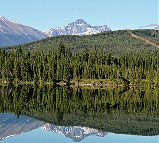
Kootenay National Park is a national park of Canada in southeastern British Columbia. The park consists of 1,406 km2 (543 sq mi) of the Canadian Rockies, including parts of the Kootenay and Park mountain ranges, the Kootenay River and the entirety of the Vermilion River. While the Vermilion River is completely contained within the park, the Kootenay River has its headwaters just outside the park boundary, flowing through the park into the Rocky Mountain Trench and eventually joining the Columbia River. The park ranges in elevation from 918 m (3,012 ft) at the southwestern park entrance to 3,424 m (11,234 ft) at Deltaform Mountain.

Heart Mountain is a mountain located in the Bow River valley just south of Exshaw, Alberta. The peak was named in 1957 for the heart shaped layer of limestone near the top.

The Canadian is a transcontinental passenger train operated by Via Rail with service between Union Station in Toronto, Ontario, and Pacific Central Station in Vancouver, British Columbia, Canada.

Castle Mountain is a ski resort located in the Westcastle Valley of southwest Alberta, Canada in the Rocky Mountains. It is approximately 260 kilometres (160 mi) from Calgary and the Calgary International Airport; 140 kilometres (87 mi) from Lethbridge; and 50 kilometres (31 mi) west of Pincher Creek. The resort is renowned for long steep runs and an average 8.5 metres (28 ft) of snowfall yearly.

Sheep River Provincial Park is a provincial park located in Alberta, Canada, 23 kilometres (14 mi) west of Diamond Valley on highway 546. It is part of the Kananaskis Country park system and encompasses a portion of the Sheep River valley.

Roche à Perdrix is a mountain in Alberta's Rockies, Canada.

Sibbaldia tridentata is a species in the plant family Rosaceae. Its synonyms include the illegitimate name Sibbaldia retusa and Sibbaldiopsis tridentata. Under the latter name, it has been treated as the only species in the genus Sibbaldiopsis. Its English names include three-toothed cinquefoil, shrubby fivefingers, and wineleaf.

Potentilla gracilis, known as slender cinquefoil or graceful cinquefoil, is a species of cinquefoil. It ranges from Alaska down the west coast of Canada and the United States, and Colorado.

The flag of Hamilton was designed by Bishop Ralph Spence and granted to the city on July 15, 2003.
The Rocher Déboulé Range, formerly known as the Roche Déboulé Mountains, is a subrange of the Bulkley Ranges, located south of Hazelton in northern British Columbia, Canada.
Shelagyote Peak is the highest mountain in the Sicintine Range of the Skeena Mountains in northern British Columbia, Canada, located at the head of Barger Creek. It has a very large prominence of 1,467 m (4,813 ft), created by the Shelagyote Pass.
Roche Percee is a village in the Canadian province of Saskatchewan within the RM of Coalfields No. 4 and Census Division No. 1. The village is near the Canada–United States border, just off Highway 39. Roche Percee is about 20 kilometres (12 mi) east of Estevan in the Souris River valley.

Potentilla diversifolia or Potentilla × diversifolia is a species of flowering plant in the Rose Family (Rosaceae) known by the common names varileaf cinquefoil, different-leaved cinquefoil, and mountain meadow cinquefoil.

Mont-Albert is an unorganized territory in the Gaspésie–Îles-de-la-Madeleine region of Quebec, Canada.

Jasper Lake is in the Rocky Mountains of Jasper National Park in Alberta, Canada. It is part of the Athabasca River, where the river broadens out. Its westernmost shore lies about 15 miles (24 km) northeast from the town of Jasper along the Yellowhead Highway and stretches farther east for about 6 miles (9.7 km).

Cinquefoil Mountain is a 2,256-metre (7,402 ft) mountain summit located in the Athabasca River valley of Jasper National Park in Alberta, Canada. It is situated in the Jacques Range of the Canadian Rockies. Cinquefoil Mountain was named in 1916 by Morrison P. Bridgland on account of cinquefoil in the area. Bridgland (1878–1948) was a Dominion Land Surveyor who named many peaks in Jasper Park and the Canadian Rockies. The mountain's name was officially adopted in 1928 by the Geographical Names Board of Canada.

Mount Cooper is a prominent 3,094-metre (10,151 ft) glaciated mountain summit located in the Selkirk Mountains of southeast British Columbia, Canada. It is situated 36 km (22 mi) northwest of Kaslo, within Goat Range Provincial Park. Mt. Cooper is the highest peak in the Goat Range and Slocan Ranges, which are subsets of the Selkirks. The nearest higher peak is Truce Mountain, 33 km (21 mi) to the east-northeast. The first ascent of Mount Cooper was made August 10, 1962, by William Boulton, Terry Beck, Richard Hahn, Lorna Ream, Jack Steele, Edward Bouttin and Gary Johnson via the Spokane Glacier. This climbing party was from the Spokane Mountaineers organization. The mountain was named in association with Cooper Creek, which in turn was named after an 1880s Kaslo prospector and trapper. The mountain's name was officially adopted June 9, 1960, when approved by the Geographical Names Board of Canada. Prior to 1960 it was called Cooper Mountain.

Roche Noire is a 2,920-metre (9,580 ft) mountain located in Alberta, Canada.


