The Willi Willi National Park is a protected national park located on the North Coast region of New South Wales, Australia. Gazetted in 1996, the 29,870-hectare (73,800-acre) park is situated 325 kilometres (202 mi) northeast of Sydney and 60 kilometres (37 mi) west of Wauchope.

Port Macquarie, locally nicknamed Port, is a coastal city the local government area of Port Macquarie-Hastings. It is located on the Mid North Coast of New South Wales, Australia, about 390 km (242 mi) north of Sydney, and 570 km (354 mi) south of Brisbane. The city is located on the Tasman Sea coast, at the mouth of the Hastings River, and at the eastern end of the Oxley Highway (B56). The city with its suburbs had a population of 47,973 in June 2018 and an estimated population of 50,307 in June 2023.

The Mid North Coast is a country region in the north-east of the state of New South Wales, Australia. The region is situated 416km north of Sydney, covers the mid northern coast of the state, beginning from Port Stephens at Hawks Nest to as far north as Woolgoolga, near Coffs Harbour. The region has heaps of beaches and many subtropical national parks and forests as well as rural farmland and logging. Major coastal towns include Coffs Harbour, Forster and Port Macquarie. The Mid North Coast is a popular destination for camping or resorts and surfing, with coastal and hinterland tracks.

Wauchope ( ) is a town in the Mid North Coast region of New South Wales, Australia. It is within the boundaries of the Port Macquarie-Hastings Council area. Wauchope is inland on the Hastings River and the Oxley Highway 19 km (12 mi) west of Port Macquarie. The town is 383 km (238 mi) north of the state capital Sydney.
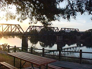
Hastings River, an open and trained intermediate wave dominated barrier estuary, is located in the Northern Tablelands and Mid North Coast districts of New South Wales, Australia.

Port Macquarie-Hastings Council is a local government area in the Mid North Coast region of New South Wales, Australia.

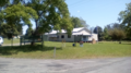
Kendall is a town on the Mid North Coast of New South Wales, Australia.

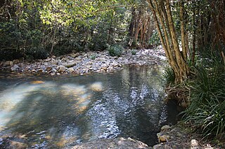
Wilson River, a perennial river of the Hastings River catchment, is located in the Mid North Coast region of New South Wales, Australia.

Karuah is a locality in both the Port Stephens and Mid-Coast Councils, the Port Stephens lga side is part the Hunter Region while the Mid-Coast lga is in the Mid North Coast region of New South Wales, Australia. It is thought that the name means 'native plum tree' in the local Aboriginal dialect.

Telegraph Point is a small village on the North Coast of New South Wales, Australia. It is located on the Pacific Highway north of Port Macquarie, and on the North Coast railway line. The village spans both sides of the Wilson River.
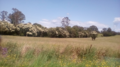
Lansdowne is a rural village on the Mid North Coast near Taree in New South Wales, Australia.
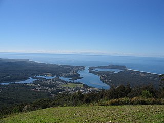
Camden Haven is a parish in the Mid North Coast region of New South Wales, Australia, approximately 30 km south of the major regional centre of Port Macquarie. The harbour is located where the Camden Haven River empties into the Tasman Sea.

Tacking Point Lighthouse is Australia's thirteenth oldest lighthouse. It was built on a rocky headland about 8 kilometres south of Port Macquarie in 1879 by Shepherd and Joseph William Mortley, to a design by the New South Wales Colonial Architect, James Barnet. It is operated by the Australian Maritime Safety Authority and is classified by the National Trust of Australia (NSW).
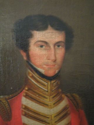
Archibald Clunes Innes (1799–1857) was a soldier and pastoralist from Thrumster, Caithness, Scotland. When he arrived in Australia in 1822 he was a captain in the Third Regiment (Buffs), on the ship Eliza, in charge of 170 convicts.

Ellenborough is a parish and village straddling the Oxley Highway and the Ellenborough River, less than one kilometre south of its confluence with the Hastings River. The village is about 33 km west of Wauchope and approximately 130 km east of Walcha. The boundaries are within the Port Macquarie-Hastings Council and Macquarie County.

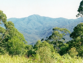
Mount Banda Banda, a mountain of the Mid North Coast region of New South Wales, Australia, is situated 320 kilometres (200 mi) from Sydney within the Willi Willi National Park. Banda Banda can be seen on the north-western horizon from Port Macquarie, as well as on the south-western horizon 39 km from the town of Kempsey. At 1,258 metres (4,127 ft) AHD it is the highest mountain in the region.
Maria River, a watercourse of the Hastings River catchment, is located in the Mid North Coast region of New South Wales, Australia.
Glencoe Creek, also known as Marowin Brook is a creek in Upper Rollands Plains, New South Wales, Australia. It is located in the Port Macquarie-Hastings Council area in the Mid North Coast region of New South Wales.

Port Macquarie First Burying Ground is a heritage-listed former cemetery and now public park at Clarence Street, Port Macquarie, Port Macquarie-Hastings Council, New South Wales, Australia. The site was chosen by Captain Allman, and it was in use from 1822 to 1824. It is also known as Allman Hill Burying Ground, Port Macquarie Burying Ground and Old Port Macquarie Cemetery. The property is owned by Port Macquarie-Hastings Council. It was added to the New South Wales State Heritage Register on 1 July 2005.

St Thomas' Anglican Church is a heritage-listed Anglican church at Hay Street, Port Macquarie, Port Macquarie-Hastings Council, New South Wales, Australia. It was built from 1823 to 1827 by convict labour under military supervision. The property is owned by the Anglican Diocese of Grafton. It was added to the New South Wales State Heritage Register on 18 October 2002.