The European Organisation for the Exploitation of Meteorological Satellites (EUMETSAT) is an intergovernmental organisation created through an international convention agreed by a current total of 30 European Member States.

Jason-1 was a satellite altimeter oceanography mission. It sought to monitor global ocean circulation, study the ties between the ocean and the atmosphere, improve global climate forecasts and predictions, and monitor events such as El Niño and ocean eddies. Jason-1 was launched in 2001 and it was followed by OSTM/Jason-2 in 2008, and Jason-3 in 2016 -- the Jason satellite series.

TOPEX/Poseidon was a joint satellite altimeter mission between NASA, the U.S. space agency; and CNES, the French space agency, to map ocean surface topography. Launched on August 10, 1992, it was the first major oceanographic research satellite. TOPEX/Poseidon helped revolutionize oceanography by providing data previously impossible to obtain. Oceanographer Walter Munk described TOPEX/Poseidon as "the most successful ocean experiment of all time." A malfunction ended normal satellite operations in January 2006.
A scatterometer or diffusionmeter is a scientific instrument to measure the return of a beam of light or radar waves scattered by diffusion in a medium such as air. Diffusionmeters using visible light are found in airports or along roads to measure horizontal visibility. Radar scatterometers use radio or microwaves to determine the normalized radar cross section of a surface. They are often mounted on weather satellites to find wind speed and direction, and are used in industries to analyze the roughness of surfaces.

Copernicus is the European Union's Earth observation programme coordinated and managed by the European Commission in partnership with the European Space Agency (ESA), the EU Member States and EU Agencies.

MetOp is a series of three polar-orbiting meteorological satellites developed by the European Space Agency (ESA) and operated by the European Organization for the Exploitation of Meteorological Satellites (EUMETSAT). The satellites form the space segment component of the overall EUMETSAT Polar System (EPS), which in turn is the European half of the EUMETSAT/NOAA Initial Joint Polar System (IJPS). The satellites carry a payload comprising 11 scientific instruments and two which support Cospas-Sarsat Search and Rescue services. In order to provide data continuity between MetOp and NOAA Polar Operational Satellites (POES), several instruments are carried on both fleets of satellites.
The National Environmental Satellite, Data, and Information Service (NESDIS) was created by the National Oceanic and Atmospheric Administration (NOAA) to operate and manage the United States environmental satellite programs, and manage the data gathered by the National Weather Service and other government agencies and departments.

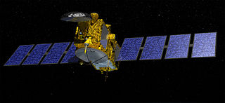
OSTM/Jason-2, or Ocean Surface Topography Mission/Jason-2 satellite, was an international Earth observation satellite altimeter joint mission for sea surface height measurements between NASA and CNES. It was the third satellite in a series started in 1992 by the NASA/CNES TOPEX/Poseidon mission and continued by the NASA/CNES Jason-1 mission launched in 2001.
DORIS is a French satellite system used for the determination of satellite orbits and for positioning. The name is an acronym of "Doppler Orbitography and Radiopositioning Integrated by Satellite" or, in French, Détermination d'Orbite et Radiopositionnement Intégré par Satellite.
The Polar-orbiting Operational Environmental Satellite (POES) was a constellation of polar orbiting weather satellites funded by the National Oceanic and Atmospheric Administration (NOAA) and the European Organization for the Exploitation of Meteorological Satellites (EUMETSAT) with the intent of improving the accuracy and detail of weather analysis and forecasting. The Spacecraft were provided by NASA and the European Space Agency, and NASA's Goddard Space Flight Center oversaw the manufacture, integration and test of the NASA-provided TIROS satellites. The first polar-orbiting weather satellite launched as part of the POES constellation was the Television Infrared Observation Satellite (TIROS), which was launched on April 1, 1960. The final spacecraft, NOAA-19, was launched in February 2009. The ESA-provided MetOp satellite operated by EUMETSAT utilize POES-heritage instruments for the purpose of data continuity. The Joint Polar Satellite System (JPSS), which was launched on November 18, 2017, is the successor to the POES Program.

Sentinel-3 is an Earth observation satellite constellation developed by the European Space Agency as part of the Copernicus Programme. It currently consists of 2 satellites: Sentinel-3A and Sentinel-3B. Two more satellites, Sentinel-3C and Sentinel-3D, are on order.
The Earth and Mission Science Division is a group of European Space Agency (ESA) staff mission scientists, contractors, research fellows, young graduates, trainees, and administrative staff working within the Science, Applications and Climate Department of the Directorate of Earth Observation Programmes. The Division is located at ESA's European Space Research and Technology Centre in Noordwijk, South Holland, The Netherlands.

The Surface Water and Ocean Topography (SWOT) mission is a future satellite altimeter jointly developed by NASA and CNES, the French space agency, in partnership with the Canadian Space Agency (CSA) and UK Space Agency (UKSA). The objectives of the mission are to make the first global survey of the Earth's surface water, to observe the fine details of the ocean surface topography, and to measure how terrestrial surface water bodies change over time. While past satellite missions like the Jason series altimeters have provided variation in river and lake water surface elevations at select locations, SWOT will provide the first truly global observations of changing water levels, slopes, and inundation extents in rivers, lakes, and floodplains. In the world's oceans, SWOT will observe ocean circulation at unprecedented scales of 15-25 km, approximately an order of magnitude finer than current satellites. Because it uses wide-swath altimetry technology, SWOT will almost completely observe the world's oceans and freshwater bodies with repeated high-resolution elevation measurements, allowing observations of variations.
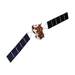
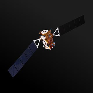
Jason-3 is a satellite altimeter created by a partnership of the European Organisation for the Exploitation of Meteorological Satellites (EUMETSAT) and National Aeronautic and Space Administration (NASA), and is an international cooperative mission in which National Oceanic and Atmospheric Administration (NOAA) is partnering with the Centre National d'Études Spatiales. The satellites' mission is to supply data for scientific, commercial, and practical applications to sea level rise, sea surface temperature, ocean temperature circulation, and climate change.

SARAL or Satellite with ARgos and ALtiKa is a cooperative altimetry technology mission of Indian Space Research Organisation (ISRO) and CNES. SARAL performs altimetric measurements designed to study ocean circulation and sea surface elevation. The payloads of SARAL are The ISRO built satellite with payloads modules, DORIS, Laser Retro-reflector Array (LRA) and ARGOS-3 data collection system provided by CNES was launched by Indian Polar Satellite Launch Vehicle rocket into the Sun-synchronous orbit (SSO). ISRO is responsible for the platform, launch, and operations of the spacecraft. A CNES/ISRO MOU on the SARAL mission was signed on Feb. 23, 2007.
Sentinel-1A is a European radar imaging satellite launched in 2014. It is the first Sentinel-1 satellite launched as part of the European Union's Copernicus programme. The satellite carries a C-band Synthetic Aperture Radar which will provide images in all light and weather conditions. It will track many aspects of our environment, from detecting and tracking oil spills and mapping sea ice to monitoring movement in land surfaces and mapping changes in the way land is used.
Sentinel-3A is a European Space Agency Earth observation satellite dedicated to oceanography which launched on 16 February 2016. It was built as a part of the Copernicus Programme, and is the first of four planned Sentinel-3 satellites. Its sister satellite, Sentinel-3B, launched on 25 April 2018.

Sentinel-4 is a satellite mission making up a part of the European Copernicus Programme, which is also known as the European Global Monitoring for Environment and Security (GMES) programme. The Copernicus Space Component consists of numerous space-borne missions known as "Sentinels"; these are procured by the European Space Agency. The Sentinel-5 precursor, Sentinel-5 and Sentinel-4 represents elements complementary of a constellation intended to serve the needs of Copernicus Atmosphere Monitoring Service (CAMS). Sentinel-4 will utilize 2 payload instruments integrated on board a Meteosat Third Generation Sounder (MTG-S) satellite to observe primarily the tropospheric composition of the Earth's atmosphere. The data will be gathered and made available to the Copernicus program with the aim of contributing to air quality applications such as with the Copernicus Atmosphere Services as well as the air quality monitoring over the regions of Europe and Northern Africa. As with other aspects of the Copernicus programme, the Sentinel-4 initiative is funded mostly through the EU and the technical design and development has been put under responsibility of the European Space Agency (ESA).
GOES-U is a planned weather satellite, the fourth and last of the GOES-R series of satellites operated by the National Oceanic and Atmospheric Administration (NOAA). The GOES-R series will extend the availability of the Geostationary Operational Environmental Satellite (GOES) system until 2036. The satellite will be built by Lockheed Martin, based on the A2100 platform.