This article needs additional citations for verification . (July 2008) (Learn how and when to remove this template message) |
Sharon, West Virginia | |
---|---|
Coordinates: 38°09′34″N81°26′49″W / 38.15944°N 81.44694°W Coordinates: 38°09′34″N81°26′49″W / 38.15944°N 81.44694°W | |
Country | United States |
State | West Virginia |
County | Kanawha |
Elevation | 673 ft (205 m) |
Time zone | UTC-5 (Eastern (EST)) |
• Summer (DST) | UTC-4 (EDT) |
Area code(s) | 304 & 681 |
GNIS feature ID | 1546622 [1] |
Other names | Penn Hollow [1] |
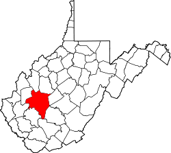
Sharon is an unincorporated community and coal town in southeastern Kanawha County, West Virginia, United States, located along the West Virginia Turnpike.
Sharon is located at 38°09′34″N81°26′49″W / 38.159549°N 81.447059°W (38.159549, -81.447059) [1] along Cabin Creek. [2] It has an elevation of 673 feet (205 m).
Sharon is located on Secondary State Route 79, locally known as Cabin Creek Road. Exit 79 of Interstate 77 is located here; no services are available at the exit.
Until the 1980s, a rail spur ran from the CSX railroad tracks up a short hollow, serving a coal mine tipple. The remnants of the tracks and rail bed can still be seen at present day along Paint Branch, however, no sign remains of the at-grade crossing of Cabin Creek Road or the trestle that crossed Cabin Creek.
As a result of the badly needed upgrade of the West Virginia Turnpike to Interstate standards, multiple homes occupying the adjacent land were bought by the state and demolished.
The cemetery is hidden behind the few homes that sit at the bottom of Sharon Hill or some call Sharon mountain. There are about 12 houses in the hollow and a church at the bottom to the left as soon as you cross the Cabin Creek bridge. If you park at the church you can walk up the road and behind the houses the mountain cemetery begins. There are generations of graves here back farther than 1700. It is a straight up hike with a narrow path of family plot after plot. This trek is not for the weary. There are rattlesnakes and it is steep. The families buried here have mined coal and farmed the Appalachias for centuries. Some of the family names include Basham, Totten, Burns, Perry, Harlow, and many more. This mountain forest cemetery is covered in flowers from top to bottom from families who keep their family traditions.
Sharon had a United States Post Office until the early 1990s, the ZIP code was 25182.
Interstate 79 (I-79) is an Interstate Highway in the eastern United States, designated from Interstate 77 in Charleston, West Virginia to Pennsylvania Route 5 and Pennsylvania Route 290 in Erie, Pennsylvania. It is a primary thoroughfare through western Pennsylvania and West Virginia, and makes up part of an important corridor to Buffalo, New York, and the border with Canada. Major metropolitan areas connected by I-79 include Charleston and Morgantown in West Virginia, and Pittsburgh, and Erie in Pennsylvania. In West Virginia, Interstate 79 is known as the Jennings Randolph Expressway, named for Jennings Randolph. In the three most northern counties it is signed as part of the High Tech Corridor. For most of its Pennsylvania stretch, it is known as the Raymond P. Shafer Highway, named for Raymond P. Shafer.
Interstate 77 (I-77) is a north–south Interstate Highway in the eastern United States. It traverses diverse terrain, from the mountainous state of West Virginia to the rolling farmlands of North Carolina and Ohio. It largely supplants the old U.S. Route 21 between Cleveland, Ohio, and Columbia, South Carolina, as an important north–south corridor through the middle Appalachians. The southern terminus of Interstate 77 is in Columbia at the junction with Interstate 26. The northern terminus is in Cleveland at the junction with Interstate 90. Other major cities that I-77 connects to include Charlotte; Charleston, West Virginia and Akron, Ohio. The East River Mountain Tunnel, connecting Virginia and West Virginia, is one of only two instances in the United States where a mountain road tunnel crosses a state line. The other is the Cumberland Gap Tunnel, connecting Tennessee and Kentucky. I-77 is a route to the southern United States for those traveling from the Great Lakes region.
Sissonville is a census-designated place (CDP) in Kanawha County, West Virginia, along the Pocatalico River. The population was 4,028 at the 2010 census. Sissonville is located less than 14 miles north of Charleston.
U.S. Route 119 (US 119) is a spur of US 19. It is a north–south route that was an original United States highway of 1926. It is Corridor G of the Appalachian Development Highway System (ADHS) east of US 23 and KY 80 in Kentucky to Interstate 64 at Charleston, West Virginia.
Midlothian, Virginia is an unincorporated area in Chesterfield County, Virginia, U.S. Settled as a coal town, Midlothian village experienced suburbanization effects and is now part of the western suburbs of Richmond, Virginia south of the James River in the Greater Richmond Region. Because of its unincorporated status, Midlothian has no formal government, and the name is used to represent either the original small Village of Midlothian, located near US-60 and Woolridge Road, or a vast expanse of Chesterfield County in the northwest portion of Southside Richmond covered by three zip codes served by the Midlothian post office. These zip codes are not coterminous with the Midlothian Magisterial District associated with the Chesterfield County government.
Mill Creek is a 14.5-mile-long (23.3 km) tributary of Opequon Creek, belonging to the Potomac River and Chesapeake Bay watersheds, located in Berkeley County in West Virginia's Eastern Panhandle. Its name reflects its past as a popular site for various types of mills, beginning with one constructed by Morgan Morgan in the mid-18th century near his cabin in present-day Bunker Hill.
Heaters is a small unincorporated community in Braxton County, West Virginia, United States. Heaters is situated about three miles north of Flatwoods on U.S. Route 19, which is a paved two-lane road. Access to I-79 is at exit 67 in Flatwoods. Heater's has a United States Postal Service post office and the ZIP Code is 26627.
Butcher Hollow is a coal-mining community located in Johnson County, Kentucky, United States. It is the birthplace of country singer Loretta Lynn, who paid tribute to the community in the song "Coal Miner's Daughter", which begins with the lyrics
Well, I was born'd a coal miner's daughter
In a cabin on a hill in Butcher Holler
U.S. Route 50 is a transcontinental highway which stretches from Ocean City, Maryland to West Sacramento, California. In the U.S. state of Virginia, US 50 extends 86 miles (138 km) from the border with Washington DC at a Potomac River crossing at Rosslyn in Arlington County to the West Virginia state line near Gore in Frederick County.
Interstate 77 (I-77) in the U.S. state of West Virginia is a major north–south Interstate Highway. It extends for 187.21 miles (301.29 km) between Bluefield at the Virginia state line and Williamstown at the Ohio state line.
U.S. Route 460 (US 460) in Virginia runs west-east through the southern part of the Commonwealth. The road has two separate pieces in Virginia, joined by a relatively short section in West Virginia. Most of US 460 is a four-lane divided highway and is a major artery in the southern third of the state. From Petersburg to Suffolk, US 460 is a four-lane non-divided highway. It is a popular alternative to Interstate 64 (I-64) when going from Richmond and other points in central Virginia to the Currituck Sound and Outer Banks of North Carolina, avoiding the congestion and tunnels of the more northerly I-64 corridor. The road passes through several small towns that built up at stops along the railroad line. Two of these, Windsor and Waverly, have earned reputations for being speed traps.
The Logan Coalfield is a coalfield located in Logan County and Wyoming County of southern West Virginia, in the Appalachia region of the eastern United States.
U.S. Route 60 (US 60) in the Commonwealth of Virginia runs 303 miles (488 km) west to east through the central part of the state, generally close to and paralleling the Interstate 64 corridor, except for the crossing of the Blue Ridge Mountains, and in the South Hampton Roads area.
State Route 100 is a primary state highway in the U.S. state of Virginia. The state highway runs 53.31 miles (85.79 km) from U.S. Route 221 in Hillsville north to SR 61 in Narrows. SR 100 is one of the major highways of the New River Valley, connecting Narrows and Pearisburg in Giles County with Dublin, Pulaski, and Interstate 81 (I-81) in Pulaski County.
Black Creek is a long source tributary of Nescopeck Creek so part of the Susquehanna River drainage basin. It is also the second & longer stream of the same name recognized by the USGS GNIS system in Luzerne County, Pennsylvania, in the United States—compared to the Black Creek beyond the ridgeline of the drainage divide, so in the Lehigh River valley and Carbon County. The headwaters of both Black Creeks in Luzerne county are only a few miles apart, and both valleys were traversed by the Lausanne-Nescopeck Turnpike in the first half of the 19th-century.
Interstate 81 (I-81) is an 854.89-mile-long (1,375.81 km) north–south Interstate Highway, stretching from Dandridge, Tennessee to Fisher's Landing, New York at the United States/Canadian border. In the state of Pennsylvania, I-81 runs for 232.63 miles (374.38 km) from the Maryland state line near Greencastle to the New York state line near Hallstead and is called the American Legion Memorial Highway. It is the longest north–south Interstate in Pennsylvania.
Beards Fork is a census-designated place (CDP) and coal town in Fayette County, West Virginia, United States that was founded as a coal town. As of the 2010 census, its population was 199.
Kay Moor, also known as Kaymoor, is the site of an abandoned coal mine, coal processing plant and coal town near Fayetteville, West Virginia. The town site is located in the New River Gorge at Kaymoor Bottom (38°03′00″N81°03′17″W). It is linked to the mine portal 560 feet (170 m) above on Sewell Bench (38°02′52″N81°03′58″W) in the wall of the Gorge by conveyors.
Cabin Creek is an unincorporated community in Kanawha County, West Virginia, United States. Cabin Creek is located on the south bank of the Kanawha River at the mouth of Cabin Creek, southeast of Chesapeake. It was the site of an early African-American community in the late nineteenth century. A notable resident was Adam Clayton Powell, Sr. and his family, who had moved there from Virginia. An exit on the West Virginia Turnpike is located near here.
Glade Springs, West Virginia is an unincorporated community consisting of a gated community and resort located just outside Beckley in Raleigh County, West Virginia.