Sharrow

Last updated

Sharrow
South Yorkshire UK location map.svg
Red pog.svg
Sharrow
Location within South Yorkshire
Metropolitan borough
Metropolitan county
Region
Country England
Sovereign state United Kingdom
Post town Sheffield
Postcode district S2, S7, S11
Dialling code 0114
Police South Yorkshire
Fire South Yorkshire
Ambulance Yorkshire
UK Parliament
List of places
UK
England
Yorkshire
53°22′02″N1°29′20″W / 53.36716°N 1.48885°W / 53.36716; -1.48885
Sharrow Mills, a snuff factory on the Porter Brook. Sharrow Mills.JPG
Sharrow Mills, a snuff factory on the Porter Brook.

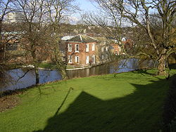
Sharrow is a suburb of Sheffield located directly southwest of Sheffield city centre. The district lies within the Nether Edge and Sharrow ward of the city.

Contents

Sharrow Ward's back to back terraced housing in Little Sheffield was redeveloped in the 1970s to provide modern, high density accommodation for the area's working class population. During the 1980s, cultural, economic and social tensions contributed to a general decline of the district.

With the economic resurgence of Sheffield in the late 1990s, Sharrow has benefited from considerable inward investment both in improved housing stock and through development of local initiatives such as the small business enterprise unit at Sheffield United F.C.'s Bramall Lane ground in nearby Highfield.

Until June 2004 Sharrow was also the name given to one of Sheffield's electoral wards which included Sharrow proper and a number of surrounding districts. This diverse ward contained 17,897 people in the 2001 UK Census subdivided as follows:

This diversity is celebrated by some with the Sharrow Festival, a multi-cultural, multi-arts event showcasing local talent and fostering a spirit of pride in the local community. The annual Sharrow Lantern Carnival is the other cultural highlight in the area, and is held in April.

History

Sharrow Ward was urbanized between 1830 and 1850 when Little Sheffield, a village and adjunct to the main town of Sheffield was redeveloped to cope with the rapidly increasing growth in population. Separated from Sheffield town by the "uninhabited, barren, gorse-covered, Sheffield Moor". [1] Industry here was based on water-power provided by Porter Brook with water-wheels at Sharrow Mill (Sharrow Vale Road), Sharrow Forge (Napier Street), and Bennetts’ Wheel (Vulcan Works). The latter two mill-dams and Broomhall Cornmill dam off Ecclesall Road were drained and filled-in around 1870 providing land for houses, schools, and new industries.

The Parish Church of St Mary's, Bramall Lane, was built in 1826 with the help of a government grant to provide churches for "impoverished industrial workers". Originally a Chapel of Ease to Sheffield Cathedral standing in open fields, 22 years later, in 1848, St Mary's became a parish in its own right. Sharrow and St Mary's was part of Poor Law Union (PLU)/Reg. District of Ecclesall Bierlow.

In 1836 the General Cemetery was opened in Sharrow on the site of a former stone quarry. Lying between Cemetery Road, which runs from Sharrow Head to the bottom of The Moor, and Sharrow Brook.

Bramall Lane was named after the Bramall family, file and graver manufacturers. The Bramalls owned "The Old White House" on the corner of Bramall Lane and Cherry Street.

Related Research Articles

<span class="mw-page-title-main">Porter Brook</span> River in Sheffield, South Yorkshire, England

The Porter Brook is a river which flows through the City of Sheffield, England, descending over 1,000 feet (300 m) from its source on Burbage Moor to the west of the city to its mouth where it joins the River Sheaf in a culvert beneath Sheffield railway station. Like the other rivers in Sheffield, its steep gradient made it ideal for powering water mills and works associated with the metalworking and cutlery industries, and around 20 dams were constructed over the centuries to facilitate this. At its lower end, it is extensively culverted, but parts of it are gradually being restored to open channels, as part of a daylighting scheme for the city.

<span class="mw-page-title-main">Ecclesall</span> Electoral ward in the City of Sheffield, South Yorkshire, England

Ecclesall Ward—which includes the neighbourhoods of Banner Cross, Bents Green, Carterknowle, Ecclesall, Greystones, Millhouses, and Ringinglow—is one of the 28 electoral wards in the City of Sheffield, England. It is located in the southwestern part of the city and covers an area of 3.6 square miles. The population of this ward in 2007 was 19,211 people in 7,626 households, reducing to 6,657 at the 2011 Census. Ecclesall ward is one of the four wards that make up the South West Community Assembly and one of five wards that make up the Sheffield Hallam Parliamentary constituency. The Member of Parliament is Olivia Blake, a Labour MP. Ecclesall is one of the least socially deprived wards in the entire country, with a 2002 deprivation score of 4.7—making it the 8,105th most deprived ward out of 8,414 wards in the country. The demographic consists largely of white, middle-class families.

<span class="mw-page-title-main">Broomhill and Sharrow Vale</span> Electoral ward in the City of Sheffield, South Yorkshire, England

Broomhill and Sharrow Vale — which includes the districts of Broomhill, Broomhall, Crookesmoor, Endcliffe, Sharrow Vale and Tapton Hill — is one of the 28 electoral wards in City of Sheffield, England. The ward was created following the 2015 local government boundary review out of parts of the old Broomhill, Central and Nether Edge wards. It is located in the western part of the city. The population of the Broomhill ward in 2011 was 16,966 people in 5,708 households, covering an area of 2.7 km2. Broomhill & Sharrow Vale is one of the wards that make up the Sheffield Central Parliamentary Constituency.

<span class="mw-page-title-main">Nether Edge and Sharrow (ward)</span> Electoral ward in the City of Sheffield, South Yorkshire, England

Nether Edge and Sharrow Ward , which includes the districts of Brincliffe, Nether Edge, Sharrow, and part of Highfield, is one of the 28 electoral wards in the City of Sheffield, England. It is located in the southern part of the city and covers an area of 1.31 square miles (3.4 km2). In 2011, the population of this ward was 18,890 people in 7,592 households. Nether Edge ward is one of the wards that make up the Sheffield Central parliamentary constituency.

Ecclesfield is a village and civil parish in the City of Sheffield, South Yorkshire, England, about 4 miles (6 km) north of Sheffield City Centre. Ecclesfield civil parish had a population of 32,073 at the 2011 Census. Ecclesfield wards of the City of Sheffield had a population of 35,994 in 2011. The population of Ecclesfield village stood at 7,163 in the most recent census.

<span class="mw-page-title-main">Millhouses</span> Neighbourhood in Sheffield, England

Millhouses is a neighbourhood in the City of Sheffield, England. It is located in Ecclesall ward; in the south-western portion of the city on the northwest bank of the River Sheaf. Its origins lie in a small hamlet that grew around the Ecclesall Corn Mill. It has a population of 4,424.

<span class="mw-page-title-main">Ringinglow</span> Village in South Yorkshire, England

Ringinglow is a village in the western section of Sheffield, England. It is on the western border of Ecclesall Ward, and although it is within the boundary of Sheffield, it is self-contained, being entirely surrounded by open countryside. The village now falls within the Fulwood ward of the City.

<span class="mw-page-title-main">Whirlow</span> Suburb of Sheffield, South Yorkshire, England

Whirlow is a suburb of the City of Sheffield in England, it lies 3.7 miles (6 km) south-west of the city centre. The suburb falls within the Dore and Totley ward of the City. It is one of the most affluent areas of Sheffield, with much high class housing and several notable small country houses within it. During the Victorian era it was home to some of Sheffield's most influential citizens. Whirlow straddles the A625, the main Sheffield to Hathersage road. The suburb covers the area from Parkhead in the north to Whirlow Bridge in the south and from Ecclesall Woods in the east to Broad Elms Lane in the west. Whirlow had a population of 1,663 in 2011.

<span class="mw-page-title-main">Fulwood (ward), South Yorkshire</span> Electoral ward in the City of Sheffield, South Yorkshire, England

Fulwood ward—which includes the districts of Fulwood, Lodge Moor, and Ranmoor—is one of the 28 electoral wards in the City of Sheffield, England. It is located in the far western part of the city and covers an area of 23.2 km2. The population of this ward in 2011 was 18,233 people in 6,476 households. Fulwood ward is one of the five wards that make up the Sheffield Hallam Parliamentary constituency. As of June 2022, Andrew Sangar, Sue Alston, and Cliff Woodcraft, all Liberal Democrats, were councillors for the ward. The current Member of Parliament is Labour's Olivia Blake.

<span class="mw-page-title-main">Loxley, South Yorkshire</span> Village in South Yorkshire, England

Loxley is a village and a suburb of the city of Sheffield, England. It is a long linear community which stretches by the side of the River Loxley and along the B6077 for almost 2.5 miles (4 km). Loxley extends from its borders with the suburbs of Malin Bridge and Wisewood westward to the hamlet of Stacey Bank near Damflask Reservoir. The centre of the suburb is situated at the junction of Rodney Hill and Loxley Road where the old village green stands and this is located 3 miles (5 km) north west of Sheffield city centre. The suburb falls within the Stannington ward of the City of Sheffield.

<span class="mw-page-title-main">City ward, Sheffield</span> Electoral ward in the City of Sheffield, South Yorkshire, England

City ward — which includes the districts of Highfield, Kelham Island and the city centre — is one of the 28 electoral wards in City of Sheffield, England. It covers the central area of the city. The ward was created following the 2015 local government boundary review out of part of the old Central ward, which, with a population of 36,412, was the largest ward in the UK. City is one of the wards that make up the Sheffield Central constituency.

<span class="mw-page-title-main">Areas of Sheffield</span>

The areas of Sheffield, a city and metropolitan borough in the north of England, vary widely in size and history. Some of the areas developed from villages or hamlets, that were absorbed into Sheffield as the city grew, and thus their centres are well defined, but the boundaries of many areas are ambiguous. The areas of Sheffield do not play a significant administrative role, but the city is divided into 28 electoral wards for local elections and 6 parliamentary constituencies for national elections.

Smallthorne is an area in the city of Stoke-on-Trent in Staffordshire, England. It is in the north-east of the city, near Burslem. Smallthorne borders Bradeley and Chell in the north, Norton-in-the-Moors in the east, Sneyd Green in the south, and Burslem in the west.

<span class="mw-page-title-main">Hunter's Bar</span> Roundabout in Sheffield, South Yorkshire, England

Hunter's Bar is a roundabout and former toll bar on Ecclesall Road in south-west Sheffield, England; the toll bar was active until the late 19th century. The name also attaches to the area surrounding Hunter's Bar roundabout at the intersection of Ecclesall Road, Brocco Bank, Sharrow Vale Road and Junction Road. The toll bar now stands in the middle of the roundabout. The gatekeeper for the toll bar, known as "Hunter's Toll Gate" lived in a house on the corner of Ecclesall Road and Sharrow Vale Road. In 1871, the gatekeeper was Jacob Thompson, who was born in Wirksworth, Derbyshire and had previously been a lead miner there. His wife and two daughters lived with him.

<span class="mw-page-title-main">Ecclesall Road</span> Road in Sheffield, South Yorkshire, England

Ecclesall Road is a road in Sheffield, South Yorkshire, England, that runs for about 3.6 miles (5.8 km) south-west from Sheffield's city centre under the number A625. At Banner Cross, where the house numbers reach 1001, the road name changes to Ecclesall Road South and numbering restarts. Ecclesall Road, as a named road, finishes at Whirlow, although the course of the road continues as Hathersage Road.

The Sheffield to Hathersage turnpike was an early road through the English Peak District, which was improved by a turnpike trust in the 18th century. The road may have originated as a Roman road.

<span class="mw-page-title-main">Sharrow Mills</span>

Sharrow Mills are a collection of industrial buildings in Sheffield, England, which have been used for the production of snuff by the firm of Wilsons of Sharrow since the mid 18th century. The mills stands on the Porter Brook in the Sharrow Vale area of the city, just off Ecclesall Road.

<span class="mw-page-title-main">Fulwood, Sheffield</span> Suburb of Sheffield in South Yorkshire, England

Fulwood is a residential suburb and ward of the City of Sheffield in England, it lies 5.5 km west-southwest of the city centre. Formerly an ancient settlement and village on the Porter Brook, it became integrated into the city in the 1930s. It is bounded by the suburbs of Lodge Moor to the NW, Ranmoor to the east and Crosspool to the NE. The open countryside of the Peak District lies to the west and SW. The sub districts of Stumperlowe and Goole Green are part of the suburb. The population of the ward at the 2011 Census was 18,233. Fulwood is located in the Sheffield Hallam constituency which, as of the 2019 general election voted Labour.

References

  1. Reminiscences 18th century Sheffield by R E Leader