
Bradfield is a civil parish in the City of Sheffield, in South Yorkshire, England.

Stocksbridge and Upper Don ward is one of the 28 electoral wards of the borough of Sheffield, South Yorkshire, England. The population of this ward was 18,541 at the 2011 Census.

The Little Don River also known as the Porter, is a tributary of the River Don in South Yorkshire, England. Arising on the Langsett Moors in the northern Peak District, the Little Don River feeds the Langsett and Underbank Reservoirs. It runs through the town of Stocksbridge before joining the River Don.

Warburton is a village and civil parish in the Metropolitan Borough of Trafford, Greater Manchester, England. Historically in Cheshire, it lies on the south bank of the River Mersey. The village remains predominantly rural. Altrincham is the nearest town. At the 2001 census, the parish had a population of 286.

Morcott is a village and civil parish in the county of Rutland in the East Midlands of England. The population at the 2001 census was 329 falling slightly to 321 at the 2011 census. It is located about 7 miles (11 km) south-east of the county town of Oakham on the A47 and A6121 roads. A prominent reconstructed windmill can be seen from both East and West-bound approaches to Morcott along the A47.

Donyatt is a village and civil parish in Somerset, England, situated at the source of the River Isle 5 miles (8.0 km) north of Chard in the South Somerset district. The village has a population of 347. The parish includes the hamlet of Peasmarsh.

Brockholes is a small village in West Yorkshire, England, in the administrative area of Kirklees Metropolitan Council and Holme Valley Parish Council. The village of Honley borders to the immediate north of the village and Holmfirth lies to the south. Brockholes is within the Postal district of Holmfirth.

Langsett Reservoir is in Yorkshire, England, near the villages of Langsett and Upper Midhope, on the edge of the Peak District National Park. The reservoir was constructed between 1898 and 1904, and is now managed by Yorkshire Water. Fed by the Little Don or Porter River, it is around a mile long, and supplies water for Sheffield and Barnsley via the Langsett Treatment Works.

The Stocksbridge Railway was a subsidiary of Samuel Fox and Company and linked the company's works at Stocksbridge, near Sheffield, South Yorkshire, England, with the main line of the Manchester, Sheffield and Lincolnshire Railway at Deepcar. As the size of Fox's steelworks expanded, better transport links were needed, and the railway was authorised by an Act of Parliament in 1874. It was completed in 1877, and remained an independent subsidiary until 1992, when it became part of the steelworks operation. When the Woodhead line was closed to the north of Deepcar, the line south to Sheffield was singled, and operates as a long siding.
Bolsterstone is a village in South Yorkshire, England, south of Stocksbridge, and 8.5 miles to the northwest of the City of Sheffield and within the city borough. It lies on the border of the Peak District national park. Bolsterstone had a population of 386 in 2011.

The A616 is a road that links Newark-on-Trent, Nottinghamshire, to the M1 motorway at Junction 30, then reappears at Junction 35A and goes on to Huddersfield, West Yorkshire.

Allington is a hamlet in north Wiltshire, England. It is on the edge of the market town of Chippenham, about 2 miles (3 km) north-west of the town centre and about 0.3 miles (500 m) north of the A420 road towards Bristol.

Dungworth is a hamlet in the civil parish of Bradfield, west of Sheffield in South Yorkshire, England.

St James’ Church, Midhopestones is situated in the small rural hamlet of Midhopestones, just within the northern boundary of the City of Sheffield in South Yorkshire. Since April 1969 it has been a Grade II* listed building. St James is small church which is often referred to as a chapel, in fact it is situated on Chapel Lane. The church is officially dedicated to James the Less and not James the Greater although there has always been some confusion. Some modern historians and clergy maintain that the church should be dedicated to James the Greater as the scallop shells carved above the church door are the traditional emblem of James the Greater. It is possible that it was re-dedicated to James the Less in the Victorian era because of the smallness of the church. The church is in the Parish of Penistone within the Diocese of Wakefield.

Upper Midhope is a village in the civil parish of Bradfield within the Stocksbridge and Upper Don electoral ward in the borough of the City of Sheffield, England. It lies just on the edge of the Peak District national park.

Brightholmlee is a small rural hamlet within the City of Sheffield in England. The hamlet falls within the Stannington Ward of the City. It is 6.2 miles (10 km) north-west of the city centre and 0.6 miles (1 km) west of Wharncliffe Side within Bradfield parish. Previously a farming community, it consist of four farmsteads, Manor Farm, Old Hall Farm, High Lea Farm and Lee Farm. It is now almost entirely residential with the last working farm being sold for development in 2013.

Bradfield Dale is a rural valley 12 kilometres (7.5 mi) west-northwest of the City of Sheffield in England. The valley stands within the north-eastern boundary of the Peak District National Park just west of the village of Low Bradfield. The dale is drained by the Strines Dike which becomes the Dale Dike lower down the valley, these being the headwaters of the River Loxley. The dale contains two reservoirs, Strines and Dale Dike, and a third, Agden Reservoir, stands in a side valley just above Low Bradfield. The dale is characterised by agricultural land interspersed with farming and residential buildings. It is approximately 5 kilometres (3.1 mi) long from its foot at Low Bradfield to its head on Strines Moor.

Colesbourne is a village and civil parish in the Cotswold district of Gloucestershire, England. The village and parish lies within the Cotswolds, a designated Area of Outstanding Natural Beauty.

The Underbank is an area of Stockport, Greater Manchester, England, containing the streets of Little Underbank and Great Underbank. Originally considered the finest shopping street in Stockport during the 19th century, the street was dubbed as Stockport's answer to Soho following an influx of independent businesses.
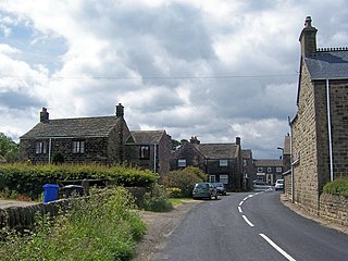
Midhopestones is a village which forms part of the parish of Bradfield, in the City of Sheffield, South Yorkshire, England; here defined as the part of the parish in the Stocksbridge and Upper Don ward and the S36 postcode area. The area contains 23 listed buildings that are recorded in the National Heritage List for England. Of these, one is listed at Grade II*, the middle of the three grades, and the others are at Grade II, the lowest grade. The area is to the northwest of the city of Sheffield, and contains the village of Midhopestones, the hamlets of Upper Midhope and Wigtwizzle, and a large area of countryside, much of which is moorland.

