Beighton, South Yorkshire

Last updated

Beighton
Beighton.jpg
High Street, Beighton
South Yorkshire UK location map.svg
Red pog.svg
Beighton
Location within South Yorkshire
OS grid reference SK408838
Metropolitan borough
Metropolitan county
Region
Country England
Sovereign state United Kingdom
Post town SHEFFIELD
Postcode district S20
Police South Yorkshire
Fire South Yorkshire
Ambulance Yorkshire
UK Parliament
List of places
UK
England
Yorkshire
53°20′44″N1°21′35″W / 53.3455506°N 1.3596662°W / 53.3455506; -1.3596662

Beighton is a village 6 miles south-east of Sheffield's city centre, now classed as a historic township of the city. Due to much expansion, the village became a part of Sheffield city in 1967, and was transferred from Derbyshire to the newly created South Yorkshire, England. During much of the late 17th to 19th centuries the village was noted for its edge tool manufacturing, with Thomas Staniforth & Co Sickle works being based at nearby Hackenthorpe. [1] [2]

Contents

The former village has a number of schools, including Beighton Nursery and Infant School and Brook House Junior School.

Today, there has been a lot of development of housing; however, due to its location on the outskirts of Sheffield, it maintains a rural setting alongside villages including Eckington, Mosborough, Ridgeway, and Dronfield.

History

The first mention of the village comes from 9th century Anglo Saxon records of Derbyshire land owners. The village was then known as Bectune.The then hamlet stood on the edges of the 'Great Forest' which stood in the area where the Rother Valley Country Park stands today and extended to areas of Derbyshire, Nottinghamshire, West Yorkshire and Lincolnshire. Today the only remnants of the 'Great Forest' is Sherwood Forest. [3]

The area was settled by the British invaders known as the Angles. The invasions took place at the end of the Romanic period around 500 AD. Prior to these invasions the area was part of the Kingdom of Mercia, the local Shire Brook formed the border with the neighbouring kingdom of Northumbria. Being so close to the border meant the hamlet was prone to invasions.

The Sheffield Museum contains a number of bones and flint tools unearthed in the area during the 19th century, dating back to the Neolithic period, this shows the area was inhabited long before the Angles settled.

The village was noted as having 15 households in the Domesday book in 1086, with the land being owned by Roger the Poitevin. [4] A moated castle was said to be evident in the village, with a reference from the 13th century describing 'the tower of the former castle ' being evident in a field named Castle Mead, however no evidence remains. [5] [6]

The parish church of St. Mary's dates back to c1150. The first documented mention of the church is in an undated deed written during the reign of Edward I (1272–1307). [7]

Prior to the 20th century, farming and smithing were the primary forms of employment, however this shifted towards mining towards the end of the 19th century, with numerous mines being opened in the area, most notably Brookhouse Colliery and Birley Collieries. [8] The Ochre Dyke stream was used to power grinding and water wheels during this time period. [9]

The village was served by Beighton railway station until its closure in 1954. [10]

Due to the villages location close to the River Rother, a number of major flooding events have occurred, notably in 1940, [11] 1954 and 1960. [12]

In 1961 the civil parish had a population of 23,056. [13] On 1 April 1967 the parish was abolished and merged with Sheffield, Eckington, "Aston cum Aughton", Wales and Killamarsh. [14] It is now in the unparished area of Sheffield.

Sport

The village has produced a number of sports teams, notably the Beighton Miners Welfare F.C. which reached the First Round of the FA Cup in 1953. [15] Cricket has also had a major presence in the village, with the Miners' Welfare Cricket Club being formed in 1928 after merging with the nearby Hackenthorpe Cricket Club.

Present day

Church of St Mary the Virgin, Beighton Beighton Parish Church - geograph.org.uk - 54371.jpg
Church of St Mary the Virgin, Beighton

Beighton, along with a number of local villages, became part of Sheffield city in 1967, being officially recognized as Beighton (ward). The Crystal Peaks shopping centre was opened in 1988, which features regular bus routes to Sheffield city centre. [16] Many of the local residents are now employed in Sheffield, Worksop and other large cities.

Rother Valley Country Park was opened in 1983, providing a site for recreational activities. Gulliver's Valley, a theme park was opened to the north of the village in 2020. [17]

Although the village once featured a number of public houses including The Railway Inn, only The Cumberland, Fox Inn and the Miners Welfare remain. [18]

Related Research Articles

<span class="mw-page-title-main">River Rother, South Yorkshire</span> River in South Yorkshire, England

The River Rother, a waterway in the northern midlands of England, gives its name to the town of Rotherham and to the Rother Valley parliamentary constituency. It rises in Pilsley in Derbyshire and flows in a generally northwards direction through the centre of Chesterfield, where it feeds the Chesterfield Canal, and on through the Rother Valley Country Park and several districts of Sheffield before joining the River Don at Rotherham in Yorkshire. Historically, it powered mills, mainly corn or flour mills, but most had ceased to operate by the early 20th century, and few of the mill buildings survive.

<span class="mw-page-title-main">Beighton (ward)</span> Electoral ward in the City of Sheffield, South Yorkshire, England

Beighton —which includes the districts of Beighton, Hackenthorpe, Owlthorpe, and Sothall—is one of the 28 electoral wards in City of Sheffield, England. It is located in the eastern part of the city, on the border with Rotherham and covers an area of 5.7 km2. The population of this ward in 2011 was 17,939 people in 7,538 households.

<span class="mw-page-title-main">Birley Spa</span>

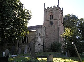
Birley Spa is a grade-II listed community bath hall and a Victorian bathhouse in the Hackenthorpe district of the City of Sheffield, England.

<span class="mw-page-title-main">Eckington, Derbyshire</span> Village in North East Derbyshire, England

Eckington is a village and civil parish in North East Derbyshire, England. It is 7 miles (11 km) northeast of Chesterfield and 9 miles (14 km) southeast of Sheffield city centre, on the border with South Yorkshire. It lies on the B6052 and B6056 roads close to the A6135 for Sheffield and Junction 30 of the M1. It had a 2001 population of 11,152, increasing to 11,855 at the 2011 Census.

<span class="mw-page-title-main">Hackenthorpe</span> Village in South Yorkshire, England

Hackenthorpe is a village 5 miles south east of Sheffield’s city centre, now classed as a historic township of the city. Due to much expansion, the village became a part of Sheffield city during the 1950s. During much of the late 19th and 20th centuries the village was noted for its steelmaking, with the Thomas Staniforth & Co Sickle works being based at Main Street. Another prominent feature of the village is the 17th century Hackenthorpe Hall, built by John Newbould for the Hounsfield family, with James Hounsfield being a prominent land owner. The building is today used as a nursery.

<span class="mw-page-title-main">Birley</span> Electoral ward in the City of Sheffield, South Yorkshire, England

Birley ward — which includes the districts of Base Green, Birley Estate, Charnock, Frecheville, Scowerdons and part of Hackenthorpe — is one of the 28 electoral wards in City of Sheffield, England. It is located in the southeastern part of the city and covers an area of 5.1 square kilometres (2 sq mi). The population of this ward in 2011 was 16,943 people in 7,393 households. It is one of the five wards that make up the Sheffield South East constituency.

<span class="mw-page-title-main">Mosborough (ward)</span> Electoral ward in the City of Sheffield, South Yorkshire, England

Mosborough is an electoral ward of the City of Sheffield, England, in the eastern part of the city, on the border with North East Derbyshire District. The population in 2011 was 17,097. It is one of the wards that make up the Sheffield South East constituency.

<span class="mw-page-title-main">Killamarsh</span> Village and civil parish in Derbyshire, England

Killamarsh is a village and civil parish in North East Derbyshire, England, bordering Rotherham to the north and Sheffield to the north-west.

<span class="mw-page-title-main">Rother Valley Country Park</span> Country park in South Yorkshire, England

The Rother Valley Country Park is a country park in the Metropolitan Borough of Rotherham, South Yorkshire, England, close to Rotherham's border with Sheffield and Derbyshire. It covers 3 square kilometres and has four artificial lakes, recreational activities and nature reserves. The majority of the park is on land that was open cast for coal, with the main excavation sites filled by the artificial lakes.

<span class="mw-page-title-main">Beighton railway station</span> Former railway station on the border between Derbyshire and South Yorkshire, England

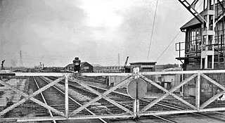
Beighton railway station is a former railway station near the village of Beighton on the border between Derbyshire and South Yorkshire, England.

The Sheffield Coal Company was a colliery owning and coal selling company with its head office situated in South Street, Sheffield, South Yorkshire, England.

<span class="mw-page-title-main">Shire Brook</span> Waterway in South Yorkshire, England

Shire Brook is a small stream in the south eastern part of the City of Sheffield in South Yorkshire, England. It rises in the suburb of Gleadless Townend and flows in a general easterly direction for 4 miles (6.5 km) to its confluence with the River Rother between Beighton and Woodhouse Mill. In the past the brook has been both the border of Yorkshire and Derbyshire and between the sees of Canterbury and York. The course of the stream has been influenced by human intervention in the 20th century with the brook being diverted underground and flowing through culverts on three occasions as it traverses locations which were formerly landfill sites and extensive railway sidings.

<span class="mw-page-title-main">Mosborough</span> Village in South Yorkshire, England

Mosborough is a village in the City of Sheffield in South Yorkshire, England. Historically part of Derbyshire, the village was named after The Moss river which flows through the village. During the late 19th century and 20th century, the village was noted for its steelmaking, with Hutton & Co. Sickle works being based at nearby Ridgeway. The village expanded due to developments in nearby Owlthorpe, Westfields and Waterthorpe. Mosborough, which was a township at the time, was transferred from Derbyshire to the West Riding of Yorkshire as part of Sheffield.

<span class="mw-page-title-main">Greenside House</span>

Greenside House is an 18th-century residence located in Hackenthorpe, Sheffield, England. The building is estimated to have been built around 1825 and is a Grade II listed building.

<span class="mw-page-title-main">Thomas Staniforth & Co</span> British tool manufacturer

Thomas Staniforth & Co. was a sickle, scythe and tool smiths based in Hackenthorpe, Sheffield, England. The company was founded by Thomas Staniforth in 1743 and operated out of workshops located on Main Street, Hackenthorpe until it was closed during the 1980s and its assets incorporated into Spear & Jackson. The company was known for its Severquick brand of gardening tools.

Birley Hay is a hamlet in North East Derbyshire in the county of Derbyshire in England.

<span class="mw-page-title-main">Plumbley</span> Human settlement in England

Plumbley is a hamlet in the City of Sheffield borough, within the county of South Yorkshire in England.

The Ochre Dyke is a small stream in the south eastern part of the City of Sheffield in South Yorkshire, England. It rises some 100m to the east/south east of the ruined barn known as Eckington Lees. This is at the extreme western end of Birley Wood Golf Course. Ochre Dyke flows east/south east along the southern border of the golf course and passes through Birley Wood; up to this point it is the county boundary between South Yorkshire and North East Derbyshire. During summer months the brook frequently dries up to this point. The Ochre dyke gets its name from the pollution of the water by yellow ochre as a result of coal mining activity in the upper reaches of the valley. The area in and around Birley wood was extensively mined for coal and black-band iron ore from at least the medieval period up to the mid 20th century when Dent Main Colliery closed. Other mines along the course of the stream were Moorhole Colliery East, Moorhole Colliery North and Moorhole Colliery South.

<span class="mw-page-title-main">Hackenthorpe Cricket Club</span> Cricket club

Hackenthorpe Cricket Club was a cricket club in Hackenthorpe, Sheffield, England. Although the team is now a local Yorkshire team, prior to Hackenthorpe being incorporated into Sheffield in the 1930s, the village and team was located in Derbyshire county.

<span class="mw-page-title-main">Normanton Spring</span> Hamlet in South Yorkshire, England

Normanton Spring, also called Normanton Springs, is a suburb and former hamlet located 4 miles east of Sheffield's City Centre, now classed as a historic township of the city. Due to expansion during the 1960s, the hamlet became a part of Sheffield City.

References

Commons-logo.svg Media related to Beighton, South Yorkshire at Wikimedia Commons

  1. "History of Beighton, in Sheffield and Derbyshire | Map and description". www.visionofbritain.org.uk. Retrieved 8 September 2020.
  2. Sheffield.), Samuel Bagshaw (of (1846). History, gazetteer and directory of Derbyshire, with the town of Burton-upon-Trent.
  3. Sheffield.), Samuel Bagshaw (of (1846). History, gazetteer and directory of Derbyshire, with the town of Burton-upon-Trent.
  4. "Beighton | Domesday Book". opendomesday.org. Retrieved 8 September 2020.
  5. "- Castlefacts". castlefacts.info. Retrieved 8 September 2020.
  6. "Heritage Gateway – Results". www.heritagegateway.org.uk. Retrieved 8 September 2020.
  7. "Pictures of Beighton". www.picturesofengland.com. Retrieved 8 September 2020.
  8. "Thomas Staniforth and Co – Graces Guide". www.gracesguide.co.uk. Retrieved 8 September 2020.
  9. "Ochre Dyke, City and Borough of Sheffield, England, United Kingdom". gb.geoview.info. Retrieved 8 September 2020.
  10. "Disused Stations: Beighton Station". www.disused-stations.org.uk. Retrieved 8 September 2020.
  11. "Picture sheffield". www.picturesheffield.com. Retrieved 8 September 2020.
  12. "River Rother at Beighton". riverlevels.uk. Retrieved 8 September 2020.
  13. "Population statistics Beighton CP/AP through time". A Vision of Britain through Time . Retrieved 25 January 2024.
  14. "Chesterfield Registration District". UKBMD. Retrieved 25 January 2024.
  15. "Club Beighton Miners Welfare, England". wildstat.com. Retrieved 8 September 2020.
  16. "Crystal Peaks Shopping Mall & Retail Park – Great Shopping for you". www.crystalpeakscentre.com. Retrieved 8 September 2020.
  17. Media, Insider. "Management team appointed at Gulliver's Valley". Insider Media Ltd. Retrieved 8 September 2020.
  18. "Cumberland, Sheffield". whatpub.com. Retrieved 8 September 2020.