
Hathersage is a village and civil parish in the Peak District in Derbyshire, England. It lies slightly to the north of the River Derwent, approximately 10 miles (16.1 km) south-west of Sheffield.

Stocksbridge is a town and civil parish, in the City of Sheffield, in South Yorkshire, England. Historically part of the West Riding of Yorkshire, it lies just to the east of the Peak District. The town is located in the steep-sided valley of the Little Don River, below the Underbank Reservoir. It blends into the areas of Deepcar, Bolsterstone and the eastern end of Ewden valley around Ewden village, which are also within the civil parish. The population of the civil parish as of the 2011 census was 13,455.

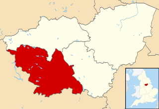
Bradfield is a civil parish in the City of Sheffield, in South Yorkshire, England.

High Bradfield is a rural village 6.5 miles (10 km) north-west of the centre of Sheffield in South Yorkshire, England and within the city's boundaries. The village lies just within the Peak District National Park, 1.3 miles (2 km) inside the park's north-eastern border, is at an altitude of 260 metres (850 feet) AOD, and has extensive views across Bradfield Dale towards Derwent Edge and the Dark Peak.

Low Bradfield is a village within the civil parish of Bradfield in South Yorkshire, England. It is situated within the boundary of the city of Sheffield in the upper part of the Loxley Valley, 6¼ miles west-northwest of the city centre and just inside the northeast boundary of the Peak District National Park. Low Bradfield and the surrounding area is noted for its attractive countryside which draws many visitors from the more urban parts of Sheffield. At weekends the village can become quite crowded, especially when there is a match on the village cricket pitch. Low Bradfield which stands in the shadow of Agden Reservoir has a sister village High Bradfield which is located at a higher altitude, ½ mile to the northeast. The two villages are joined by the steep Woodfall Lane.
The City of Sheffield is a city and metropolitan borough in South Yorkshire, England. The metropolitan borough includes the administrative centre of Sheffield, the town of Stocksbridge and larger village of Chapeltown and part of the Peak District. It has a population of 584,853, making it technically the third largest city in England by population behind Birmingham and Leeds, since London is not considered a single entity. It is governed by Sheffield City Council.
Ecclesfield is a village and civil parish in the City of Sheffield, South Yorkshire, England, about 4 miles (6 km) north of Sheffield City Centre. Ecclesfield civil parish had a population of 32,073 at the 2011 Census. Ecclesfield wards of the City of Sheffield had a population of 35,994 in 2011. The population of Ecclesfield village stood at 7,163 in the most recent census.

The areas of Sheffield, a city and metropolitan borough in the north of England, vary widely in size and history. Some of the areas developed from villages or hamlets, that were absorbed into Sheffield as the city grew, and thus their centres are well defined, but the boundaries of many areas are ambiguous. The areas of Sheffield do not play a significant administrative role, but the city is divided into 28 electoral wards for local elections and 6 parliamentary constituencies for national elections.

Stocksbridge and Upper Don ward is one of the 28 electoral wards of the borough of Sheffield, South Yorkshire, England. The population of this ward was 18,541 at the 2011 Census.

Deepcar is a village located on the eastern fringe of the town of Stocksbridge, South Yorkshire, England. It is in the electoral ward of Stocksbridge and Upper Don, 7 miles (11 km) approximately north-west of Sheffield city centre.

Oughtibridge is a residential village in the north of Sheffield within the bounds of Bradfield civil parish. The village stands 5 miles (8 km) north-west of the city centre in the valley of the River Don. The population of the village has increased significantly in recent years due to much private housing development and stood at 3,542 in 2006 over an area of 355 hectares. The population of Oughtibridge increased to 3,584 in 2011.

Swanland is a village and civil parish in the East Riding of Yorkshire in England. The village is about seven miles (11 km) to the west of Kingston upon Hull city centre and two miles (3.2 km) north of the Humber Estuary in the foothills of the Yorkshire Wolds on the B1231 road.

West Ella is a small village in the civil parish of Kirk Ella west of Kirk Ella settlement, within the East Riding of Yorkshire, England, on the eastern edge of the Yorkshire Wolds, approximately 6 miles (10 km) west of the city of Kingston upon Hull.

Dungworth is a hamlet in the civil parish of Bradfield, west of Sheffield in South Yorkshire, England.

St Mary's Church, Bolsterstone is situated in the village of Bolsterstone, within the boundary of the City of Sheffield in South Yorkshire, England. The church dates from 1879 although there is evidence that a place of worship has existed on the site since the 12th century. It is located 8.1 miles (13 km) north-west of the city centre and is a grade II listed building.

Midhopestones is a village in the civil parish of Bradfield within the Stocksbridge and Upper Don electoral ward in the borough of the City of Sheffield, England.

Ewden Valley is a valley in the civil parish of Bradfield in the Stocksbridge and Upper Don electoral ward of Sheffield, South Yorkshire, England.

Upper Midhope is a village in the civil parish of Bradfield within the Stocksbridge and Upper Don electoral ward in the borough of the City of Sheffield, England. It lies just on the edge of the Peak District national park.

Broomhead Hall was a large English country house that stood in the Ewden valley, to the west of Sheffield, England. The hall stood near the hamlet of Wigtwizzle, to the west of Broomhead Reservoir.
Stocksbridge is a town and civil parish in the City of Sheffield, South Yorkshire, England. The parish contains 38 listed buildings that are recorded in the National Heritage List for England. All the listed buildings are designated at Grade II, the lowest of the three grades, which is applied to "buildings of national importance and special interest". The parish is to the northwest of the city of Sheffield, and in addition to Stocksbridge contains the villages of Bolsterstone and Deepcar.


