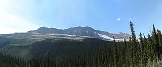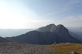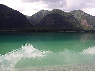
The Winston Churchill Range is a mountain range in the central section of the Park Ranges of the Canadian Rockies located in Jasper National Park. The range was named after Sir Winston Churchill, former British prime minister.
Mount Clemenceau is the fourth highest mountain in the Park Ranges of the Canadian Rockies. The peak was originally named "Pyramid" in 1892 by Arthur Coleman. The mountain was renamed by the Interprovincial Boundary Survey in 1919 to its present name, which is for Georges Clemenceau, premier of France during World War I.

The Slate Range is a mountain range of the Canadian Rockies, located in Banff National Park, Canada. The range is named after slate, the primary composition of the mountains in the area.

The President Range is a mountain range of the Canadian Rockies, located in the northwestern section of Yoho National Park. The range is named for the highest peak in the range, The President.
The Victoria Cross Ranges are a set of mountain ranges in the Canadian Rockies, located to the northwest of Jasper. Of the 19 peaks contained within this range, five are named after Canadian recipients of the Victoria Cross. The area of the ranges is 678 square kilometres (262 sq mi).

The Beaverfoot Range is a mountain range of the Canadian Rockies, located in southeastern British Columbia. The range extends from Cedared Creek near Spillimacheen north to the Kicking Horse River.
Mount Ayles is a mountain located on Ellesmere Island, Nunavut, Canada. It forms part of the border of the Quttinirpaaq National Park. Like the nearby Ayles Ice Shelf, the mountain was named by the Geological Survey of Canada in 1965 for Adam Ayles, a petty officer on-board HMS Alert, who was serving in the British Arctic Expedition under George Nares.

The Wapta Icefield is a series of glaciers located on the Continental Divide in the Waputik Mountains of the Canadian Rockies, in the provinces of British Columbia and Alberta, in Yoho National Park in the Canadian Rockies. The icefield is shared by Banff and Yoho National Parks and numerous outlet glaciers extend from the icefield, including the Vulture, Bow and Peyto Glaciers. Runoff from the icefields and outlet glaciers supply water to both the Kicking Horse and Bow Rivers, as well as numerous streams and lakes.

The Fiddle Range is a mountain range of the Canadian Rockies located south of Highway 16 on the east border of Jasper National Park, Canada.

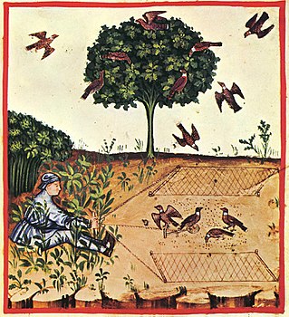
Animal trapping, or simply trapping or ginning, is the use of a device to remotely catch and often kill an animal. Animals may be trapped for a variety of purposes, including for meat, fur, sport hunting, pest control, and wildlife management.

The South Jasper Ranges are mountain ranges of the Rocky Mountains in Alberta and British Columbia, Canada.
Mount Rutherford is a mountain in Jasper National Park in Alberta, Canada. It is part of the Northern Front Ranges of the Canadian Rockies. Its peak stands 3 km (2 mi) east of Harvey Lake and north of the Snaring River, a tributary of the Athabasca River.

The Snaring River is a medium-sized river in the Canadian Rockies. It runs through parts of Jasper National Park in Alberta, Canada. The Snaring River is a significant tributary of the Athabasca River. The Snaring is named after a former local tribe of first nations people who lived in dugouts and trapped animals with snares.

Mount Root, also named Boundary Peak 165, is a mountain in Alaska and British Columbia, located on the Canada–United States border, and part of the Fairweather Range of the Saint Elias Mountains. It is named for Elihu Root, who was one of the diplomats involved in settling the Alaska boundary dispute between the United States and Canada. It is where the Margerie Glacier is located.
Consort Mountain is on the north side of an unnamed creek that drains eastward into the Snaring River. The origin of the name is unknown. It is located in the Victoria Cross Ranges in Alberta.
The Lewis Range is a small mountain range in southwestern British Columbia, Canada, located north of Mereworth Sound. It has an area of 52 km2 and is a subrange of the Pacific Ranges which in turn form part of the Coast Mountains.

The Park Ranges, also known as the Main Ranges, are a group of mountain ranges in the Canadian Rockies of southeastern British Columbia and southwestern Alberta, Canada. It is one of the three main subranges and the most central of the Continental Ranges, extending from southeast of Mount McGregor to the Fernie Basin.

The Terminal Range is the northernmost mountain range of the Canadian Rockies, so-named for its position at the northern terminus of the Rockies. Lying west of Muncho Lake and the Trout River, its northern perimeter is the Liard River. The Sentinel Range lies to its east.

Morrissey Ridge is a mountain range of the Border Ranges located south-east of Fernie.

The Sundance Range is a mountain range in the Canadian Rockies, south of the town of Banff. It is located on the Continental Divide, which forms the boundary between British Columbia and Alberta in this region.


