Verona (called Te-o-na-ta-le, "pine forest" by the Haudenosaunee[3]) is a town in southwestern Oneida County, New York, United States. The population was 6,293 at the 2010 census. The town was named after Verona, Italy.[4]
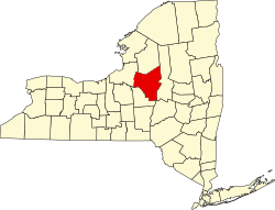
Verona is located 8 miles (13km) south of the city of Rome.
History
Part of the extensive territory of the Haudenosaunee or Iroquois League, the municipality was first settled by European Americans in 1792, after the American Revolutionary War.
In 1993, the Oneida Nation purchased land in the town. On this site it built and opened a casino and bingo hall. By 1997, this facility had been developed as a full-scale resort called Turning Stone Resort Casino.
Geography
According to the United States Census Bureau, the town has a total area of 69.7 square miles (181km2), of which 69.3 square miles (179km2) is land and 0.4 square miles (1.0km2) (0.59%) is water.
Mineral springs in the town have sulfurous gas.[5]
As of the census[7] of 2000, there were 6,425 people, 2,399 households, and 1,813 families residing in the town. The population density was 92.7 inhabitants per square mile (35.8/km2). There were 2,665 housing units at an average density of 38.5 per square mile (14.9/km2). The racial makeup of the town was 97.71% White, 0.37% African American, 0.64% Native American, 0.37% Asian, 0.02% Pacific Islander, 0.05% from other races, and 0.84% from two or more races. Hispanic or Latino of any race were 0.47% of the population.
There were 2,399 households, out of which 34.5% had children under the age of 18 living with them, 61.8% were married couples living together, 8.5% had a female householder with no husband present, and 24.4% were non-families. 19.0% of all households were made up of individuals, and 8.2% had someone living alone who was 65 years of age or older. The average household size was 2.68 and the average family size was 3.05.
In the town, the population was spread out, with 26.6% under the age of 18, 6.6% from 18 to 24, 29.2% from 25 to 44, 25.2% from 45 to 64, and 12.4% who were 65 years of age or older. The median age was 38 years. For every 100 females, there were 103.1 males. For every 100 females age 18 and over, there were 101.6 males.
The median income for a household in the town was $42,745, and the median income for a family was $47,951. Males had a median income of $32,328 versus $23,646 for females. The per capita income for the town was $18,017. About 3.8% of families and 5.7% of the population were below the poverty line, including 6.8% of those under age 18 and 3.0% of those age 65 or over.
Cmaylo, Dorothy M.; Beaver, Thomas A.; Regner, Kenneth A.; Hoffman, Sheila B. (2010). Verona. Arcadia. ISBN978-0738572369. Volume in the well-known series from Arcadia that features history, old photographs and postcards.
This page is based on this Wikipedia article Text is available under the CC BY-SA 4.0 license; additional terms may apply. Images, videos and audio are available under their respective licenses.