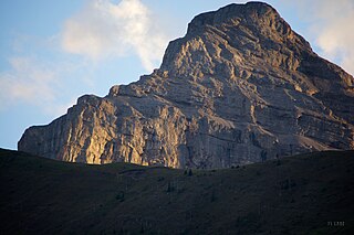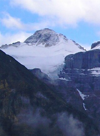
Mount Columbia is a mountain located in the Winston Churchill Range of the Rocky Mountains. It is the highest point in Alberta, Canada, and is second only to Mount Robson for height and topographical prominence in the Canadian Rockies. It is located on the border between Alberta and British Columbia on the northern edge of the Columbia Icefield. Its highest point, however, lies within Jasper National Park in Alberta.

Mount Bryce is a mountain at the southwestern corner of the Columbia Icefield, in British Columbia, Canada, near the border with Alberta. It can be seen from the Icefields Parkway.

The Rainbow Range is a small subrange of the Park Ranges subdivisions of the Northern Continental Ranges of the Rocky Mountains on the border between Alberta and British Columbia in Mount Robson Provincial Park.

Mount Muir is a mountain located on the Continental Divide on the Alberta-British Columbia border. The mountain was named in 1918 after Alexander Muir. It is located in the High Rock Range.
Mount Farnham is British Columbia's 17th highest peak, and 21st most prominent. It was named after Paulding Farnham from New York. It is the highest peak in the Purcells.
Mount Morkill is located on the border of Alberta and British Columbia, near McBride which is a town in British Columbia, Canada. There is a subpeak to the southwest of the main peak, at an elevation of 2,185 m (7,169 ft) named The Gazetted Peak. It was named in 1965 after D.B. Morkill, a British Columbia land surveyor.
Mount Talbot is located on the northern side of Shale Pass on the Alberta-British Columbia border. It was officially named on 4 November 1925 after Senator Peter Talbot (1854-1919), an early pioneer of the Lacombe region of central Alberta. A teacher and farmer, he turned to politics and became an elected representative of the Northwest Territories and later the province of Alberta. In 1906, Sir Wilfrid Laurier appointed him to the Senate of Canada.
Treadmill Ridge is a mountain ridge located at the northern end of Mount Robson Provincial Park, on the Alberta/British Columbia border. It is Alberta's 98th most prominent mountain. It was named in 1923 by Arthur O. Wheele who believed that the mountain resembled a treadmill.
Upright Mountain is located east of the head of the Moose River at the NE side of Mount Robson Provincial Park on the Continental Divide marking the Alberta-British Columbia border. Arthur O. Wheeler named the mountain in 1911 as the strata of the mountain have been upheaved to an almost vertical position.
Salient Mountain is located just north of Miette Pass, at the NE end of Mount Robson Provincial Park on the Continental Divide marking the Alberta-British Columbia border. It is Alberta's 80th most prominent mountain. It was named in 1922 by Arthur O. Wheeler. It was noted to be the "sharpest" peak in the area.
Mount O'Beirne is a mountain in the Continental Ranges on the border of Alberta and British Columbia. It is Alberta's 59th most prominent mountain. It was named in 1918 by Arthur Oliver Wheeler after Eugene Francis O'Beirne, a "sponger and general pest" who in 1864 had attached himself to William Wentworth-FitzWilliam, Viscount Milton and Walter Butler Cheadle's expedition over the Yellowhead Pass.
Vista Peak is located near the head of Rockingham Creek, south of Yellowhead Pass in Mount Robson Provincial Park on the Continental Divide marking the Alberta-British Columbia border. It was named in 1917, the name refers to the view from the peak of the mountain.
Drawbridge Peak is located on the Continental Divide along the provincial borders of Alberta and British Columbia. The Alberta side is in Jasper National Park while Mount Robson Provincial Park is on the B.C. side. It was named in 1920 by the Interprovincial Boundary Survey.
Whitecrow Mountain is located at the head of the Fraser River in Mount Robson Provincial Park on the Continental Divide marking the Alberta-British Columbia border. It was named in 1922 by Arthur O. Wheeler for the number of white crows that were seen on the peak.
Breaker Mountain is a mountain located on the border of Alberta and British Columbia. It is part of the Waputik Range. It was named in 1917 by Arthur O. Wheeler for the resemblance of a cornice on its summit to a breaking wave.
Mount Barlow is located on the Continental Divide along the border of Alberta and British Columbia at the southern edge of the Freshfield Icefield in Banff National Park. It was named in 1916 by D.B. Dowling after Dr. Alfred Ernest Barlow, a cartographer with the Geological Survey of Canada who died in the 1914 Empress of Ireland disaster.

Mount Little is situated at the northern end of Kootenay National Park, and straddles the Continental Divide marking the Alberta-British Columbia border. It was named in 1916 after George F. Little, a member of the first ascent party.
A mountain formerly known as Mount Pétain, but with no current official name, is located on the border of the Canadian provinces of Alberta and British Columbia (BC) on the Continental Divide.
Mount Ptolemy is the highest mountain of the Flathead Range and is located on the Continental Divide along the provincial borders of Alberta and British Columbia. Situated 10 km (6.2 mi) southeast of Crowsnest Pass and 5 km (3 mi) northeast of Corbin, it is Alberta's 57th most prominent mountain. It was named in 1914 by Arthur Wheeler for its resemblance to a man sitting with folded arms. The mountain has also been known as Mummy Mountain.
Scarpe Mountain is located at the head of Commerce Creek and straddles the Continental Divide marking the Alberta-British Columbia border. It was named after the Scarpe River in France.


