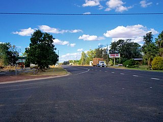
Condamine is a rural town and locality in the Western Downs Region, Queensland, Australia. In the 2016 census, the locality of Condamine had a population of 384 people.

Moonie is a rural town in the Western Downs Region and a locality split between the Western Downs Region and the Goondiwindi Region in Queensland, Australia. In the 2016 census, the locality of Moonie had a population of 189 people.
Goombi is a rural locality in the Western Downs Region, Queensland, Australia. In the 2016 census Goombi had a population of 34 people.
Weranga is a rural locality in the Western Downs Region, Queensland, Australia. In the 2016 census Weranga had a population of 215 people.
Wheatvale is a rural locality in the Southern Downs Region, Queensland, Australia. In the 2016 census, Wheatvale had a population of 56 people.
Hannaford is a rural locality in the Western Downs Region, Queensland, Australia. In the 2016 census Hannaford had a population of 118 people.
Canaga is a rural locality in the Western Downs Region, Queensland, Australia. In the 2016 census, Canaga had a population of 110 people.

Columboola is a rural town and locality in the Western Downs Region, Queensland, Australia. In the 2016 census, the locality of Columboola had a population of 72 people.
Ranges Bridge is a rural locality in the Western Downs Region, Queensland, Australia. In the 2016 census Ranges Bridge had a population of 132 people.
Fairyland is a rural locality in the Western Downs Region, Queensland, Australia. In the 2016 census, Fairyland had a population of 67 people.
Greymare is a rural locality in the Southern Downs Region, Queensland, Australia. In the 2016 census Greymare had a population of 64 people.
Tuckerang is a rural locality in the Western Downs Region, Queensland, Australia. In the 2016 census Tuckerang had a population of 85 people.
Pelican is a rural locality in the Western Downs Region, Queensland, Australia. In the 2016 census Pelican had a population of 14 people.
Springvale is a rural locality in the Western Downs Region, Queensland, Australia. In the 2016 census Springvale had a population of 74 people.
Wychie is a rural locality in the Western Downs Region, Queensland, Australia. In the 2016 census Wychie had a population of 17 people.
St Ruth is a locality split between the Western Downs Region and the Toowoomba Region in Queensland, Australia. In the 2016 census St Ruth had a population of 139 people.
Roche Creek is a locality in the Western Downs Region, Queensland, Australia. In the 2016 census, Roche Creek had a population of 55 people.
Bogandilla is a locality in the Western Downs Region, Queensland, Australia. In the 2016 census, Bogandilla had a population of 28 people.
Irvingdale is a locality split between the Toowoomba Region and the Western Downs Region, both in Queensland, Australia. In the 2016 census, Irvingdale had a population of 194 people.
Montrose is a rural locality in the Western Downs Region, Queensland, Australia. In the 2016 census, Montrose had a population of 65 people.


