1932 Atlantic hurricane season

Last updated

1932 Atlantic hurricane season
1932 Atlantic hurricane season summary map.png
Season summary map
Seasonal boundaries
First system formedMay 5, 1932
Last system dissipatedNovember 13, 1932
Strongest storm
Name "Cuba"
  Maximum winds175 mph (280 km/h)
(1-minute sustained)
  Lowest pressure915 mbar (hPa; 27.02 inHg)
Seasonal statistics
Total storms15
Hurricanes6
Major hurricanes
(Cat. 3+)
4
Total fatalities≥3,472 direct, 1 indirect
Total damage$87.57 million (1932 USD)
Related articles
Atlantic hurricane seasons
1930, 1931, 1932, 1933, 1934

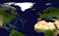
The 1932 Atlantic hurricane season featured several powerful storms, including the Cuba hurricane , which remains the deadliest tropical cyclone in the history of Cuba and among the most intense to strike the island nation. It was a relatively active season, with fifteen known storms, six hurricanes, and four major hurricanes. [nb 1] However, tropical cyclones that did not approach populated areas or shipping lanes, especially if they were relatively weak and of short duration, may have remained undetected. Because technologies such as satellite monitoring were not available until the 1960s, historical data on tropical cyclones from this period are often not reliable. The Atlantic hurricane reanalysis project discovered four new tropical cyclones, all of which were tropical storms, that occurred during the year. [2] Two storms attained Category 5 intensity, the first known occurrence in which multiple Category 5 hurricanes formed in the same year. The season's first cyclone developed on May 5, while the last remaining system transitioned into an extratropical cyclone by November 13.

Contents

The strongest storm of the season was the Cuba hurricane, which heavily impacted portions of northern Colombia, the Netherlands Antilles, the Greater Antilles, and the Bahamas in November, leaving at least 3,144 fatalities and $44 million (1932  USD) in damage, [nb 2] the vast majority of which occurred in Cuba. In early September, the Bahamas hurricane devastated portions of the island nation as a Category 5 hurricane, resulting in at least 16 deaths. Another destructive storm was the Freeport hurricane , which caused 40 deaths and about $7.5 million in damage in Texas in August. The San Ciprian hurricane also wreaked havoc on the Virgin Islands, Puerto Rico, and the Dominican Republic in late September, with damage totaling approximately $35.8 million and the death toll reaching 272. Collectively, the tropical cyclones during the 1932 season caused around $87.57 million in damage and at least 3,473 fatalities.

Season summary

1932 Cuba hurricane1932 San Ciprian hurricane1932 Bahamas hurricane1932 Florida–Alabama hurricane1932 Freeport hurricaneSaffir–Simpson scale1932 Atlantic hurricane season

Tropical cyclogenesis began in early May, with a system developing over the central Caribbean Sea on May 5. The storm made landfall in the Dominican Republic, before becoming extratropical offshore the East Coast of the United States on May 10. However, the season went dormant for about three months until the next system, the Freeport hurricane , formed over the southern Gulf of Mexico on August 12. Two other storms originated in the month of August the Florida–Alabama and Bahamas hurricanes. September was the most active month, with a total of six tropical cyclones developing, five tropical storms and one hurricane, the San Ciprián hurricane . Four more tropical cyclone formed in October, including three tropical storms and a hurricane, the Cuba hurricane , though much of its duration was in November. The season's final tropical cyclone, a hurricane, developed well east of the Windward Islands on November 3 and transitioned into an extratropical cyclone southwest of the Azores on November 10. [3]

A total of fifteen tropical cyclones developed, the most since 1916. Six of the systems strengthened into a hurricane, while four reached major hurricane status, which is Category 3 or higher on the Saffir–Simpson scale. [1] Two cyclones intensified into Category 5 hurricanes, [3] making the season the first of only seven featuring multiple Category 5 storms, the other years being 1933, 1961, 2005, 2007, 2017, and 2019. [4] The Bahamas hurricane became the first of four tropical cyclones to have struck the Bahamas at Category 5 intensity, later followed by the Cuba–Brownsville hurricane in 1933, Hurricane Andrew in 1992, and Hurricane Dorian in 2019. [5] Additionally, the Cuba hurricane remains among the most intense tropical systems to strike that country. [6] Most of the storms also impacted land, with several causing devastating effects. [2] Overall, the tropical cyclones of the season collectively resulted in at least $87.57 million in damage and approximately 3,473 deaths. [7]

The season's total activity was reflected with an accumulated cyclone energy (ACE) rating of 170, the highest value since 1926, [1] and well above the 19311943 average of 91.2. [8] ACE is a metric used to express the energy used by a tropical cyclone during its lifetime. Therefore, a storm with a longer duration will have high values of ACE. It is only calculated at six-hour increments in which specific tropical and subtropical systems are either at or above sustained wind speeds of 39 mph (63 km/h), which is the threshold for tropical storm intensity. Thus, tropical depressions are not included here. [1]

Systems

Tropical Storm One

Tropical storm (SSHWS)
Tropical Storm One Analysis 9 May 1932.png   1932 Atlantic tropical storm 1 track.png
DurationMay 5 – May 10
Peak intensity65 mph (100 km/h) (1-min);
995  mbar  (hPa)

A tropical depression formed on May 5 in the south-central Caribbean Sea. Moving slowly northeast, the system became a tropical storm the next day and gradually strengthened before making landfall just west of Baní in the Dominican Republic's modern-day Peravia Province with winds of 45 mph (72 km/h) on May 7. Within six hours, the storm emerged into the western Atlantic on May 8 and continued to strengthen. The system reached its peak intensity of 65 mph (105 km/h) on May 9 while centered south-southwest of Bermuda. The diffuse system later transitioned into an extratropical cyclone the same day, later dissipating on May 11 well to the northwest of Bermuda after merging with a frontal boundary. [2] [3] Heavy rainfall was reported in far eastern Cuba and the Dominican Republic, with the latter recording over 6 in (150 mm) of precipitation in 12 hours. [9]

Hurricane Two

Category 4 hurricane (SSHWS)
1932 Freeport hurricane analysis 13 Aug 1932.png   1932 Atlantic hurricane 2 track.png
DurationAugust 12 – August 15
Peak intensity150 mph (240 km/h) (1-min);
935  mbar  (hPa)

The Freeport Hurricane of 1932

A tropical disturbance developed into a tropical storm in the southern Gulf of Mexico near the Yucatán Peninsula early on August 12. Moving north-northwestward, the cyclone strengthened into a hurricane by early the next day. Thereafter, the storm rapidly intensified, [3] becoming a Category 4 hurricane early on August 13. Strengthening slightly further, the compact hurricane attained its peak intensity with maximum sustained winds estimated at 150 mph (240 km/h) and a minimum barometric pressure of 935 mbar (27.6 inHg) shortly before making landfall near Freeport, Texas, at 04:00 UTC on August 13. [2] The cyclone then rapidly weakened, falling below major hurricane intensity just eight hours later and to tropical storm intensity about fourteen hours after landfall. On August 15, the system deteriorated to a tropical depression, before dissipating over the Texas Panhandle around 18:00 UTC. [3]

Official warning on the storm began just four hours prior to the storm's landfall in Texas, forcing many people evacuating inland to abandon their cars in high winds and heavy rains. [10] In Galveston, power to electrical and phone service was cut off, temporarily reducing communications. The passage between Galveston Island and mainland Texas was flooded, briefly isolating Galveston. Heavy rains occurred, and a foot of rain fell as the storm moved north towards the coast. [10] [11] A total of 40 people were killed by the hurricane. The greatest single death toll for any town was seven in West Columbia, where sustained winds over 100 mph (160 km/h) flattened several homes. Two neighborhoods that had been constructed for oil industry workers there were nearly destroyed by the high tides and storm surge. Angleton, Freeport, and Galveston suffered extensive wind damage, while the inland towns of Brazoria, West Columbia, Damon and Needville, all in the path of the eye, were also devastated. Damages associated with the hurricane were estimated to total to $7.5 million. [10]

Hurricane Three

Category 1 hurricane (SSHWS)
Hurricane Three Analysis 30 Aug 1932.png   1932 Atlantic hurricane 3 track.png
DurationAugust 26 – September 2
Peak intensity85 mph (140 km/h) (1-min);
979  mbar  (hPa)

A tropical disturbance was first identified southeast of Puerto Rico on August 24. [2] Moving northwestward, the disturbance developed into a tropical depression two days later north of Hispaniola. Slowly moving towards the west-northwest, it intensified into a tropical storm late on August 27. The storm made landfall on the north end of Key Largo, Florida, with sustained winds of 65 mph (105 km/h) around 04:00 UTC on August 30, before striking the mainland south of Homestead. After crossing the Florida peninsula and entering the Gulf of Mexico, the system reached its peak intensity as a Category 1 hurricane with maximum sustained winds of 85 mph (137 km/h), before subsequently making its final landfall just east MississippiAlabama state line on September 1 at the same intensity. Over land, the hurricane weakened, and after becoming an extratropical cyclone over northwestern Mississippi on September 2, [3] the storm merged with another extratropical system over Quebec on September 4. [2]

At the storm's landfall in southern Florida, heavy rains and strong winds caused extensive damage to crops, particularly to avocado and citrus. [2] A fire in Hollywood that firefighters were unable to extinguish due to winds damaging equipment led to approximately $20,000 in damage. [12] As the strengthening hurricane moved northwestwards through the Gulf of Mexico, it generated strong surf that caused severe damage to coastal areas across western Florida, [2] [13] before making its second landfall, where it produced hurricane-force winds across a wide swath of the coast. In and around Pensacola, the hurricane caused about $100,000 in damage, including impacts to buildings, homes, waterfront properties, power lines, and cotton crops. Agricultural lands in coastal regions of Mississippi and Alabama were damaged by strong winds and heavy rain. [2] Storm surge also submerged portions of Bayou La Batre and Mobile in Alabama, with about $105,000 in damage in the latter. [14] The hurricane caused one death and about $229,000 in total damages across its path. [2] [12] [15]

Hurricane Four

Category 5 hurricane (SSHWS)
1932 Bahamas hurricane Analysis 6 Sep 1932.png   1932 Bahamas hurricane track.png
DurationAugust 30 – September 9
Peak intensity160 mph (260 km/h) (1-min);
≤921  mbar  (hPa)

The Great Bahamas Hurricane of 1932

A tropical depression was first detected north of the Virgin Islands late on August 30. Moving towards the west-northwest, the depression steadily intensified, reaching tropical storm strength and later hurricane strength on September 2, as it passed near the Turks and Caicos Islands. After reaching hurricane intensity, the hurricane began to rapidly intensify, becoming a major hurricane on September 4. The intensifying hurricane moved through the Bahamas and reached its peak intensity as a Category 5 hurricane, the first of the season, with maximum sustained winds of 160 mph (260 km/h) at 18:00 UTC on September 5. Shortly thereafter, the hurricane struck the Abaco Islands. Curving north-northeastward, the cyclone slowly weakened, falling to Category 4 intensity by late on September 6. The storm continued weakening as it accelerated northeastward, bypassing New England before becoming extratropical about 150 mi (240 km) south of Cape Sable Island on September 9. The extratropical cyclone brushed Newfoundland and traversed across Iceland and later dissipated just offshore Russia's Kola Peninsula on September 17. [3]

The hurricane caused extensive devastation across much of the Bahamas, where it killed 16 people and injured an additional 300 people. [2] Strong winds destroyed numerous homes and hampered water and food supplies. The large hurricane also generated a strong storm surge which inundated the Abaco Islands. [16] The Abaco Islands were the worst impacted area, where the severity of damage indicated that sustained wind speeds exceeded 150 mph (240 km/h). [17] At Hope Town, the hurricane demolished 83 homes, severely damaged 63 others, and damaged 40 others to a lesser degree. Strong winds also destroyed all churches and public buildings in the community. Similarly, all buildings including churches, government buildings, and schools and homes were demolished on Green Turtle Cay. Only six homes remained standing in Coopers Town and just four others withstood the hurricane at Great Guana Cay. The hurricane also completely destroyed the Bluff Point community. Most homes in Marsh Harbour were severely damaged, while the cyclone destroyed 12 other homes and all schools in the town. [18] Effects in the United States were much less severe, due to the distance of the hurricane. However, strong gales still swept through much of New England. [17] In Atlantic Canada, the storm caused 14 or 15 deaths, all related to maritime incidents. On land, wind gusts reached 81 mph (130 km/h) in Halifax, Nova Scotia. Some homes and buildings were damaged or destroyed, while approximately 10 percent of apple crops in Annapolis Valley were lost. [19]

Tropical Storm Five

Tropical storm (SSHWS)
Tropical Storm Five Analysis 6 Sep 1932.png   Five 1932 track.png
DurationSeptember 4 – September 7
Peak intensity70 mph (110 km/h) (1-min);
992  mbar  (hPa)

On September 4, an area of low pressure developed from a stationary front approximately 740 mi (1,190 km) south-southeast of Cape Race, Newfoundland. [2] [3] At the time, a warm front and cold front were connected to the system, but further observations revealed minimal temperature deviations. The following day, the disturbance appeared to have acquired subtropical characteristics, but became tropical after observations showed that winds associated with the storm were near the center. [2] The system peaked as a strong tropical storm with maximum sustained winds of 70 mph (110 km/h) on September 5. [3] The storm later weakened and was absorbed by a frontal boundary at 18:00 UTC on September 7 roughly 165 mi (265 km) southeast of Cape Race. [2] [3]

Tropical Storm Six

Tropical storm (SSHWS)
Tropical Storm Six Analysis 14 Sep 1932.png   1932 Atlantic tropical storm 5 track.png
DurationSeptember 9 – September 15
Peak intensity60 mph (95 km/h) (1-min);
999  mbar  (hPa)

A tropical storm formed in the Bay of Campeche on September 9. Moving slowly northwards, the storm reached its peak intensity with maximum sustained winds of 60 mph (95 km/h) while located south of the Mississippi River Delta. [3] Beginning on September 14, the storm began to accelerate as it turned towards the northeast. Around 04:00 UTC on September 15, the cyclone made landfall in St. Marks, Florida, at peak intensity. The storm crossed the state quickly and briefly entered Georgia before emerging into the Atlantic less than eight hours after landfall. However, the system soon transitioned into an extratropical cyclone a short distance east of Sapelo Island around 12:00 UTC on September 15. The extratropical cyclone quickly accelerated parallel to the United States East Coast, [3] before being absorbed by another extratropical system over Quebec. [2]

The storm's quick passage over the Florida peninsula left relatively minor damage. [2] A train crossed over a washout on its railroad, causing it to derail. [20] In Apalachicola, there was considerable damage to crops, and torrential rains caused $2,000 in damages. [2] Electric power in the city was also disabled, and some buildings suffered structural damage, totaling to $8,000 in damages. [15] Tallahassee observed 5.61 in (142 mm) of precipitation. In Georgia, Thomasville and Valdosta experienced "high winds and considerable rainfall," according to the Tallahassee Democrat . [21] A few weather stations along the East Coast of the United States recorded sustained tropical storm force winds, including Hatteras, North Carolina; Atlantic City, New Jersey; and New York City, New York. [2] There were scattered reports of wind damage across Atlantic Canada, including the toppling of telephone and electrical wires, and the deroofing of buildings and homes. In Nova Scotia, Annapolis Valley lost approximately 75% of its apple crops. The storm also left maritime impacts, damaging or destroying docks, wharves, and boats. At least one death occurred in Canada, while eight other people went missing along with their vessel. [22]

Tropical Storm Seven

Tropical storm (SSHWS)
Tropical Storm Seven Analysis 19 Sep 1932.png   1932 Atlantic tropical storm 7 track.png
DurationSeptember 16 – September 23
Peak intensity65 mph (100 km/h) (1-min);
994  mbar  (hPa)

On September 16, a tropical storm with winds of 40 mph (64 km/h) developed out of a frontal boundary about 860 mi (1,385 km) southwest of the northwesternmost islands of the Azores. [2] [3] Moving slowly towards the northwest, [3] gales were reported by ships in the region as the cyclone slowly intensified. [2] On September 20, the storm began to move towards the southwest. The system reached peak intensity on September 21, with winds of 65 mph (105 km/h), before transitioning into an extratropical cyclone about halfway between Bermuda and Nova Scotia as it recurved northwards on September 23. The extratropical cyclone later made landfall on Nova Scotia the following day, before dissipating over southern Greenland on September 26. [3] Sustained winds in Atlantic Canada peaked at 29 mph (47 km/h) on Resolution Island in Nunavut. [2]

Tropical Storm Eight

Tropical storm (SSHWS)
Tropical Storm Eight Analysis 18 Sept 1932.png   1932 Atlantic tropical storm 6 track.png
DurationSeptember 18 – September 20
Peak intensity65 mph (100 km/h) (1-min);
998  mbar  (hPa)

Another tropical depression was first identified on September 18 in the Bay of Campeche. [2] Moving quickly towards the north-northeast, the depression intensified to a tropical storm and reached peak intensity with maximum sustained winds of 65 mph (105 km/h) and a minimum barometric pressure of 998 mbar (29.5 inHg) early the next day. The storm subsequently made landfall near Morgan City, Louisiana, at 19:00 UTC on September 19. Weakening over land, the tropical storm degenerated to a tropical depression at 12:00 UTC on September 20, before becoming extratropical the next day just west of Louisville, Kentucky, [3] and later dissipating after it was absorbed by an approaching frontal system over southern Ohio late on September 21. [2]

Since the storm made landfall in a sparsely populated region of Louisiana, only minimal damage was reported. Prior to the storm's landfall, however, hedge selling of cotton were offset in late dealings caused by fears of the storm's potential impact. [23] Tropical storm-force winds damaged some fishing shacks in southwestern Louisiana. [24] A tornado was reported in West Baton Rouge Parish, blowing down sugarcane along a path 8 mi (13 km) long. [15] Another tornado in Gulfport, Mississippi, damaged half a dozen homes and injured three people. [24] Farther inland, heavy rains associated with the system were reported, peaking at 3.01 in (76 mm) in Vicksburg. [2]

Hurricane Nine

Category 4 hurricane (SSHWS)
San Ciprien Hurricane Analysis 27 Sept 1932.png   1932 Atlantic hurricane 9 track.png
DurationSeptember 25 – October 2
Peak intensity145 mph (230 km/h) (1-min);
943  mbar  (hPa)

San Ciprián hurricane of 1932

On September 25, ships first noted a tropical storm east of the Leeward Islands. The storm quickly intensified as it moved towards the west due to a nearby high pressure system, [2] reaching hurricane strength at 12:00 UTC that day. As it approached Puerto Rico, the hurricane continued to rapidly intensify, before reaching its peak intensity as a Category 4 hurricane with winds of 145 mph (233 km/h) and a minimum pressure of 943 mbar (27.8 inHg) on September 27, before making landfall near Ceiba, Puerto Rico, at 03:00 UTC. The hurricane slightly weakened over the island, and after crossing the Mona Passage, made a second landfall in southern areas of the Dominican Republic as a Category 2 hurricane. Its passage of Hispaniola significantly weakened the hurricane, downgrading it to tropical strength on September 28. After brushing Jamaica to the south, the storm remained weak as it traversed the Caribbean. The cyclone made landfall in British Honduras between Hopkins and Placencia with winds of 45 mph (72 km/h) late on October 1. Thereafter, the storm quickly weakened and dissipated over southeastern Mexico on October 3. [3]

Possible due to the storm's small size, sustained wind speeds reached only 60 mph (97 km/h) on Saint Croix and Saint Thomas, while Saint Barthélemy experienced sustained winds between 60 and 85 mph (97 and 137 km/h). [2] On Saint Thomas, winds downed wires and trees and damaged homes. The storm also capsized ships in Saint Thomas harbor and at Tortola. Property damage on Saint Thomas alone exceeded $200,000, while 15 fatalities were reported. [25] [26] Most of the damage caused by the San Ciprián hurricane occurred in Puerto Rico, particularly along the island's northern half, [2] with the cyclone drawing comparisons to the 1928 Okeechobee hurricane. [27] The powerful winds destroyed numerous buildings. More than 40,000 homes were demolished, rendering 25,000 families homeless. [28] Winds also knocked out communications systems, hampering relief efforts. [29] Heavy losses were incurred to crops, particularly to citrus and coffee. The hurricane caused 257 deaths and injured 4,820 other people, while inflicting about $35.6 million in damage. [28] Economic losses related to the hurricane amounted to about 20 percent of Puerto Rico's gross income. [30] Significant damage to agriculture occurred in the Dominican Republic. [31] Impacts in Jamaica and British Honduras were minimal. [32] [33]

Tropical Storm Ten

Tropical storm (SSHWS)
Tropical Storm Ten Analysis 28 Sep 1932.png   1932 Atlantic tropical storm 10 track.png
DurationSeptember 28 – September 30
Peak intensity45 mph (75 km/h) (1-min);
1004  mbar  (hPa)

A tropical storm was first identified in the eastern Atlantic on September 28 as a small, compact system, [2] with winds of 40 mph (64 km/h) and a minimum pressure of 1,004 mbar (29.6 inHg). Initially situated roughly 800 mi (1,285 km) south-southeast of Cape Race, Newfoundland, the storm moved southeastward and intensified slightly to peak with maximum sustained winds of 45 mph (72 km/h). [3] Thereafter, the storm interacted with an extratropical cyclone which pulled it to the northwest. The extratropical cyclone later absorbed the system at 06:00 UTC on September 30 near its location of development. [2] [3]

Tropical Storm Eleven

Tropical storm (SSHWS)
Tropical Storm Eleven Analysis 15 Oct 1932.png   1932 Atlantic tropical storm 11 track.png
DurationOctober 7 – October 15
Peak intensity70 mph (110 km/h) (1-min);
990  mbar  (hPa)

A tropical depression formed on October 7 from a broad low-pressure area in the central Caribbean offshore Honduras. [2] [3] Moving slowly to the west-northwest, the depression steadily intensified, reaching tropical storm strength at 12:00 UTC the same day. The storm continued to intensify as it moved towards the Yucatán Peninsula, reaching peak intensity late on October 9, with maximum sustained wind speeds of 70 mph (110 km/h). [3] The storm made landfall near Playa del Carmen at 04:00 UTC the next day, while still at peak intensity. [2] Over land, the storm weakened to a tropical depression on October 11 as it curved northwestward. On the next day, the depression later emerged into the Gulf of Mexico, where it began to restrengthen. By 12:00 UTC on October 13, the elongated system regained tropical storm strength, before reaching a secondary peak intensity of 60 mph (97 km/h). [3] However, baroclinic forces caused the storm to become extratropical prior to striking Louisiana on October 15. The extratropical remnants of the storm continued to trek to the northeast, before it merged with another extratropical system over West Virginia. [2]

In Mexico, the storm produced tropical storm-force winds, with a sustained wind speed of 52 mph (84 km/h) in the city of Veracruz. [2] As the system approached the Gulf Coast of the United States, storm warnings were issued from Brownsville, Texas, to Apalachicola, Florida. Its extratropical remnants brought gale–force winds to portions of Louisiana. [34] Offshore, a cargo ship carrying asphalt sunk due to strong waves, causing $30,000 in losses. [35] In addition heavy rains caused rivers to exceed flood stage, particularly east of where the storm made landfall, [11] isolating homes and interrupting traffic. The Black Warrior River exceeded its flood stage by 14 ft (4.3 m), and the Catawba River also overflowed. [36] A peak rainfall of 8.5 in (220 mm) was reported during a 17‑hour period in Tuscaloosa, Alabama. The storm also brought widespread rainfall across the South Atlantic states through orographic lift, peaking at 9.3 in (240 mm) in Rock House, North Carolina. [11] Washout from the rains also caused a train wreck. [36]

Tropical Storm Twelve

Tropical storm (SSHWS)
Tropical Storm Twelve Analysis 10 Oct 1932.png   1932 Atlantic tropical storm 12 track.png
DurationOctober 8 – October 12
Peak intensity60 mph (95 km/h) (1-min);
997  mbar  (hPa)

A tropical depression was first identified on October 8 about 575 mi (925 km) northeast of the Virgin Islands and quickly intensified to a tropical storm. Moving towards the west and then northwest, the storm intensified to its peak intensity of 60 mph (97 km/h) at 1800 UTC on October 10 as it neared Bermuda. [3] The island reported sustained wind speeds up to 40 mph (64 km/h). [2] The storm weakened as it progressed farther northward and curved toward the northeast, before transitioning into an extratropical cyclone by 0600 UTC on October 12 approximately 205 mi (330 km) southeast of Sable Island. [3] The system was absorbed by a strong cold frontal boundary later that day. [2]

Tropical Storm Thirteen

Tropical storm (SSHWS)
Tropical Storm Thirteen 19 Oct 1932.png   1932 Atlantic tropical storm 13 track.png
DurationOctober 18 – October 21
Peak intensity70 mph (110 km/h) (1-min);
999  mbar  (hPa)

On October 17, a stationary front positioned over the eastern Atlantic began to dissipate, and a large area of low pressure began to form along the front boundary. [2] The disturbance intensified to tropical storm strength at 0000 UTC on October 18 about 1,220 mi (1,965 km) northwest of the westernmost islands of Cabo Verde, [3] after losing baroclinity. [2] As it moved towards the north, the system slowly intensified to an estimated peak intensity of 70 mph (110 km/h) at 0600 UTC on October 19, [3] as suggested by a nearby ship that also reported 70 mph (110 km/h) winds. [2] At the same time, the storm also turned eastward, and subsequently began to weaken. The system degenerated to tropical depression strength on October 21, and dissipated shortly thereafter around 415 mi (670 km) southwest of the central Azores. [3]

Hurricane Fourteen

Category 5 hurricane (SSHWS)
Hurricane Fourteen Analysis 8 Nov 1932.png   1932 Atlantic hurricane 14 track.png
DurationOctober 30 – November 13
Peak intensity175 mph (280 km/h) (1-min);
≤915  mbar  (hPa)

The Great Cuba Hurricane of 1932

Early on October 30, a tropical depression formed about 300 mi (485 km) northeast of Barbados. Moving nearly due west, the depression brushed Martinique on October 31, shortly before entering the Caribbean and intensifying into a tropical storm. Upon reaching the central Caribbean, the cyclone turned west-southwestward and strengthened into a hurricane early on November 2. It reached Category 2 status about 24 hours later near the Guajira Peninsula. The storm strengthened into a major hurricane on November 4, and continued to intensify, [3] peaking as a Category 5 hurricane with maximum sustained winds of 175 mph (282 km/h) and a minimum barometric pressure at or below 915 mb (27.02 inHg) on November 5 as it moved west-northwestward over the western Caribbean. [2] The storm later turned northward and then northeastward by early November 9, around the time that it weakened to a Category 4 hurricane. [3] Overall, the system maintained Category 5 status for 78 hours, which is the longest amount of time on record for a storm to remain at that intensity. [5] The cyclone struck Camagüey Province in Cuba on November 9 as a Category 4 hurricane with winds of 150 mph (240 km/h) and a barometric pressure of 918 mb (27.11 inHg). The storm emerged into the Atlantic over the Bahamas and continued to slowly weaken. On November 13, the cyclone fell to tropical storm intensity and became extratropical several hours later about 530 mi (855 km) southeast of Cape Race, Newfoundland. The extratropical low turned eastward and dissipated near the Azores late on the following day. [3]

In the ABC islands, the hurricane destroyed Curaçao's harbor fortifications, [37] while the pier on Bonaire was demolished. [38] Several coastal towns and seaports in Colombia in the vicinities of Barranquilla and Santa Marta suffered extensive damage. [39] Some inland farms were ruined by flooding and strong winds. [37] On Providencia Island, major damage to agriculture occurred and 36 homes were demolished. [2] High winds in Jamaica downed more than 2 million trees and caused up to a 50 percent loss of banana crops in some areas. [2] [40] Damage in Jamaica totaled approximately $4 million. [41] In the Cayman Islands, the storm was considered the worst to strike the archipelago until Hurricane Ivan in 2004. On Grand Cayman, 60 homes were either destroyed or suffered major damage, rendering about 250 people homeless, while only 6 dwellings remained standing on Little Cayman. The hurricane demolished schools on both Cayman Brac and Grand Cayman. The death toll in the Cayman Islands reached at least 109. [42] In Cuba, a massive storm surge measuring 21 ft (6.5 m) in height inundated Santa Cruz del Sur in Camagüey Province. Out of the approximately 4,800 residents, [43] an estimated 2,870 people in Santa Cruz del Sur were killed and less than 10 percent of the town's population was uninjured. [2] [43] Few homes in the town remained standing following the storm. [2] Many other communities in the province suffered devastation. [44] A Pan Am radio operator in Nuevitas reported that nearly all frame-buildings in the area were destroyed and most public buildings sustained serious damage. [45] The hurricane also caused impacts in Oriente and Santa Clara provinces. [46] Overall, damage in Cuba totaled approximately $40 million, while at least 3,033 fatalities occurred, [43] making the storm the deadliest in the nation's history. The cyclone also caused significant impacts in the central Bahamas, especially on Cat Island, Exuma, Long Island, and Rum Cay, [2] damaging or destroying many crops, structures, and vessels. Two deaths occurred in the Bahamas. [47] Wind gusts on Bermuda reached 87 mph (140 km/h) at St. George's, downing some electrical and telephone wires and tree branches. [2]

Hurricane Fifteen

Category 2 hurricane (SSHWS)
Hurricane Fifteen Analysis 8 Nov 1932.png   1932 Atlantic hurricane 15 track.png
DurationNovember 3 – November 10
Peak intensity100 mph (155 km/h) (1-min);
973  mbar  (hPa)

A tropical storm was first identified in the Central Atlantic about 785 mi (1,265 km) east of Barbados at 0600 UTC on November 3, [3] with ships reporting moderate gales in its vicinity. [2] Throughout its existence, the storm moved in an erratic path, generally to the north. Steadily intensifying, the storm became a hurricane at 1800 UTC on November 6, as it began to move towards the northeast towards the Azores. The hurricane continued to intensify, attaining Category 2 intensity early on November 8 and at the same time reaching its peak intensity with maximum sustained winds of 100 mph (160 km/h). After reaching peak intensity, a weakening trend began as the storm accelerated east-northeastward. Early on November 10, the system transitioned into an extratropical cyclone about 210 mi (340 km) southwest of the northwesternmost islands of the Azores, while still maintaining hurricane-force winds. [3] The extratropical system continued to quickly move east-northeastward until it coalesced with another extratropical cyclone on November 11. [2]

Season effects

The following table lists all of the storms that formed in the 1932 Atlantic hurricane season. It includes their duration, names, areas affected, damages, and death totals. Deaths in parentheses are indirect (an example of an indirect death would be a traffic accident), but were still related to that storm. Damage and deaths include totals from the storm's precursor and its remnants, and all of the damage figures are in 1932 USD.

Saffir–Simpson scale
TDTSC1C2C3C4C5
1932 North Atlantic tropical cyclone season statistics
Storm
name
Dates activeStorm category
at peak intensity
Max 1-min
wind
mph (km/h)
Min.
press.
(mbar)
Areas affectedDamage
(USD)
DeathsRef(s)
OneMay 5–10Tropical storm65 (100)995 Hispaniola NoneNone
Two August 12–15Category 4 hurricane150 (240)935 Texas $7.5 million40 [10]
Three August 26 – September 2Category 1 hurricane85 (140)979 Turks and Caicos Islands, the Bahamas, Southeastern United States (Florida and Alabama), Midwest United States, Ontario, Quebec $229,000(1) [2] [12] [15]
Four August 30 – September 9Category 5 hurricane160 (260)≤921The Bahamas, Southeastern United States, East Coast of the United States, Newfoundland, Greenland, Iceland, Jan Mayen Island, Scandinavia, Soviet Union Unknown16 [2]
FiveSeptember 4–7Tropical storm70 (110)992NoneNoneNone
SixSeptember 9–15Tropical storm60 (95)999 Gulf Coast of the United States, East Coast of the United States, Atlantic Canada $10,000None [2] [15]
SevenSeptember 16–22Tropical storm65 (100)994Atlantic CanadaUnknownNone
EightSeptember 18–20Tropical storm65 (100)998 West South Central United States (Louisiana), Ohio River Valley UnknownNone
Nine September 25 – October 2Category 4 hurricane145 (230)943 Leeward Islands (Virgin Islands), Greater Antilles (Puerto Rico, Hispaniola, Jamaica), Belize, Mexico $35.8 million272 [25] [26] [28]
TenSeptember 28–30Tropical storm45 (75)1004NoneNoneNone
ElevenOctober 7–15Tropical storm70 (110)990Belize, Mexico, Southeastern United States, Ohio River Valley$30,000None [35]
TwelveOctober 8–12Tropical storm60 (95)997BermudaUnknownNone
ThirteenOctober 18–21Tropical storm70 (110)999NoneNoneNone
Fourteen October 30 – November 13Category 5 hurricane175 (280)≤915Leeward Islands, Venezuela, Colombia, Jamaica, Cayman Islands, Cuba, the Bahamas, Bermuda$44 million>3,144 [41] [42] [43] [47]
FifteenNovember 3–10Category 2 hurricane100 (155)973 Azores UnknownNone
Season aggregates
15 systemsMay 5 – November 13 175 (280)≤915$87.569 million>3,472 (1) 

See also

Notes

  1. A major hurricane is a storm that ranks as Category 3 or higher on the Saffir–Simpson hurricane scale. [1]
  2. All damage totals are in 1932 United States dollars unless otherwise noted.

Related Research Articles

<span class="mw-page-title-main">1961 Atlantic hurricane season</span> Hurricane season in the Atlantic Ocean

The 1961 Atlantic hurricane season was a very active Atlantic hurricane season, with an accumulated cyclone energy (ACE) total of 189. The season, however, was an average one in terms of named storms. The season featured eight hurricanes and a well above average number of five major hurricanes. It was previously thought that the season had a record-tying seven major hurricanes, before the Atlantic hurricane reanalysis project downgraded two storms in 2019. Two Category 5 hurricanes were seen in 1961, making it one of only seven Atlantic hurricane seasons to feature multiple Category 5 hurricanes in one season. The season started on June 15, and ended on November 15. These dates conventionally delimit the period of each year when most tropical cyclones form in the Atlantic basin. The first system, an operationally unclassified tropical depression, formed offshore east Central Florida on June 10, but dissipated a few days later. Next, Hurricane Anna developed in the eastern Caribbean Sea near the Windward Islands on July 20. It brought minor damage to the islands, as well as wind and flood impacts to Central America after striking Belize as a hurricane. Anna caused one death and about $300,000 (1961 USD) in damage. Activity went dormant for nearly a month and a half, until Hurricane Betsy developed on September 2. Betsy peaked as a Category 4 hurricane, but remained at sea and caused no impact.

<span class="mw-page-title-main">1963 Atlantic hurricane season</span> Hurricane season in the Atlantic Ocean

The 1963 Atlantic hurricane season featured one of the deadliest tropical cyclones on record in the Atlantic basin: Hurricane Flora. The season officially began on June 15, and lasted until November 15. These dates conventionally delimit the period of each year when most tropical cyclones form in the Atlantic basin. It was a slightly below average season in terms of tropical storms, with a total of ten nameable storms. The first system, an unnamed tropical storm, developed over the Bahamas on June 1. In late July, Hurricane Arlene, developed between Cape Verde and the Lesser Antilles. The storm later impacted Bermuda, where strong winds resulted in about $300,000 (1963 USD) in damage. Other storms such as hurricanes Beulah and Debra, as well as an unnamed tropical storm, did not impact land. During the month of September, Tropical Storm Cindy caused wind damage and flooding in Texas, leaving three deaths and approximately $12.5 million in damage. Hurricane Edith passed through the Lesser Antilles and the eastern Greater Antilles, causing 10 deaths and about $43 million in damage, most of which occurred on Martinique.

<span class="mw-page-title-main">1966 Atlantic hurricane season</span> Hurricane season in the Atlantic Ocean

The 1966 Atlantic hurricane season saw the Weather Bureau office in Miami, Florida, be designated as the National Hurricane Center (NHC) and assume responsibility of tropical cyclone forecasting in the basin. The season officially began on June 1, and lasted until November 30. These dates conventionally delimit the period of each year when most tropical cyclones form in the Atlantic basin. It was an above-average season in terms of tropical storms, with a total of 15. The first system, Hurricane Alma, developed over eastern Nicaragua on June 4 and became the most recent major hurricane in the month of June. Alma brought severe flooding to Honduras and later to Cuba, but caused relatively minor impact in the Southeastern United States. Alma resulted in 91 deaths and about $210.1 million (1966 USD) in damage.

<span class="mw-page-title-main">1949 Atlantic hurricane season</span> Hurricane season in the Atlantic Ocean

The 1949 Atlantic hurricane season was the last season that tropical cyclones were not publicly labeled by the United States Weather Bureau. It officially began on June 15, and lasted until November 15. These dates conventionally delimit the period of each year when most tropical cyclones form in the Atlantic basin. The first storm, a tropical depression, developed in the northern Gulf of Mexico on August 14. The final system, Tropical Storm Sixteen, dissipated in the southwestern Caribbean Sea on November 5. It was a fairly active season, featuring 16 tropical storms and seven hurricanes. Two of these strengthened into major hurricanes, which are Category 3 or higher on the Saffir–Simpson hurricane wind scale.

<span class="mw-page-title-main">1945 Atlantic hurricane season</span> Hurricane season in the Atlantic Ocean

The 1945 Atlantic hurricane season produced multiple landfalling tropical cyclones. It officially began on June 16 and lasted until October 31, dates delimiting the period when a majority of storms were perceived to form in the Atlantic Ocean. A total of 11 systems were documented, including a late-season cyclone retroactively added a decade later. Five of the eleven systems intensified into hurricanes, and two further attained their peaks as major hurricanes. Activity began with the formation of a tropical storm in the Caribbean on June 20, which then made landfalls in Florida and North Carolina at hurricane intensity, causing one death and at least $75,000 in damage. In late August, a Category 3 hurricane on the modern-day Saffir–Simpson hurricane wind scale struck the Texas coastline, with 3 deaths and $20.1 million in damage. The most powerful hurricane of the season, reaching Category 4 intensity, wrought severe damage throughout the Bahamas and East Coast of the United States, namely Florida, in mid-September; 26 people were killed and damage reached $60 million. A hurricane moved ashore the coastline of Belize in early October, causing one death, while the final cyclone of the year resulted in 5 deaths and $2 million in damage across Cuba and the Bahamas two weeks later. Overall, 36 people were killed and damage reached at least $82.85 million.

<span class="mw-page-title-main">1944 Atlantic hurricane season</span> Hurricane season in the Atlantic Ocean

The 1944 Atlantic hurricane season featured the first instance of upper-tropospheric observations from radiosonde – a telemetry device used to record weather data in the atmosphere – being incorporated into tropical cyclone track forecasting for a fully developed hurricane. The season officially began on June 15, 1944, and ended on November 15, 1944. These dates describe the period of each year when most tropical cyclones form in the Atlantic basin. The season's first cyclone developed on July 13, while the final system became an extratropical cyclone by November 13. The season was fairly active season, with 14 tropical storms, 8 hurricanes, and 3 major hurricanes. In real-time, forecasters at the Weather Bureau tracked eleven tropical storms, but later analysis uncovered evidence of three previously unclassified tropical storms.

<span class="mw-page-title-main">1942 Atlantic hurricane season</span> Hurricane season in the Atlantic Ocean

The 1942 Atlantic hurricane season was one of seven seasons to feature multiple hurricane landfalls in Texas. The season officially lasted from June 16, 1942, to October 31, 1942. These dates conventionally delimit the period of each year when most tropical cyclones form in the Atlantic basin. A total of 11 tropical storms from 1943 are listed in the Atlantic hurricane database, with two additional tropical depressions. The first system of the year, a tropical depression, developed over the central Gulf of Mexico on June 3, while the last system, the Belize hurricane, dissipated over the Yucatán Peninsula on November 11. After the depression dissipated on June 3, the season remained dormant until the next system developed two months later. In mid-August, a hurricane struck Texas, causing about $790,000 (1942 USD) in damage.

<span class="mw-page-title-main">1940 Atlantic hurricane season</span> Hurricane season in the Atlantic Ocean

The 1940 Atlantic hurricane season was a generally average period of tropical cyclogenesis in 1940. Though the season had no official bounds, most tropical cyclone activity occurred during August and September. Throughout the year, fourteen tropical cyclones formed, of which nine reached tropical storm intensity; six were hurricanes. None of the hurricanes reached major hurricane intensity. Tropical cyclones that did not approach populated areas or shipping lanes, especially if they were relatively weak and of short duration, may have remained undetected. Because technologies such as satellite monitoring were not available until the 1960s, historical data on tropical cyclones from this period are often not reliable. As a result of a reanalysis project which analyzed the season in 2012, an additional hurricane was added to HURDAT. The year's first tropical storm formed on May 19 off the northern coast of Hispaniola. At the time, this was a rare occurrence, as only four other tropical disturbances were known to have formed prior during this period; since then, reanalysis of previous seasons has concluded that there were more than four tropical cyclones in May before 1940. The season's final system was a tropical disturbance situated in the Greater Antilles, which dissipated on November 8.

<span class="mw-page-title-main">1931 Atlantic hurricane season</span> Hurricane season in the Atlantic Ocean

The 1931 Atlantic hurricane season was an active hurricane season, with a total of 13 storms recorded, which was the most since 1916. However, only three of them intensified into hurricanes and just one reached major hurricane intensity, which is Category 3 or higher on the modern-day Saffir–Simpson scale. Nine of the tropical cyclones were identified in real-time, while evidence of the existence of four other tropical cyclones was uncovered by the Atlantic hurricane reanalysis project in 2012 and added to the Atlantic hurricane database. Additionally, two of the tropical storms were upgraded to hurricane status as part of the reanalysis.

<span class="mw-page-title-main">1928 Atlantic hurricane season</span> Hurricane season in the Atlantic Ocean

The 1928 Atlantic hurricane season was a near average hurricane season in which seven tropical cyclones developed. Of these, six intensified into a tropical storm and four further strengthened into hurricanes. One hurricane deepened into a major hurricane, which is Category 3 or higher on the modern-day Saffir–Simpson scale. The first system, the Fort Pierce hurricane, developed near the Lesser Antilles on August 3. The storm crossed the Bahamas and made landfall in Florida. Two fatalities and approximately $235,000 in damage was reported. A few days after the first storm developed, the Haiti hurricane, formed near the southern Windward Islands on August 7. The storm went on to strike Haiti, Cuba, and Florida. This storm left about $2 million in damage and at least 210 deaths. Impacts from the third system are unknown.

<span class="mw-page-title-main">1921 Atlantic hurricane season</span> Hurricane season in the Atlantic Ocean

The 1921 Atlantic hurricane season was an active hurricane season, with 12 tropical cyclones forming. Among them, seven became tropical storms, of which five strengthened into hurricanes. Furthermore, two of these strengthened into a major hurricane, Category 3 or higher on the modern-day Saffir–Simpson hurricane wind scale, the most since the 1917 season. The first system, a tropical depression, developed on June 1, while the last, a tropical storm, dissipated on November 25. Of note, three tropical cyclones co-existed with another during the season.

<span class="mw-page-title-main">1919 Atlantic hurricane season</span> Hurricane season in the Atlantic Ocean

The 1919 Atlantic hurricane season was among the least active hurricane seasons in the Atlantic on record, featuring only five tropical storms. Of those five tropical cyclones, two of them intensified into a hurricane, with one strengthening into a major hurricane Two tropical depressions developed in the month of June, both of which caused negligible damage. A tropical storm in July brought minor damage to Pensacola, Florida, but devastated a fleet of ships. Another two tropical depressions formed in August, the first of which brought rainfall to the Lesser Antilles.

<span class="mw-page-title-main">1913 Atlantic hurricane season</span> Hurricane season in the Atlantic Ocean

The 1913 Atlantic hurricane season was the third consecutive year with a tropical cyclone developing before June. The first system, a tropical depression, developed on May 5 while the last transitioned into an extratropical cyclone on October 30. Of note, the seventh and eighth cyclones existed simultaneously from August 30 to September 4.

<span class="mw-page-title-main">1908 Atlantic hurricane season</span> Hurricane season in the Atlantic Ocean

The 1908 Atlantic hurricane season was an active Atlantic hurricane season. Thirteen tropical cyclones formed, of which ten became tropical storms; six became hurricanes, and one of those strengthened into a major hurricane – tropical cyclones that reach at least Category 3 on the modern day Saffir–Simpson scale. The season's first system developed on March 6, and the last storm transitioned into an extratropical cyclone on October 23.

<span class="mw-page-title-main">1901 Atlantic hurricane season</span> Hurricane season in the Atlantic Ocean

The 1901 Atlantic hurricane season was the most active season without a major hurricane – tropical cyclones that reach at least Category 3 on the Saffir–Simpson hurricane wind scale – until 2013. The first system was initially observed in the northeastern Caribbean on June 11. The fourteenth and final system transitioned into an extratropical cyclone near Bermuda on November 5. These dates fall within the period with the most tropical cyclone activity in the Atlantic. Eight of the fourteen tropical cyclones existed simultaneously.

<span class="mw-page-title-main">1899 Atlantic hurricane season</span> Hurricane season in the Atlantic Ocean

The 1899 Atlantic hurricane season featured the longest-lasting tropical cyclone in the Atlantic basin on record. There were nine tropical storms, of which five became hurricanes. Two of those strengthened into major hurricanes, which are Category 3 or higher on the modern day Saffir–Simpson hurricane wind scale. The first system was initially observed in the northeastern Gulf of Mexico on June 26. The tenth and final system dissipated near Bermuda on November 10. These dates fall within the period with the most tropical cyclone activity in the Atlantic. In post-season analysis, two tropical cyclones that existed in October were added to HURDAT – the official Atlantic hurricane database. At one point during the season, September 3 through the following day, a set of three tropical cyclones existed simultaneously.

<span class="mw-page-title-main">Timeline of the 2001 Atlantic hurricane season</span>

The 2001 Atlantic hurricane season was an above-average Atlantic hurricane season in which fifteen named storms formed. The season officially began on June 1 and ended on November 30, dates that conventionally delimit the period of each year when most tropical cyclones form in the Atlantic basin. The season's first tropical cyclone, Tropical Storm Allison, formed on June 5 while the season's final system, Hurricane Olga, dissipated on December 6.

<span class="mw-page-title-main">Timeline of the 2010 Atlantic hurricane season</span>

The 2010 Atlantic hurricane season was an event in the annual tropical cyclone season in the north Atlantic Ocean. It was one of the most active Atlantic hurricane seasons since record keeping began in 1851 as 19 named storms formed. The season officially began on June 1, 2010, and ended on November 30, 2010, dates that conventionally delimit the period of each year when most tropical cyclones develop in the Atlantic basin. The first storm to form was Hurricane Alex, on June 25; and the last to dissipate was Hurricane Tomas, on November 7.

<span class="mw-page-title-main">Timeline of the 2011 Atlantic hurricane season</span>

The 2011 Atlantic hurricane season was an event in the annual hurricane season in the north Atlantic Ocean. It was well above average, with 19 tropical storms forming. Even so, it was the first season on record in which the first eight storms failed to attain hurricane strength. The season officially began on June 1, 2011, and ended on November 30, 2011, dates that conventionally delimit the period of each year when most tropical cyclones develop in the Atlantic basin. The season's first storm, Tropical Storm Arlene did not form until June 28. The final storm to develop, Tropical Storm Sean, dissipated on November 11.

<span class="mw-page-title-main">2020 Atlantic hurricane season</span> Hurricane season in the Atlantic Ocean

The 2020 Atlantic hurricane season was the most active Atlantic hurricane season on record, in terms of number of systems. It featured a total of 31 tropical or subtropical cyclones, with all but one cyclone becoming a named storm. Of the 30 named storms, 14 developed into hurricanes, and a record-tying seven further intensified into major hurricanes. It was the second and final season to use the Greek letter storm naming system, the first being 2005, the previous record. Of the 30 named storms, 11 of them made landfall in the contiguous United States, breaking the record of nine set in 1916. During the season, 27 tropical storms established a new record for earliest formation date by storm number. This season also featured a record ten tropical cyclones that underwent rapid intensification, tying it with 1995, as well as tying the record for most Category 4 hurricanes in a singular season in the Atlantic Basin. This unprecedented activity was fueled by a La Niña that developed in the summer months of 2020, continuing a stretch of above-average seasonal activity that began in 2016. Despite the record-high activity, this was the first season since 2015 in which no Category 5 hurricane formed.

References

  1. 1 2 3 4 "Atlantic Basin Comparison of Original and Revised HURDAT". Hurricane Research Division. Atlantic Oceanographic and Meteorological Laboratory. June 2019. Retrieved August 15, 2021.
  2. 1 2 3 4 5 6 7 8 9 10 11 12 13 14 15 16 17 18 19 20 21 22 23 24 25 26 27 28 29 30 31 32 33 34 35 36 37 38 39 40 41 42 43 44 45 46 47 48 49 50 Christopher W. Landsea; et al. "Documentation of Atlantic Tropical Cyclones Changes in HURDAT". Atlantic Oceanographic and Meteorological Laboratory. Retrieved May 10, 2019.
  3. 1 2 3 4 5 6 7 8 9 10 11 12 13 14 15 16 17 18 19 20 21 22 23 24 25 26 27 28 29 30 31 32 "Atlantic hurricane best track (HURDAT version 2)" (Database). United States National Hurricane Center. April 5, 2023. Retrieved November 7, 2023.PD-icon.svg This article incorporates text from this source, which is in the public domain .
  4. Matthew Cappucci; Jason Samenow (September 29, 2019). "Hurricane Lorenzo hit Category 5 strength the farthest northeast on record in the Atlantic". The Washington Post. Retrieved May 4, 2020.
  5. 1 2 Sam Clancy (September 3, 2019). "5 facts you should know about Category 5 hurricanes". WTSP . Retrieved August 15, 2021.
  6. José Fernández Partagás (1993). Impact on Hurricane History of a Revised Lowest Pressure at Havana (Cuba) During the October 11, 1846 Hurricane (PDF) (Report). Archived (PDF) from the original on March 26, 2009. Retrieved August 16, 2021.
  7. Christopher W. Landsea; et al. (August 15, 2014). "A Reanalysis of the 1931–43 Atlantic Hurricane Database" (PDF). Journal of Climate. Miami, Florida: National Oceanic and Atmospheric Administration. 27 (16): 6111. Bibcode:2014JCli...27.6093L. doi: 10.1175/JCLI-D-13-00503.1 . S2CID   1785238 . Retrieved October 4, 2021.
  8. "Report Freakish Turn in Weather". Edmonton Journal. May 9, 1932. p. 17. Retrieved August 11, 2021 via Newspapers.com. Lock-green.svg
  9. 1 2 3 4 David Roth (January 17, 2010). "Texas Hurricane History: Early 20th century" (PDF). Hydrometeorological Prediction Center. pp. 40–41. Retrieved August 11, 2021.
  10. 1 2 3 R.W. Schoner and S. Molansky (July 1956). "Rainfall Associated With Hurricanes (And Other Tropical Disturbances)" (PDF). United States Weather Bureau's National Hurricane Research Project. p. 80. Retrieved August 11, 2021.
  11. 1 2 3 "Southern Florida Escapes Fury Of Hurricane Winds". Greensburg Daily Tribune. United Press International. August 30, 1932. p. 1. Retrieved August 12, 2021.
  12. "Tropical Disturbance is Moving With Force Being Greatly Diminished Today". Times Daily. Associated Press. September 1, 1932. p. 1. Retrieved August 12, 2021.
  13. "Tropical Storm In South Diminishing". The Lewiston Daily Sun. Associated Press. September 1, 1932. p. 1,10. Retrieved January 5, 2013.
  14. 1 2 3 4 5 "Severe Local Storms, September, 1932". Monthly Weather Review. 60 (9): 191–192. September 1, 1932. Bibcode:1932MWRv...60..191.. doi: 10.1175/1520-0493(1932)60<191:SLSS>2.0.CO;2 . Retrieved August 11, 2021.
  15. "Hurricane Reports Received From Abaco Show 11 Dead, Many Hurt". The Palm Beach Post. Associated Press. September 10, 1932. p. 1. Retrieved April 23, 2021 via Newspapers.com. Lock-green.svg
  16. 1 2 Charles L. Mitchell (September 1932). "The Tropical Storm of August 30-September 15, 1932" (PDF). Monthly Weather Review. 60 (9): 177–178. Bibcode:1932MWRv...60..177.. doi: 10.1175/1520-0493(1932)60<177:TTSOAI>2.0.CO;2 .
  17. "Hurricane Reports Show Eleven Dead". The Palm Beach Post. Associated Press. September 10, 1932. p. 6. Retrieved August 12, 2021 via Newspapers.com. Lock-green.svg
  18. 1932-4 (Report). Environment Canada. November 17, 2009. Archived from the original on October 6, 2013. Retrieved August 12, 2021.
  19. "Georgia, Florida Struck By Gale". Spokane Daily Chronicle . Associated Press. September 15, 1932. p. 1. Retrieved January 6, 2013.
  20. "Little Damage in Local Area; Storm Moves on". Tallahassee Democrat. Associated Press. September 15, 1932. p. 1. Retrieved April 23, 2021 via Newspapers.com. Lock-green.svg
  21. 1932-5 (Report). Environment Canada. November 17, 2009. Archived from the original on October 6, 2013. Retrieved April 23, 2021.
  22. "Cotton Prices Rise After Wide Range". The New York Times. September 20, 1932. p. 34. Retrieved August 11, 2021.
  23. 1 2 "Damage Left by Louisiana Storm". The Cushing Daily Citizen. September 20, 1932. p. 3. Retrieved August 11, 2021 via Newspapers.com. Lock-green.svg
  24. 1 2 "Southern Storm Kills 215; Heavy Porto Rico Loss". The Bremen Enquirer. September 29, 1932. p. 1. Retrieved April 18, 2020 via Newspapers.com. Lock-green.svg
  25. 1 2 "15 Dead in Virgin Islands". Chicago Daily Tribune. September 28, 1932. p. 2. Retrieved May 9, 2020 via Newspapers.com. Lock-green.svg
  26. "San Juan is Hit By Hurricane; 30 Lives Lost, Damage Great". The Southeast Missourian. Associated Press. September 27, 1932. p. 1. Retrieved August 12, 2021.
  27. 1 2 3 James R. Beverly (July 1, 1933). Thirty-Third Annual Report of the Governor of Puerto Rico 1933 (Excerpts). Puerto Rico in the Great Depression (Report). San Juan, Puerto Rico: Government of Puerto Rico. Hurricane of 1932. Archived from the original on July 7, 2001. Retrieved April 8, 2020 via Franklin and Eleanor Roosevelt Institute.
  28. James R. Beverly (September 30, 1932). "Hurricane Deaths Reach 204 and Injuries 2,000; Puerto Rico Chief Estimates $35,000,000 Loss". The Pittsburgh Press. p. 17. Retrieved August 12, 2021.
  29. Orlando Sotomayor (July 2013). "Fetal and infant origins of diabetes and ill health: Evidence from Puerto Rico's 1928 and 1932 hurricanes". Economics & Human Biology. Elsevier. 11 (3): 281–293. doi:10.1016/j.ehb.2012.02.009. PMID   22445329.
  30. "Repair Begins in Porto Rico". Los Angeles Times. Associated Press. September 29, 1932. p. 3. Retrieved April 18, 2020 via Newspapers.com. Lock-green.svg
  31. "Hurricane Passes Island on the South". The Daily Gleaner. September 30, 1932. p. 1 via NewspaperArchive.
  32. "Honduras Reports No Hurricane Damage". The Muncie Sunday Star. Associated Press. October 2, 1932. p. 1. Retrieved April 18, 2020 via Newspapers.com. Lock-green.svg
  33. R. H. Weightman (October 1, 1932). "Tropical Disturbance of October 7 to 15, 1932". Monthly Weather Review. 60 (10): 193. Bibcode:1932MWRv...60..193W. doi: 10.1175/1520-0493(1932)60<193c:TDOOT>2.0.CO;2 . Retrieved August 11, 2021.
  34. 1 2 "Severe Local Storms, October 1932". Monthly Weather Review. 60 (10): 206. October 1, 1932. Bibcode:1932MWRv...60..206.. doi: 10.1175/1520-0493(1932)60<206:SLSO>2.0.CO;2 . Retrieved August 11, 2021.
  35. 1 2 "Floods Threaten 3 States in the South". The New York Times. Associated Press. October 17, 1932. Retrieved January 11, 2013.
  36. 1 2 James A. Ryan (November 7, 1932). "Coastline of Colombia Hit By Hurricane". Belvidere Daily Republican. International News Service. p. 4. Retrieved August 13, 2021 via Newspapers.com. Lock-green.svg
  37. "Sea Wall Collapses". The Brownsville Herald. Associated Press. November 2, 1932. p. 17. Retrieved August 13, 2021 via Newspapers.com. Lock-green.svg
  38. "Tropic Storm Coming North". The Daily Northwestern. Associated Press. November 7, 1932. p. 1. Retrieved August 13, 2021 via Newspapers.com. Lock-green.svg
  39. "Hurricane on Caribbean Sea Hits Freighter". The Coshocton Tribune. Associated Press. November 7, 1932. p. 1. Retrieved August 14, 2021 via Newspapers.com. Lock-green.svg
  40. 1 2 "$4,000,000 Loss In Kingston". Alton Evening Telegraph. Associated Press. November 10, 1932. p. 2. Retrieved September 7, 2014 via Newspapers.com. Lock-green.svg
  41. 1 2 "Storms: 1900 - 1999". Hazard Management Cayman Islands. Retrieved August 14, 2021.
  42. 1 2 3 4 Roger A. Pielke Jr.; Jose Rubiera; Christopher Landsea; Mario L. Fernandez; Roberta Klein (August 2003). "Hurricane Vulnerability in Latin America and The Caribbean: Normalized Damage and Loss Potentials" (PDF). National Hazards Review. National Oceanic and Atmospheric Administration. Retrieved August 14, 2021.
  43. "Funeral Pyres Blaze In Ruins Of Coast Town". The Baltimore Sun. Associated Press. November 12, 1932. Retrieved August 14, 2021 via Newspapers.com. Lock-green.svg
  44. "Sends Wireless Report". The Tampa Daily Times. November 10, 1932. p. 2. Retrieved August 14, 2021 via Newspapers.com. Lock-green.svg
  45. "1,000 Dead Mark Path of Storm Across Island". The York Dispatch. Associated Press. November 11, 1932. p. 1. Retrieved August 14, 2021 via Newspapers.com. Lock-green.svg
  46. 1 2 "Eleven Houses Levelled By Storm". Calgary Herald. The Canadian Press. November 12, 1932. p. 1. Retrieved August 14, 2021 via Newspapers.com. Lock-green.svg