Staffordshire is a landlocked ceremonial county in the West Midlands of England. It borders Cheshire to the northwest, Derbyshire and Leicestershire to the east, Warwickshire to the southeast, the West Midlands county and Worcestershire to the south, and Shropshire to the west. The largest settlement is the city of Stoke-on-Trent, and the county town is Stafford.

The A41 is a trunk road between London and Birkenhead, England. Now in parts replaced by motorways, it passes through or near Watford, Kings Langley, Hemel Hempstead, Aylesbury, Bicester, Solihull, Birmingham, West Bromwich, Wolverhampton, Newport, Whitchurch, Chester and Ellesmere Port.

The A5, the London-Holyhead trunk road, is a major road in England and Wales. It runs for about 243 miles (391 km) from London to the Irish Sea at the ferry port of Holyhead. In many parts the route follows that of the Roman Iter II route which later took the Anglo-Saxon name Watling Street.

The A6 is one of the main north–south roads in England. It runs from Luton in Bedfordshire to Carlisle in Cumbria, although it formerly started at a junction with the A1 at Barnet in north London, and is described as running from London to Carlisle.

The A57 is a major road in England. It runs east from Liverpool to Lincoln via Warrington, Salford and Manchester, and then through the Pennines over the Snake Pass (between the high moorlands of Bleaklow and Kinder Scout), around the Ladybower Reservoir, through Sheffield and past Worksop. Between Liverpool and Glossop, the road has largely been superseded by the M62, M602 and M67 motorways. Within Manchester a short stretch becomes the Mancunian Way, designated A57(M).

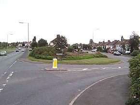
Rugeley is a market town and civil parish in the Cannock Chase District, in Staffordshire, England. It lies on the north-eastern edge of Cannock Chase next to the River Trent; it is situated 8 miles (13 km) north of Lichfield, 10 miles (16 km) south-east of Stafford, 5 miles (8.0 km) north-east of Hednesford and 11 miles (18 km) south-west of Uttoxeter. At the 2021 Census, the population was 26,156.

The A52 is a major road in the East Midlands, England. It runs east from a junction with the A53 at Newcastle-under-Lyme near Stoke-on-Trent via Ashbourne, Derby, Stapleford, Nottingham, West Bridgford, Bingham, Grantham, Boston and Skegness to the east Lincolnshire coast at Mablethorpe. It is approximately 147 miles (237 km) long.

The A53 is a primary route in the English Midlands, that runs from Buxton in Derbyshire to Shrewsbury in Shropshire.
Pye Green is an English village on Cannock Chase in the south of Staffordshire standing nearly 800 feet above sea-level, literally overlooking Hednesford, Cannock, Walsall and much of the Black Country. Birmingham city centre can be clearly seen when the weather is good.

The Chase Line is a suburban railway line in the West Midlands region of England. It runs from its southern terminus, Birmingham New Street, to Walsall, and then Rugeley Trent Valley in Staffordshire, where it joins the Trent Valley line. The name of the line refers to Cannock Chase which it runs through at its northern end.

The A689 is a road in northern England that runs east from the A595, 3.1 miles (5.0 km) to the west of Carlisle in Cumbria, to Hartlepool in County Durham.

The A449 is a major road in the United Kingdom. It runs north from junction 24 of the A48 road at Newport in South Wales to Stafford in Staffordshire.

The A4150 Wolverhampton Inner Ring Road is a ring road that encircles the city centre of Wolverhampton in the West Midlands, England. The circumference of the road is around 2.1 miles (3.4 km). Technically, the route is listed as an "Inner Ring Road", although only a tiny section of the "Outer Ring Road" was ever constructed with only one of the two designed carriageways built. A second carriageway was built in 2017 along a short stretch between Patshull Avenue and Stafford Road. The section of outer ring road is called Wobaston Road and locally classified by Wolverhampton City Council as U119.

The A453 road was formerly the main trunk road connecting the English cities of Nottingham and Birmingham. However, the middle section of this mainly single-carriageway road has largely been downgraded to B roads or unclassified roads following the construction of the parallel M42-A42 link around 1990. The M42 was originally meant to pass further north than it does, and to join the M1 at Sandiacre in Derbyshire. The M42/A42 does not enter Derbyshire, but instead joins the M1 closer to the A453 junction at Kegworth. The A42 shadows the former A453 from Appleby Magna to Castle Donington. The road historically connected the East Midlands with the West Midlands.

Essington is a village and civil parish in the South Staffordshire, district, in Staffordshire, England, near the city of Wolverhampton and towns of Walsall, Bloxwich, Cannock and Brewood. The villages of Cheslyn Hay, Great Wyrley, Coven, Penkridge and Featherstone are also nearby. The village forms part of the Staffordshire/West Midlands border. The parish includes the hamlet of Springhill. In 2021 the parish had a population of 5,200.

The M54 is a 23-mile-long (37 km) east-west motorway in the counties of Shropshire and Staffordshire, England. It is also referred to as the Telford motorway, after the road's primary westbound destination, the town of Telford. It cost £65 million to construct, and is two-lane dual carriageway for the majority of its length, with sections of three-lane.

The A444 is a primary road running between Coventry and Burton upon Trent in England, usually referred to as the "A treble four" or "A triple four".

The A459 is a main road in the West Midlands of England, which runs from Halesowen to Wolverhampton City Centre. Is also a primary route connecting Wolverhampton and Dudley.

The current Cannock Extension Canal is a 1.8-mile (2.9 km) canal in England. It runs from Pelsall Junction on the Wyrley and Essington Canal, north to Norton Canes Docks and forms part of the Birmingham Canal Navigations. Historically, it ran to Hednesford, and served a number of collieries, which provided the main traffic. It opened in 1863, and the northern section closed in 1963, as a result of mining subsidence.

The Cannock Chase Railways were mineral lines which served the collieries and many parts of Staffordshire. The branch lines and sidings branched off the local mainlines including the Grand Junction Railway, Chase Line, South Staffordshire Line and Rugby–Birmingham–Stafford line. The main junction on the railways was Norton Junction. This junction connected the lines from Walsall and Hednesford to Wolverhampton and Rugeley Trent Valley for the local collieries and the mines in the towns of Brownhills, Burntwood, Chasetown, Penkridge and Cannock.