Albany Creek Moreton Bay, Queensland | |||||||||||||||
---|---|---|---|---|---|---|---|---|---|---|---|---|---|---|---|
Albany Creek Road, Queensland | |||||||||||||||
Coordinates | 27°20′49″S152°58′05″E / 27.34694°S 152.96806°E Coordinates: 27°20′49″S152°58′05″E / 27.34694°S 152.96806°E | ||||||||||||||
Population | 15,769 (2016 census) [1] | ||||||||||||||
• Density | 1,643/km2 (4,254/sq mi) | ||||||||||||||
Postcode(s) | 4035 | ||||||||||||||
Area | 9.6 km2 (3.7 sq mi) | ||||||||||||||
Location |
| ||||||||||||||
LGA(s) | Moreton Bay Region | ||||||||||||||
State electorate(s) | |||||||||||||||
Federal Division(s) | Dickson | ||||||||||||||
|
Albany Creek is a southern suburb in the Moreton Bay Region, Queensland, Australia. [2] In the 2016 census, Albany Creek had a population of 15,769 people. [3]
Albany Creek is located approximately 18.8 kilometres north-west of the City of Brisbane, Queensland, Australia, about a half-hour drive to the Brisbane central business district.
It is positioned on a small hill which runs down to the South Pine River. Albany Creek is west of Bridgeman Downs and east of Eatons Hill.
Albany Creek is situated in the Yugarabul traditional Aboriginal country. [4]
The suburb of Albany Creek was originally established on the intersection of two Aboriginal tracks. The main track formed the primary route north of Brisbane and is still known as "Old Northern Road". The second track formed a route from Old Northern Road to Little Cabbage Tree Creek in Aspley and onto Downfall Creek in Chermside. Albany Creek Road and Gympie Road now follow this route.
Albany Creek was originally known as "Chinaman's Creek" before its name was changed in 1888.
Chinaman's Creek State School opened on 25 January 1875, but was downgraded to Chinamans Creek Provisional School in 1883. In 1887, it became Albany Creek State School. [5]
Initially a rural area, Albany Creek began to develop as a suburban area in the 1960s as the Brisbane metropolitan area expanded. [6] This led to the opening of more schools to cater for the growing population with Albany Hills State School opening on 30 January 1979, [5] Albany Creek State High School opening on 25 January 1982, [5] Good Shepherd Christian (Baptist) School opening in 1983, [7] and All Saints (Catholic) Primary School opening on 24 January 1989. [5]
Albany Creek public library opened in 2000. [8]
Albany Creek has one state high school and four primary schools. It is a major suburban service centre within the Moreton Bay Regional Council, featuring fast food restaurants, a council branch library, a municipal pool, and a bus interchange. The Albany Creek Library is located at 16 Ferguson Street. [9] Albany Creek also has three main shopping centres, including Woolworths, Aldi and a Centro Albany Creek, which hosts a Coles supermarket. Several smaller shopping facilities are also located along Albany Creek Road.
Albany Creek also has 4 churches. Good Shepherd Baptist Church, [10] All Saints Parish, Albany Creek Uniting Church and Southpine Seventh-day Adventist Church.
Albany Creek is located in Zones 4 and 5 of the TransLink public transport fare system and is serviced by several Brisbane Transport bus routes. The nearest railway station is Strathpine.
Albany Creek State School is a government primary (Prep-6) school for boys and girls at 696 Albany Creek Road ( 27°20′45″S152°58′14″E / 27.3458°S 152.9706°E ). [11] [12] In 2017, the school had an enrolment of 847 students with 59 teachers (51 full-time equivalent) and 31 non-teaching staff (20 full-time equivalent). [13] It includes a special education program. [11]
Albany Hills State School is a government primary (Prep-6) school for boys and girls at Keong Road ( 27°21′37″S152°58′22″E / 27.3603°S 152.9727°E ). [11] [14] In 2017, the school had an enrolment of 812 students with 58 teachers (51 full-time equivalent) and 33 non-teaching staff (21 full-time equivalent). [13] It includes a special education program. [11]
All Saints Primary School is a Catholic primary (Prep-6) school for boys and girls at 4 Faheys Road East ( 27°21′00″S152°58′14″E / 27.3500°S 152.9706°E ). [11] [15] In 2017, the school had an enrolment of 656 students with 42 teachers (36 full-time equivalent) and 30 non-teaching staff (19 full-time equivalent). [13]
Good Shepherd Christian School is a private primary and secondary (Prep-12) school for boys and girls at 185 Old Northern Road ( 27°20′38″S152°57′56″E / 27.3439°S 152.9655°E ). [11] [16] In 2017, the school had an enrolment of 109 students with 14 teachers (11 full-time equivalent) and 10 non-teaching staff (4 full-time equivalent). [13]
Albany Creek State High School is a government secondary (7-12) school for boys and girls at Albany Forest Drive ( 27°21′27″S152°58′07″E / 27.3576°S 152.9686°E ). [11] [17] In 2017, the school had an enrolment of 1261 students with 104 teachers (97 full-time equivalent) and 45 non-teaching staff (31 full-time equivalent). [13] It includes a special education program. [11]
In the 2011 census, Albany Creek recorded a population of 15,860 people, 50.6% female and 49.4% male.
The median age of the Albany Creek population was 38, 1 year above the national median of 37.
79% of people living in Albany Creek were born in Australia. The other top responses for country of birth were England 4.9%, New Zealand 3.4%, South Africa 2%, Scotland 0.8%, and Italy 0.4%.
92.4% of people spoke only English at home; the next most common languages were 0.7% Italian, 0.4% Afrikaans, 0.4% German, 0.3% Hindi, and 0.3% Cantonese.
The local soccer or football club is ACE FC. With over 1000 registered players and more than 2,500 members, it is the largest soccer club in Brisbane. It provides for junior and senior players. Its other activities include the clubs Kindy Program for players aged 3 to 5, and the club's Football School which provides players a soccer development program for 12 months of the year and is modelled on European academies. In the off-season, ACE FC provides a Five A Side Competition which incorporates over 35 men and women. The Five A Side competition has grown to be one of the largest off-season social comps in Brisbane. ACE FC coaching staff include ex-European players Salvo Sottile as Technical Director, Josh McCloughan, retired Brisbane Roar defender and Roberto Lettieri who played National League at the end of his career after a successful season in Brazil.
Albany Creek's local rugby league club team is the Albany Creek Crushers.
The suburb also has a cricket team that goes by the name of Albany Creek Hawks or just Albany Creek Cricket Club.
Aspley is a suburb in the City of Brisbane, Queensland, Australia. In the 2016 census, Aspley had a population of 12,108 people.
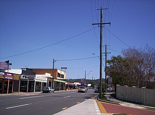
Burpengary is a town and suburb in the Moreton Bay Region, Queensland, Australia. It is 35 kilometres (22 mi) from the Brisbane CBD.
Mitchelton is a north-western suburb in the City of Brisbane, Queensland, Australia. In the 2016 census, Mitchelton had a population of 8,559 people.
Mount Gravatt is a southern suburb of the City of Brisbane, Queensland, Australia and a prominent hill within this suburb. In the 2016 census, Mount Gravatt had a population of 3,366 people.
The Gap is a north-western suburb in the City of Brisbane, Queensland, Australia. In the 2016 census, The Gap had a population of 16,692 people.
Caboolture is a town and suburb in Moreton Bay Region, Queensland, Australia. In the 2016 census, the suburb of Caboolture had a population of 26,433 people. It is located on the north side of the Caboolture River, which separates the town from Morayfield and Caboolture South.
Ashgrove is a suburb in the City of Brisbane, Queensland, Australia. In the 2016 census, Ashgrove had a population of 13,039 people.
Bardon is a western suburb of the City of Brisbane, Queensland, Australia. It is located approximately 5 kilometres (3.1 mi) north-west of the Brisbane CBD. Bardon is a leafy residential suburb, much of which nestles into the foothills of Mount Coot-tha. In the 2016 census, Bardon had a population of 9,500 people. It includes the neighbourhood of Rainworth.
Indooroopilly is a western suburb in the City of Brisbane, Queensland, Australia. In the 2016 census, Indooroopilly had a population of 12,242 people.
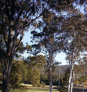
Brookfield is a semi-rural suburb in the City of Brisbane, Queensland, Australia. In the 2016 census, Brookfield had a population of 3,524 people.
Corinda is a suburb in the City of Brisbane, Queensland, Australia. In the 2016 census, Corinda had a population of 5,064 people.
Ferny Grove is an outer north-western suburb in the City of Brisbane, Queensland, Australia. In the 2016 census, Ferny Grove had a population of 5,725 people.
Fig Tree Pocket is a riverside western suburb in the City of Brisbane, Queensland, Australia. In the 2016 census, Fig Tree Pocket had a population of 4,045 people.
Morayfield is a town and suburb of Moreton Bay Region, Queensland, Australia. It is 44 kilometres (27 mi) north of Brisbane CBD, the state capital. In the 2016 census, Morayfield had a population of 21,394 people.
Everton Park is a suburb of the City of Brisbane, Queensland, Australia. In the 2016 census, Everton Park had a population of 8,862 people.
Bray Park is a suburb of Moreton Bay Region, Queensland, Australia. It is a part of Brisbane metropolitan area. In the 2016 census, Bray Park had a population of 10,246 people.
Durack is an outer south-western suburb of the City of Brisbane, Queensland, Australia. In the 2016 census, Durack had a population of 7,487 people.
Redbank Plains is a suburb in the City of Ipswich, Queensland, Australia. In the 2016 census, Redbank Plains had a population of 19,299 people.
Silkstone is a suburb in the City of Ipswich, Queensland, Australia. In the 2016 census, Silkstone had a population of 3,480 people.
Brassall is a suburb in the City of Ipswich, Queensland, Australia. In the 2016 census, Brassall had a population of 10,898 people.