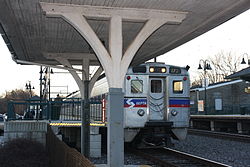
Rowland Park, Pennsylvania | |
|---|---|
Unincorporated community | |
 | |
 Rowland Park  Rowland Park | |
| Coordinates: 40°03′42″N75°05′57″W / 40.06167°N 75.09917°W | |
| Country | United States |
| State | Pennsylvania |
| County | Montgomery |
| Elevation | 135 ft (41 m) |
| Time zone | UTC-5 (Eastern (EST)) |
| • Summer (DST) | UTC-4 (EDT) |
| Area codes | 215, 267 and 445 |
| GNIS feature ID | 1202992 [1] |
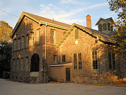
Rowland Park is an unincorporated community in Cheltenham Township, Montgomery County, Pennsylvania, United States. [1] The George K. Heller School, now the Cheltenham Center for the Arts, which is listed on the National Register of Historic Places, is located in Ashmead Village. [2]