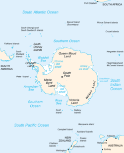
Socks Glacier is a small glacier descending the east slopes of Queen Alexandra Range just north of Owen Hills to enter the west side of Beardmore Glacier. Discovered by the British Antarctic Expedition (1907–09) and named for one of the ponies taken with the South Pole Party. Socks, the last pony to survive the journey, fell into a crevasse on 7 December 1908, on Beardmore Glacier near Socks Glacier.

Underwood Glacier is a channel glacier in Wilkes Land, Antarctica about 15 nautical miles long, flowing to the Antarctic coast between Reist Rocks and Cape Nutt. It was mapped in 1955 by G. D. Blodgett from aerial photographs taken by U.S. Navy Operation Highjump in 1947 and named by Advisory Committee on Antarctic Names (US-ACAN) after Lieutenant Thomas Joseph Underwood, Jr., USMC, who served on the sloop Vincennes of the United States Exploring Expedition (1838–42) under Lieutenant Charles Wilkes.

Jaburg Glacier is a broad glacier draining westward between the Dufek Massif and the Cordiner Peaks in the Pensacola Mountains of Antarctica. It was mapped by the United States Geological Survey from surveys and U.S. Navy air photos, 1956–66. The glacier was named by the Advisory Committee on Antarctic Names after Lieutenant Conrad J. Jaburg, U.S. Navy, a helicopter pilot with the Ellsworth Station winter party, 1957.

Astro Glacier is a glacier in Antarctica, between the Turner Hills and Tricorn Peak in the Miller Range, flowing northeast into the Marsh Glacier. It was seen by the northern party of the New Zealand Geological Survey Antarctic Expedition (1961–62) and so named because an astronomical station was set up on the bluff at the mouth of the glacier in December 1961.
Abrupt Point, also known as Brattodden, is a rocky point 4.8 kilometres (3 mi) southwest of Patricia Islands, on the west side of Edward VIII Bay. Mapped by Norwegian cartographers from aerial photos taken by the Lars Christensen Expedition, 1936–37, and named Brattodden. The Norwegian name was translated by ANCA following a 1954 ANARE survey of the area.

Adams Glacier, also known as John Quincy Adams Glacier, is a broad channel glacier in Wilkes Land, Antarctica which is over 20 miles (32 km) long. It debouches into the head of Vincennes Bay, just east of Hatch Islands. It was first mapped in 1955 by G.D. Blodgett from aerial photographs taken by U.S. Navy Operation Highjump (1947), and it was named by the Advisory Committee on Antarctic Names (US-ACAN) for John Quincy Adams, sixth President of the United States. Adams was instrumental while later serving as U.S. representative from Massachusetts in gaining congressional authorization of the United States Exploring Expedition (1838–42) under Lieutenant Charles Wilkes, and perpetuating the compilation and publication of the large number of scientific reports based on the work of this expedition.
Oakley Glacier, is a glacier in the Mountaineer Range that descends east from Mount Casey to merge with the floating tongue from the Icebreaker Glacier at Lady Newnes Bay, in Victoria Land, Antarctica. Mapped by U.S. Geological Survey (USGS) from surveys and U.S. Navy air photos, 1960-64. Named by Advisory Committee on Antarctic Names (US-ACAN) for Lieutenant Commander Donald C. Oakley, U.S. Navy (USN), Protestant chaplain with the winter party at McMurdo Station, 1967.

Stephenson Glacier is a glacier close west of Dovers Moraine on the east side of Heard Island in the southern Indian Ocean. Its terminus is between Dovers Moraine and Stephenson Lagoon, with part of the glacier flowing to Doppler Hill and Sealers Beach. To the north of Stephenson Glacier is Brown Glacier, whose terminus is located at Brown Lagoon. To the southwest of Stephenson Glacier is Winston Glacier, whose terminus is located at Winston Lagoon, between Cape Lockyer and Oatt Rocks.

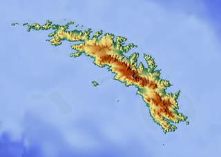
Henningsen Glacier is a glacier 3 nautical miles (6 km) long, flowing southwest to the south coast of South Georgia between Cape Darnley and Rocky Bay. It was surveyed in the period 1951–57 by the South Georgia Survey expedition led by Duncan Carse, and was named by the UK Antarctic Place-Names Committee for Leonard Henningsen, Manager of Tønsbergs Hvalfangeri, Husvik, 1945–50.

Asimutbreen Glacier is a small, steep tributary glacier to Vangengeym Glacier, descending southeast and then northeast between Solhogdene Heights and Skuggekammen Ridge, in the eastern Gruber Mountains of the Wohlthat Mountains, Queen Maud Land. It was discovered and plotted from air photos by the Third German Antarctic Expedition, 1938–39, replotted from air photos and from surveys by the Sixth Norwegian Antarctic Expedition, 1956–60, and named Asimutbreen.

Blair Glacier is a glacier draining northward to the western corner of Maury Bay. It was delineated from aerial photographs taken by U.S. Navy Operation Highjump (1946–47), and named by the Advisory Committee on Antarctic Names for James L. Blair, Midshipman on the sloop Peacock during the United States Exploring Expedition (1838–42) under Lieutenant Charles Wilkes.

Brandau Glacier is a wide tributary glacier, 15 nautical miles (28 km) long, flowing westward from an ice divide between Haynes Table and Husky Heights to enter Keltie Glacier just west of Ford Spur. It was named by the Advisory Committee on Antarctic Names for Lieutenant Commander James F. Brandau, U.S. Navy, a pilot with Squadron VX-6, Operation Deepfreeze 1964 and 1965.
Nottarp Glacier is a small glacier draining eastward into Lowery Glacier just south of Mount Damm in the Queen Elizabeth Range. Mapped by the United States Geological Survey (USGS) from tellurometer surveys and Navy air photos, 1960-62. Named by Advisory Committee on Antarctic Names (US-ACAN) for Klemens J. Nottarp, United States Antarctic Research Program (USARP) glaciologist on the Ross Ice Shelf, 1962–63 and 1965–66.

Driscoll Glacier is a glacier 13 nautical miles (24 km) long in the Heritage Range, draining southeast between the Collier Hills and the Buchanan Hills to enter Union Glacier. It was mapped by the United States Geological Survey from surveys and U.S. Navy air photos, 1961–66, and was named by the Advisory Committee on Antarctic Names for Commander Jerome M. Driscoll, an administration officer with U.S. Navy Squadron VX-6 during Operation Deep Freeze 1965.

Flanagan Glacier is a glacier in the Pioneer Heights of the Heritage Range, Antarctica, draining east from Thompson Escarpment between the Gross Hills and the Nimbus Hills to the confluent ice at the lower end of Union Glacier. It was mapped by the United States Geological Survey from surveys and U.S. Navy air photos, 1961–66, and was named by the Advisory Committee on Antarctic Names for Lieutenant Walter B. Flanagan, an assistant maintenance officer with U.S. Navy Squadron VX-6 at McMurdo Station during Operation Deep Freeze 1963 and 1964.
Cape Mikhaylov is an ice-covered point about 42 nautical miles (78 km) east of Totten Glacier, Wilkes Land, Antarctica. It was photographed by U.S. Navy Operation Highjump in 1947, and plotted on base compilation maps by Gardner Blodgett of the Office of Geography, U.S. Department of the Interior, in 1955. The cape was photographed by the Soviet Antarctic Expedition in 1956, and was named after Pavel N. Mikhaylov, artist with the Bellingshausen expedition of 1819–21.
The Longstaff Peaks are a series of high peaks standing just west of Davidson Glacier in the north-central part of the Holland Range in Antarctica. They were discovered by the British National Antarctic Expedition (1901–04), and named Mount Longstaff for Llewellyn Wood Longstaff, a principal contributor to the expedition. The descriptive term was amended by the New Zealand Antarctic Place-Names Committee.

Hyde Glacier is a short glacier flowing east through the Edson Hills to join Union Glacier, in the Heritage Range, Antarctica. It was mapped by the United States Geological Survey from surveys and U.S. Navy air photos, 1961–66, and was named by the Advisory Committee on Antarctic Names for William H. Hyde, an ionospheric scientist at Little America V Station in 1958.
Maury Bay is an ice-filled bay indenting the coast of Antarctica just east of Cape Lewis. It was mapped by G.D. Blodgett in 1955 from aerial photographs taken by U.S. Navy Operation Highjump (1946–47), and named by the Advisory Committee on Antarctic Names for William Lewis Maury, lieutenant on the brig Porpoise during the United States Exploring Expedition (1838–42) under Lieutenant Charles Wilkes.

Holmes Glacier is a broad glacier debouching into the western part of Porpoise Bay about 10 nautical miles (20 km) south of Cape Spieden. It was delineated from aerial photographs taken by U.S. Navy Operation Highjump (1946–47), and was named by the Advisory Committee on Antarctic Names after Dr. Silas Holmes, Assistant Surgeon on the brig Porpoise during the United States Exploring Expedition (1838–42) under Lieutenant Charles Wilkes.


