Centuria, Wisconsin

Last updated

Centuria, Wisconsin
Polk County Wisconsin Incorporated and Unincorporated areas Centuria Highlighted.svg
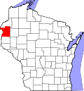
Location of Centuria in Polk County, Wisconsin.
Coordinates: 45°26′59″N92°33′12″W / 45.44972°N 92.55333°W / 45.44972; -92.55333
Country Flag of the United States.svg  United States
State Flag of Wisconsin.svg  Wisconsin
County Polk
Area
[1]
  Total1.70 sq mi (4.40 km2)
  Land1.70 sq mi (4.40 km2)
  Water0.00 sq mi (0.00 km2)
Elevation
[2]
1,230 ft (375 m)
Population
 (2010) [3]
  Total948
  Estimate 
(2019) [4]
910
  Density535.61/sq mi (206.74/km2)
Time zone UTC-6 (Central (CST))
  Summer (DST) UTC-5 (CDT)
Area code(s) 715 & 534
FIPS code 55-13850 [5]
GNIS feature ID1562913 [2]
Website www.centuria-wi.org

Centuria is a village in Polk County, Wisconsin, United States. The population was 891 at the 2020 census. [6]

Contents

Geography

Centuria is located at 45°26′59″N92°33′12″W / 45.44972°N 92.55333°W / 45.44972; -92.55333 (45.449651, -92.553201). [7]

According to the United States Census Bureau, the village has a total area of 1.70 square miles (4.40 km2), all of it land. [8]

Centuria is along Wisconsin Highway 35 and Polk County Road I.

Demographics

Historical population
CensusPop.Note
1910 301
1920 35818.9%
1930 43521.5%
1940 411−5.5%
1950 52126.8%
1960 5515.8%
1970 63214.7%
1980 71112.5%
1990 79011.1%
2000 8659.5%
2010 9489.6%
2019 (est.)910 [4] −4.0%
U.S. Decennial Census [9]

2010 census

As of the census [3] of 2010, there were 948 people, 414 households, and 227 families living in the village. The population density was 557.6 inhabitants per square mile (215.3/km2). There were 449 housing units at an average density of 264.1 per square mile (102.0/km2). The racial makeup of the village was 95.6% White, 0.6% African American, 0.7% Native American, 0.5% Asian, 0.1% from other races, and 2.4% from two or more races. Hispanic or Latino of any race were 0.5% of the population.

There were 414 households, of which 30.9% had children under the age of 18 living with them, 33.3% were married couples living together, 15.2% had a female householder with no husband present, 6.3% had a male householder with no wife present, and 45.2% were non-families. 35.7% of all households were made up of individuals, and 16.6% had someone living alone who was 65 years of age or older. The average household size was 2.29 and the average family size was 3.00.

The median age in the village was 34.9 years. 26.3% of residents were under the age of 18; 9.7% were between the ages of 18 and 24; 26.1% were from 25 to 44; 23% were from 45 to 64; and 15.1% were 65 years of age or older. The gender makeup of the village was 48.3% male and 51.7% female.

2000 census

As of the census [5] of 2000, there were 865 people, 343 households, and 218 families living in the village. The population density was 558.6 people per square mile (215.5/km2). There were 361 housing units at an average density of 233.1 per square mile (89.9/km2). The racial makeup of the village was 96.99% White, 0.58% African American, 0.58% Native American, 1.27% Asian, 0.12% from other races, and 0.46% from two or more races. Hispanic or Latino of any race were 1.50% of the population.

There were 343 households, out of which 33.5% had children under the age of 18 living with them, 49.3% were married couples living together, 11.1% had a female householder with no husband present, and 36.2% were non-families. 30.6% of all households were made up of individuals, and 12.2% had someone living alone who was 65 years of age or older. The average household size was 2.45 and the average family size was 3.09.

In the village, the population was spread out, with 27.9% under the age of 18, 7.7% from 18 to 24, 30.1% from 25 to 44, 19.2% from 45 to 64, and 15.1% who were 65 years of age or older. The median age was 35 years. For every 100 females, there were 92.7 males. For every 100 females age 18 and over, there were 93.2 males.

The median income for a household in the village was $32,560, and the median income for a family was $39,375. Males had a median income of $31,838 versus $21,736 for females. The per capita income for the village was $15,317. About 4.1% of families and 7.9% of the population were below the poverty line, including 9.3% of those under age 18 and 14.6% of those age 65 or over.

Notable people

Education

Related Research Articles

<span class="mw-page-title-main">Menifee, Arkansas</span> Town in Arkansas, United States

Menifee is a town in Conway County, Arkansas, United States. The population was 302 at the 2010 census.

<span class="mw-page-title-main">Goreville, Illinois</span> Village in Illinois, United States

Goreville is a village in Johnson County, Illinois, United States. The population was 1,049 as of the 2010 census, up from 938 at the 2000 census.

<span class="mw-page-title-main">Greenwood, Minnesota</span> City in Minnesota, United States

Greenwood is a community on Saint Albans Bay on Lake Minnetonka in Hennepin County, Minnesota, United States just northeast of the community of Excelsior, Minnesota. The population was 688 at the 2010 census.

<span class="mw-page-title-main">Milroy, Minnesota</span> City in Minnesota, United States

Milroy is a city in Redwood County, Minnesota, United States. The population was 252 at the 2010 census. It is named after Robert H. Milroy, a Union Army general in the American Civil War.

<span class="mw-page-title-main">Scotsdale, Missouri</span> Village in Missouri, United States

Scotsdale is a village in Jefferson County, Missouri, United States. The population was 222 at the 2010 census.

<span class="mw-page-title-main">Country Life Acres, Missouri</span> Village in Missouri, United States

Country Life Acres is a village in St. Louis County, Missouri, United States. The population was 72 at the 2020 census.

<span class="mw-page-title-main">Glen Echo Park, Missouri</span> Former Village in Missouri, United States

Glen Echo Park was a village in St. Louis County, Missouri, United States. The population was 122 at the 2020 census. The community took its name from the nearby Glen Echo Country Club.

<span class="mw-page-title-main">Haywood City, Missouri</span> Village in Missouri, United States

Haywood City is a village in Scott County, Missouri, United States. The population was 206 at the 2010 census.

<span class="mw-page-title-main">Darbyville, Ohio</span> Village in Ohio, United States

Darbyville is a village in Pickaway County, Ohio, United States. The population was 186 at the 2020 census.

<span class="mw-page-title-main">Cleveland Township, Columbia County, Pennsylvania</span> Township in Pennsylvania, United States

Cleveland Township is a township in Columbia County, Pennsylvania. It is part of Northeastern Pennsylvania. The population was 1,131 at the 2020 census.

<span class="mw-page-title-main">North Cornwall Township, Pennsylvania</span> Township in Pennsylvania, United States

North Cornwall Township is a township in Lebanon County, Pennsylvania, United States. The population of North Cornwall Township was 8,511 as of the 2020 census. It is part of the Lebanon, PA Metropolitan Statistical Area.

<span class="mw-page-title-main">West Cornwall Township, Pennsylvania</span> Township in Pennsylvania, United States

West Cornwall Township is a township in Lebanon County, Pennsylvania, United States. It is part of the Lebanon, PA Metropolitan Statistical Area. The population was 1,987 at the 2020 census.

<span class="mw-page-title-main">Frailey Township, Pennsylvania</span> Township in Pennsylvania, United States

Frailey Township is a township in Schuylkill County, Pennsylvania, United States. The population was 420 at the 2020 census.

<span class="mw-page-title-main">Fawn Township, York County, Pennsylvania</span> Township in Pennsylvania, United States

Fawn Township is a township in York County, Pennsylvania, United States. The population was 3,011 at the 2020 census.

<span class="mw-page-title-main">Greenville, Rhode Island</span> Census-designated place in Rhode Island, United States

Greenville is a village and census-designated place (CDP) in the town of Smithfield in Providence County, Rhode Island, United States. The population was 8,658 at the 2010 census. The CDP is centered on the village of Greenville but also encompasses the nearby villages of West Greenville and Spragueville, as well as the Mountaindale Reservoir and beach.

<span class="mw-page-title-main">Oliver, Wisconsin</span> Village in Wisconsin, United States

Oliver is a village in Douglas County, Wisconsin, United States. The population was 423 at the 2020 census.

<span class="mw-page-title-main">Bay City, Wisconsin</span> Village in Wisconsin, United States

Bay City is a village on the Mississippi River in Pierce County, Wisconsin, United States. The population was 500 at the 2010 census.

<span class="mw-page-title-main">Wilson, St. Croix County, Wisconsin</span> Village in Wisconsin, United States

Wilson is a village in St. Croix County, Wisconsin, United States. The population was 184 at the 2010 census.

<span class="mw-page-title-main">Riceville, Iowa</span> City in Iowa, United States

Riceville is a city in Howard and Mitchell counties in the U.S. state of Iowa. The population was 806 at the time of the 2020 census.

<span class="mw-page-title-main">Dallas, Wisconsin</span> Village in Wisconsin, United States

Dallas is a village in Barron County in the U.S. state of Wisconsin. The population was 409 at the 2010 census. The village is located within the Town of Dallas.

References

  1. "2019 U.S. Gazetteer Files". United States Census Bureau. Retrieved August 7, 2020.
  2. 1 2 "US Board on Geographic Names". United States Geological Survey. October 25, 2007. Retrieved January 31, 2008.
  3. 1 2 "U.S. Census website". United States Census Bureau . Retrieved November 18, 2012.
  4. 1 2 "Population and Housing Unit Estimates". United States Census Bureau. May 24, 2020. Retrieved May 27, 2020.
  5. 1 2 "U.S. Census website". United States Census Bureau . Retrieved January 31, 2008.
  6. "Explore Census Data". data.census.gov. Retrieved April 30, 2024.
  7. "US Gazetteer files: 2010, 2000, and 1990". United States Census Bureau. February 12, 2011. Retrieved April 23, 2011.
  8. "US Gazetteer files 2010". United States Census Bureau. Archived from the original on January 25, 2012. Retrieved November 18, 2012.
  9. "Census of Population and Housing". Census.gov. Retrieved June 4, 2015.