D'Aguilar, Queensland

Last updated

D'Aguilar
Queensland
D'Aguilar Hotel.JPG
D'Aguilar Hotel
Australia Queensland location map.svg
Red pog.svg
D'Aguilar
D'Aguilar, Queensland
Coordinates 26°59′23″S152°48′00″E / 26.9897°S 152.8°E / -26.9897; 152.8 (D'Aguilar (town centre))
Population1,474 (2021 census)
 • Density147.4/km2 (381.8/sq mi)
Postcode(s) 4514
Area10.0 km2 (3.9 sq mi)
Time zone AEST (UTC+10:00)
Location
LGA(s) City of Moreton Bay
State electorate(s) Glass House
Federal division(s) Longman
Suburbs around D'Aguilar:
Woodford Woodford Woodford
Woodford
Delaneys Creek
D'Aguilar Bracalba
Delaneys Creek Delaneys Creek
Bracalba
Bracalba

D'Aguilar is a rural town and locality in the City of Moreton Bay, Queensland, Australia. [1] [2] In the 2021 census, D'Aguilar had a population of 1,474 people. [3]

Contents

It is located northwest of the larger centre of Caboolture.

Geography

D'Aguilar lies on the D'Aguilar Highway between Wamuran and Woodford. It is also the northern endpoint of Brisbane–Woodford Road (Mount Mee Road), which leads south through Delaneys Creek and Mount Mee to Dayboro. A small section of the Beerburrum West State Forest is in D'Aguilar. [4]

History

The town is named for Major General Sir George D'Aguilar, a military officer who wrote Regulations and Punishments of the British Army, the army textbook in use at the time of the town's establishment. [5] As time passed, the mountain range that the town is situated in came to be named after the town.

Demographics

In the 2021 census, D'Aguilar had a population of 1,474 people. It had a median age of 36 and weekly income of $1,896. [3]

Related Research Articles

<span class="mw-page-title-main">Mount Pleasant, Queensland (Moreton Bay)</span> Suburb of City of Moreton Bay, Queensland, Australia

Mount Pleasant is a rural locality in the City of Moreton Bay, Queensland, Australia. In the 2021 census, Mount Pleasant had a population of 390 people.

<span class="mw-page-title-main">Mount Glorious</span> Suburb of City of Moreton Bay, Queensland, Australia

Mount Glorious is a rural locality in the City of Moreton Bay, Queensland, Australia. In the 2021 census, Mount Glorious had a population of 343 people.

Ningi is a town and locality in the City of Moreton Bay, Queensland, Australia. In the 2021 census, Ningi had a population of 5,349 people. It is near Caboolture.

<span class="mw-page-title-main">D'Aguilar Highway</span> Highway in Queensland, Australia

The D'Aguilar Highway is a two-lane highway linking the Bruce Highway near Caboolture with the Bunya Highway in Kingaroy in the state of Queensland, Australia. Major towns along the route include Woodford, Kilcoy, Blackbutt, Yarraman, and Nanango. The highway is approximately 164 km (102 mi) in length. The D'Aguilar Highway's highest elevation along its length is 527 m just north of Yarraman, and the lowest point is at 26.8 m just west of Caboolture.

<span class="mw-page-title-main">Woodford, Queensland</span> Town in Queensland, Australia

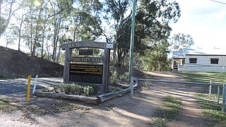
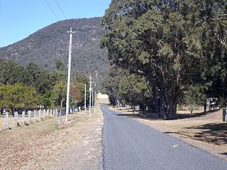
Woodford is a rural town and locality in the City of Moreton Bay, Queensland, Australia. In the 2016 census, the locality of Woodford had a population of 3,458 people.

<span class="mw-page-title-main">City of Moreton Bay</span> Local government area in Queensland, Australia

The City of Moreton Bay, known until July 2023 as the Moreton Bay Region, is a local government area in the north of the Brisbane metropolitan city in South East Queensland, Australia. Established in 2008, it replaced three established local government areas, the City of Redcliffe and the Shires of Pine Rivers and Caboolture.

Ocean View is a rural locality in the City of Moreton Bay, Queensland, Australia. In the 2021 census, Ocean View had a population of 1,022 people.

<span class="mw-page-title-main">Mount Mee, Queensland</span> Town in Queensland, Australia

Mount Mee is a rural town and locality in the City of Moreton Bay, Queensland, Australia. In the 2021 census, Mount Mee had a population of 519 people.

<span class="mw-page-title-main">Delaneys Creek, Queensland</span> Suburb of City of Moreton Bay, Queensland, Australia

Delaneys Creek is a rural locality in the City of Moreton Bay, Queensland, Australia. In the 2021 census, Delaneys Creek had a population of 1,366 people.

Bellmere is a rural locality in the City of Moreton Bay, Queensland, Australia. In the 2021 census, Bellmere had a population of 6,588 people.

King Scrub is a rural locality in the City of Moreton Bay, Queensland, Australia. In the 2021 census, King Scrub had a population of 363 people. It is located on the northern outskirts of Dayboro.

Elimbah is a rural town and locality in the City of Moreton Bay, Queensland, Australia. In the 2021 census, the locality of Elimbah had a population of 4,290 people.

<span class="mw-page-title-main">Wamuran, Queensland</span> Town in Queensland, Australia

Wamuran is a rural town and locality in the City of Moreton Bay, Queensland, Australia. In the 2021 census, the locality of Wamuran had a population of 4,228 people.

<span class="mw-page-title-main">Moodlu, Queensland</span> Suburb of City of Moreton Bay, Queensland, Australia

Moodlu is a rural locality in the City of Moreton Bay, Queensland, Australia. In the 2021 census, Moodlu had a population of 285 people.

Stony Creek is a rural locality in the City of Moreton Bay in Queensland, Australia. In the 2021 census, Stony Creek had a population of 245 people.

<span class="mw-page-title-main">Mount Delaney</span> Suburb of City of Moreton Bay, Queensland, Australia

Mount Delaney is a rural locality in the City of Moreton Bay, Queensland, Australia. In the 2021 census, Mount Delaney had a population of 80 people.

<span class="mw-page-title-main">Mount Archer, Queensland (Somerset Region)</span> Suburb of Somerset Region, Queensland, Australia

Mount Archer is a mountain and a rural locality in the Somerset Region, Queensland, Australia. In the 2021 census, Mount Archer had a population of 331 people.

Beerburrum Road is a continuous 15.2-kilometre (9.4 mi) road route in the Moreton Bay and Sunshine Coast local government areas of Queensland, Australia. It is designated as part of State Route 60. It is a state-controlled district road, rated as a local road of regional significance (LRRS).

Kilcoy–Beerwah Road is a continuous 30.4-kilometre (18.9 mi) road route in the Moreton Bay and Sunshine Coast local government areas of Queensland, Australia. It is designated as part of State Route 6. It is a state-controlled regional road. It is part of a route that carries tourist traffic from the New England Highway to the Bruce Highway.

Brisbane–Woodford Road is the official name for a continuous 60.5-kilometre (37.6 mi) road route in the Moreton Bay local government area of Queensland, Australia. It is designated as part of State Route 58. It is a state-controlled road part regional and part district, rated as a local road of regional significance (LRRS).

References

  1. "D'Aguilar – town in Moreton Bay Region (entry 9157)". Queensland Place Names. Queensland Government . Retrieved 20 July 2021.
  2. "D'Aguilar – locality in Moreton Bay Region (entry 49226)". Queensland Place Names. Queensland Government . Retrieved 20 July 2021.
  3. 1 2 "2021 D'Aguilar, Census All persons QuickStats | Australian Bureau of Statistics". www.abs.gov.au. Retrieved 29 May 2024.
  4. Google (17 January 2023). "D'Aguilar" (Map). Google Maps . Google. Retrieved 17 January 2023.
  5. "Caboolture Town History". Archived from the original on 28 May 2008. Retrieved 6 May 2008.