| Site of Special Scientific Interest | |
 | |
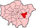
| Location | Greater London |
|---|---|
| Grid reference | TQ418786 |
| Interest | Geological |
| Area | 5.2 hectares |
| Notification | 1985 |
| Location map | Magic Map |
Gilbert's Pit is a 5.2-hectare (13-acre) geological Site of Special Scientific Interest in Charlton in the Royal Borough of Greenwich. It was notified in 1985 and was formerly known as Charlton Sand Pit. [1] It is a Geological Conservation Review site. [2] It is also part of the Maryon Wilson Park and Gilbert's Pit Local Nature Reserve. [3] [4] It adjoins Maryon Park and is close to Maryon Wilson Park.


