Golden Beach, Florida

Last updated • 4 min readFrom Wikipedia, The Free Encyclopedia

Golden Beach, Florida
Town of Golden Beach
Golden-Beach-Seal.gif
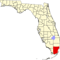
Miami-Dade County Florida Incorporated and Unincorporated areas Golden Beach Highlighted.svg
Location in Miami-Dade County and the state of Florida
Golden Beach.gif
U.S. Census Bureau map showing town boundaries
Coordinates: 25°57′54″N80°7′21″W / 25.96500°N 80.12250°W / 25.96500; -80.12250
Country Flag of the United States.svg  United States of America
State Flag of Florida.svg  Florida
County Flag of Miami-Dade County, Florida.png Miami-Dade
Settled 1924
Incorporated May 23, 1929
Government
  Type Council-Manager
   Mayor Glenn Singer
   Vice Mayor Bernard Einstein
   Councilmembers Kenneth Bernstein,
Judy Lusskin, and
Jaime Mendal
   Town Manager Alexander Diaz
   Town Clerk Lissette Perez
Area
[1]
  Total0.42 sq mi (1.07 km2)
  Land0.33 sq mi (0.84 km2)
  Water0.09 sq mi (0.23 km2)  0.0%
Elevation
0 ft (0 m)
Population
 (2020) [2]
  Total961
  Density2,947.85/sq mi (1,139.63/km2)
Time zone UTC-5 (Eastern (EST))
  Summer (DST) UTC-4 (EDT)
ZIP code
33160
Area code(s) 305, 786, 645
FIPS code 12-26250 [3]
GNIS feature ID0283145 [4]
Website www.goldenbeach.us
Golden Beach, Florida

Golden Beach is a town in Miami-Dade County, Florida, United States, between the Intracoastal Waterway and Atlantic Ocean. The town is part of the Miami metropolitan area of South Florida. As of the 2020 US census, the town had a population of 961. [2]

Contents

Golden Beach is known as a very upscale community, and many of its houses are worth over a million dollars. Several celebrities, including Bill Gates, own homes there.[ citation needed ] Eric Clapton's album 461 Ocean Boulevard was named after the Golden Beach house at that address, a photo of which is also featured on the album cover. [5] High-rise construction and commercial development are not permitted within the town limits.

In 1981, all but one of the roads into the town from A1A were closed as a means of preventing "criminals, curious tourists from nearby hotels, joggers and Haitian refugees" from entering Golden Beach. [6] The blockades remained and the Strand continues to be the only road into town and is still patrolled by a police guardhouse.

Geography

The approximate coordinates for the Town of Golden Beach is located in the northeast corner of Miami-Dade County at 25°57′54″N80°07′21″W / 25.964869°N 80.122481°W / 25.964869; -80.122481 . [7]

It is on the barrier island that separates the Intracoastal Waterway from the ocean; the entire town is about one mile from north to south, and four blocks from east to west. It is bordered to the south by the city of Sunny Isles Beach, to the west by the city of Aventura, and to the north by the city of Hallandale Beach in Broward County. According to the U.S. Census Bureau, the town has a total area of 0.42 square miles (1.09 km2), of which 0.33 square miles (0.85 km2) are land and 0.09 square miles (0.23 km2), or 21.45%, are water. [1]

Surrounding areas

  Broward County (Hallandale Beach)
  Broward County (Hallandale Beach) Up arrow left.svg Up-1.svg Up arrow right.svg Atlantic Ocean
  Aventura Left.svg   Right.svg Atlantic Ocean
  Aventura Down arrow left.svg Down arrow.svg Down arrow right.svg Atlantic Ocean
  Sunny Isles Beach

Climate

The Town of Golden Beach has a tropical climate, similar to the climate found in much of the Caribbean. It is part of the only region in the 48 contiguous states that falls under that category. More specifically, it generally has a tropical savanna climate (Köppen climate classification: Aw), bordering a tropical monsoon climate (Köppen climate classification: Am). [8]

Demographics

Historical population
CensusPop.Note
1930 36
1940 83130.6%
1950 15688.0%
1960 413164.7%
1970 849105.6%
1980 612−27.9%
1990 77426.5%
2000 91918.7%
2010 9190.0%
2020 9614.6%
U.S. Decennial Census [9]

2010 and 2020 census

Golden Beach racial composition
(Hispanics excluded from racial categories)
(NH = Non-Hispanic)
RacePop 2010 [10] Pop 2020 [11] % 2010% 2020
White (NH)66060871.82%63.27%
Black or African American (NH)1401.52%0.00%
Native American or Alaska Native (NH)000.00%0.00%
Asian (NH)330.33%0.31%
Pacific Islander or Native Hawaiian (NH)000.00%0.00%
Some other race (NH)170.11%0.73%
Two or more races/Multiracial (NH)0180.00%1.87%
Hispanic or Latino (any race)24132526.22%33.82%
Total919961100.00%100.00%

As of the 2020 United States census, there were 961 people, 175 households, and 147 families residing in the town. [12]

As of the 2010 United States census, there were 919 people, 236 households, and 202 families residing in the town. [13]

2000 census

In 2000, 49.3% had children under the age of 18 living with them, 72.3% were married couples living together, 8.5% had a female householder with no husband present, and 17.0% were non-families. 13.8% of all households were made up of individuals, and 8.2% had someone living alone who was 65 years of age or older. The average household size was 3.26 and the average family size was 3.55.

In 2000, the town population was spread out, with 34.6% under the age of 18, 3.5% from 18 to 24, 24.5% from 25 to 44, 26.2% from 45 to 64, and 11.2% who were 65 years of age or older. The median age was 39 years. For every 100 females, there were 96.4 males. For every 100 females age 18 and over, there were 85.5 males.

In 2000, the median income for a household in the town was $136,686, and the median income for a family was $141,557. Males had a median income of $81,193 versus $58,750 for females. The per capita income for the town was $73,053.

As of 2000, speakers of English as a first language accounted for 55.01% of the population, while Spanish accounted for 35.09% of the populace, speakers of Hebrew made up 4.40%, French was at 3.85%, and Russian was the mother tongue for 1.65% of residents. [14]

Education

Miami-Dade County Public Schools serves Golden Beach.

All residents are zoned to Norman S. Edelcup/Sunny Isles Beach K-8 in Sunny Isles Beach for elementary and K–8. [15] Prior to August 2008 residents were zoned to Highland Oaks Elementary School. [16] Residents who want a standard comprehensive middle school instead of a K–8 may choose to enroll at a separate middle school, [15] Highland Oaks Middle School. [17] Alonzo and Tracy Mourning Senior High Biscayne Bay Campus is the zoned senior high school. [18] Prior to the opening of Mourning in 2009, Dr. Michael M. Krop Senior High School served Eastern Shores. [19]

Related Research Articles

<span class="mw-page-title-main">Broward County, Florida</span> County in Florida, United States

Broward County is a county in Florida, United States, located in the Miami metropolitan area. It is Florida's second-most populous county after Miami-Dade County and the 17th-most populous in the United States, with 1,944,375 residents as of the 2020 census. Its county seat and most populous city is Fort Lauderdale, which had a population of 182,760 as of 2020. The county is part of the South Florida region of the state.

<span class="mw-page-title-main">Hallandale Beach, Florida</span> City in Florida

Hallandale Beach is a city in southern Broward County, Florida, United States. The city is named after Luther Halland, the son of a Swedish worker for Henry Flagler's Florida East Coast Railroad. It is also part of the Miami metropolitan area of South Florida. As of the 2020 census, the population was 41,217.

<span class="mw-page-title-main">Pembroke Park, Florida</span> Town in the state of Florida, United States

Pembroke Park is a town in Broward County, Florida, United States. The town took its name from its location along Pembroke Road. It is part of the South Florida metropolitan area. Almost one-half of its residents live in mobile homes. As of the 2020 census, the population was 6,260.

<span class="mw-page-title-main">Aventura, Florida</span> City in Florida

Aventura is a planned suburban city in northeastern Miami-Dade County, Florida, United States, 15 miles (24 km) north of Miami and part of the Miami metropolitan area. The city is especially known for Aventura Mall, the third largest mall in the United States by total square feet of retail space and the largest mall in Florida.

<span class="mw-page-title-main">Bal Harbour, Florida</span> Village in Florida

Bal Harbour is a village in Miami-Dade County, Florida. The village is part of the Miami metropolitan area of South Florida. The population was 3,093 at the 2020 US Census.

<span class="mw-page-title-main">Florida City, Florida</span> City in Florida

Florida City is a city in Miami-Dade County, Florida, United States. It is the southernmost municipality in the South Florida metropolitan area. Florida City is primarily a Miami suburb and a major agricultural area. As of the 2020 census, it had a population of 13,085, up from 11,245 in 2010.

<span class="mw-page-title-main">Golden Glades, Florida</span> Census-designated place in Florida

Biscayne Gardens is a census-designated place (CDP) in Miami-Dade County, Florida, United States. It is part of the Miami metropolitan area of South Florida. The population was 32,499 at the 2020 US census.

<span class="mw-page-title-main">Indian Creek, Florida</span> Village in Florida

Indian Creek is a village, gated community, and man-made barrier island in Miami-Dade County, Florida, United States. It has 41 residential home sites and the Indian Creek Country Club. The village is part of the Miami metropolitan area of South Florida. The concentration of highly affluent people on the island has earned it the nickname "Billionaire Bunker". The population was 84 at the 2020 census. The village has its own government and law enforcement.

<span class="mw-page-title-main">Ives Estates, Florida</span> Census-designated place in Florida

Ives Estates is a census-designated place (CDP) in Miami-Dade County, Florida. It is part of the Miami metropolitan area of South Florida. The population was 25,005 at the 2020 census, up from 19,525 in 2010.

<span class="mw-page-title-main">Key Biscayne, Florida</span> Village in Miami-Dade County, Florida

Key Biscayne is an island village in Miami-Dade County, Florida, United States. The village is part of the Miami metropolitan area of South Florida. The population was 14,809 at the 2020 census, up from 12,344 in 2010.

<span class="mw-page-title-main">North Bay Village, Florida</span> City in Florida

North Bay Village is a city located in Miami-Dade County, Florida. The city is part of the Miami metropolitan area of South Florida. As of the 2020 census, the city had a total population of 8,159.

<span class="mw-page-title-main">North Miami, Florida</span> City in Florida

North Miami is a suburban city located in northeast Miami-Dade County, Florida, United States, about 10 miles (16 km) north of Miami. The city lies on Biscayne Bay and hosts the Biscayne Bay Campus of Florida International University. Originally the "Town of Arch Creek", the area was incorporated as the "Town of Miami Shores", which was renamed the "Town of North Miami" in 1931. It was reincorporated as a city in 1953. The city is part of the Miami metropolitan area of South Florida.

<span class="mw-page-title-main">North Miami Beach, Florida</span> City in Florida

North Miami Beach is a city in Miami-Dade County, Florida, United States. The City of North Miami Beach is part of the Miami metropolitan area of South Florida. Originally named "Fulford-by-the-Sea" in 1926, after Captain William H. Fulford of the U.S. Coast Guard, the city was renamed "North Miami Beach" in 1931. The population was 43,676 at the 2020 US census.

<span class="mw-page-title-main">Ojus, Florida</span> Census-designated place in Florida

Ojus is a census-designated place and formerly incorporated town in Miami-Dade County, Florida, United States. It is part of the Miami metropolitan area of South Florida. The population was 19,673 at the 2020 census, up from 18,036 in 2010.

<span class="mw-page-title-main">Sunny Isles Beach, Florida</span> City in Florida

Sunny Isles Beach is a city located on a barrier island in northeast Miami-Dade County, Florida, United States. The city is part of the Miami metropolitan area of South Florida, and is bounded by the Atlantic Ocean on the east and the Intracoastal Waterway on the west. As of the 2020 census, it had a population of 22,342.

<span class="mw-page-title-main">Miami metropolitan area</span> Metropolis in the U.S. state of Florida

The Miami metropolitan area is a coastal metropolitan area in southeastern Florida. It is the ninth-largest metropolitan statistical area (MSA) in the United States, the fifth-largest metropolitan area in the Southern United States, and the largest metropolitan area in Florida. It is also known as South Florida, SoFlo, SoFla, the Gold Coast, Southeast Florida, the Tri-County Area, or Greater Miami, and officially as the Miami–Fort Lauderdale–West Palm Beach Metropolitan Statistical Area. With a population of 6.18 million, its population exceeds 31 of the nation's 50 states as of 2023. It comprises the three most populated counties in the state, Miami-Dade County, Broward County, and Palm Beach County, which rank as the first, second, and third-most populous counties in the state, respectively. Miami-Dade County, with 2,701,767 people in 2020, is the seventh-most populous county in the United States.

<span class="mw-page-title-main">Dr. Michael M. Krop Senior High School</span> Public magnet school in Miami, Florida, United States

Dr. Michael M. Krop Senior High School is a secondary school located at 1410 County Line Road in Ives Estates, an unincorporated area of north Miami-Dade County, Florida, US. However, it serves the city of Aventura, northern fringes of North Miami Beach, and the unincorporated areas around the school such as Ives Estates/California Club and Ojus. The school is located on the Miami-Dade side of the Miami-Dade-Broward County line, and is the northernmost high school in the district. Lee Krueger currently serves as principal.

Eastern Shores is a neighborhood within the city of North Miami Beach in Miami-Dade County, Florida, United States. It is located about 12 miles (19 km) north of Miami, just south of the city of Aventura.

Alonzo and Tracy Mourning Sr. High Biscayne Bay Campus is a secondary school in North Miami, Florida, United States which opened August 2009, located two blocks north of Florida International University's Biscayne Bay Campus. It is part of the Miami-Dade County Public Schools system. It was built to relieve overcrowding at three nearby high schools. The school is named after Alonzo Mourning, former player for the Miami Heat NBA basketball team, and his ex-wife Tracy.

<span class="mw-page-title-main">Miami-Dade County, Florida</span> County in Florida, United States

Miami-Dade County is a county located in the southeastern part of the U.S. state of Florida. The county had a population of 2,701,767 as of the 2020 census, making it the most populous county in Florida and the seventh-most populous county in the United States. It is Florida's third largest county in terms of land area with 1,946 square miles (5,040 km2). The county seat is Miami, the core of the nation's ninth-largest and world's 65th-largest metropolitan area with a 2020 population of 6.138 million people, exceeding the population of 31 of the nation's 50 states as of 2022.

References

  1. 1 2 "2022 U.S. Gazetteer Files: Florida". United States Census Bureau. Retrieved December 29, 2022.
  2. 1 2 "P1. Race – Golden Beach town, Florida: 2020 DEC Redistricting Data (PL 94-171)". U.S. Census Bureau. Retrieved December 29, 2022.
  3. "U.S. Census website". United States Census Bureau . Retrieved January 31, 2008.
  4. "US Board on Geographic Names". United States Geological Survey. October 25, 2007. Retrieved January 31, 2008.
  5. Sokol, Brett. "Musical Mecca: After 30 years, they still flock to that most fabled of oceanfront homes" Archived December 11, 2013, at the Wayback Machine , Miami New Times , December 9, 2004.
  6. Associated Press, "Town Closes its Doors to Crime and Tourists", The Dispatch (Lexington, North Carolina), October 21, 1981.
  7. "US Gazetteer files: 2010, 2000, and 1990". United States Census Bureau. February 12, 2011. Retrieved April 23, 2011.
  8. "Köppen Climate Classification Map: South Florida=Am/Aw=tropical wet & dry". Archived from the original on July 6, 2011.
  9. "Census of Population and Housing". Census.gov. Retrieved June 4, 2015.
  10. "P2 HISPANIC OR LATINO, AND NOT HISPANIC OR LATINO BY RACE - 2010: DEC Redistricting Data (PL 94-171) - Golden Beach town, Florida". United States Census Bureau .
  11. "P2 HISPANIC OR LATINO, AND NOT HISPANIC OR LATINO BY RACE - 2020: DEC Redistricting Data (PL 94-171) - Golden Beach town, Florida". United States Census Bureau .
  12. "S1101 HOUSEHOLDS AND FAMILIES - 2020: Golden Beach town, Florida". United States Census Bureau .
  13. "S1101 HOUSEHOLDS AND FAMILIES - 2010: Golden Beach town, Florida". United States Census Bureau .
  14. "MLA's Data Center Results of Golden Beach, FL". Modern Language Association . Retrieved October 27, 2007.
  15. 1 2 "NORMAN S. EDELCUP/SUNNY ISLES BEACH K-8 Boundary Description". Miami-Dade County Public Schools . Retrieved June 28, 2021.
  16. Boyd-Barret, Claudia (February 4, 2007). "K-8 center will ease overcrowding at schools". The Miami Herald . pp. 8, 46. - Clipping of first and of second page from Newspapers.com.
  17. "HIGHLAND OAKS MS Boundary Description". Miami-Dade County Public Schools . Retrieved June 28, 2021.
  18. "ALONZO AND TRACY MOURNING SENIOR HIGH BISCAYNE BAY Boundary Description". Miami-Dade County Public Schools . Retrieved June 28, 2021.
  19. "SS_QQQ1_1-24-09.pdf Archived 2009-08-15 at the Wayback Machine ." Alonzo and Tracy Mourning Senior High Biscayne Bay Campus. Retrieved on May 6, 2012.