
Waikouaiti is a small town in East Otago, New Zealand, within the city limits of Dunedin. The town is close to the coast and the mouth of the Waikouaiti River.

Middlemarch is a small town in the Otago region of New Zealand's South Island. It lies at the foot of the Rock and Pillar Range of hills in the broad Strath-Taieri valley, through which flows the middle reaches of the Taieri River. Since local government reorganisation in the late 1980s, Middlemarch and much of the Strath-Taieri has been administered as part of Dunedin city, the centre of which lies some 80 km to the southeast. Middlemarch is part of the Taieri electorate, and is currently represented in parliament by Ingrid Leary. Middlemarch has reticulated sewerage but no reticulated water supply. A description of 1903, that "[T]he summer seasons are warm, but not enervating, and the winters cold, but dry" is still true today.

Otakou is a settlement within the boundaries of the city of Dunedin, New Zealand. It is located 25 kilometres from the city centre at the eastern end of Otago Peninsula, close to the entrance of Otago Harbour. Though a small fishing village, Otakou is important in the history of Otago for several reasons. The settlement is the modern centre and traditional home of the Ōtākou rūnanga (assembly) of Ngāi Tahu. In 1946 Otakou Fisheries was founded in the township; this was later to become a major part of the Otago fishing industry.

Clyde, formerly Dunstan, is a small town in Central Otago, New Zealand with a population of 1,260 in June 2023. It is located on the Clutha River, between Cromwell and Alexandra.

Ranfurly is a town in the Central Otago District of Otago, New Zealand. Located 110 kilometres north of Dunedin, it lies in the dry rough plain of Maniototo at a moderately high altitude close to a small tributary of the Taieri River. It operates as a service town for the local farming community. The town was formerly known as Eweburn, one of the "farmyard" names bestowed by former Otago Chief Surveyor John Turnbull Thomson on many small streams and locations in the district. The modern name honours the Fifth Earl of Ranfurly, who served as Governor of New Zealand (1897–1904) at the time of the extension of the Otago Central Railway to the area. Ranfurly is well known for its Art Deco buildings, such as its hotel and the milk bar.

Lake Roxburgh is an artificial lake, created by the Roxburgh Dam, the earliest of the large hydroelectric projects in the southern South Island of New Zealand. It lies on the Clutha River, some 160 km (99 mi) from Dunedin. It covers an area of some 6 km2 (2.3 sq mi), and extends for nearly 30 km (19 mi) towards the town of Alexandra. The town of Roxburgh lies 5 kilometres (3.1 mi) south of the Dam.

The small town of Karitane is located within the limits of the city of Dunedin in New Zealand, 35 kilometres to the north of the city centre.

Taieri Mouth is a small fishing village at the mouth of the Taieri River, New Zealand. Taieri Island (Moturata) lies in the ocean several hundred metres off the river's mouth.
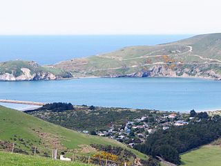
Aramoana is a small coastal settlement 27 kilometres (17 mi) north of Dunedin on the South Island of New Zealand. The settlement's permanent population in the 2001 Census was 261. Supplementing this are seasonal visitors from the city who occupy cribs. The name Aramoana is Māori for "pathway of the sea".
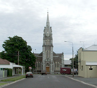
Clutha District is a local government district of southern New Zealand, with its headquarters in the Otago town of Balclutha. Clutha District has a land area of 6,334.47 km2 (2,445.75 sq mi) and an estimated population of 18,900 as of June 2023. Clutha District occupies the majority of the geographical area known as South Otago.

Outram is a rural suburb of Dunedin, New Zealand, with a population of 880 as of June 2023. It is located 28 kilometres west of the central city at the edge of the Taieri Plains, close to the foot of Maungatua. The Taieri River flows close to the southeast of the town. Outram lies on State Highway 87 between Mosgiel and Middlemarch.
Pounawea is a small town in The Catlins, an area of the southern South Island of New Zealand. It is located four kilometres southwest of Owaka, at the mouth of the Catlins River. It is a popular holiday spot with a seasonal population, there are numerous cribs at the settlement.

Clinton is a small town in South Otago, in New Zealand's South Island. Handy to the Catlins, Dunedin, Lawrence, Central Otago and Tapanui. It is located on State Highway 1 approximately halfway between Balclutha and Gore, and the Main South Line railway passes through the town.
Allanton is a small town in Otago, New Zealand, located some 20 kilometres southwest of Dunedin on State Highway 1. The settlement lies at the eastern edge of the Taieri Plains close to the Taieri River at the junction of the main road to Dunedin International Airport at Momona.
Waitati, from the Māori Waitete, is a small seaside settlement in Otago, New Zealand, within the city limits of Dunedin. It is located close to the tidal mudflats of Blueskin Bay, 19 kilometres north of the Dunedin city centre. The small Waitati River flows through the bay to the sea.
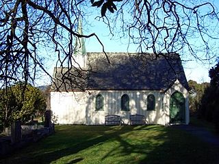
Warrington, known in Māori as Ōkāhau, is a small settlement on the coast of Otago, in the South Island of New Zealand. It is situated close to the northern shore of Blueskin Bay, an area of mudflats north of Dunedin, and is administered as part of Dunedin City. Warrington is 3 km (1.9 mi) from State Highway 1 linked by Coast Road. The Main South Line railway passes through the township and a tourist train, the Seasider passes through the settlement once or twice a week between Dunedin and Palmerston.
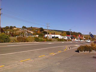
The township of Waihola lies between Dunedin and Milton, New Zealand in Otago, in New Zealand's South Island. It lies close to the southeast shore of the shallow tidal lake which shares its name.

Benhar is a town in New Zealand. It is located five kilometres east of Balclutha in South Otago, close to the small Lake Tuakitoto.

Pūrākaunui is a small settlement in Otago, in the South Island of New Zealand. It is located within the bounds of the city of Dunedin, in a rural coastal area some 25 km to the north of the city centre.
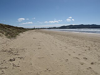
Tokerau Beach is a settlement on the northwestern side of Doubtless Bay on the Karikari Peninsula of Northland, New Zealand.


