Middlemarch, New Zealand

Last updated

Middlemarch
Rural settlement
State Highway 87, Middlemarch, NZ.JPG
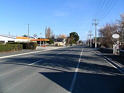
Looking south along State Highway 87 at Middlemarch
Middlemarch, New Zealand
Coordinates: 45°31′S170°07′E / 45.517°S 170.117°E / -45.517; 170.117
CountryNew Zealand
Region Otago
District Dunedin
Community board Strath Taieri Community Board [1]
Electorates
Government
   Territorial authority Dunedin City Council
  Regional council Otago Regional Council
   Mayor of Dunedin Jules Radich
   Taieri MP Ingrid Leary
   Te Tai Tonga MP Tākuta Ferris
Area
[2]
  Total1.05 km2 (0.41 sq mi)
Population
 (June 2023) [3]
  Total160
  Density150/km2 (390/sq mi)
Time zone UTC+12 (NZST)
  Summer (DST) UTC+13 (NZDT)
Postcode
9597
Area code03
Local iwi Ngāi Tahu

Middlemarch is a small town in the Otago region of New Zealand's South Island. It lies at the foot of the Rock and Pillar Range of hills in the broad Strath-Taieri valley, through which flows the middle reaches of the Taieri River. Since local government reorganisation in the late 1980s, Middlemarch and much of the Strath-Taieri has been administered as part of Dunedin city, the centre of which lies some 80 km to the southeast. Middlemarch is part of the Taieri electorate (formerly known as Dunedin South), [4] and is currently represented in parliament by Ingrid Leary. Middlemarch has reticulated sewerage but no reticulated water supply. A description of 1903, that "[T]he summer seasons are warm, but not enervating, and the winters cold, but dry" is still true today. [5]

Contents

It is a crucial service town for the local farming community, the terminus of the Taieri Gorge Railway, and the start of the Otago Central Rail Trail.

Several suggestions exist about how the township was named. One is that Mrs Alice Humphreys (née Hawdon, 1848–1934), whose husband Edward Wingfield Humphreys owned and had surveyed for sale sections in this new township, [6] named the town in 1876 after George Eliot's novel Middlemarch: A Study of Provincial Life. [7] [8] Another is that the name is from the now obsolete English term "march" meaning a boundary - in this case a middle area between two rivers. As with many places in and close to the Maniototo area, its name may have been influenced by the Northumberland ancestry of early surveyor John Turnbull Thomson (there is a Middle March region in Northumberland, centred on the town of Otterburn).

Demographics

Middlemarch is described by Statistics New Zealand as a rural settlement. It covers 1.05 km2 (0.41 sq mi) [2] and had an estimated population of 160 as of June 2023, [3] with a population density of 152 people per km2. It is part of the much larger Strath Taieri statistical area. [9]

Historical population
YearPop.±% p.a.
2006165    
2013156−0.80%
2018153−0.39%
Source: [10]
Middlemarch community centre Middlemarch Community Centre Building.jpg
Middlemarch community centre

Middlemarch had a population of 153 at the 2018 New Zealand census, a decrease of 3 people (−1.9%) since the 2013 census, and a decrease of 12 people (−7.3%) since the 2006 census. There were 66 households, comprising 81 males and 72 females, giving a sex ratio of 1.12 males per female. The median age was 50.2 years (compared with 37.4 years nationally), with 21 people (13.7%) aged under 15 years, 18 (11.8%) aged 15 to 29, 90 (58.8%) aged 30 to 64, and 30 (19.6%) aged 65 or older.

Ethnicities were 96.1% European/Pākehā, and 21.6% Māori. People may identify with more than one ethnicity.

Although some people chose not to answer the census's question about religious affiliation, 62.7% had no religion, and 31.4% were Christian.

Of those at least 15 years old, 12 (9.1%) people had a bachelor's or higher degree, and 30 (22.7%) people had no formal qualifications. The median income was $25,200, compared with $31,800 nationally. 15 people (11.4%) earned over $70,000 compared to 17.2% nationally. The employment status of those at least 15 was that 51 (38.6%) people were employed full-time, 21 (15.9%) were part-time, and 6 (4.5%) were unemployed. [10]

Education

Strath Taieri School is a co-educational state full primary school for Year 1 to 8 students, [11] with a roll of 41 students as of February 2024. The school opened in 1880, and was initially a high school. It became a full primary in 1975. [12]

Related Research Articles

<span class="mw-page-title-main">Otago</span> Region of New Zealand

Otago is a region of New Zealand located in the southern half of the South Island administered by the Otago Regional Council. It has an area of approximately 32,000 square kilometres (12,000 sq mi), making it the country's second largest local government region. Its population was 254,600 in June 2023.

<span class="mw-page-title-main">Waikouaiti</span> Town in Otago, New Zealand

Waikouaiti is a small town in East Otago, New Zealand, within the city limits of Dunedin. The town is close to the coast and the mouth of the Waikouaiti River.

<span class="mw-page-title-main">Mosgiel</span> Town in Otago, New Zealand

Mosgiel is an urban satellite of Dunedin in Otago, New Zealand, fifteen kilometres west of the city's centre. Since the re-organisation of New Zealand local government in 1989 it has been inside the Dunedin City Council area. Mosgiel has a population of approximately 14,800 as of June 2023. A nickname for Mosgiel is "The pearl of the plain". Its low-lying nature does pose problems, making it prone to flooding after heavy rains. Mosgiel takes its name from Mossgiel Farm, Ayrshire, the farm of the poet Robert Burns, the uncle of the co-founder in 1848 of the Otago settlement, the Reverend Thomas Burns.

<span class="mw-page-title-main">Naseby, New Zealand</span> Town in the South Island of New Zealand

Naseby is a small town, formerly a borough, in the Maniototo area of Central Otago, New Zealand. It is named after a village in Northamptonshire, England. Previous names of the township were Parker's, Hogburn and Mt Ida. The town catch phrase is "2000 feet above worry level" indicating its altitude. Naseby is 395 km from Christchurch and 143 km from Dunedin.

<span class="mw-page-title-main">Tapanui</span> Town in Otago, New Zealand

Tapanui is a small town in West Otago in New Zealand's South Island, close to the boundary with Southland region.

<span class="mw-page-title-main">Ranfurly, New Zealand</span> Settlement in Otago, New Zealand

Ranfurly is a town in the Central Otago District of Otago, New Zealand. Located 110 kilometres north of Dunedin, it lies in the dry rough plain of Maniototo at a moderately high altitude close to a small tributary of the Taieri River. It operates as a service town for the local farming community. The town was formerly known as Eweburn, one of the "farmyard" names bestowed by former Otago Chief Surveyor John Turnbull Thomson on many small streams and locations in the district. The modern name honours the Fifth Earl of Ranfurly, who served as Governor of New Zealand (1897–1904) at the time of the extension of the Otago Central Railway to the area. Ranfurly is well known for its Art Deco buildings, such as its hotel and the milk bar.

<span class="mw-page-title-main">Taieri Mouth</span> Rural settlement in Otago, New Zealand

Taieri Mouth is a small fishing village at the mouth of the Taieri River, New Zealand. Taieri Island (Moturata) lies in the ocean several hundred metres off the river's mouth.

<span class="mw-page-title-main">Strath Taieri</span> Geographic region in New Zealand

The Strath Taieri is a large glacial valley and river plateau in New Zealand's South Island. It is surrounded by the rugged hill ranges to the north and west of Otago Harbour. Since 1989 it has been part of the city of Dunedin. The small town of Middlemarch is located at its southern end.

<span class="mw-page-title-main">Clutha District</span> Territorial authority district in Otago, New Zealand

Clutha District is a local government district of southern New Zealand, with its headquarters in the Otago town of Balclutha. Clutha District has a land area of 6,334.47 km2 (2,445.75 sq mi) and an estimated population of 18,900 as of June 2023. Clutha District occupies the majority of the geographical area known as South Otago.

<span class="mw-page-title-main">Outram, New Zealand</span> Town in the South Island of New Zealand

Outram is a rural suburb of Dunedin, New Zealand, with a population of 880 as of June 2023. It is located 28 kilometres west of the central city at the edge of the Taieri Plains, close to the foot of Maungatua. The Taieri River flows close to the southeast of the town. Outram lies on State Highway 87 between Mosgiel and Middlemarch.

Balfour is a small town located in the Southland region of New Zealand.

<span class="mw-page-title-main">Clinton, New Zealand</span> Town in Otago, New Zealand

Clinton is a small town in South Otago, in New Zealand's South Island. Handy to the Catlins, Dunedin, Lawrence, Central Otago and Tapanui. It is located on State Highway 1 approximately halfway between Balclutha and Gore, and the Main South Line railway passes through the town.

Allanton is a small town in Otago, New Zealand, located some 20 kilometres southwest of Dunedin on State Highway 1. The settlement lies at the eastern edge of the Taieri Plains close to the Taieri River at the junction of the main road to Dunedin International Airport at Momona.

Waitati, from the Māori Waitete, is a small seaside settlement in Otago, New Zealand, within the city limits of Dunedin. It is located close to the tidal mudflats of Blueskin Bay, 19 kilometres north of the Dunedin city centre. The small Waitati River flows through the bay to the sea.

<span class="mw-page-title-main">Warrington, New Zealand</span> Town in South Island, New Zealand

Warrington, known in Māori as Ōkāhau, is a small settlement on the coast of Otago, in the South Island of New Zealand. It is situated close to the northern shore of Blueskin Bay, an area of mudflats north of Dunedin, and is administered as part of Dunedin City. Warrington is 3 km (1.9 mi) from State Highway 1 linked by Coast Road. The Main South Line railway passes through the township and a tourist train, the Seasider passes through the settlement once or twice a week between Dunedin and Palmerston.

<span class="mw-page-title-main">Dunedin City Council</span>

The Dunedin City Council is the local government authority for Dunedin in New Zealand. It is a territorial authority elected to represent the 134,600 people of Dunedin. Since October 2022, the Mayor of Dunedin is Jules Radich, who succeeded Aaron Hawkins. The council consists of a mayor who is elected at large, and 14 councillors elected at large, one of whom gets chosen as deputy-mayor. The councillors are elected under the Single Transferable Vote (STV) system in triennial elections, with the most recent election held on 8 October 2022.

<span class="mw-page-title-main">Waihola</span> Town in Otago, New Zealand

The township of Waihola lies between Dunedin and Milton, New Zealand in Otago, in New Zealand's South Island. It lies close to the southeast shore of the shallow tidal lake which shares its name.

<span class="mw-page-title-main">Benhar, New Zealand</span> Rural settlement in Otago, New Zealand

Benhar is a town in New Zealand. It is located five kilometres east of Balclutha in South Otago, close to the small Lake Tuakitoto.

Waikaia, formerly known as Switzers, is a town in the Southland region of New Zealand's South Island. From 1909 until 1959, it was the terminus of the Waikaia Branch railway. The population in the 2013 census was 99, unchanged from the previous census in 2006.

Harwood is a rural settlement on the northern side of the Otago Peninsula. It is within the boundaries of Dunedin city in New Zealand.

References

  1. "2016 Strath Taieri Community Board Boundary" (PDF). dunedin.govt.nz. Dunedin City Council . Retrieved 2 June 2022.
  2. 1 2 "ArcGIS Web Application". statsnz.maps.arcgis.com. Retrieved 25 December 2021.
  3. 1 2 "Subnational population estimates (RC, SA2), by age and sex, at 30 June 1996-2023 (2023 boundaries)". Statistics New Zealand . Retrieved 25 October 2023. (regional councils); "Subnational population estimates (TA, SA2), by age and sex, at 30 June 1996-2023 (2023 boundaries)". Statistics New Zealand . Retrieved 25 October 2023. (territorial authorities); "Subnational population estimates (urban rural), by age and sex, at 30 June 1996-2023 (2023 boundaries)". Statistics New Zealand . Retrieved 25 October 2023. (urban areas)
  4. "Taieri - Electorate Profile - New Zealand Parliament". 27 June 2023.
  5. p 596 THE CYCLOPEDIA OF NEW ZEALAND [OTAGO & SOUTHLAND PROVINCIAL DISTRICTS], 1903.
  6. https://www.otago.ac.nz/library/pdf/hoc_fr_bulletins/Bull%2058%20pts1+2.pdf [ bare URL PDF ]
  7. "History". Middlemarch official website. Retrieved 30 April 2010.
  8. Thomson, J. (ed) (1998) Southern People A Dictionary of Otago Southland Biography Dunedin, NZ: Longacre Press with Dunedin City Council. ISBN   1-877135-11-9. p. 240.
  9. 2018 Census place summary: Strath Taieri
  10. 1 2 "Statistical area 1 dataset for 2018 Census". Statistics New Zealand. March 2020. 7028205.
  11. Education Counts: Strath Taieri School
  12. "Our History". Strath Taieri School. 14 January 2019.

Further reading