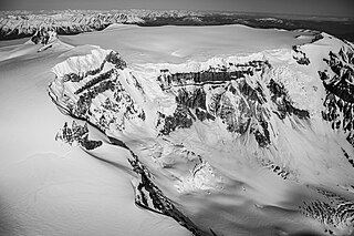
Mount Temple is a mountain in Banff National Park of the Canadian Rockies of Alberta, Canada.

Mount Garibaldi is a dormant stratovolcano in the Garibaldi Ranges of the Pacific Ranges in southwestern British Columbia, Canada. It has a maximum elevation of 2,678 metres and rises above the surrounding landscape on the east side of the Cheakamus River in New Westminster Land District. In addition to the main peak, Mount Garibaldi has two named sub-peaks. Atwell Peak is a sharp, conical peak slightly higher than the more rounded peak of Dalton Dome. Both were volcanically active at different times throughout Mount Garibaldi's eruptive history. The northern and eastern flanks of Mount Garibaldi are obscured by the Garibaldi Névé, a large snowfield containing several radiating glaciers. Flowing from the steep western face of Mount Garibaldi is the Cheekye River, a tributary of the Cheakamus River. Opal Cone on the southeastern flank is a small volcanic cone from which a lengthy lava flow descends. The western face is a landslide feature that formed in a series of collapses between 12,800 and 11,500 years ago. These collapses resulted in the formation of a large debris flow deposit that fans out into the Squamish Valley.

Williston Lake is a reservoir created by the W. A. C. Bennett Dam which is located in the Northern Interior of British Columbia, Canada.

Blue Knob State Park is a 6,128-acre (2,480 ha) Pennsylvania state park in Kimmel, Lincoln, and Pavia townships in Bedford County, Pennsylvania, in the United States. The average annual snowfall at the park is about 12 feet (370 cm). The park is named for Blue Knob, the second highest mountain in Pennsylvania at 3,146 feet (959 m). It is the location of Blue Knob All Seasons Resort, the ski slope in Pennsylvania with the highest elevation. Blue Knob State Park is just off Interstate 99 on Pennsylvania Route 869 west of Pavia.
Patterson Creek Mountain is a mountain ridge that forms the border between Mineral and Hampshire counties and Grant and Hardy Counties in West Virginia's Eastern Panhandle. The mountain's namesake, Patterson Creek, parallels its western flank. The southern end of the Patterson Creek Mountain is near the confluence of Lunice Creek and the South Branch Potomac River and its northern end is located southwest of Springfield. The mountain reaches its highest elevation at Charles Knob.

Pilot Mountain is a mountain in the Bow River valley of Banff National Park in Alberta, Canada. It is located southeast of Redearth Creek and directly west of the Trans-Canada Highway.

Castle Mountain is a ski resort located in the Westcastle Valley of southwest Alberta, Canada in the Rocky Mountains. It is approximately 260 kilometres (160 mi) from Calgary and the Calgary International Airport; 140 kilometres (87 mi) from Lethbridge; and 50 kilometres (31 mi) west of Pincher Creek. The resort is renowned for long steep runs and an average 8.5 metres (28 ft) of snowfall yearly.
Pine Le Moray Provincial Park is a provincial park in British Columbia, Canada. The park, 70 km southwest of Chetwynd covers 43,289 hectares. It is located within the Hart Ranges ecosection near the Rocky Mountains. It is within the Engelmann Spruce-Subalpine Fir biogeoclimatic zone. Water courses include Link and Mountain Creeks, the Pine River, and Heart Lake. It provides habitat for trout, Arctic grayling, mountain whitefish, high elevation caribou, moose, wolverine, and grizzly bear. It is recognized by the province as an area traditionally used by First Nations people. Its topography has examples of Karst topography and alpine areas.

Sheep River Provincial Park is a provincial park located in Alberta, Canada, 23 kilometres (14 mi) west of Diamond Valley on highway 546. It is part of the Kananaskis Country park system and encompasses a portion of the Sheep River valley.

Mount Edziza, known to the local Tahltan people as Tenh Dẕetle, is a volcanic mountain in Cassiar Land District of northwestern British Columbia, Canada. It is located on the Big Raven Plateau of the Tahltan Highland which extends along the western side of the Stikine Plateau. Mount Edziza has an elevation of 2,786 metres, making it the highest point of the Mount Edziza volcanic complex. However, it had an elevation of at least 3,396 metres before its formerly cone-shaped summit was likely destroyed by a violent eruption in the geologic past; its current flat summit contains an ice-filled, 2-kilometre-in diameter (1.2-mile) crater. The mountain contains several lava domes, cinder cones and lava fields on its flanks, as well as an ice cap containing several outlet glaciers which stretch out to lower altitudes. All sides of Mount Edziza are drained by tributaries of Mess Creek and Kakiddi Creek which are situated within the Stikine River watershed.

The Spectrum Range, formerly gazetted as the Spectrum Mountains and the Rainbow Mountains, is a small mountain range in Cassiar Land District of northwestern British Columbia, Canada. Located at the southern end of the Tahltan Highland, it borders the Skeena Mountains in the east and the Boundary Ranges of the Coast Mountains in the west. The Spectrum Range is surrounded by the Arctic Lake Plateau in the southwest and the Kitsu Plateau in the northwest, both of which contain volcanic features such as cinder cones. It lies at the southern end of the Mount Edziza volcanic complex which includes the two neighbouring plateaus as well as Mount Edziza and the Big Raven Plateau to the north. The mountain range is drained on all sides by streams within the Stikine River watershed and, unlike Mount Edziza to the north, contains relatively small separate glaciers. Mount Edziza Provincial Park is the main protected area surrounding the Spectrum Range.

Level Mountain is a large volcanic complex in the Northern Interior of British Columbia, Canada. It is located 50 kilometres north-northwest of Telegraph Creek and 60 kilometres west of Dease Lake on the Nahlin Plateau. With a maximum elevation of 2,164 metres, it is the second-highest of four large complexes in an extensive north–south trending volcanic region. Much of the mountain is gently sloping; when measured from its base, Level Mountain is about 1,100 metres tall, slightly taller than its neighbour to the northwest, Heart Peaks. The lower, broader half of Level Mountain consists of a shield-like structure while its upper half has a more steep, jagged profile. Its broad summit is dominated by the Level Mountain Range, a small mountain range with prominent peaks cut by deep valleys. These valleys serve as a radial drainage for several small streams that flow from the mountain. Meszah Peak is the only named peak in the Level Mountain Range.
Pylon Peak is the southernmost of six named volcanic peaks comprising the Mount Meager massif in British Columbia, Canada. Two pinnacled ridges extend from Pylon and are named respectively the Pylons and the Marionettes. Pylon Peak overlooks the Meager Creek Hot Springs.

The La Cloche Silhouette Trail is a 78-kilometre (48 mi) backpacking loop across the white quartzite peaks of the La Cloche mountain range. The trail is situated in Killarney Provincial Park, Ontario, Canada. The trail is named for Group of Seven painter Franklin Carmichael's painting "La Cloche Silhouette." Wildlife can be seen throughout the trail - black bears, moose, wolverines, mountain lions, lynx, fishers, snakes, porcupines, beavers, river otters, among other animals, can be encountered at various points along the way.

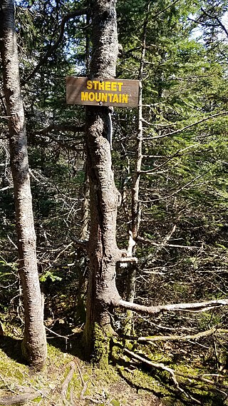
Street Mountain is a mountain located in Essex County, New York, named after Alfred Billings Street (1811–1881), a poet and New York State Librarian. The mountain is the high point of the Street Range of the Adirondack Mountains. Street's northeast ridge is Nye Mountain.

The Mount Edziza volcanic complex is a group of volcanoes and associated lava flows in northwestern British Columbia, Canada. Located on the Tahltan Highland, it is 40 kilometres southeast of Telegraph Creek and 85 kilometres southwest of Dease Lake. The complex encompasses a broad, steep-sided lava plateau that extends over 1,000 square kilometres. Its highest summit is 2,786 metres in elevation, making the MEVC the highest of four large complexes in an extensive north–south trending volcanic region. It is obscured by an ice cap characterized by several outlet glaciers that stretch out to lower altitudes.

Mount Robie Reid 2,095 m (6,873 ft) is a mountain in the eastern part of Golden Ears Provincial Park in the southern end of the Garibaldi Ranges overlooking the Lower Mainland region of British Columbia, Canada. It lies to the north of Mission, British Columbia and on the west side of the upper end of Stave Lake, and to the northeast of the group of summits known as the Golden Ears. Mount Judge Howay is to the north. Robie Reid has a prominence of 1,245 m (4,085 ft) relative to the lowest col between the valleys of Tingle and Osprey Creeks.
The Cariboo Heart Range is a subrange of the Hogem Ranges of the Omineca Mountains, located between Ominicetla Creek and Lion Creek in northern British Columbia, Canada.
The Fitzsimmons Range is a small mountain range on the northwestern edge of the Garibaldi Ranges in southwestern British Columbia, Canada, located between the valleys of Cheakamus Lake (SW) and Fitzsimmons Creek (NE). Its most famous summit is Whistler Mountain, which overlooks the resort town of Whistler and is one of the two mountains forming the Whistler Blackcomb ski resort. Most of the range is within Garibaldi Provincial Park, while its northeastern extremity is part of the resort municipality, and of the lands associated with the ski resort operation. Other summits in the range include Oboe Summit, Piccolo Summit and Flute Summit, which are hillocks along the ridge running southeast from Whistler Mountain and were named in association with the renaming of Whistler. Beyond them is Singing Pass and Mount Fitzsimmons 2603 m (8540 ft) which is at the opposite end of the range from Whistler Mountain and the location of Fitzsimmons Glacier, which is the source of Fitzsimmons Creek.

Pisgah Mountain, or Pisgah Ridge on older USGS maps, is a ridgeline running 12.5 miles (20.1 km) from Tamaqua to Jim Thorpe, Pennsylvania from the Little Schuylkill River water gap to the Lehigh River water gap.


