Hughson Street (Hamilton, Ontario)

Last updated
Hamilton Harbour Queen, Pier 8 HamiltonHarbourQueen.JPG
Hamilton Harbour Queen, Pier 8

Hughson Street is a Lower City collector road in Hamilton, Ontario, Canada. It starts at Charlton Avenue East at St. Joseph's hospital and runs north to Haymarket Street in the downtown where it's cut off by the Hamilton GO Transit station. Up to this point it is a two-way street. It then starts up again north of the station on Hunter Street East, where it then becomes a one-way street going north just past Barton Street East to Murray Street where it's cut off again by a parking lot for LIUNA Station. It then starts up again one block north past the CN railway tracks on Strachan Street and from this point onwards becomes a two-way street again that extends to the city's North End to the waterfront on Guise Street West, the site of the Canada Marine Discovery Centre and Pier 9.

Hamilton, Ontario City in Ontario, Canada

Hamilton is a port city in the Canadian province of Ontario. An industrialized city in the Golden Horseshoe at the west end of Lake Ontario, Hamilton has a population of 536,917, and its census metropolitan area, which includes Burlington and Grimsby, has a population of 747,545. The city is 58 miles (93 km) southwest of Toronto, with which the Greater Toronto and Hamilton Area (GTHA) is formed.

GO Transit Ontario regional public transport agency

GO Transit is a regional public transit system serving the Greater Golden Horseshoe region of Ontario, Canada. With its hub at Union Station in Toronto, GO Transit's distinctive green and white commuter rail trains and coach-style buses serve a population of more than seven million across an area over 11,000 square kilometres (4,200 sq mi) stretching from Brantford and Kitchener in the west to Newcastle and Peterborough in the east, and from Barrie in the north to Niagara Falls in the south. GO Transit carried 68.5 million passengers in 2017, and its ridership continues to grow. GO Transit operates diesel-powered double-decker trains and coach buses, on routes that connect with all local transit systems in its service area, as well as Via Rail, Canada's national rail system.

Two-way street

A two-way street is a street that allows vehicles to travel in both directions. On most two-way streets, especially main streets, a line is painted down the middle of the road to remind drivers to stay on their side of the road. Sometimes one portion of a street is two-way and the other portion is one-way. If there is no line, a car must stay on the appropriate side and watch for cars coming in the opposite direction and prepare to pull over to let them pass.

Contents

History

Pier 8, Hamilton Waterfront Trail, Art Sculpture PierEightHamilton.JPG
Pier 8, Hamilton Waterfront Trail, Art Sculpture
Pier 8, Hamilton Waterfront Trail, Restaurant WaterfrontRestaurantHamilton.JPG
Pier 8, Hamilton Waterfront Trail, Restaurant

Hughson Street was named after Nathaniel Hughson (1755–1837), a farmer and hotel owner. Hughson was a Loyalist who moved to Canada following the American Revolution, one of the city founders. Other streets in the city were named after his family members: James Street (son), Rebecca Street (wife) and Catharine Street (daughter). [1]

Nathaniel Hughson was a farmer and hotel owner, a Loyalist who moved to Canada following the American Revolution, and one of the city founders of Hamilton, Ontario. Married to Rebecca Land who was the daughter of Robert Land and Phoebe Scott, both United Empire Loyalists.

American Revolution Revolt in which the Thirteen Colonies won independence from Great Britain

The American Revolution was a colonial revolt which occurred between 1765 and 1783. The American Patriots in the Thirteen Colonies defeated the British in the American Revolutionary War (1775–1783) with the assistance of France, winning independence from Great Britain and establishing the United States of America.

The Sir John A. Macdonald Statue at Gore Park arrived in Hamilton from London, England on 30 October 1893. Official dedication of the statue took place 1 November 1893. Originally, the statue was located at the intersection of King and Hughson Streets and pointed West. Prime Minister Sir John Thompson was in attendance. [2] Alexander Aitchison, a local Hamilton Fire Chief, died of injuries he sustained from crashing into the base of the statue with his horse and buggy and because of it, the statue was then relocated to Gore Park near King and John Streets only this time the statue instead of pointing West, now points East. [3]

John A. Macdonald 1st Prime Minister of Canada

Sir John Alexander Macdonald was the first prime minister of Canada. The dominant figure of Canadian Confederation, he had a political career which spanned almost half a century.

John Sparrow David Thompson 4th Prime Minister of Canada

Sir John Sparrow David Thompson was a Canadian lawyer, judge, and politician who served as the fourth prime minister of Canada, in office from 1892 until his death. He had previously been premier of Nova Scotia for a brief period in 1882.

Canadian Canners Ltd. (1903–1986) used to be on 44 Hughson Street South across the street from the County Courthouse. Today it is the site of a parking lot. [4]

In 1996, The refurbished TH&B Station became the GO Station, as well as the city's bus terminal. [5]

Waterfront Trolley

The Hamilton Waterfront Trolley is a narrated tour along the 12 kilometre Hamilton Waterfront Trail. The main stop and departure spot is at the Hamilton Waterfront SCOOPS Ice Cream parlour, which provides the famous Stoney Creek Dairy Ice Cream. There are a dozen stops along the way between Princess Point at the western-end of the route to the eastern-end, the site of HMCS Haida. Also near this eastern-end route is the site of the Hamiltonian Tour Boat, which is a 12-passenger tour boat that offers a leisurely guided tour of Hamilton harbour with the captain providing interesting stories and history of one of North America's most noteworthy harbours. In addition to this there is also the Hamilton Harbour Queen Cruises which is another ship that offers 3-hour tour of the harbour along with Lunch, Dinner or other special events like Dance parties. This Harbour Queen Cruise was also the 2005 winner of the Hamilton Tourism Awards for "best tourism idea." It has a passenger capacity of 200. [6]

HMCS <i>Haida</i> Ceremonial Flagship, Royal Canadian Navy

HMCS Haida is a Tribal-class destroyer that served in the Royal Canadian Navy (RCN) from 1943 to 1963, participating in World War II and the Korean War. She was named for the Haida people.

Hamilton Harbour

Hamilton Harbour, formerly known as Burlington Bay, lies on the western tip of Lake Ontario, bounded on the northwest by the City of Burlington, on the south by the City of Hamilton, and on the east by Hamilton Beach and Burlington Beach. It is joined to Cootes Paradise by a narrow channel formerly excavated for the Desjardins Canal. Within Hamilton itself, it is referred to as "Hamilton Harbour", "The Harbour" and "The Bay". The bay is naturally separated from Lake Ontario by a sand bar. The opening in the north end was filled in and channel cut in the middle for ships to pass. The Port of Hamilton is on the Hamilton side of the harbour.

Landmarks

Waterfront Trolley, Pier 8 HamiltonWaterfrontTrolley.JPG
Waterfront Trolley, Pier 8
Hamiltonian, tour boat, Pier 8 HamiltonianTourBoat.JPG
Hamiltonian, tour boat, Pier 8

Note: Listing of Landmarks from North to South.

Communities

Note: Listing of neighbourhoods from North to South [7]

Major roads that cross Hughson Street

Canada Parks Discovery Centre CanadaMarineDiscoveryCentreB.JPG
Canada Parks Discovery Centre
Canada Parks Discovery Centre CanadaMarineDiscoveryCentreC.JPG
Canada Parks Discovery Centre
Mascot w/ Security, Canada Parks Discovery Centre CanadaMarineDiscoveryCentreA.JPG
Mascot w/ Security, Canada Parks Discovery Centre

Note: Listing of streets from North to South.

Roads that are parallel with Hughson Street

Note: Listing of streets from West to East.

Images

Related Research Articles

Lake Shore Boulevard

Lake Shore Boulevard is a major arterial road running along more than half of the Lake Ontario waterfront in the city of Toronto, Ontario, Canada. Prior to 1998, two segments of Lake Shore Boulevard were designated as part of Highway 2, with the highway following the Gardiner Expressway between these two sections.

Bay Street (Hamilton, Ontario)

Bay Street is a Lower City arterial road in Hamilton, Ontario, Canada. It starts at Inglewood Drive, just South of Aberdeen Avenue, as a collector road with only two lanes, then eventually becomes a six lane thoroughfare at its peak. Bay Street also passes through Downtown Hamilton, where many high-rise buildings are found. Bay Street is a one-way street from Aberdeen Avenue to Cannon Street West. Bay Street continues as an arterial route to Strachan Street, where it is downgraded to a neighbourhood collector and eventually ends at a curb at Pier 4 Park at Burlington Street in the city's North End.

MacNab Street (Hamilton, Ontario)

MacNab Street is a Lower City collector road in Hamilton, Ontario, Canada. It starts in the Durand neighbourhood on Markland Street, as a one-way street going north to Bold Street, where it becomes two-way for one block until Hurst Place where it's cut off by a wall for the Hunter Street railway bridge. Pedestrians may cross Hunter Street at an underpass. MacNab Street starts again north of the Railway line on Hunter Street as a two-way street but is cut off again at King Street where the Lloyd D. Jackson Square mall and Stelco Tower are situated. MacNab Street continues north of this Mall on York Boulevard, in front of the Hamilton Public Library & the entrance to the Hamilton Farmer's Market, again as a two-way street right through the city's North End to Burlington Street. It continues as a one-way street to the waterfront where it ends at Guise Street West, the site of the Royal Hamilton Yacht Club and Pier 5.

John Street (Hamilton, Ontario) street in Hamilton, Ontario, Canada

John Street is a Lower City arterial road in Hamilton, Ontario, Canada. Originally it was known as Mountain Road or Ancaster Road. It starts off at the base of Arkledun Avenue, a Mountain-access road in the city, just east of St. Joseph's Hospital, where it is a one-way street going north and tunnels underneath the Hunter Street Railway bridge and continues onward to the city's North End at the waterfront, where it ends at Guise Street East, the site of Pier 9.

James Street (Hamilton, Ontario) arterial road in Hamilton, Ontario, Canada

James Street is a Lower City arterial road in Hamilton, Ontario, Canada. It starts off at the base of the Niagara Escarpment from James Mountain Road, a mountain-access road in the city, originally was a one-way street going south throughout but now has sections of it that are two-way. It extends north to the city's waterfront at the North End where it ends at Guise Street West right in front of the Harbour West Marina Complex and the Royal Hamilton Yacht Club.

Hess Street (Hamilton, Ontario)

Hess Street is a Lower City collector road in Hamilton, Ontario, Canada. It starts off at the base of the Niagara Escarpment right before Aberdeen Avenue, and is a one-way street going north past the Durand and Central neighbourhoods. Between Main and King Street West is Hess Village, a cobblestone pedestrian zone of nightclubs, bars, and historic buildings. Hess Street then continues onwards to the waterfront where it ends at Stuart Street, right in front of the Canadian National Railway Yard.

Wellington Street (Hamilton, Ontario)

Wellington Street is a Lower City arterial road in Hamilton, Ontario, Canada. It starts off at Charlton Avenue East as a two-way street for only one block where it's then blocked off by the Corktown Park and a couple of Canadian National Railway lines that cut through it. It then starts up again north of the park on Young Street and is a one-way street the rest of the way (Southbound). It ends in the North End of the City on Burlington Street East, in front of the Lakeport Brewing Company and the Administration offices of the Hamilton Port Authority.

Dundurn Street (Hamilton, Ontario)

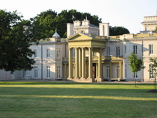
Dundurn Street is a Lower City arterial road in Hamilton, Ontario, Canada. It is a two-way street that starts off at Mountain Face Park, Niagara Escarpment in front of the Bruce Trail as a collector road, right behind Hillcrest Avenue and then turns into a four lane thoroughfare from Aberdeen Avenue northward to York Boulevard where it ends in front of Dundurn Park.

Victoria Avenue (Hamilton, Ontario) street in Ontario, Canada

Victoria Avenue is a Lower City arterial road in Hamilton, Ontario, Canada. It starts off as a ramp and part of a Mountain-access road, the Claremont Access, on Hunter Street East in the Stinson neighbourhood. It's also a one-way thoroughfare that flows north through the Landsdale and the city's North End industrial neighbourhood past Burlington Street East where it ends at Pier 11.

Catharine Street (Hamilton, Ontario)

Catharine Street is a Lower City collector road in Hamilton, Ontario, Canada. It starts off at Charlton Avenue East at Woolverton Park in the Corktown neighbourhood as a one-way street (southbound), tunnels underneath the Hunter Street Railway bridge and stretches up to Barton Street East where it then turns two-way and cutoff by the CN Railway lines that cut through Strachan Street Park one block north past Barton. Catharine Street then resumes again on Strachan Street East, north of the Park again as a two-way road for 3 blocks and interrupted again at Picton Street East, the site of St. Lawrence Elementary School and resumes again north of this property on Macauley Street East, again as a two-way street for another 3 blocks where it's interrupted for a third time at Brock Street, the site of Eastwood Park and Eastwood Arena. Catherine Street resumes again north of Eastwood Park on Guise Street East and ends at the city's North End waterfront, the site of a Royal Canadian Navy base and Pier 9.

Ferguson Avenue (Hamilton, Ontario)

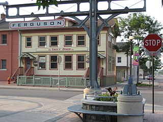
Ferguson Avenue is a Lower City collector road in Hamilton, Ontario, Canada. It is a two-way street throughout that starts off at the base of the Mountain on Foster Street. It's interrupted 3 blocks north at Corktown Park where Canadian Pacific Railway lines passes through it. Ferguson Avenue resumes again north of the Park right before Hunter Street East, extending northward past Barton Street East through the city's North End industrial neighbourhood where it ends on Dock Service Road, the site of a Royal Canadian Navy base and Pier 10.

Wentworth Street (Hamilton, Ontario) Street in Hamilton, Ontario

Wentworth Street is a Lower City arterial road in Hamilton, Ontario, Canada. It starts off at the base of the Niagara Escarpment (mountain) on Charlton Avenue East just south of the CP lines and runs right through the city's North End industrial neighbourhood and ends north of Burlington Street East at Pier 14, which one time was used by International Harvester (1902–1992).

Sherman Avenue (Hamilton, Ontario)

Sherman Avenue is a collector road in the lower portion of Hamilton, Ontario, Canada. It begins at the Niagara Escarpment just south of Cumberland Avenue and is a one-way street bisecting the industrialized northern neighbourhoods of the city. It ends at Ship Street — the site of Steel Company of Canada (Stelco).

Gage Avenue (Hamilton, Ontario)

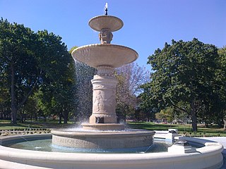
Gage Avenue is a Lower City arterial road in Hamilton, Ontario, Canada. It starts off at Lawrence Road at the base of the Niagara Escarpment (mountain) at the south end of Gage Park. It is a two-way arterial road that extends north through the city's North End industrial neighbourhood and ends at Industrial Drive.

King William Street (Hamilton, Ontario)

King William Street is a Lower City collector road in Hamilton, Ontario, Canada. It starts off at the western-end at James Street North and is a one-way street (Eastbound) until Mary Street, where it becomes a two-way street that ends at Wentworth Street North. It is named after King William IV of the United Kingdom.

King Street (Hamilton, Ontario) road in Hamilton, Ontario, Canada

King Street is a Lower City arterial road in Hamilton, Ontario, Canada, also known as Highway 8. The western-end starts off in front of the McMaster University Medical Centre as a two-way street and passes through Westdale. At Paradise Road, King Street switches over to a one-way street (westbound) right through the city's core up to "the Delta", a spot in town where King and Main streets intersect. From the Delta onwards, King Street then switches over to become a two-way street again and ends at Highway 8 in Stoney Creek.

Charlton Avenue (Hamilton, Ontario) street in Ontario, Canada

Charlton Avenue, is a Lower City collector road in Hamilton, Ontario, Canada. This collector road starts off just West of Dundurn Street as a one-way street (Westbound) up to James Street South where it then switches over to a two-way street the rest of the way eastward and ends at Wentworth Street South right in front of Mountain Face Park and the Escarpment Rail Trail.

York Boulevard Arterial road in Hamilton, Ontario, Canada

York Boulevard is a Lower City arterial road in Hamilton, Ontario, Canada. Formerly known as Highway 2 and Highway 6, it starts in Burlington, Ontario at Plains Road West as a two-way arterial road that wraps around and over Hamilton Harbour, enters the city of Hamilton in the west end at Dundurn Park, and ends at James Street North. It has a one-way section from Queen Street to Bay Street North, and continues east of James Street North as Wilson Street.)

Toronto streetcar system loops

Turning loops of the Toronto streetcar system serve as termini and turnback points for streetcar routes in Toronto, Ontario, Canada. The single-ended streetcars require track loops in order to reverse direction. Besides short off-street track loops these can also be larger interchange points, having shelters and driver facilities, or be part of a subway station structure for convenient passenger interchange.

West Harbour GO Station railway station in Ontario, Canada

West Harbour GO Station is a railway station in downtown Hamilton, Ontario, Canada on the Canadian National Railway line through the north end of the city. The station is on GO Transit's Lakeshore West line, and service began on July 9, 2015. The station is expected to be a stop on the A-Line, part of a rapid transit system being planned by Metrolinx. Via Rail service may eventually be provided.

References

  1. Bailey, Thomas Melville (1981). Dictionary of Hamilton Biography (Vol I, 1791-1875). W.L. Griffin Ltd.
  2. "Sir John A. Macdonald statue, 1893". Archived from the original on 2007-09-26. Retrieved 2007-03-26.
  3. Houghton, Margaret (2003). The Hamiltonians, 100 Fascinating Lives . James Lorimer & Company Ltd., Publishers Toronto. p.  6. ISBN   1-55028-804-0.
  4. "History of Industry in Hamilton, Ontario" . Retrieved 2009-07-27.
  5. Johnston, Bill. "Hamilton Spectator article: "Lament for a Downtown"". Archived from the original on 2004-08-13. Retrieved 2007-03-26.
  6. "Hamilton Waterfront Trolley" . Retrieved 2007-06-05.
  7. "Hamilton Neighbourhood Boundaries, (map.hamilton.ca)" (PDF). Archived from the original (PDF) on 2007-09-27. Retrieved 2007-05-11.

Coordinates: 43°16′11″N79°51′43″W / 43.26984°N 79.86186°W / 43.26984; -79.86186