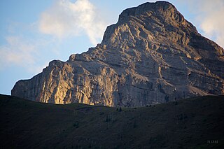
Mount Muir is a mountain located on the Continental Divide on the Alberta-British Columbia border. The mountain was named in 1918 after Alexander Muir. It is located in the High Rock Range.
Kakwa Mountain is located on the border of Alberta and British Columbia. It was named in 1925 by Samuel P. Fay.
Big Shale Hill is located on the border of Alberta and British Columbia. The name is thought to come from the thick layer of shale on the mountain.
Bingley Peak is located on the border of Alberta and British Columbia. It was named in 1863 by Walter Cheadle.
Kataka Mountain is located on the border of Alberta and British Columbia. It was named in 1916 by Morrison P. Bridgland.
Drawbridge Peak is located on the Continental Divide along the provincial borders of Alberta and British Columbia. The Alberta side is in Jasper National Park while Mount Robson Provincial Park is on the B.C. side. It was named in 1920 by the Interprovincial Boundary Survey.

Mount Fraser is a mountain located on the border of Alberta and British Columbia. It is Alberta's 38th highest peak and Alberta's 22nd most prominent mountain. It is also British Columbia's 50th highest peak. It was named in 1917 after Simon Fraser.
Divergence Peak is located on the border of Alberta and British Columbia. It was named in 1921 by Arthur O. Wheeler.
Mount Hooker is located on the border of Alberta and British Columbia, Canada. It was named in 1827 by David Douglas after William Jackson Hooker. Until the turn of the century, Mount Hooker and the nearby Mount Brown were thought to be the highest mountains in the Canadian Rockies.
Chaba Peak is located in the Chaba Icefield south of Fortress Lake in Hamber Provincial Park on the Continental Divide marking the Alberta-British Columbia border. It was named in 1920 after the Chaba River by the Interprovincial Boundary Survey. Chaba is the Stoney Indian word for beaver.
Fresnoy Mountain is located on the border of Alberta and British Columbia. It was named in 1919 after Fresnoy-en-Gohelle, a village in France, in commemoration of the World War I battle fought there by Canadian forces in 1917.
Douai Mountain is a mountain on the border of Alberta and British Columbia, named in 1918 after Douai, a village in France liberated by Canadians and allies in World War I.
Farbus Mountain is located on the provincial border of Alberta and British Columbia in Banff National Park. It was named in 1918 after Farbus, a village on the eastern slopes of Vimy Ridge in France.In the Battle of Vimy Ridge, Canadian troops retook Farbus from German control on April 9, 1917 as part of securing the Brown Line objective.
Ebon Peak is a mountain located on the border of Alberta and British Columbia. It was named in 1917 by Arthur O. Wheeler.
Collier Peak is located on the border of Alberta and British Columbia. It was named in 1903 after Collier, Dr. Joseph.

Fatigue Mountain is located on the border of Alberta and British Columbia on the Continental DivideThe mountain was named in 1888 by W.S. Drewry who became fatigued on the first ascent.

Golden Mountain is located on the border of Alberta and British Columbia on the Continental Divide.
Mount Cordonnier is located north of Mount Joffre in Height of the Rockies Provincial Park and straddles the Continental Divide marking the Alberta-British Columbia border. It was named in 1918 after General Victor Louis Emilien Cordonnier.
Mount Ptolemy is the highest mountain of the Flathead Range and is located on the Continental Divide along the provincial borders of Alberta and British Columbia. Situated 10 km (6.2 mi) southeast of Crowsnest Pass and 5 km (3 mi) northeast of Corbin, it is Alberta's 57th most prominent mountain. It was named in 1914 by Arthur Wheeler for its resemblance to a man sitting with folded arms. The mountain has also been known as Mummy Mountain.
Scarpe Mountain is located at the head of Commerce Creek and straddles the Continental Divide marking the Alberta-British Columbia border. It was named after the Scarpe River in France.


