The lead section of this article may need to be rewritten.(April 2018) (Learn how and when to remove this template message) |
A junction is where two or more roads meet.
The lead section of this article may need to be rewritten.(April 2018) (Learn how and when to remove this template message) |
A junction is where two or more roads meet.
Roads began as a means of linking locations of interest: towns, forts and geographic features such as river fords. Where roads met outside of an existing settlement, these junctions often led to a new settlement. Scotch Corner is an example of such a location.

A road is a thoroughfare, route, or way on land between two places that has been paved or otherwise improved to allow travel by foot or some form of conveyance, including a motor vehicle, cart, bicycle, or horse.

A town is a human settlement. Towns are generally larger than villages but smaller than cities, though the criteria to distinguish them vary considerably between different parts of the world.

A fortification is a military construction or building designed for the defense of territories in warfare, and is also used to solidify rule in a region during peacetime. The term is derived from the Latin fortis ("strong") and facere.
In the United Kingdom and other countries, the practice of giving names to junctions emerged, to help travellers find their way. Junctions took the name of a prominent nearby business or a point of interest.
As of the road networks increased in density and traffic flows followed suit, managing the flow of traffic across the junction became of increasing importance, to minimize delays and improve safety. The first innovation was to add traffic control devices, such as stop signs and traffic lights that regulated traffic flow. Next came lane controls that limited what each lane of traffic was allowed to do while crossing. Turns across oncoming traffic might be prohibited, or allowed only when oncoming and crossing traffic was stopped.

A stop sign is a traffic sign designed to notify drivers that they must come to a complete stop and make sure no other road users are coming before proceeding.

Traffic lights, also known as traffic signals, traffic lamps, traffic semaphore, signal lights, stop lights, robots, and traffic control signals, are signalling devices positioned at road intersections, pedestrian crossings, and other locations to control flows of traffic.
This was followed by specialized junction designs that incorporated information about traffic volumes, speeds, driver intent and many other factors.
The most basic distinction among junction types is whether or not the roads cross at the same or different elevations. More expensive, grade-separated interchanges generally offer higher throughput at higher cost. Single-grade intersections are lower cost and lower throughput. Each main type comes in many variants. [1]
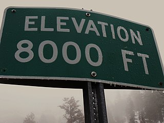
The elevation of a geographic location is its height above or below a fixed reference point, most commonly a reference geoid, a mathematical model of the Earth's sea level as an equipotential gravitational surface . The term elevation is mainly used when referring to points on the Earth's surface, while altitude or geopotential height is used for points above the surface, such as an aircraft in flight or a spacecraft in orbit, and depth is used for points below the surface.
At interchanges, roads pass above or below each other, using grade separation and slip roads. The terms motorway junction and highway junction typically refer to this layout. They can be further subdivided into those with and without signal controls.

In the field of road transport, an interchange is a road junction that uses grade separation, and typically one or more ramps, to permit traffic on at least one highway to pass through the junction without interruption from other crossing traffic streams. It differs from a standard intersection, where roads cross at grade. Interchanges are almost always used when at least one road is a controlled-access highway or a limited-access divided highway (expressway), though they are sometimes used at junctions between surface streets.

Grade separation is a method of aligning a junction of two or more surface transport axes at different heights (grades) so that they will not disrupt the traffic flow on other transit routes when they cross each other. The composition of such transport axes does not have to be uniform; it can consist of a mixture of roads, footpaths, railways, canals, or airport runways. Bridges, tunnels, or a combination of both can be built at a junction to achieve the needed grade separation.
Signalized (traffic-light controlled) interchanges include such "diamond" designs as the diverging diamond, [2] Michigan urban diamond, three-level diamond, and tight diamond. Others include center-turn overpass, contraflow left, single loop, and single-point urban overpass. [3]

A diamond interchange is a common type of road junction, used where a freeway crosses a minor road.

A diverging diamond interchange (DDI), also called a double crossover diamond interchange (DCD), is a type of diamond interchange in which the two directions of traffic on the non-freeway road cross to the opposite side on both sides of the bridge at the freeway. It is unusual in that it requires traffic on the freeway overpass to briefly drive on the opposite side of the road from what is customary for the jurisdiction. The crossover "X" sections can either be traffic-light intersections or one-side overpasses to travel above the opposite lanes without stopping, to allow nonstop traffic flow when relatively sparse traffic.
Non-signalized designs include the cloverleaf, contraflow left, dogbone (restricted dumbbell), double crossover merging, [2] [4] [5] dumbbell (grade-separated bowtie), echelon, free-flow interchange, partial cloverleaf, raindrop, single and double roundabouts (grade-separated roundabout), single-point urban, stack, and windmill. [3]

A cloverleaf interchange is a two-level interchange in which left turns are handled by ramp roads. To go left, vehicles first continue as one road passes over or under the other, then exit right onto a one-way three-fourths loop ramp (270°) and merge onto the intersecting road. The objective of a cloverleaf is to allow two highways to cross without the need for any traffic to be stopped by red lights, even for left and right turns. The limiting factor in the capacity of a cloverleaf interchange is traffic weaving.
A free-flow interchange is an interchange in which all roads are grade-separated, and where movement from one road to another does not require the driver to stop for traffic. Free-flow interchanges are less likely to induce traffic congestion than non-free-flow, but are typically more expensive both in money and in land.

A partial cloverleaf interchange or parclo is a modification of a cloverleaf interchange.
Autobahnkreuz (literally autobahn cross), short form kreuz, and abbreviated as AK, is a four-way interchange on the German autobahn network. Autobahndreieck (literally autobahn triangle), short form dreieck, and abbreviated as AD, is a three-way interchange on the German autobahn network.
At intersections, roads cross at-grade. They also can be further subdivided into those with and without signal controls.
Signalized designs include advanced stop line, bowtie, box junction, continuous-flow intersection, [6] continuous Green-T, double-wide, hook turn, jughandle, median u-turn, Michigan left, paired, quadrant, seagulls, slip lane, split, staggered, superstreet, Texas T, Texas U-turn and turnarounds. [3]
Non-signalized designs include unsignalized variations on continuous-flow 3 and 4-leg, median u-turn and superstreet, along with Maryland T/J, roundabout and traffic circle. [3]
Intersections generally must manage pedestrian as well as vehicle traffic. Pedestrian aids include crosswalks, pedestrian-directed traffic signals ("walk light") and over/underpasses. Walk lights may be accompanied by audio signals to aid the visually impaired. Medians can offer pedestrian islands, allowing pedestrians to divide their crossings into a separate segment for each traffic direction, possibly with a separate signal for each.
A number of features make this protected intersection much safer. A corner refuge island, a setback crossing of the pedestrians and cyclists, generally between 1.5–7 metres of setback, a forward stop bar, which allows cyclists to stop for a traffic light well ahead of motor traffic who must stop behind the crosswalk. Separate signal staging or at least an advance green for cyclists and pedestrians is used to give cyclists and pedestrians no conflicts or a head start over traffic. The design makes a right turn on red, and sometimes left on red depending on the geometry of the intersection in question, possible in many cases, often without stopping. [7]
Cyclists ideally have a protected bike lane on the approach to the intersection, separated by a concrete median with splay kerbs if possible, and have a protected bike lane width of at least 2 metres if possible (one way). In the Netherlands, most one way cycle paths are at least 2.5 metres wide. [8]
Bicycle traffic can be accommodated with the low grade bike lanes in the roadway or higher grade and much safer Protected Bicycle Path that are physically separated from the roadway.
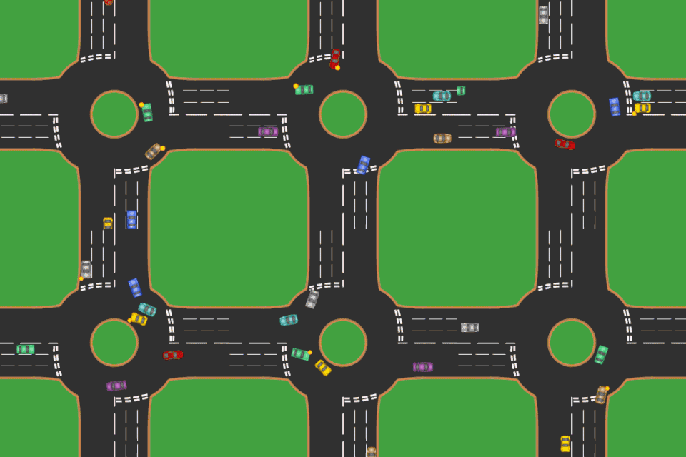
A roundabout is a type of circular intersection or junction in which road traffic is permitted to flow in one direction around a central island, and priority is typically given to traffic already in the junction.

An intersection is an at-grade junction where two or more roads meet or cross. Intersections may be classified by number of road segments, traffic controls, and/or lane design.

A Michigan left is an at-grade intersection design that replaces each left turn at an intersection between a (major) divided roadway and a secondary (minor) roadway with the combination of a right turn followed by a U-turn, or a U-turn followed by a right turn, depending on the situation.
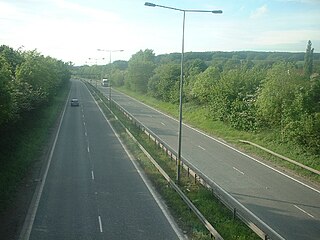
A dual carriageway or divided highway is a class of highway with carriageways for traffic travelling in opposite directions separated by a central reservation. Roads with two or more carriageways which are designed to higher standards with controlled access are generally classed as motorways, freeways, etc., rather than dual carriageways.

A single-point urban interchange, also called a single-point interchange (SPI) or single-point diamond interchange (SPDI), is a type of highway interchange. The design was created in order to help move large volumes of traffic through limited amounts of space safely and efficiently.

A superstreet, also known as a restricted crossing U-turn (RCUT), J-turn, or reduced conflict intersection, is a type of road intersection that is a variation of the Michigan left. In this configuration, in contrast to the Michigan left, traffic on the minor road is not permitted to proceed straight across the major road or highway. Drivers on the minor road wishing to turn left or go straight must turn right onto the major road, then, a short distance away, queue (wait) into a designated U-turn lane in the median. When traffic clears, they complete the U-turn and then either go straight or make a right turn when they intersect the other half of the minor road.

An advanced stop line (ASL), also called advanced stop box or bike box, are road markings at signalised road junctions allowing certain types of vehicle a head start when the traffic signal changes from red to green. Advanced stop lines are implemented widely in Belgium, Denmark, the United Kingdom, and other European countries.
In the field of road transport, a turnaround is a type of junction that allows traffic traveling in one direction on a road to efficiently make a U-turn typically without backing up or making dangerous maneuvers in the middle of the traffic stream. While many junction types permit U-turns, the term turnaround often applies to road junctions built specifically for this purpose.
Access management, when used in traffic and traffic engineering circles, generally refers to the regulation of interchanges, intersections, driveways and median openings to a roadway. Its objectives are to enable access to land uses while maintaining roadway safety and mobility through controlling access location, design, spacing and operation. This is particularly important for major roadways intended to provide efficient service to through-traffic movements.
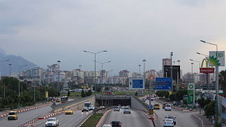
A roundabout interchange is a type of interchange between a controlled access highway, such as a motorway or freeway, and a minor road. The slip roads to and from the motorway carriageways converge at a single roundabout, which is grade-separated from the motorway lanes with bridges.
These road signs are used in Germany.

Cycling infrastructure refers to all infrastructure which may be used by cyclists. This includes the same network of roads and streets used by motorists, except those roads from which cyclists have been banned, plus additional bikeways that are not available to motor vehicles, such as bike paths, bike lanes, cycle tracks and, where permitted, sidewalks, plus amenities like bike racks for parking and specialized traffic signs and signals. Cycling modal share is strongly associated with the size of local cycling infrastructure.

A protected intersection is an at-grade road junction in which cyclists and pedestrians are separated from cars. Vehicles turning right are separated by a car length from crossing cyclists and pedestrians, providing increased reaction times and visibility. Drivers looking to turn right have better visibility to cyclists and pedestrians as they can look to the side for conflicts instead of over their shoulders.
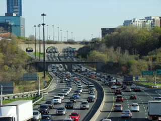
Terminology related to road transport—the transport of passengers or goods on paved routes between places—is diverse, with variation between dialects of English. There may also be regional differences within a single country, and some terms differ based on the side of the road traffic drives on. This glossary is an alphabetical listing of road transport terms.