List of United Kingdom locations: Me-Mic

Last updated

The United Kingdom Uk-map.svg
The United Kingdom

This is part of the list of United Kingdom locations: a gazetteer of place names in the United Kingdom showing each place's locality and geographical coordinates.

Contents

Me

Mea–Mee

LocationLocality Coordinates
(links to map & photo sources)
OS grid
reference
Mead Cornwall 50°55′N4°32′W / 50.92°N 04.53°W / 50.92; -04.53 SS2217
Mead Devon 50°31′N3°44′W / 50.51°N 03.73°W / 50.51; -03.73 SX7770
Mead End Wiltshire 51°00′N1°58′W / 51.00°N 01.97°W / 51.00; -01.97 SU0223
Mead End (Denmead)Hampshire 50°53′N1°04′W / 50.89°N 01.06°W / 50.89; -01.06 SU6611
Mead End (Sway)Hampshire 50°47′N1°38′W / 50.78°N 01.63°W / 50.78; -01.63 SZ2698
Meadgate Bath and North East Somerset 51°19′N2°28′W / 51.32°N 02.46°W / 51.32; -02.46 ST6858
Meadle Buckinghamshire 51°44′N0°50′W / 51.73°N 00.84°W / 51.73; -00.84 SP8005
Meadowbank Cheshire 53°12′N2°31′W / 53.20°N 02.52°W / 53.20; -02.52 SJ6568
Meadowbank City of Edinburgh 55°57′N3°09′W / 55.95°N 03.15°W / 55.95; -03.15 NT2874
Meadowend Essex 52°02′N0°32′E / 52.03°N 00.53°E / 52.03; 00.53 TL7440
Meadowfield Durham 54°44′N1°37′W / 54.74°N 01.62°W / 54.74; -01.62 NZ2439
Meadowfoot North Ayrshire 55°41′N4°50′W / 55.68°N 04.84°W / 55.68; -04.84 NS2147
Meadow Green Herefordshire 52°12′N2°25′W / 52.20°N 02.42°W / 52.20; -02.42 SO7156
Meadowhall Sheffield 53°25′N1°25′W / 53.42°N 01.41°W / 53.42; -01.41 SK3992
Meadow Head Sheffield 53°20′N1°29′W / 53.33°N 01.49°W / 53.33; -01.49 SK3482
Meadowley Shropshire 52°31′N2°30′W / 52.52°N 02.50°W / 52.52; -02.50 SO6692
Meadowmill East Lothian 55°56′N2°58′W / 55.94°N 02.96°W / 55.94; -02.96 NT4073
Meadows Nottinghamshire 52°56′N1°09′W / 52.93°N 01.15°W / 52.93; -01.15 SK5738
Meadowtown Shropshire 52°36′N3°01′W / 52.60°N 03.02°W / 52.60; -03.02 SJ3101
Meads East Sussex 50°45′N0°16′E / 50.75°N 00.26°E / 50.75; 00.26 TV6097
Meadside Oxfordshire 51°38′N1°10′W / 51.63°N 01.16°W / 51.63; -01.16 SU5893
Mead Vale Surrey 51°13′N0°11′W / 51.22°N 00.19°W / 51.22; -00.19 TQ2649
Meadwell Devon 50°36′N4°16′W / 50.60°N 04.26°W / 50.60; -04.26 SX4081
Meaford Staffordshire 52°55′N2°10′W / 52.91°N 02.17°W / 52.91; -02.17 SJ8835
Meagill North Yorkshire 53°59′N1°44′W / 53.99°N 01.74°W / 53.99; -01.74 SE1755
Mealabost / Melbost (Point, Lewis)Western Isles 58°12′N6°19′W / 58.20°N 06.32°W / 58.20; -06.32 NB4632
Mealabost Bhuirgh / Melbost Borve (north Lewis)Western Isles 58°25′N6°26′W / 58.42°N 06.43°W / 58.42; -06.43 NB4157
Mealasta Island Western Isles 58°04′N7°07′W / 58.07°N 07.12°W / 58.07; -07.12 NA979213
Meal Bank Cumbria 54°20′N2°42′W / 54.34°N 02.70°W / 54.34; -02.70 SD5495
Meal Hill Kirklees 53°33′N1°44′W / 53.55°N 01.74°W / 53.55; -01.74 SE1707
Mealista / MealastaWestern Isles 58°06′N7°07′W / 58.10°N 07.11°W / 58.10; -07.11 NA9924
Meall Mòr Highland 58°17′N5°12′W / 58.29°N 05.20°W / 58.29; -05.20 NC120380
Mealrigg Cumbria 54°47′N3°22′W / 54.79°N 03.37°W / 54.79; -03.37 NY1245
Mealsgate Cumbria 54°46′N3°14′W / 54.76°N 03.24°W / 54.76; -03.24 NY2042
Meanwood Leeds 53°49′N1°34′W / 53.82°N 01.57°W / 53.82; -01.57 SE2837
Mearbeck North Yorkshire 54°02′N2°17′W / 54.03°N 02.29°W / 54.03; -02.29 SD8160
Meare Somerset 51°10′N2°47′W / 51.16°N 02.78°W / 51.16; -02.78 ST4541
Meare Green (West Hatch)Somerset 50°59′N3°01′W / 50.99°N 03.01°W / 50.99; -03.01 ST2922
Meare Green (Stoke St Gregory)Somerset 51°01′N2°57′W / 51.02°N 02.95°W / 51.02; -02.95 ST3326
Mearns Bath and North East Somerset 51°19′N2°30′W / 51.32°N 02.50°W / 51.32; -02.50 ST6558
Mearns East Renfrewshire 55°46′N4°19′W / 55.76°N 04.32°W / 55.76; -04.32 NS5455
Mears Ashby Northamptonshire 52°17′N0°47′W / 52.28°N 00.78°W / 52.28; -00.78 SP8366
Measborough Dike Barnsley 53°32′N1°27′W / 53.54°N 01.45°W / 53.54; -01.45 SE3605
Measham Leicestershire 52°42′N1°31′W / 52.70°N 01.51°W / 52.70; -01.51 SK3312
Meath Green Surrey 51°11′N0°11′W / 51.18°N 00.18°W / 51.18; -00.18 TQ2744
Meathop Cumbria 54°13′N2°52′W / 54.21°N 02.87°W / 54.21; -02.87 SD4380
Meaux East Riding of Yorkshire 53°50′N0°20′W / 53.84°N 00.33°W / 53.84; -00.33 TA0939
Meavaig Western Isles 57°59′N6°56′W / 57.98°N 06.93°W / 57.98; -06.93 NB085104
Meaver Cornwall 50°01′N5°14′W / 50.01°N 05.24°W / 50.01; -05.24 SW6818
Meavy Devon 50°29′N4°03′W / 50.48°N 04.05°W / 50.48; -04.05 SX5467
Medbourne Leicestershire 52°31′N0°50′W / 52.52°N 00.83°W / 52.52; -00.83 SP7993
Medburn Northumberland 55°01′N1°47′W / 55.02°N 01.79°W / 55.02; -01.79 NZ1370
Meddon Devon 50°55′N4°28′W / 50.92°N 04.46°W / 50.92; -04.46 SS2717
Meden Vale Nottinghamshire 53°13′N1°08′W / 53.21°N 01.14°W / 53.21; -01.14 SK5769
Medhurst Row Kent 51°12′N0°05′E / 51.20°N 00.08°E / 51.20; 00.08 TQ4647
Medlam Lincolnshire 53°05′N0°02′W / 53.08°N 00.04°W / 53.08; -00.04 TF3156
Medlar Lancashire 53°48′N2°53′W / 53.80°N 02.89°W / 53.80; -02.89 SD4135
Medlicott Shropshire 52°32′N2°53′W / 52.54°N 02.88°W / 52.54; -02.88 SO4094
Medlyn Cornwall 50°09′N5°13′W / 50.15°N 05.22°W / 50.15; -05.22 SW7033
Medmenham Buckinghamshire 51°32′N0°50′W / 51.54°N 00.84°W / 51.54; -00.84 SU8084
Medomsley Durham 54°53′N1°50′W / 54.88°N 01.83°W / 54.88; -01.83 NZ1154
Medstead Hampshire 51°07′N1°04′W / 51.12°N 01.07°W / 51.12; -01.07 SU6537
Meerbrook Staffordshire 53°08′N2°01′W / 53.13°N 02.01°W / 53.13; -02.01 SJ9960
Meer Common Herefordshire 52°10′N2°56′W / 52.16°N 02.93°W / 52.16; -02.93 SO3652
Meer End Solihull 52°22′N1°38′W / 52.36°N 01.64°W / 52.36; -01.64 SP2474
Meerhay Dorset 50°49′N2°44′W / 50.81°N 02.73°W / 50.81; -02.73 ST4802
Meersbrook Sheffield 53°21′N1°28′W / 53.35°N 01.47°W / 53.35; -01.47 SK3584
Meesden Hertfordshire 51°58′N0°05′E / 51.96°N 00.08°E / 51.96; 00.08 TL4332
Meeson Shropshire 52°46′N2°31′W / 52.77°N 02.52°W / 52.77; -02.52 SJ6520
Meeson Heath Shropshire 52°46′N2°31′W / 52.77°N 02.52°W / 52.77; -02.52 SJ6520
Meeth Devon 50°51′N4°04′W / 50.85°N 04.07°W / 50.85; -04.07 SS5408
Meethe Devon 50°59′N3°53′W / 50.98°N 03.89°W / 50.98; -03.89 SS6722
Meethill Aberdeenshire 57°29′N1°49′W / 57.49°N 01.81°W / 57.49; -01.81 NK1145
Meeting Green Suffolk 52°10′N0°32′E / 52.16°N 00.54°E / 52.16; 00.54 TL7455
Meeting House Hill Norfolk 52°48′N1°25′E / 52.80°N 01.41°E / 52.80; 01.41 TG3028

Meg–Mel

LocationLocality Coordinates
(links to map & photo sources)
OS grid
reference
Meidrim Carmarthenshire 51°51′N4°29′W / 51.85°N 04.49°W / 51.85; -04.49 SN2820
Meifod Powys 52°42′N3°15′W / 52.70°N 03.25°W / 52.70; -03.25 SJ1513
Meigle Perth and Kinross 56°35′N3°10′W / 56.58°N 03.17°W / 56.58; -03.17 NO2844
Meigle North Ayrshire 55°50′N4°53′W / 55.84°N 04.89°W / 55.84; -04.89 NS1965
Meikle Earnock South Lanarkshire 55°45′N4°03′W / 55.75°N 04.05°W / 55.75; -04.05 NS7153
Meikle Kilchattan Butts Argyll and Bute 55°46′N5°02′W / 55.76°N 05.04°W / 55.76; -05.04 NS0957
Meikleour Perth and Kinross 56°32′N3°23′W / 56.53°N 03.38°W / 56.53; -03.38 NO1539
Meikle Wartle Aberdeenshire 57°22′N2°28′W / 57.36°N 02.46°W / 57.36; -02.46 NJ7230
Meikle Whitefield Perth and Kinross 56°29′N3°20′W / 56.49°N 03.34°W / 56.49; -03.34 NO1734
Meinciau Carmarthenshire 51°46′N4°14′W / 51.76°N 04.23°W / 51.76; -04.23 SN4610
Meir City of Stoke-on-Trent 52°58′N2°06′W / 52.97°N 02.10°W / 52.97; -02.10 SJ9342
Meir Heath Staffordshire 52°56′N2°06′W / 52.94°N 02.10°W / 52.94; -02.10 SJ9339
Melbourn Cambridgeshire 52°04′N0°01′E / 52.07°N 00.01°E / 52.07; 00.01 TL3844
Melbourne East Riding of Yorkshire 53°53′N0°52′W / 53.88°N 00.86°W / 53.88; -00.86 SE7544
Melbourne Derbyshire 52°49′N1°26′W / 52.82°N 01.43°W / 52.82; -01.43 SK3825
Melbury Abbas Dorset 50°58′N2°10′W / 50.97°N 02.17°W / 50.97; -02.17 ST8820
Melbury Bubb Dorset 50°51′N2°35′W / 50.85°N 02.58°W / 50.85; -02.58 ST5906
Melbury Osmond Dorset 50°52′N2°37′W / 50.86°N 02.61°W / 50.86; -02.61 ST5707
Melbury Sampford Dorset 50°51′N2°37′W / 50.85°N 02.61°W / 50.85; -02.61 ST5706
Melby Shetland Islands 60°17′N1°40′W / 60.29°N 01.67°W / 60.29; -01.67 HU1857
Melchbourne Bedfordshire 52°16′N0°30′W / 52.27°N 00.50°W / 52.27; -00.50 TL0265
Melcombe Somerset 51°05′N3°01′W / 51.09°N 03.02°W / 51.09; -03.02 ST2833
Melcombe Bingham Dorset 50°49′N2°20′W / 50.81°N 02.34°W / 50.81; -02.34 ST7602
Melcombe Regis Dorset 50°37′N2°27′W / 50.61°N 02.45°W / 50.61; -02.45 SY6880
Meldon Devon 50°42′N4°03′W / 50.70°N 04.05°W / 50.70; -04.05 SX5592
Meldon Northumberland 55°08′N1°49′W / 55.14°N 01.82°W / 55.14; -01.82 NZ1183
Meldreth Cambridgeshire 52°05′N0°00′E / 52.09°N -00.00°E / 52.09; -00.00 TL3746
Melfort Argyll and Bute 56°16′N5°30′W / 56.26°N 05.50°W / 56.26; -05.50 NM8314
Meliden Denbighshire 53°18′N3°25′W / 53.30°N 03.41°W / 53.30; -03.41 SJ0680
Melinbyrhedyn Powys 52°34′N3°45′W / 52.56°N 03.75°W / 52.56; -03.75 SN8198
Melin Caiach Merthyr Tydfil 51°39′N3°18′W / 51.65°N 03.30°W / 51.65; -03.30 ST1096
Melincourt Neath Port Talbot 51°41′N3°43′W / 51.69°N 03.72°W / 51.69; -03.72 SN8101
Melincryddan Neath Port Talbot 51°38′N3°49′W / 51.64°N 03.82°W / 51.64; -03.82 SS7496
Melinsey Cornwall 50°13′N4°56′W / 50.21°N 04.94°W / 50.21; -04.94 SW9039
Melin-y-coed Conwy 53°07′N3°46′W / 53.12°N 03.77°W / 53.12; -03.77 SH8160
Melin-y-Wig Denbighshire 53°01′N3°26′W / 53.02°N 03.44°W / 53.02; -03.44 SJ0348
Melkington Northumberland 55°40′N2°12′W / 55.66°N 02.20°W / 55.66; -02.20 NT8741
Melkinthorpe Cumbria 54°37′N2°41′W / 54.61°N 02.69°W / 54.61; -02.69 NY5525
Melkridge Northumberland 54°58′N2°25′W / 54.97°N 02.42°W / 54.97; -02.42 NY7364
Melksham Wiltshire 51°22′N2°08′W / 51.37°N 02.14°W / 51.37; -02.14 ST9064
Melksham Forest Wiltshire 51°22′N2°08′W / 51.37°N 02.13°W / 51.37; -02.13 ST9164
Mellangoose Cornwall 50°05′N5°14′W / 50.08°N 05.24°W / 50.08; -05.24 SW6826
Mell Green Berkshire 51°29′N1°21′W / 51.49°N 01.35°W / 51.49; -01.35 SU4577
Mellguards Cumbria 54°47′N2°52′W / 54.79°N 02.87°W / 54.79; -02.87 NY4445
Melling Lancashire 54°08′N2°37′W / 54.13°N 02.62°W / 54.13; -02.62 SD5971
Melling Sefton 53°29′N2°56′W / 53.49°N 02.93°W / 53.49; -02.93 SD3800
Mellingey Cornwall 50°30′N4°56′W / 50.50°N 04.93°W / 50.50; -04.93 SW9271
Melling Mount Sefton 53°30′N2°54′W / 53.50°N 02.90°W / 53.50; -02.90 SD4001
Mellis Suffolk 52°19′N1°04′E / 52.32°N 01.06°E / 52.32; 01.06 TM0974
Mellis Green Suffolk 52°19′N1°04′E / 52.32°N 01.06°E / 52.32; 01.06 TM0974
Mellon Charles Highland 57°51′N5°38′W / 57.85°N 05.64°W / 57.85; -05.64 NG8491
Mellon Udrigle Highland 57°53′N5°34′W / 57.89°N 05.57°W / 57.89; -05.57 NG8895
Mellor Lancashire 53°46′N2°32′W / 53.76°N 02.53°W / 53.76; -02.53 SD6530
Mellor Stockport 53°23′N2°02′W / 53.38°N 02.04°W / 53.38; -02.04 SJ9788
Mellor Brook Lancashire 53°46′N2°32′W / 53.77°N 02.54°W / 53.77; -02.54 SD6431
Mells Somerset 51°14′N2°24′W / 51.23°N 02.40°W / 51.23; -02.40 ST7249
Mells Suffolk 52°19′N1°31′E / 52.32°N 01.52°E / 52.32; 01.52 TM4076
Mells Green Somerset 51°14′N2°24′W / 51.23°N 02.40°W / 51.23; -02.40 ST7248
Melmerby Cumbria 54°43′N2°36′W / 54.72°N 02.60°W / 54.72; -02.60 NY6137
Melmerby (Richmondshire)North Yorkshire 54°16′N1°53′W / 54.26°N 01.89°W / 54.26; -01.89 SE0785
Melmerby (Harrogate)North Yorkshire 54°10′N1°29′W / 54.17°N 01.49°W / 54.17; -01.49 SE3376
Melon Green Suffolk 52°11′N0°41′E / 52.18°N 00.69°E / 52.18; 00.69 TL8457
Melplash Dorset 50°46′N2°44′W / 50.77°N 02.73°W / 50.77; -02.73 SY4898
Melrose Scottish Borders 55°35′N2°44′W / 55.59°N 02.73°W / 55.59; -02.73 NT5434
Melsonby North Yorkshire 54°28′N1°42′W / 54.46°N 01.70°W / 54.46; -01.70 NZ1908
Meltham Kirklees 53°35′N1°52′W / 53.58°N 01.86°W / 53.58; -01.86 SE0910
Meltham Mills Kirklees 53°35′N1°51′W / 53.58°N 01.85°W / 53.58; -01.85 SE1010
Melton Suffolk 52°06′N1°19′E / 52.10°N 01.32°E / 52.10; 01.32 TM2850
Melton East Riding of Yorkshire 53°43′N0°32′W / 53.72°N 00.53°W / 53.72; -00.53 SE9726
Meltonby East Riding of Yorkshire 53°57′N0°47′W / 53.95°N 00.79°W / 53.95; -00.79 SE7952
Melton Constable Norfolk 52°51′N1°01′E / 52.85°N 01.02°E / 52.85; 01.02 TG0433
Melton Mowbray Leicestershire 52°46′N0°53′W / 52.76°N 00.88°W / 52.76; -00.88 SK7519
Melton Ross North Lincolnshire 53°34′N0°23′W / 53.57°N 00.38°W / 53.57; -00.38 TA0710
Melvaig Highland 57°48′N5°48′W / 57.80°N 05.80°W / 57.80; -05.80 NG7486
Melverley Shropshire 52°44′N2°59′W / 52.73°N 02.99°W / 52.73; -02.99 SJ3316
Melverley Green Shropshire 52°44′N3°00′W / 52.74°N 03.00°W / 52.74; -03.00 SJ3217
Melvich Highland 58°33′N3°55′W / 58.55°N 03.92°W / 58.55; -03.92 NC8864

Mem–Mep

LocationLocality Coordinates
(links to map & photo sources)
OS grid
reference
Membland Devon 50°19′N4°01′W / 50.31°N 04.02°W / 50.31; -04.02 SX5648
Membury Devon 50°49′N3°02′W / 50.82°N 03.03°W / 50.82; -03.03 ST2703
Memsie Aberdeenshire 57°38′N2°03′W / 57.64°N 02.05°W / 57.64; -02.05 NJ9762
Memus Angus 56°43′N2°56′W / 56.71°N 02.94°W / 56.71; -02.94 NO4259
Mena Cornwall 50°25′N4°46′W / 50.42°N 04.76°W / 50.42; -04.76 SX0462
Menadarva Cornwall 50°13′N5°21′W / 50.22°N 05.35°W / 50.22; -05.35 SW6141
Menagissey Cornwall 50°16′N5°13′W / 50.26°N 05.21°W / 50.26; -05.21 SW7146
Menai Bridge Isle of Anglesey 53°13′N4°10′W / 53.22°N 04.17°W / 53.22; -04.17 SH5572
Mendham Suffolk 52°23′N1°20′E / 52.38°N 01.33°E / 52.38; 01.33 TM2782
Mendlesham Suffolk 52°14′N1°04′E / 52.24°N 01.07°E / 52.24; 01.07 TM1065
Mendlesham Green Suffolk 52°13′N1°03′E / 52.22°N 01.05°E / 52.22; 01.05 TM0963
Menethorpe North Yorkshire 54°05′N0°50′W / 54.09°N 00.83°W / 54.09; -00.83 SE7667
Mengham Hampshire 50°47′N0°58′W / 50.78°N 00.97°W / 50.78; -00.97 SZ7299
Menheniot Cornwall 50°26′N4°25′W / 50.43°N 04.42°W / 50.43; -04.42 SX2862
Menherion Cornwall 50°10′N5°13′W / 50.17°N 05.22°W / 50.17; -05.22 SW7036
Menithwood Worcestershire 52°19′N2°26′W / 52.31°N 02.44°W / 52.31; -02.44 SO7069
Menna Cornwall 50°20′N4°56′W / 50.34°N 04.93°W / 50.34; -04.93 SW9154
Mennock Dumfries and Galloway 55°21′N3°53′W / 55.35°N 03.89°W / 55.35; -03.89 NS8008
Menston Bradford 53°53′N1°44′W / 53.88°N 01.74°W / 53.88; -01.74 SE1743
Menstrie Stirling 56°08′N3°52′W / 56.14°N 03.86°W / 56.14; -03.86 NS8496
Menthorpe North Yorkshire 53°48′N0°56′W / 53.80°N 00.93°W / 53.80; -00.93 SE7034
Mentmore Buckinghamshire 51°52′N0°41′W / 51.86°N 00.69°W / 51.86; -00.69 SP9019
Menzion Scottish Borders 55°29′N3°26′W / 55.49°N 03.44°W / 55.49; -03.44 NT0923
Meoble Highland 56°55′N5°38′W / 56.92°N 05.63°W / 56.92; -05.63 NM7987
Meole Brace Shropshire 52°41′N2°46′W / 52.68°N 02.77°W / 52.68; -02.77 SJ4810
Meols Wirral 53°23′N3°10′W / 53.39°N 03.17°W / 53.39; -03.17 SJ2289
Meon Hampshire 50°49′N1°14′W / 50.82°N 01.24°W / 50.82; -01.24 SU5303
Meon Park Hampshire 50°53′N1°11′W / 50.89°N 01.19°W / 50.89; -01.19 SU5711
Meonstoke Hampshire 50°58′N1°08′W / 50.96°N 01.13°W / 50.96; -01.13 SU6119
Meopham Kent 51°22′N0°21′E / 51.36°N 00.35°E / 51.36; 00.35 TQ6465
Meopham Green Kent 51°22′N0°20′E / 51.36°N 00.34°E / 51.36; 00.34 TQ6365
Meopham Station Kent 51°22′N0°20′E / 51.37°N 00.34°E / 51.37; 00.34 TQ6367
Mepal Cambridgeshire 52°23′N0°07′E / 52.39°N 00.11°E / 52.39; 00.11 TL4480
Meppershall Bedfordshire 52°01′N0°21′W / 52.01°N 00.35°W / 52.01; -00.35 TL1336

Mer–Mez

LocationLocality Coordinates
(links to map & photo sources)
OS grid
reference
Merbach Herefordshire 52°05′N3°01′W / 52.09°N 03.02°W / 52.09; -03.02 SO3045
Mercaston Derbyshire 52°59′N1°37′W / 52.98°N 01.61°W / 52.98; -01.61 SK2643
Merchant Fields Kirklees 53°44′N1°43′W / 53.73°N 01.71°W / 53.73; -01.71 SE1926
Merchiston City of Edinburgh 55°56′N3°13′W / 55.93°N 03.21°W / 55.93; -03.21 NT2472
Mere Wiltshire 51°05′N2°16′W / 51.08°N 02.27°W / 51.08; -02.27 ST8132
Mere Cheshire 53°19′N2°25′W / 53.32°N 02.42°W / 53.32; -02.42 SJ7281
Mere Brow Lancashire 53°39′N2°53′W / 53.65°N 02.89°W / 53.65; -02.89 SD4118
Mereclough Lancashire 53°46′N2°11′W / 53.76°N 02.19°W / 53.76; -02.19 SD8730
Mere Green Birmingham 52°35′N1°50′W / 52.58°N 01.83°W / 52.58; -01.83 SP1199
Mere Green Worcestershire 52°15′N2°04′W / 52.25°N 02.07°W / 52.25; -02.07 SO9562
Merehead Wrexham 52°56′N2°49′W / 52.93°N 02.81°W / 52.93; -02.81 SJ4538
Mere Heath Cheshire 53°13′N2°31′W / 53.22°N 02.51°W / 53.22; -02.51 SJ6670
Meresborough Kent 51°20′N0°37′E / 51.34°N 00.61°E / 51.34; 00.61 TQ8264
Mereside Lancashire 53°47′N3°00′W / 53.79°N 03.00°W / 53.79; -03.00 SD3434
Meretown Staffordshire 52°46′48″N2°21′47″W / 52.78°N 02.363°W / 52.78; -02.363 SJ7520
Mereworth Kent 51°15′N0°22′E / 51.25°N 00.37°E / 51.25; 00.37 TQ6653
Meriden Solihull 52°26′N1°38′W / 52.43°N 01.64°W / 52.43; -01.64 SP2482
Meriden Hertfordshire 51°40′N0°23′W / 51.67°N 00.39°W / 51.67; -00.39 TQ1199
Merkadale Highland 57°17′N6°21′W / 57.29°N 06.35°W / 57.29; -06.35 NG3831
Merkinch Highland 57°29′N4°15′W / 57.48°N 04.25°W / 57.48; -04.25 NH6546
Merkland North Ayrshire 55°36′N5°08′W / 55.60°N 05.14°W / 55.60; -05.14 NS0239
Merle Common Surrey 51°13′N0°00′E / 51.22°N -00.00°E / 51.22; -00.00 TQ4049
Merley Poole 50°47′N1°58′W / 50.78°N 01.97°W / 50.78; -01.97 SZ0298
Merlin's Bridge Pembrokeshire 51°47′N4°59′W / 51.78°N 04.98°W / 51.78; -04.98 SM9414
Merlin's Cross Pembrokeshire 51°40′N4°54′W / 51.66°N 04.90°W / 51.66; -04.90 SM9900
Merridale Wolverhampton 52°35′N2°10′W / 52.58°N 02.16°W / 52.58; -02.16 SO8998
Merridge Somerset 51°05′N3°08′W / 51.09°N 03.14°W / 51.09; -03.14 ST2034
Merrie Gardens Isle of Wight 50°38′N1°11′W / 50.64°N 01.18°W / 50.64; -01.18 SZ5883
Merrifield Cornwall 50°47′N4°28′W / 50.78°N 04.46°W / 50.78; -04.46 SS2601
Merrifield Devon 50°19′N3°40′W / 50.31°N 03.67°W / 50.31; -03.67 SX8147
Merrington Shropshire 52°46′N2°47′W / 52.77°N 02.78°W / 52.77; -02.78 SJ4720
Merrion Pembrokeshire 51°38′N4°59′W / 51.63°N 04.99°W / 51.63; -04.99 SR9397
Merriott Somerset 50°54′N2°47′W / 50.90°N 02.79°W / 50.90; -02.79 ST4412
Merriott Dorset 50°45′N2°41′W / 50.75°N 02.69°W / 50.75; -02.69 SY5195
Merriottsford Somerset 50°54′N2°47′W / 50.90°N 02.79°W / 50.90; -02.79 ST4412
Merritown Dorset 50°46′N1°50′W / 50.77°N 01.84°W / 50.77; -01.84 SZ1197
Merrivale Devon 50°33′N4°04′W / 50.55°N 04.06°W / 50.55; -04.06 SX5475
Merrivale Herefordshire 51°54′N2°35′W / 51.90°N 02.58°W / 51.90; -02.58 SO6023
Merrow Surrey 51°14′N0°33′W / 51.24°N 00.55°W / 51.24; -00.55 TQ0150
Merrybent Darlington 54°31′N1°38′W / 54.52°N 01.63°W / 54.52; -01.63 NZ2414
Merry Field Hill Dorset 50°48′N1°58′W / 50.80°N 01.97°W / 50.80; -01.97 SU0201
Merry Hill Wolverhampton 52°34′N2°10′W / 52.57°N 02.17°W / 52.57; -02.17 SO8897
Merry Hill Hertfordshire 51°38′N0°22′W / 51.63°N 00.36°W / 51.63; -00.36 TQ1394
Merryhill Green Berkshire 51°26′N0°52′W / 51.43°N 00.87°W / 51.43; -00.87 SU7871
Merrylee East Renfrewshire 55°48′N4°17′W / 55.80°N 04.29°W / 55.80; -04.29 NS5659
Merry Lees Leicestershire 52°38′N1°18′W / 52.64°N 01.30°W / 52.64; -01.30 SK4705
Merrymeet Cornwall 50°27′N4°26′W / 50.45°N 04.43°W / 50.45; -04.43 SX2765
Merry Meeting Cornwall 50°31′N4°43′W / 50.52°N 04.71°W / 50.52; -04.71 SX0873
Merry Oak City of Southampton 50°54′N1°22′W / 50.90°N 01.37°W / 50.90; -01.37 SU4412
Mersea Island Essex 51°47′N0°56′E / 51.79°N 00.94°E / 51.79; 00.94 TM034149
Mersham Kent 51°07′N0°55′E / 51.11°N 00.92°E / 51.11; 00.92 TR0539
Merstham Surrey 51°16′N0°09′W / 51.26°N 00.15°W / 51.26; -00.15 TQ2953
Merston West Sussex 50°49′N0°44′W / 50.81°N 00.73°W / 50.81; -00.73 SU8902
Merstone Isle of Wight 50°40′N1°16′W / 50.66°N 01.26°W / 50.66; -01.26 SZ5285
Merther Cornwall 50°15′N5°00′W / 50.25°N 05.00°W / 50.25; -05.00 SW8644
Merther Lane Cornwall 50°14′N5°01′W / 50.23°N 05.01°W / 50.23; -05.01 SW8542
Merthyr Carmarthenshire 51°51′N4°23′W / 51.85°N 04.39°W / 51.85; -04.39 SN3520
Merthyr Cynog Powys 52°01′N3°29′W / 52.02°N 03.48°W / 52.02; -03.48 SN9837
Merthyr Dyfan The Vale Of Glamorgan 51°25′N3°17′W / 51.41°N 03.28°W / 51.41; -03.28 ST1169
Merthyr Mawr Bridgend 51°29′N3°37′W / 51.48°N 03.61°W / 51.48; -03.61 SS8877
Merthyr Tydfil Merthyr Tydfil 51°44′N3°22′W / 51.74°N 03.37°W / 51.74; -03.37 SO0506
Merthyr Vale Merthyr Tydfil 51°41′N3°20′W / 51.68°N 03.34°W / 51.68; -03.34 ST0799
Merton Devon 50°53′N4°06′W / 50.88°N 04.10°W / 50.88; -04.10 SS5212
Merton Norfolk 52°32′N0°48′E / 52.54°N 00.80°E / 52.54; 00.80 TL9098
Merton Oxfordshire 51°50′N1°10′W / 51.84°N 01.17°W / 51.84; -01.17 SP5717
Merton London Borough of Merton 51°24′N0°12′W / 51.40°N 00.20°W / 51.40; -00.20 TQ2569
Merton Park Merton 51°24′N0°12′W / 51.40°N 00.20°W / 51.40; -00.20 TQ2569
Meshaw Devon 50°57′N3°47′W / 50.95°N 03.78°W / 50.95; -03.78 SS7519
Messing Essex 51°49′N0°44′E / 51.82°N 00.74°E / 51.82; 00.74 TL8918
Messingham North Lincolnshire 53°31′N0°39′W / 53.52°N 00.65°W / 53.52; -00.65 SE8904
Mesty Croft Sandwell 52°32′N2°01′W / 52.54°N 02.01°W / 52.54; -02.01 SO9994
Mesur-y-dorth Pembrokeshire 51°55′N5°09′W / 51.92°N 05.15°W / 51.92; -05.15 SM8330
Metal Bridge Durham 54°42′N1°33′W / 54.70°N 01.55°W / 54.70; -01.55 NZ2934
Metcombe Devon 50°43′N3°19′W / 50.72°N 03.31°W / 50.72; -03.31 SY0792
Metfield Suffolk 52°22′N1°22′E / 52.37°N 01.36°E / 52.37; 01.36 TM2980
Metham East Riding of Yorkshire 53°43′N0°46′W / 53.72°N 00.77°W / 53.72; -00.77 SE8025
Metherell Cornwall 50°29′N4°15′W / 50.49°N 04.25°W / 50.49; -04.25 SX4069
Metheringham Lincolnshire 53°08′N0°25′W / 53.13°N 00.41°W / 53.13; -00.41 TF0661
Methersgate Suffolk 52°04′N1°19′E / 52.06°N 01.32°E / 52.06; 01.32 TM2846
Methil Fife 56°10′N3°02′W / 56.17°N 03.03°W / 56.17; -03.03 NT3699
Methilhill Fife 56°10′N3°02′W / 56.17°N 03.04°W / 56.17; -03.04 NT3599
Methley Leeds 53°43′N1°25′W / 53.72°N 01.41°W / 53.72; -01.41 SE3926
Methley Junction Wakefield 53°43′N1°25′W / 53.72°N 01.41°W / 53.72; -01.41 SE3925
Methley Lanes Wakefield 53°43′N1°26′W / 53.72°N 01.44°W / 53.72; -01.44 SE3725
Methlick Aberdeenshire 57°25′N2°15′W / 57.42°N 02.25°W / 57.42; -02.25 NJ8537
Methven Perth and Kinross 56°25′N3°35′W / 56.41°N 03.59°W / 56.41; -03.59 NO0226
Methwold Norfolk 52°31′N0°32′E / 52.51°N 00.54°E / 52.51; 00.54 TL7394
Methwold Hythe Norfolk 52°31′N0°31′E / 52.51°N 00.51°E / 52.51; 00.51 TL7194
Mettingham Suffolk 52°26′N1°28′E / 52.44°N 01.47°E / 52.44; 01.47 TM3689
Metton Norfolk 52°53′N1°15′E / 52.88°N 01.25°E / 52.88; 01.25 TG1937
Mevagissey Cornwall 50°16′N4°47′W / 50.27°N 04.79°W / 50.27; -04.79 SX0145
Mewith Head North Yorkshire 54°05′N2°28′W / 54.08°N 02.46°W / 54.08; -02.46 SD7066
Mexborough Doncaster 53°29′N1°17′W / 53.49°N 01.29°W / 53.49; -01.29 SE4700
Meyrick Park Bournemouth 50°43′N1°53′W / 50.72°N 01.88°W / 50.72; -01.88 SZ0892
Meysey Hampton Gloucestershire 51°41′N1°50′W / 51.68°N 01.84°W / 51.68; -01.84 SU1199

Mi

Mia-Mic

LocationLocality Coordinates
(links to map & photo sources)
OS grid
reference
Miabhaig / Meavag (Loch Ceann Dibig, Harris)Western Isles 57°52′N6°48′W / 57.86°N 06.80°W / 57.86; -06.80 NG1596
Miabhaig / Meavaig (North Harris)Western Isles 57°56′N6°55′W / 57.94°N 06.92°W / 57.94; -06.92 NB0906
Mial Highland 57°43′N5°43′W / 57.72°N 05.71°W / 57.72; -05.71 NG7977
Miavaig Western Isles 58°11′N6°58′W / 58.19°N 06.97°W / 58.19; -06.97 NB0834
Michaelchurch Herefordshire 51°55′N2°41′W / 51.92°N 02.69°W / 51.92; -02.69 SO5225
Michaelchurch Escley Herefordshire 52°00′N3°00′W / 52.00°N 03.00°W / 52.00; -03.00 SO3134
Michaelchurch-on-Arrow Powys 52°08′N3°07′W / 52.14°N 03.11°W / 52.14; -03.11 SO2450
Michaelston-le-Pit The Vale Of Glamorgan 51°26′N3°13′W / 51.44°N 03.22°W / 51.44; -03.22 ST1572
Michaelston-super-Ely The Vale Of Glamorgan 51°28′N3°17′W / 51.47°N 03.28°W / 51.47; -03.28 ST1176
Michaelston-y-Fedw City of Newport 51°32′N3°05′W / 51.54°N 03.09°W / 51.54; -03.09 ST2484
Michaelstow Cornwall 50°34′N4°43′W / 50.57°N 04.71°W / 50.57; -04.71 SX0878
Michelcombe Devon 50°29′N3°50′W / 50.49°N 03.84°W / 50.49; -03.84 SX6968
Micheldever Hampshire 51°08′N1°16′W / 51.14°N 01.27°W / 51.14; -01.27 SU5139
Michelmersh Hampshire 51°02′N1°31′W / 51.03°N 01.51°W / 51.03; -01.51 SU3426
Mickfield Suffolk 52°12′N1°07′E / 52.20°N 01.11°E / 52.20; 01.11 TM1361
Micklebring Doncaster 53°26′N1°14′W / 53.44°N 01.23°W / 53.44; -01.23 SK5194
Mickleby North Yorkshire 54°29′N0°46′W / 54.49°N 00.76°W / 54.49; -00.76 NZ8012
Micklefield Buckinghamshire 51°37′N0°44′W / 51.62°N 00.73°W / 51.62; -00.73 SU8892
Micklefield Leeds 53°47′N1°20′W / 53.79°N 01.33°W / 53.79; -01.33 SE4433
Micklefield Green Hertfordshire 51°40′N0°29′W / 51.67°N 00.49°W / 51.67; -00.49 TQ0498
Mickleham Surrey 51°16′N0°19′W / 51.26°N 00.32°W / 51.26; -00.32 TQ1753
Micklehurst Tameside 53°31′N2°02′W / 53.51°N 02.03°W / 53.51; -02.03 SD9802
Mickleover Derbyshire 52°54′N1°33′W / 52.90°N 01.55°W / 52.90; -01.55 SK3034
Micklethwaite Cumbria 54°50′N3°07′W / 54.84°N 03.12°W / 54.84; -03.12 NY2850
Micklethwaite Bradford 53°52′N1°50′W / 53.86°N 01.84°W / 53.86; -01.84 SE1041
Mickleton Gloucestershire 52°05′N1°46′W / 52.08°N 01.76°W / 52.08; -01.76 SP1643
Mickleton Durham 54°36′N2°04′W / 54.60°N 02.06°W / 54.60; -02.06 NY9623
Mickletown Leeds 53°44′N1°25′W / 53.73°N 01.41°W / 53.73; -01.41 SE3927
Mickle Trafford Cheshire 53°13′N2°50′W / 53.21°N 02.84°W / 53.21; -02.84 SJ4469
Mickley North Yorkshire 54°10′N1°37′W / 54.17°N 01.61°W / 54.17; -01.61 SE2576
Mickley Derbyshire 53°18′N1°31′W / 53.30°N 01.52°W / 53.30; -01.52 SK3279
Mickley Shropshire 52°53′N2°35′W / 52.88°N 02.58°W / 52.88; -02.58 SJ6132
Mickley Green Suffolk 52°11′N0°41′E / 52.18°N 00.69°E / 52.18; 00.69 TL8457
Mickley Square Northumberland 54°57′N1°53′W / 54.95°N 01.89°W / 54.95; -01.89 NZ0762

Related Research Articles

Britain most often refers to:

<span class="mw-page-title-main">Parliament of the United Kingdom</span> Supreme legislative body of the United Kingdom

The Parliament of the United Kingdom of Great Britain and Northern Ireland is the supreme legislative body of the United Kingdom, and may also legislate for the Crown Dependencies and the British Overseas Territories. It meets at the Palace of Westminster in London. Parliament possesses legislative supremacy and thereby holds ultimate power over all other political bodies in the United Kingdom and the Overseas Territories. While Parliament is bicameral, it has three parts: the sovereign, the House of Lords, and the House of Commons. The three parts acting together to legislate may be described as the King-in-Parliament. The Crown normally acts on the advice of the prime minister, and the powers of the House of Lords are limited to only delaying legislation.

<span class="mw-page-title-main">Primary school</span> School for children

A primary school, elementary school, or grade school is a school for primary education of children who are 4 to 10 years of age. Primary schooling follows preschool and precedes secondary schooling.
<span class="mw-page-title-main">United Kingdom</span> Island country in Northwestern Europe

The United Kingdom of Great Britain and Northern Ireland, commonly known as the United Kingdom (UK) or Britain, is a country in Northwestern Europe, off the coast of the continental mainland. It comprises England, Scotland, Wales, and Northern Ireland. The UK includes the island of Great Britain, the north-eastern part of the island of Ireland, and most of the smaller islands within the British Isles, a total area of 94,354 square miles (244,376 km2). Northern Ireland shares a land border with the Republic of Ireland; otherwise, the United Kingdom is surrounded by the Atlantic Ocean, the North Sea, the English Channel, the Celtic Sea, and the Irish Sea. The United Kingdom had an estimated population of nearly 68.3 million people in 2023. The capital and largest city of both England and the United Kingdom is London, whose wider metropolitan area is the largest in Western Europe, with a population of 14.9 million. The cities of Edinburgh, Cardiff, and Belfast are the national capitals of Scotland, Wales, and Northern Ireland, respectively.

The Peerage of Ireland consists of those titles of nobility created by the English monarchs in their capacity as Lord or King of Ireland, or later by monarchs of the United Kingdom of Great Britain and Ireland. It is one of the five divisions of Peerages in the United Kingdom. The creation of such titles came to an end in the 19th century. The ranks of the Irish peerage are duke, marquess, earl, viscount and baron. As of 2016, there were 135 titles in the Peerage of Ireland extant: two dukedoms, ten marquessates, 43 earldoms, 28 viscountcies, and 52 baronies. However, these titles have no official recognition in Ireland, with Article 40.2 of the Constitution of Ireland forbidding the state conferring titles of nobility and stating that an Irish citizen may not accept titles of nobility or honour except with the prior approval of the Irish government.

<span class="mw-page-title-main">Kingdom of England</span> Kingdom in northwestern Europe (927–1707)

The Kingdom of England was a sovereign state on the island of Great Britain from the early tenth century, when it was unified from various Anglo-Saxon kingdoms, until 1 May 1707, when it united with Scotland to form the Kingdom of Great Britain, which would later become the United Kingdom. The Kingdom of England was among the most powerful states in Europe during the medieval and early modern periods.
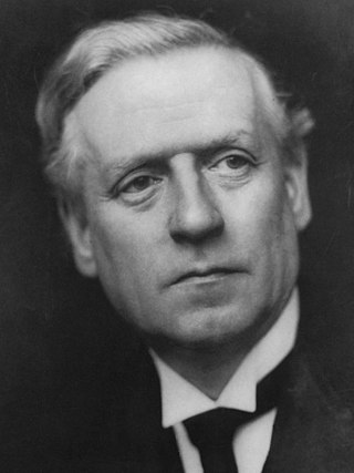
<span class="mw-page-title-main">December 1910 United Kingdom general election</span>

The December 1910 United Kingdom general election was held from 3 to 19 December. It was the last general election to be held over several days and the last to be held before the First World War.
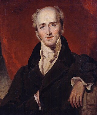
<span class="mw-page-title-main">1832 United Kingdom general election</span>

The 1832 United Kingdom general election was the first United Kingdom general election held in the Reformed House of Commons following the Reform Act, which introduced significant changes to the electoral system.
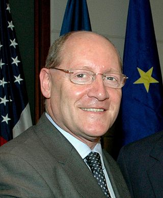
<span class="mw-page-title-main">2004 European Parliament election in the United Kingdom</span> Election

The 2004 European Parliament election was the United Kingdom's part of the wider 2004 European Parliament election which was held between 10 and 13 June 2004 in the 25 member states of the European Union. The United Kingdom's part of this election was held on Thursday 10 June 2004. The election also coincided with the 2004 local elections and the London Assembly and mayoral elections. In total, 78 Members of the European Parliament were elected from the United Kingdom using proportional representation.

<span class="mw-page-title-main">Lists of places in Wales</span>

These are lists of places in Wales.

<span class="mw-page-title-main">Member of Parliament (United Kingdom)</span> Representative in the House of Commons

In the United Kingdom, a member of Parliament (MP) is an individual elected to serve in the House of Commons, the lower house of the Parliament of the United Kingdom.
<span class="mw-page-title-main">United Kingdom of Portugal, Brazil and the Algarves</span> Pluricontinental monarchy

The United Kingdom of Portugal, Brazil and the Algarves was a pluricontinental monarchy formed by the elevation of the Portuguese colony named State of Brazil to the status of a kingdom and by the simultaneous union of that Kingdom of Brazil with the Kingdom of Portugal and the Kingdom of the Algarves, constituting a single state consisting of three kingdoms.

<span class="mw-page-title-main">Unitary authorities of England</span> Local government in some parts of England

The unitary authorities of England are a type of local authority responsible for all local government services in an area. They combine the functions of a non-metropolitan county council and a non-metropolitan district council, which elsewhere in England provide two tiers of local government.

<span class="mw-page-title-main">Kingdom of Portugal</span> Kingdom in Southwestern Europe (1139–1910)

The Kingdom of Portugal was a monarchy in the western Iberian Peninsula and the predecessor of the modern Portuguese Republic. Existing to various extents between 1139 and 1910, it was also known as the Kingdom of Portugal and the Algarves after 1415, and as the United Kingdom of Portugal, Brazil and the Algarves between 1815 and 1822. The name is also often applied to the Portuguese Empire, the realm's overseas colonies.

<span class="mw-page-title-main">United Kingdom in the Eurovision Song Contest</span>

The United Kingdom has participated in the Eurovision Song Contest 66 times. Its first participation was at the second contest, in 1957, and it has entered every year since 1959. The British participant broadcaster in the contest is the British Broadcasting Corporation (BBC). The country has won the contest five times: in 1967, with "Puppet on a String" performed by Sandie Shaw; in 1969, with "Boom Bang-a-Bang" by Lulu ; in 1976, with "Save Your Kisses for Me" by Brotherhood of Man; in 1981, with "Making Your Mind Up" by Bucks Fizz; and in 1997, with "Love Shine a Light" by Katrina and the Waves. The UK has also achieved a record sixteen second-place finishes, the first in 1959 and the most recent in 2022.

<span class="mw-page-title-main">Countries of the United Kingdom</span> Component parts of the UK since 1922

Since 1922, the United Kingdom has been made up of four countries: England, Scotland, Wales and Northern Ireland. The UK Prime Minister's website has used the phrase "countries within a country" to describe the United Kingdom.