List of covered bridges in Oregon

Last updated

Map all coordinates using: OpenStreetMap

This list of Oregon covered bridges contains 50 historic covered bridges remaining in the U.S. state of Oregon.

Contents

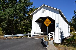
Most covered bridges in Oregon were built between 1905 and 1925. At its peak, there were an estimated 450 covered bridges, which by 1977, had dwindled to 56. [1] As of 2021, there were only 49 remaining. [2] :xiv Lane County has more covered bridges than any other county west of the Mississippi River. [3]

List

PhotoBridgeCountyLocationBuiltLength (ft)CrossesCoordinatesNotes
0707 Harris bridge.jpg Harris Benton Wren 192975 Marys River 44°34′48″N123°27′37″W / 44.5800°N 123.4602°W / 44.5800; -123.4602 (Harris Covered Bridge) NRHP
Hayden Covered Bridge.jpg Hayden Benton Alsea 191891 Alsea River 44°22′59″N123°37′51″W / 44.3831°N 123.6307°W / 44.3831; -123.6307 (Hayden Covered Bridge) [4] NRHP
Irish Bend Covered Bridge.jpg Irish Bend Benton Corvallis 195460 Oak Creek 44°34′00″N123°18′03″W / 44.566535°N 123.300802°W / 44.566535; -123.300802 (Irish Bend Covered Bridge) NRHP
Sandy creek bridge P4447a.jpeg Sandy Creek Coos Remote 192160 Sandy Creek 43°00′23″N123°53′30″W / 43.00637°N 123.89177°W / 43.00637; -123.89177 (Sandy Creek Covered Footbridge) NRHP, footbridge
Rock O' the Range Bridge, road view.jpg Rock O' the Range Deschutes Bend 196342 Swalley Canal 44°07′20″N121°17′13″W / 44.12236°N 121.28691°W / 44.12236; -121.28691 (Rock O' the Range Covered Bridge) NRHP, only covered bridge east of the Cascades, some consider it not to be a true covered bridge since it lacks a truss [5] privately owned and maintained covered bridge open to the public [6]
Cavitt Creek Covered Bridge.jpg Cavitt Creek Douglas Peel 194370 Little River 43°14′39″N123°01′18″W / 43.24410°N 123.02177°W / 43.24410; -123.02177 (Cavitt Creek Covered Bridge) Raw log upper supports with a portal shape for log truck passage
Horse Creek Covered Bridge.jpg Horse Creek Douglas Myrtle Creek 1930105 Myrtle Creek 43°01′24″N123°17′24″W / 43.02335°N 123.29004°W / 43.02335; -123.29004 (Horse Creek Covered Bridge) Closed in 1968, dismantled 1987 and moved from 44°09′44″N122°09′18″W / 44.16212°N 122.15508°W / 44.16212; -122.15508 (Horse Creek Covered Bridge (original location)) and reconstructed in 1990, open to foot traffic in city park
MILO ACADEMY BRIDGE.jpg Milo Academy Douglas Milo 1962100 South Umpqua River 42°56′07″N123°02′20″W / 42.93521°N 123.03890°W / 42.93521; -123.03890 (Milo Academy Covered Bridge) NRHP, Current steel bridge with a wood housing and metal roof replaces a 1920 wooden truss covered bridge at same location. [7]
Neal Lane Covered Bridge (Myrtle Creek, Oregon).jpg Neal Lane Douglas Myrtle Creek 193942 South Myrtle Creek 43°01′01″N123°16′28″W / 43.01696°N 123.27452°W / 43.01696; -123.27452 (Neal Lane Covered Bridge) Built for only $1,000. One of the shortest covered bridges in Oregon and the only Oregon covered bridge with a king post truss. [8]
Pass Creek Covered Bridge (14038119622).jpg Pass Creek Douglas Drain 192561 Pass Creek 43°39′38″N123°19′00″W / 43.66064°N 123.31659°W / 43.66064; -123.31659 (Pass Creek Covered Bridge) A covered bridge may date back to 1906 originally at 43°39′37″N123°18′55″W / 43.66036°N 123.31521°W / 43.66036; -123.31521 (Pass Creek Covered Bridge (original site)) , closed 1981 and rebuilt nearby in 1989. [9] [10]
Rochester Bridge.jpg Rochester Douglas 3 miles (5 km) west of Sutherlin 193380 Calapooya Creek 43°24′07″N123°21′47″W / 43.402062°N 123.363135°W / 43.402062; -123.363135 (Rochester Covered Bridge) [11] Unusual bridge design includes eight side windows with curved tops and portals with flat arched openings. [12]
Antelope Creek Covered Bridge.jpg Antelope Creek Jackson Eagle Point 192258 Little Butte Creek 42°28′20″N122°48′01″W / 42.47209°N 122.80022°W / 42.47209; -122.80022 (Antelope Creek Bridge) delisted from NRHP, formerly crossed Antelope Creek [13] relisted on NRHP 2012 after further restoration
Lost Creek Bridge 1 - Oregon.jpg Lost Creek Jackson Lake Creek 191939 Lost Creek 42°22′49″N122°34′46″W / 42.380139°N 122.579500°W / 42.380139; -122.579500 (Lost Creek Covered Bridge) NRHP
McKee Covered Bridge (Jackson County, Oregon scenic images) (jacDA0033).jpg McKee Jackson Ruch 1917122 Applegate River 42°07′33″N123°04′21″W / 42.12580°N 123.07262°W / 42.12580; -123.07262 (McKee Covered Bridge) [note 1] NRHP; Howe truss, flying buttresses, open daylight windows at roofline, shingle roof; closed to vehicle traffic in 1956 due to structural concern, extensive restoration work in 1965, 1985, and 1989 [14]
Wimer Covered Bridge.jpg Wimer Jackson Wimer 192785 Evans Creek 42°32′18″N123°08′59″W / 42.53820°N 123.14978°W / 42.53820; -123.14978 (Wimer Covered Bridge) [note 2] Rebuilt in 2008 [15] after having collapsed July 6, 2003. [16] Queenpost truss, flying buttresses, open daylight windows at roofline, wood floor. [17] The 1927 Wimer bridge was a replacement for one originally built at the same site in 1892. [16]
Grave Creek Covered Bridge Josephine County, Oregon.jpg Grave Creek Josephine Sunny Valley 1920105 Grave Creek 42°38′10″N123°22′39″W / 42.636097°N 123.377638°W / 42.636097; -123.377638 (Grave Creek Covered Bridge) [18] NRHP, Because of proximity to I-5, it is Oregon's most viewed covered bridge; also the only remaining covered bridge in Josephine County. [18]
Belknap bridge exterior end P1850.jpeg Belknap Lane Rainbow 1966120 McKenzie River 44°10′05″N122°13′42″W / 44.16803°N 122.22836°W / 44.16803; -122.22836 (Belknap Covered Bridge) NRHP, fourth instance (information)
CentennialBridge.jpg Centennial Lane Cottage Grove 198784 Coast Fork Willamette River 43°47′51″N123°03′52″W / 43.79744°N 123.06441°W / 43.79744; -123.06441 (Centennial Covered Bridge)

Constructed from timbers salvaged from the Meadows and Brumbaugh bridges, which were dismantled in 1979; [19] Bicycle and foot traffic

Chambers Covered Bridge - Cottage Grove OR.jpg Chambers Railroad Lane Cottage Grove 1925, replaced 2011 [2] :9478 Coast Fork Willamette River 43°47′22″N123°04′11″W / 43.78937°N 123.06968°W / 43.78937; -123.06968 (Chambers Covered Bridge) NRHP, no longer in service for rail traffic, Oregon's only remaining covered rail bridge. [20]
Coyote Creek Bridge.jpg Coyote Creek Lane Crow 192260 Coyote Creek 43°58′12″N123°19′08″W / 43.970123°N 123.318983°W / 43.970123; -123.318983 (Coyote Creek Covered Bridge) [21] NRHP
Oregon Currin Bridge.jpg Currin Lane Cottage Grove 1925105 Row River 43°47′35″N122°59′47″W / 43.7930389°N 122.9964583°W / 43.7930389; -122.9964583 (Currin Covered Bridge) [22] NRHP
Deadwood Creek Bridge (Lane County, Oregon).jpg Deadwood Creek Lane Swisshome 1932105 Deadwood Creek 44°08′37″N123°43′14″W / 44.14358°N 123.72042°W / 44.14358; -123.72042 (Deadwood Creek Covered Bridge) [note 3] NRHP; the floor is banked for turning traffic; renovated in 1986 [23]
Dorena Covered Bridge.jpg Dorena Lane Dorena 1949105 Row River 43°44′15″N122°53′01″W / 43.737623°N 122.883680°W / 43.737623; -122.883680 (Dorena Covered Bridge) [24] NRHP
Earnest Bridge Lane County Oregon 1.JPG Ernest Lane Marcola 193875 Mohawk River 44°12′05″N122°50′11″W / 44.201515°N 122.836471°W / 44.201515; -122.836471 (Earnest Covered Bridge) [25] NRHP (misspelled by the USGS as "Earnest Bridge")
Goodpasture Covered Bridge - Vida Oregon.jpg Goodpasture Lane Vida 1938165 McKenzie River 44°8′53″N122°35′15″W / 44.14806°N 122.58750°W / 44.14806; -122.58750 (Goodpasture Covered Bridge) NRHP
Nelson Mountain Covered Bridge (Greenleaf, Oregon).jpg Lake Creek (Nelson Mountain) Lane Greenleaf 1925105 Lake Creek 44°06′16″N123°40′25″W / 44.104333°N 123.673639°W / 44.104333; -123.673639 (Lake Creek (Nelson Mountain) Covered Bridge) NRHP; also called Nelson Mountain Bridge, rehabilitated 1984 with concrete floor [26]
Lowell Covered Bridge - Lowell Oregon.jpg Lowell Lane Lowell 1945165 Middle Fork Willamette River 43°54′34″N122°46′46″W / 43.909570°N 122.779515°W / 43.909570; -122.779515 (Lowell Covered Bridge) [27] NRHP, replacement for a bridge built in 1907
Mosby Creek Covered Bridge.jpg Mosby Creek Lane Cottage Grove 192090 Mosby Creek 43°46′41″N123°00′17″W / 43.77817°N 123.00480°W / 43.77817; -123.00480 (Mosby Creek Covered Bridge) [28] NRHP, rehabilitated 2002 [29]
Office bridge spanning river P1747.jpeg Office Lane Westfir 1944180 North Fork Middle Fork Willamette River 43°45′30″N122°29′45″W / 43.75847°N 122.49571°W / 43.75847; -122.49571 (Office Covered Bridge) NRHP
Parvin Covered Bridge (Dexter, Oregon) 1921.jpg Parvin Bridge Lane Dexter 192175 Lost Creek 43°53′58.0″N122°49′22.8″W / 43.899444°N 122.823000°W / 43.899444; -122.823000 (Parvin (Lost Creek) Covered Bridge) [30] NRHP
Pengra Bridge in 2006.jpg Pengra Bridge Lane Jasper 1938120 Fall Creek 43°57′59″N122°50′33″W / 43.966515°N 122.842576°W / 43.966515; -122.842576 (Pengra Covered Bridge) [31] NRHP
Stewart Bridge Walden OR.jpg Stewart Lane Walden 193060 Mosby Creek 43°45′58″N122°59′39″W / 43.76601°N 122.99415°W / 43.76601; -122.99415 (Stewart Covered Bridge) [32] NRHP
Unity Bridge, Big Fall Creek.JPG Unity Lane Lowell 193690 Fall Creek 43°56′42″N122°46′32″W / 43.945126°N 122.775627°W / 43.945126; -122.775627 (Unity Covered Bridge) [33] NRHP
Wendling Bridge - Lane County Oregon.jpg Wendling Lane Wendling 193860 Mill Creek 44°11′29″N122°47′56″W / 44.19133°N 122.79879°W / 44.19133; -122.79879 (Wendling Bridge) [note 4] NRHP
Wildcat Creek Covered Bridge.jpg Wildcat Creek Lane Walton 192575 Wildcat Creek 44°0′13″N123°39′9″W / 44.00361°N 123.65250°W / 44.00361; -123.65250 (Wildcat Creek Bridge) NRHP
The Chitwood Covered Bridge.jpg Chitwood Lincoln Chitwood 192696 Yaquina River 44°39′15″N123°49′04″W / 44.65423°N 123.81767°W / 44.65423; -123.81767 (Chitwood Bridge) [note 5] NRHP
Drift Creek Covered Bridge.jpg Drift Creek Lincoln Rose Lodge 1914?66 Bear Creek 44°59′34″N123°53′15″W / 44.992888°N 123.887613°W / 44.992888; -123.887613 (Drift Creek Covered Bridge) [34] The bridge housing included flared board-and-batten siding, arched portals, ribbon daylighting and wooden flooring; The bridge has long been closed to vehicular traffic but served pedestrian traffic up until quite recently when the approaches were removed; delisted from the NRHP; by tradition the oldest covered span in Oregon, thought its construction date is unknown. It was the covered bridge closest to the Oregon Coast, only 1.5 miles from the Pacific Ocean. [note 6] It may have been destroyed by a flood and rebuilt in 1933. [35] Lincoln County maintained the bridge as a historical exhibit-in-place since 1965. Because of severe structural problems, the bridge was dismantled and removed from its original location in the fall of 1997. The bridge was reconstructed on private property near Otis. [34]
FisherSchoolBridge.JPG Fisher School Lincoln Fisher 191972 Five Rivers 44°17′30″N123°50′29″W / 44.29164°N 123.84139°W / 44.29164; -123.84139 (Fisher School (Five Rivers) Covered Bridge) [note 7] NRHP, also known as Five Rivers Covered Bridge [36]
North Fork of the Yachats Covered Bridge.jpg North Fork Yachats Lincoln Yachats (vicinity)193842 North Fork Yachats River 44°18′36″N123°58′11″W / 44.31000°N 123.96972°W / 44.31000; -123.96972 (North Fork Yachats River Covered Bridge) NRHP
Crawfordsville Covered Bridge.jpg Crawfordsville Linn Crawfordsville 1932105 Calapooia River 44°21′24″N122°51′39″W / 44.356791°N 122.860919°W / 44.356791; -122.860919 (Crawfordsville Covered Bridge) [37] NRHP, also known as Calapooia River Bridge [37]
Gilkey Covered Bridge.JPG Gilkey Linn Crabtree 1939120 Thomas Creek 44°41′16″N122°54′12″W / 44.68786°N 122.90343°W / 44.68786; -122.90343 (Gilkey Covered Bridge) [38] NRHP, aka Thomas Creek Bridge, Thomas Creek-Gilkey Covered Bridge
Hannah Bridge 1 - Scio Oregon.jpg Hannah Linn Scio 1936105 Thomas Creek 44°42′43″N122°43′06″W / 44.712067°N 122.718420°W / 44.712067; -122.718420 (Hannah Covered Bridge) [39] NRHP, Howe truss; also known as Thomas Creek Bridge [39] Named in honor of John Joseph Hannah, an early settler. [40]
Hoffman Bridge.JPG Hoffman Linn Crabtree 193690 Crabtree Creek 44°39′12″N122°53′26″W / 44.653332°N 122.890419°W / 44.653332; -122.890419 NRHP, aka Crabtree Creek-Hoffman Covered Bridge
Larwood Covered Bridge.jpg Larwood Linn Crabtree 1939105 Crabtree Creek 44°37′50″N122°44′27″W / 44.630678°N 122.740921°W / 44.630678; -122.740921 (Larwood Covered Bridge) [41] NRHP; located at the confluence of Roaring River and Crabtree Creek, carries the historical name of the community. The Larwood Bridge is one of three covered bridges across the Crabtree Creek in Linn County. The 105-foot housed Howe truss exhibits the common Linn County design of exposed truss side openings. The bridge is open to vehicular traffic and is adjacent to the Larwood Wayside Park. [41]
Shimanek Covered Bridge.JPG Shimanek Linn Scio 1966105 Thomas Creek 44°42′56″N122°48′16″W / 44.715673°N 122.804398°W / 44.715673; -122.804398 (Shimanek Covered Bridge) NRHP, aka Thomas Creek-Shimanek Covered Bridge
Short Covered Bridge South Santiam River.jpg Short Linn Cascadia 1945105 South Santiam River 44°23′30″N122°30′36″W / 44.391792°N 122.510082°W / 44.391792; -122.510082 (Short Covered Bridge) [42] NRHP; originally named Whiskey Butte Bridge for nearby Whiskey Butte, later renamed for long-term area resident, Gordon Short. Also known as South Fork Santiam River Bridge; Howe truss [42]
Weddle Bridge in Sweet Home, Oregon cropped.jpg Weddle Linn Sweet Home 1937120 Ames Creek 44°23′41″N122°43′36″W / 44.394602°N 122.726623°W / 44.394602; -122.726623 (Weddle Covered Bridge) [43] placed in storage in 1987, rebuilt 1990 at the Cascade Forest Resource Center, in Sweet Home; originally located on Kelly County Road over Thomas Creek near Crabtree, possibly at 44°41′16″N122°54′07″W / 44.68778°N 122.90194°W / 44.68778; -122.90194 (Weddle Covered Bridge (original location))
Gallon House Bridge, Oregon.jpg Gallon House Marion 191784 Abiqua Creek 45°01′56″N122°47′53″W / 45.03215°N 122.79814°W / 45.03215; -122.79814 (Gallon House Covered Bridge) NRHP
Stayton Jordon Bridge Stayton Oregon side.JPG Jordan Marion (originally Linn) Stayton 1998 (1937)90Salem Power Canal off the North Santiam River 44°47′51″N122°46′01″W / 44.797622°N 122.767033°W / 44.797622; -122.767033 (Jordan Covered Bridge) [44] A housed Howe truss, originally located on Jordan County Road near Lyons. It was moved in 1988 to a city park in Stayton. The Jordan Bridge was one of Linn County's seven distinctive covered bridges with large side openings before its move to Marion County. [45]
Cedar Crossing Covered Bridge.jpg Cedar Crossing Multnomah Portland 198260 Johnson Creek 45°28′19″N122°31′26″W / 45.47207°N 122.52381°W / 45.47207; -122.52381 (Cedar Crossing Covered Bridge) Only covered bridge in Multnomah County, Oregon's most populous county
Ritner Creek Covered Bridge.JPG Ritner Creek Polk Pedee 192773 Ritner Creek 44°43′40″N123°26′31″W / 44.727897°N 123.442048°W / 44.727897; -123.442048 (Ritner Creek Covered Bridge) [46] NRHP, Removed from service in 1976 and was the last covered bridge on a state highway in Oregon.

Preservation efforts

In 2008, The National Historic Covered Bridge Preservation Program, administered by the Federal Highway Administration, awarded grants for rehabilitation of seven covered bridges in Oregon. [47]

2008 National Historic Covered Bridge Preservation Program for Oregon [47]
BridgeGrant
Chambers Railroad Bridge$1,315,370
Chitwood Covered Bridge$1,076,760
N. Fk. Yachats River Covered Bridge$596,704
Gallon House Covered Bridge$51,147
Nelson Mountain Covered Bridge$17,946
Mosby Creek (Layng) Covered Bridge$17,946
Pengra Covered Bridge$17,946
Total$3,093,819

See also

Footnotes

  1. Adjusted coordinate from "Archived copy". Archived from the original on 2009-06-08. Retrieved 2009-07-26.{{cite web}}: CS1 maint: archived copy as title (link) to center of bridge by Google Maps satellite view
  2. Adjusted coordinate from "Oregon Covered Bridges - Evans Creek River Covered Bridge". Archived from the original on 2012-09-07. Retrieved 2009-06-10. to center of bridge by Google Maps satellite view
  3. Adjusted coordinate from "Archived copy". Archived from the original on 2009-06-11. Retrieved 2009-06-10.{{cite web}}: CS1 maint: archived copy as title (link) to center of bridge viewed by Google Maps satellite view
  4. Coordinate obtained from "Archived copy". Archived from the original on 2009-06-11. Retrieved 2009-06-09.{{cite web}}: CS1 maint: archived copy as title (link) and adjusted to center of bridge per Google satellite image
  5. Coordinate obtained from "Archived copy". Archived from the original on 2009-06-11. Retrieved 2009-06-09.{{cite web}}: CS1 maint: archived copy as title (link) and adjusted to center of bridge per Google satellite image
  6. Based on descriptions at http://www.oregon.gov/ODOT/HWY/GEOENVIRONMENTAL/historic_bridges_covered1.shtml and http://www.oregon.com/covered_bridges/bridges/bear_creek.cfm Archived 2009-02-07 at the Wayback Machine , the Drift Creek Covered Bridge was originally located at 44°54′45″N124°00′16″W / 44.91246°N 124.00453°W
  7. "Archived copy". Archived from the original on 2009-06-09. Retrieved 2009-06-09.{{cite web}}: CS1 maint: archived copy as title (link) adjusted to center Google satellite image

Related Research Articles

<span class="mw-page-title-main">Cuyahoga River</span> River in Ohio, United States

The Cuyahoga River is a river located in Northeast Ohio that bisects the City of Cleveland and feeds into Lake Erie.

<span class="mw-page-title-main">Quinn River</span> River in Nevada, United States

The Quinn River, once known as the Queen River, is an intermittent river, approximately 110 miles (180 km) long, in the desert of northwestern Nevada in the United States. It drains an enclosed basin inside the larger Great Basin.

<span class="mw-page-title-main">Castle Peak (Colorado)</span> Mountain in the state of Colorado, United States

Castle Peak is the ninth highest summit of the Rocky Mountains of North America and the U.S. state of Colorado. The prominent 14,279-foot (4352.2 m) fourteener is the highest summit of the Elk Mountains and the Maroon Bells-Snowmass Wilderness. The peak is located 11.6 miles (18.7 km) northeast by north of the Town of Crested Butte, Colorado, United States, on the drainage divide separating Gunnison National Forest and Gunnison County from White River National Forest and Pitkin County. The summit of Castle Peak is the highest point of both counties.

<span class="mw-page-title-main">Butte Creek (Butte County, California)</span> River in California, United States

Butte Creek is a tributary to the Sacramento River, joining the river in the vicinity of Colusa, California, United States. About 93 miles (150 km) in length, it runs through much of Butte County, California. It travels through a spectacular mini-Grand Canyon as it reaches the Sacramento Valley floor, where it then flows somewhat south and west of the city of Chico towards the southwestern corner of the county.

<span class="mw-page-title-main">Bear Creek (Rogue River tributary)</span> River in Oregon, United States

Bear Creek is the name of a stream located entirely within Jackson County, Oregon. The stream drains approximately 400 square miles (1,000 km2) of the Rogue Valley and discharges an annual average of 114 cubic feet per second (3.2 m3/s) into the Rogue River. It begins near Emigrant Lake and travels 28.8 miles (46.3 km) through the municipalities of Ashland, Talent, Phoenix, Medford, and Central Point.

<span class="mw-page-title-main">Vida, Oregon</span> Former unincorporated community in Oregon, United States

Vida is an unincorporated community in Lane County, Oregon, United States. It is located on Oregon Route 126 and the McKenzie River.

<span class="mw-page-title-main">Bridge Creek Wildlife Area</span> Wildlife reserve in Oregon, United States

The Bridge Creek Wildlife Area is a wildlife management area located near Ukiah, Oregon, United States. The location was set aside in 1961 as a wintering area for elk.

<span class="mw-page-title-main">Alvord Lake (Oregon)</span> Seasonal, alkali in Oregon, U.S.

Alvord Lake is a seasonal shallow alkali lake in Harney County of the U.S. state of Oregon. Its elevation is 4,026 feet (1,227 m). It is located about 10 miles (16 km) southeast of Alvord Desert in the Alvord Basin and serves as terminus for all its streams. Its water level varies from dry to several feet deep. The nearest habitation is tiny Fields, 14.1 kilometres (8.8 mi) SSW.

<span class="mw-page-title-main">Wimer, Oregon</span> Unincorporated community in the state of Oregon, United States

Wimer is an unincorporated community and census-designated place (CDP) in Jackson County, Oregon, United States. As of the 2010 census it had a population of 678. Wimer lies along Evans Creek north of the city of Rogue River.

Culp Creek is an unincorporated community in Lane County, Oregon, United States, southeast of Cottage Grove on the Row River. It lies on Row River Road between Dorena and Disston.

<span class="mw-page-title-main">Lookingglass, Oregon</span> Community in Oregon, United States

Lookingglass is an unincorporated community and census-designated place in the Lookingglass Valley of Douglas County, Oregon, United States, about 9 miles (14 km) southwest of Roseburg. As of the 2010 census it had a population of 855. Lookingglass is considered a suburb of Roseburg.

<span class="mw-page-title-main">Milo, Oregon</span> Unincorporated community in the state of Oregon, United States

Milo is an unincorporated community in Douglas County, Oregon, United States, about 17 miles (27 km) east of Canyonville on the South Umpqua River.

<span class="mw-page-title-main">Crooked Creek (Allegheny River tributary)</span> River in the United States

Crooked Creek is a tributary of the Allegheny River in both Armstrong and Indiana counties in the U.S. state of Pennsylvania.

<span class="mw-page-title-main">Unity, Lane County, Oregon</span> Unincorporated community in the state of Oregon, United States

Unity is an unincorporated community in Lane County in the U.S. state of Oregon. It lies long Fall Creek just below Fall Creek Reservoir, north of Lowell and southeast of Springfield and Eugene.

<span class="mw-page-title-main">Lost Creek (South Fork Little Butte Creek tributary)</span> River in Oregon, United States

Lost Creek is a tributary of the south fork of Little Butte Creek in Jackson County in the U.S. state of Oregon. Flowing north from near Lost Lake east of Medford, it enters the larger stream about 4 miles (6 km) upstream of the rural community of Lake Creek and about 20 miles (32 km) from the confluence of Little Butte Creek with the Rogue River. The only named tributary of Lost Creek is Coon Creek, which enters from the left.

<span class="mw-page-title-main">Evans Creek (Rogue River tributary)</span> Tributary in US

Evans Creek is a tributary, about 35 miles (56 km) long, of the Rogue River in the U.S. state of Oregon. It begins near Richter Mountain in the Cascade Range and flows generally south to The Meadows then southwest to Wimer then south to the city of Rogue River, all in Jackson County. The creek enters the river about 111 miles (179 km) from the Rogue's mouth on the Pacific Ocean. Wimer Bridge, a one-lane covered bridge crosses the creek at Wimer.

References

General references
Specific citations
  1. "Oregon's Covered Bridges". Oregon.com. Retrieved June 10, 2009.
  2. 1 2 Caswell, William S. World Guide to Covered Bridges (2021 ed.). Concord, New Hampshire: National Society for the Preservation of Covered Bridges. ISBN   978-0-578-30263-8.
  3. "Historic Covered Bridges In Lane County". Lane County . Retrieved 6 January 2021.
  4. "Alsea River (Hayden) Covered Bridge" (PDF). Oregon Department of Transportation. Retrieved 2014-09-26.
  5. "Rock O' the Range Bridge". Archived from the original on 2012-10-25. Retrieved 2011-08-31.
  6. "Swalley Canal (Rock O' The Range) Covered Bridge" (PDF). Oregon Department of Transportation. Retrieved 2014-09-26.
  7. "South Umpqua River (Milo Academy) Covered Bridge" (PDF). Oregon Department of Transportation. Retrieved 2009-02-03.
  8. "Neal Lane Bridge". Geographic Names Information System . United States Geological Survey, United States Department of the Interior . Retrieved 2009-01-21.
  9. "Pass Creek Covered Bridge" (PDF). Oregon Department of Transportation. Retrieved 2009-02-03.
  10. "Pass Creek Covered Bridge". State of Oregon. Retrieved 2009-02-03.
  11. "Rochester Covered Bridge". Geographic Names Information System . United States Geological Survey, United States Department of the Interior . Retrieved 2009-01-20.
  12. Smith, Dwight A.; Norman, James B.; Dykman, Pieter T. (1989) [1986]. Historic Highway Bridges of Oregon (2nd ed.). Portland: Oregon Historical Society Press. p. 81. ISBN   0-87595-205-4.
  13. "Antelope Creek Bridge". Waymarking.com. Groundspeak, Inc. Retrieved 2009-05-15.
  14. "Applegate River (McKee) Covered Bridge". Oregon Covered Bridges. Oregon.com. Archived from the original on 2009-06-08. Retrieved 2009-06-10.
  15. Huntington, Howard. "Bridge celebration? Wimer's got it covered", Daily Courier, Grants Pass, Oregon, 07 July 2008.
  16. 1 2 Dennis Rasmussen. "Wimer Covered Bridge Collapse Challenges Community". Citizens for Rebuilding the Wimer Covered Bridge. Retrieved 2009-06-10.
  17. "Evans Creek (Wimer) Covered Bridge". Oregon Covered Bridges. Oregon.com. Archived from the original on 2012-09-07. Retrieved 2009-06-10.
  18. 1 2 "Grave Creek Bridge". Geographic Names Information System . United States Geological Survey, United States Department of the Interior . Retrieved 2009-01-21.
  19. "Centennial Bridge, Cottage Grove, Oregon". Archived from the original on 2011-07-16. Retrieved 2008-10-17.
  20. "Chambers Covered Bridge". Lane County, Oregon. Archived from the original on 2012-04-01. Retrieved 2013-09-06.
  21. "Coyote Creek Bridge". Geographic Names Information System . United States Geological Survey, United States Department of the Interior . Retrieved 2009-01-21.
  22. "Currin Bridge". Geographic Names Information System . United States Geological Survey, United States Department of the Interior . Retrieved 2009-01-21.
  23. "Deadwood Creek Covered Bridge". Oregon Covered Bridges. Oregon.com. Archived from the original on 2009-06-11. Retrieved 2009-06-10.
  24. "Dorena Bridge". Geographic Names Information System . United States Geological Survey, United States Department of the Interior . Retrieved 2009-01-21.
  25. "Earnest Bridge". Geographic Names Information System . United States Geological Survey, United States Department of the Interior . Retrieved 2009-01-21.
  26. "Lake Creek (Nelson Mountain) Covered Bridge" (PDF). Oregon Department of Transportation. Retrieved 2014-12-05.
  27. "Lowell Covered Bridge". Geographic Names Information System . United States Geological Survey, United States Department of the Interior . Retrieved 2009-01-20.
  28. "Archived copy". Archived from the original on 2009-06-11. Retrieved 2009-06-10.{{cite web}}: CS1 maint: archived copy as title (link)
  29. "Mosby Creek (Layng) Covered Bridge". Oregon Covered Bridges. Oregon.com. Archived from the original on 2009-06-11. Retrieved 2009-06-10.
  30. "Lost Creek (Parvin) Covered Bridge" (PDF). Oregon Department of Transportation. Retrieved 2009-06-10.
  31. "Pengra Covered Bridge". Geographic Names Information System . United States Geological Survey, United States Department of the Interior . Retrieved 2009-01-20.
  32. GNIS feature 1135668 "Stewart Bridge". Geographic Names Information System . United States Geological Survey, United States Department of the Interior . Retrieved 2009-09-04. is incorrect, using USGS topomap coordinate
  33. "Unity Covered Bridge". Geographic Names Information System . United States Geological Survey, United States Department of the Interior . Retrieved 2009-01-20.
  34. 1 2 "Drift Creek Bridge (historical)". Geographic Names Information System . United States Geological Survey, United States Department of the Interior . Retrieved 2009-01-21.
  35. "Drift Creek Covered Bridge". Lincoln County Public Works. Archived from the original on 2008-08-17. Retrieved 2009-02-03.
  36. "Five Rivers (Fisher School) Covered Bridge". Oregon Covered Bridges. Oregon.com. Archived from the original on 2009-06-09. Retrieved 2009-06-08.
  37. 1 2 "Crawfordsville Bridge". Geographic Names Information System . United States Geological Survey, United States Department of the Interior . Retrieved 2009-01-21.
  38. "Archived copy". Archived from the original on 2009-06-11. Retrieved 2009-06-09.{{cite web}}: CS1 maint: archived copy as title (link) and adjusted to center Google Satellite view
  39. 1 2 "Hannah Bridge". Geographic Names Information System . United States Geological Survey, United States Department of the Interior . Retrieved 2009-01-21.
  40. Young, Amalie (July 8, 2001). "The bridges in our own back yard". Eugene Register-Guard. pp. 3H. Retrieved 30 April 2015.
  41. 1 2 "Larwood Bridge". Geographic Names Information System . United States Geological Survey, United States Department of the Interior . Retrieved 2009-01-21.
  42. 1 2 "Short Bridge". Geographic Names Information System . United States Geological Survey, United States Department of the Interior . Retrieved 2009-01-21.
  43. "Weddle Covered Bridge". Geographic Names Information System . United States Geological Survey, United States Department of the Interior . Retrieved 2009-01-20.
  44. "Jordan Bridge". Geographic Names Information System . United States Geological Survey, United States Department of the Interior . Retrieved 2009-01-21.
  45. Smith, Dwight A.; Norman, James B.; Dykman, Pieter T. (1989) [1986]. Historic Highway Bridges of Oregon (2nd ed.). Portland: Oregon Historical Society Press. p. 215. ISBN   0-87595-205-4.
  46. "Ritner Creek Bridge". Geographic Names Information System . United States Geological Survey, United States Department of the Interior . Retrieved 2009-01-21.
  47. 1 2 "National Historic Covered Bridge Preservation Program" . Retrieved 2009-01-28.