
Sikar is a city and municipal council in the Sikar district of the state of Rajasthan in India. It is the administrative headquarters of the Sikar district. It is part of the Shekhawati region, which consists of Sikar, Churu and Jhunjhunu. Sikar is a major coaching hub of the country post Kota for competitive examination preparations and has a number of engineering and medical coaching institutes.

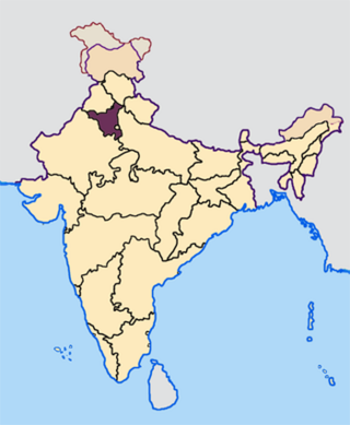
Shekhawati is a semi-arid historical region located in the northeast part of Rajasthan, India. The region was ruled by Shekhawat Rajputs. Shekhawati is located in North Rajasthan, comprising the districts of Jhunjhunu, parts of Sikar that lies to the west of the Aravalis and Churu. It is bounded on the northwest by the Jangladesh region, on the northeast by Haryana, on the east by Mewat, on the southeast by Dhundhar, on the south by Ajmer, and on the southwest by the Marwar region. Its area is 13784 square kilometers.

Loharu is a city, municipal committee and assembly constituency, near Bhiwani City in the Bhiwani district of the Indian state of Haryana. It is the administrative headquarters of one of the four administrative sub-divisions of the district and covers 119 villages. It is also a railway junction station.
Rajgarh, is a city, municipality, tehsil and Legislative Assembly seat in Churu district of northern part of Rajasthan state in India. It lies in Shekhawati region at an elevation of 239 metres (784 ft). To distinguish Rajgarh from several other places with same name, Sadulpur has become a synonym of Rajgarh town's name in recent times.
Nalwa is a village, as well as an Assembly Constituency in Haryana Legislative Assembly, located in Hisar district in the state of Haryana in India.

Tosham is a town and a Gram Panchayat on the foot of Tosham Hill range in Bhiwani district in the Indian state of Haryana. It has been awarded the title of "Adarsh Village". It is situated in the foothill of Tosham hill range of Aravali Mountain Range. The hill has several historic places, such as forts, carvings, paintings, temples, sacred ponds, dating as far back 1800 years. It is a rural area.
Kanwari, also spelled Kunwari, or Kwari, is a village of 7,000 population, in Hansi-I Tehsil, Hisar-1 Rural Development Block, Hansi and Hisar of Hisar District of Hisar Division in the Haryana state of India. It is part of the saat bas bhaichara grouping of 7 villages. The village has 4 panna/patti (subdivisions), named as Nangalia Panna , upparla Panna , parla Panna , etc. with a total revenue land area of 43903 kanal or 5487 acre as per HALRIS records.
Baloda is a village in the Indian state of Rajasthan. Its mandal is Surajgarh and district is Jhunjhunu. It is located 17.7 kilometres (11.0 mi) from Surajgarh, 54.2 kilometres (33.7 mi) from Jhunjhunu, and 157 kilometres (98 mi) from Jaipur.
Bidhwan is a village and administrative unit with a democratically elected panchayat samiti in the Loharu, Siwani Tehsil of Bhiwani District under Bhiwani-Mahendragarh Lok Sabha constituency and Hisar Division of Haryana state.
Balawas is a village in Hisar-1 Rural Development Block, Nalwa Chaudhry and Hisar of Hisar District of Hisar Division in the Haryana state of India.
Madhogarh is a village in Mahendragarh district, Haryana, India. It is located at the foot of Madhogarh Hill of Aravalli Mountain Range. Madhogarh Fort is on top of the hill.

Saharwa is a village in Hisar tehsil and district in Haryana, India, located on the Hisar-Isarwal road about 28 km from Hisar. It is situated at the boundary of the Hisar and Bhiwani districts. It also marks the onset of Thar desert. Saharwa village was established about 350 years ago in what was then Punjab province. The village has over the last decade become known for strawberry cultivation, and it is now the second largest producer of strawberries after Mahabaleshwar, Maharashtra. There is a small but locally revered temple of Khattu Shyamji. In 2013 the village was identified by the Geological Survey of India as having large reserves of gypsum.
Jamalpur is a village in the Bawani Khera tehsil and Bawani Khera of Bhiwani district in Haryana state of India. It lies approximately 8 kilometres (5.0 mi) north west of Bawani Khera and 25 kilometres (16 mi) south east of the district headquarters town of Bhiwani.

Khetri Mahal , also known as the Wind Palace, whose ruins are an example of palace architecture in the Indian state of Rajasthan.
Badya Jattan, next to Badyan Brahmnan, is a village of less than 7,000 population, in Hisar-1 Rural Development Block, Nalwa Chaudhry and Hisar of Hisar District of Hisar Division in the Haryana state of India.
Badya Brahmnan, next to Badya Jattan, is a village of less than 7,000 population, in Hisar-1 Rural Development Block, Nalwa Chaudhry and Hisar of Hisar District of Hisar Division in the Haryana state of India.
Kalali is a village and administrative unit with a democratically elected panchayat samiti in the Loharu, Siwani Tehsil of Bhiwani District under Bhiwani-Mahendragarh Lok Sabha constituency and Hisar Division of Haryana state.
Mandholi Kalan, next to Mandholi Khurd, Rambass situated 5 km from Mandholi Gopalwas, Kasni Kalan and Isharwal, is a village and administrative unit with a democratically elected panchayat samiti in the Loharu, Loharu Tehsil of Bhiwani District under Bhiwani-Mahendragarh Lok Sabha constituency and Hisar Division of Haryana state.
Mandholi Khurd, next to Mandholi Kalan, is a village and administrative unit with a democratically elected panchayat samiti in the Loharu, Siwani Tehsil of Bhiwani District under Bhiwani-Mahendragarh Lok Sabha constituency and Hisar Division of Haryana state.
Loharu Fort, built in 16th century, is a state protected archaeological monument in Loharu town in Haryana state of India. Fort is part of interstate Shekhawati region which lies on the either side of Haryana-Rajasthan border in the sandy bagar tract.
