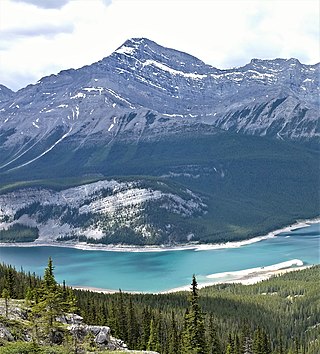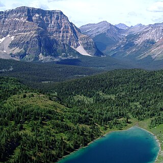
Mount Columbia is a mountain located in the Winston Churchill Range of the Rocky Mountains. It is the highest point in Alberta, Canada, and is second only to Mount Robson for height and topographical prominence in the Canadian Rockies. It is located on the border between Alberta and British Columbia on the northern edge of the Columbia Icefield. Its highest point, however, lies within Jasper National Park in Alberta.

Mount Hector is a 3,394-metre (11,135-foot) mountain summit located in the Bow River valley of Banff National Park, in the Canadian Rockies of Alberta, Canada. The mountain was named in 1884 by George M. Dawson after James Hector, a geologist on the Palliser expedition. The mountain is located beside the Icefields Parkway, 17 km (11 mi) north of Lake Louise.

Old Goat Mountain is a 3,120-metre (10,240 ft) mountain summit located in Kananaskis Country of Alberta, Canada.

The Monarch is a 2,895-metre (9,498-foot) mountain summit located in the Ball Range of the Canadian Rockies in British Columbia, Canada. The Monarch is situated on the boundary between Kootenay National Park and Mount Assiniboine Provincial Park, four kilometres to the west side of the Continental Divide. Although not visible from roads, The Monarch is a prominent feature seen from the slopes above Sunshine Village ski resort. Its nearest higher peak is Mount Bourgeau, 10.35 km (6.43 mi) to the north-northeast.

Rearguard Mountain is a 2,744-metre (9,003-foot) summit located within Mount Robson Provincial Park in British Columbia, Canada. It is part of the Rainbow Range which is a sub-range of the Canadian Rockies. Its nearest higher peak is Mount Robson, 4.0 km (2.5 mi) to the southwest. Rearguard is situated between Berg Lake and the Robson Glacier.

Wedgwood Peak is a 3,024-metre (9,921-foot) mountain summit located in Mount Assiniboine Provincial Park, in the Canadian Rockies of British Columbia, Canada. Its nearest higher peak is Mount Assiniboine, 2.0 km (1.2 mi) to the south. The mountain is situated northwest of Lake Magog and 1.0 km (0.62 mi) south of Sunburst Peaks.

The Marshall is a 3,180-metre (10,430-foot) mountain summit located in Mount Assiniboine Provincial Park, in the Canadian Rockies of British Columbia, Canada. Its nearest higher peak is Mount Assiniboine, 3.0 km (1.9 mi) to the east-southeast. The mountain is situated west of Wedgwood Peak.

Sunburst Peaks is a 2,849-metre (9,347-foot) mountain summit located in Mount Assiniboine Provincial Park, in the Canadian Rockies of British Columbia, Canada. Its nearest higher peak is Wedgwood Peak, 1.0 km (0.62 mi) to the south. The mountain is situated immediately southeast of Sunburst Lake, west of Lake Magog, and south of Cerulean Lake.

Mount Watson is a 2,955-metre (9,695-foot) mountain summit located in Mount Assiniboine Provincial Park, in the Canadian Rockies of British Columbia, Canada. The nearest higher peak is The Marshall, 2.0 km (1.2 mi) to the southeast.

Mount King George is a prominent 3,413-metre (11,198-foot) mountain summit located in Height of the Rockies Provincial Park, in the Canadian Rockies of British Columbia, Canada. The mountain is the highest point of The Royal Group, a subset of the Rockies, which includes Mount Queen Mary, Mount Princess Mary, Mount Prince George, Mount Prince Albert, Mount Prince Henry, Mount Prince John, and Mount Prince Edward. Its nearest higher peak is Mount Joffre, 16.0 km (9.9 mi) to the east. Mount King George is composed of sedimentary rock laid down during the Cambrian period. Formed in shallow seas, this sedimentary rock was pushed east and over the top of younger rock during the Laramide orogeny.

Mount Prince Henry is a remote 3,219-metre (10,561-foot) mountain summit located in Height of the Rockies Provincial Park, in the Canadian Rockies of British Columbia, Canada. The mountain is part of The Royal Group, a subset of the Rockies, which includes Mount King George, Mount Queen Mary, Mount Princess Mary, Mount Prince George, Mount Prince Albert, Mount Prince John, and Mount Prince Edward. Its nearest higher peak is Mount Prince Edward, 1.0 km (0.62 mi) to the south-southeast. Mt. Prince Henry is composed of sedimentary rock laid down during the Cambrian period. Formed in shallow seas, this sedimentary rock was pushed east and over the top of younger rock during the Laramide orogeny.

Barbette Mountain is 3,072-metre (10,079-foot) summit located on the shared border of Alberta and British Columbia, Canada.

Mount Ogden is a mountain in the Canadian Rockies of British Columbia, Canada.

Mount Anne-Alice is a mountain summit in the Canadian Rockies of British Columbia, Canada.

Nestor Peak is a 2,972-metre (9,751-foot) mountain summit located in Mount Assiniboine Provincial Park of British Columbia, Canada.

Indian Peak is a 2,992-metre (9,816-foot) mountain summit located in Mount Assiniboine Provincial Park of British Columbia, Canada.

Mount Shanks is a 2,838-metre (9,311-foot) mountain summit located in British Columbia, Canada.

Octopus Mountain is a 2,932-metre (9,619-foot) mountain summit located in Mount Assiniboine Provincial Park of British Columbia, Canada.

Mount Sam is a 2,871-metre (9,419-foot) mountain summit located in Mount Assiniboine Provincial Park of British Columbia, Canada.

Mount Swiderski is a 3,133-metre (10,279-foot) mountain summit in British Columbia, Canada.


