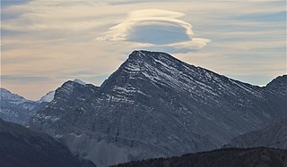
Mount Bishop is a mountain named in 1918 after W.A. "Billy" Bishop VC who was a Colonel and a Canadian fighter pilot awarded the Victoria Cross during World War I. It is located in the Elk Range of the Canadian Rockies and sits on the Continental Divide, which forms the British Columbia-Alberta border in this area.
Mount Morkill is located on the border of Alberta and British Columbia, near McBride which is a town in British Columbia, Canada. There is a subpeak to the southwest of the main peak, at an elevation of 2,185 m (7,169 ft) named The Gazetted Peak. It was named in 1965 after D.B. Morkill, a British Columbia land surveyor.
Mount Talbot is located on the northern side of Shale Pass on the Alberta-British Columbia border. It was officially named on 4 November 1925 after Senator Peter Talbot (1854-1919), an early pioneer of the Lacombe region of central Alberta. A teacher and farmer, he turned to politics and became an elected representative of the Northwest Territories and later the province of Alberta. In 1906, Sir Wilfrid Laurier appointed him to the Senate of Canada.
Mount Bess is located on the border of Alberta and British Columbia. It is the 83rd highest peak in Alberta. It was named in 1910 by J. Norman Collie after Bessie Gunn, who accompanied Collie's expedition.

Mount Phillips is a mountain located on the border of Jasper National Park (Alberta) and Mount Robson Provincial Park. It is Alberta's 61st highest peak, and British Columbia's 84th highest peak. It was named in 1923 by J. Norman Collie after Donald "Curly" Phillips, a Jasper area outfitter and guide who made the disputed first ascent of Mount Robson in 1909.
Mount McCord is located at the northern end of Miette Pass, NE side of Mount Robson Provincial Park on the Continental Divide marking the Alberta-British Columbia border. It was named in 1923 after W.C. McCord, a surveyor who led a Canadian Pacific Railway trail-making party in 1872.

Mount Fraser is a mountain located on the border of Alberta and British Columbia. It is Alberta's 38th highest peak and Alberta's 22nd most prominent mountain. It is also British Columbia's 50th highest peak. It was named in 1917 after Simon Fraser.
Mount Ross Cox is located north of the Hooker Icefield in Hamber Provincial Park and straddles the Continental Divide marking the Alberta-British Columbia border. It was named in 1920 after Ross Cox who traveled the area in 1817.
Mount Scott is located on the border of Alberta and British Columbia, North of the Hooker Icefield in Hamber Provincial Park. It is Alberta's 44th highest peak, and Alberta's 46th most prominence mountain. It is also British Columbia's 57th highest peak. It was named in 1913 after Captain Robert Falcon Scott.
Mount Ermatinger is located on the border of Alberta and British Columbia, NE of Kinbasket Lake. It was named in 1920 by Arthur O. Wheeler for Edward Ermatinger.
Mount Hooker is located on the border of Alberta and British Columbia, Canada. It was named in 1827 by David Douglas after William Jackson Hooker. Until the turn of the century, Mount Hooker and the nearby Mount Brown were thought to be the highest mountains in the Canadian Rockies.

Ernest Peak - a.k.a. Lyell 3, L3 or Mt. Lyell - is the central and highest peak of five distinct subpeaks on Mount Lyell (Canada) and is located on the border of Alberta and British Columbia.. It was named in 1972 by Sydney R. Vallance after Ernest Feuz Jr.

Mount Pilkington is located on the border of Alberta and British Columbia, between Mount Freshfield and Waitabit Peak. It was named in 1898 after Charles Pilkington. Mount Pilkington is located on the Continental Divide between the Campbell Icefield and the Freshfield Icefield.
Mount Bulyea is located in Banff National Park on the border of Alberta and British Columbia. It was named in 1920 after Hon. George H. V. Bulyea, a Canadian Pacific Railway employee and first Lieutenant Governor of Alberta.
Mount Barnard is located on the border of Alberta and British Columbia, NW of the head of Waitabit Creek and North of Golden. It is the 30th highest peak in Alberta and the 42nd highest peak in British Columbia. It was named in 1917 by boundary surveyors after Sir Francis Stillman Barnard, a Lieutenant Governor of BC during the 1910s. It should not be confused with the higher Californian peak of the same name.
Mount Little is situated at the northern end of Kootenay National Park, and straddles the Continental Divide marking the Alberta-British Columbia border. It was named in 1916 after George F. Little, a member of the first ascent party.
Mount King Albert is located on the border of Alberta and British Columbia on the Continental Divide at the North end of Height of the Rockies Provincial Park. It was named in 1918 after King Albert.

Mount Beatty is a mountain located on the border of Alberta and British Columbia on the Continental Divide. It was named in 1924 after David Beatty, a British naval officer of Irish ancestry who commanded ships in the First World War.
A mountain formerly known as Mount Pétain, but with no current official name, is located on the border of the Canadian provinces of Alberta and British Columbia (BC) on the Continental Divide.
Mount Dent is a summit that straddles the border between British Columbia and Alberta, Canada.


