
The Park Ranges, also known as the Main Ranges, are a group of mountain ranges in the Canadian Rockies of southeastern British Columbia and southwestern Alberta, Canada. It is one of the three main subranges and the most central of the Continental Ranges, extending from southeast of Mount McGregor to the Fernie Basin.
Mount Hooker is the name of several mountains worldwide:
Mount Morkill is located on the border of Alberta and British Columbia, near McBride which is a town in British Columbia, Canada. There is a subpeak to the southwest of the main peak, at an elevation of 2,185 m (7,169 ft) named The Gazetted Peak. It was named in 1965 after D.B. Morkill, a British Columbia land surveyor.
Mount Talbot is located on the northern side of Shale Pass on the Alberta-British Columbia border. It was officially named on 4 November 1925 after Senator Peter Talbot (1854-1919), an early pioneer of the Lacombe region of central Alberta. A teacher and farmer, he turned to politics and became an elected representative of the Northwest Territories and later the province of Alberta. In 1906, Sir Wilfrid Laurier appointed him to the Senate of Canada.
Mount Pauline is located on the south side of Beaverdam Pass on the Alberta-British Columbia border. It is the 26th most prominent in Alberta. It was named in 1925 after F.A. Pauline. The three slopes are covered in mostly metamorphic shale or slate, due to this it is unknown how difficult it would be to climb to the peak.
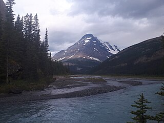
Mount Bess is located on the border of Alberta and British Columbia. It is the 83rd highest peak in Alberta. It was named in 1910 by J. Norman Collie after Bessie Gunn, who accompanied Collie's expedition.
Mount McCord is located at the northern end of Miette Pass, NE side of Mount Robson Provincial Park on the Continental Divide marking the Alberta-British Columbia border. It was named in 1923 after W.C. McCord, a surveyor who led a Canadian Pacific Railway trail-making party in 1872.

Mount Fraser is a mountain located on the border of Alberta and British Columbia. It is Alberta's 38th highest peak and Alberta's 22nd most prominent mountain. It is also British Columbia's 50th highest peak. It was named in 1917 after Simon Fraser.
Mount Ross Cox is located north of the Hooker Icefield in Hamber Provincial Park and straddles the Continental Divide marking the Alberta-British Columbia border. It was named in 1920 after Ross Cox who traveled the area in 1817.
Mount Scott is located on the border of Alberta and British Columbia, North of the Hooker Icefield in Hamber Provincial Park. It is Alberta's 44th highest peak, and Alberta's 46th most prominence mountain. It is also British Columbia's 57th highest peak. It was named in 1913 after Captain Robert Falcon Scott.
Mount Oates is a mountain located north of the Hooker Icefield, on the border of Alberta and British Columbia. It was named in 1913 by G.E. Howard for Captain Lawrence Oates a member of the ill-fated 1910-13 Terra Nova Expedition under command of Captain Robert F. Scott.
Mount Ermatinger is located on the border of Alberta and British Columbia, NE of Kinbasket Lake. It was named in 1920 by Arthur O. Wheeler for Edward Ermatinger.
Mount Conway is a mountain located on the border of Alberta and British Columbia. It was named in 1901 by J. Norman Collie after Martin Conway, an alpinist.
Mount Bulyea is located in Banff National Park on the border of Alberta and British Columbia. It was named in 1920 after Hon. George H. V. Bulyea, a Canadian Pacific Railway employee and first Lieutenant Governor of Alberta.
Mount Queen Elizabeth is located on the border of Alberta and British Columbia, directly east of Mount King Albert. It was named in 1916 by interprovincial boundary surveyors after Queen Elisabeth of Belgium. Note that Elisabeth is the correct spelling of her name.
Mount Little is situated at the northern end of Kootenay National Park, and straddles the Continental Divide marking the Alberta-British Columbia border. It was named in 1916 after George F. Little, a member of the first ascent party.
Mount King Albert is located on the border of Alberta and British Columbia on the Continental Divide at the North end of Height of the Rockies Provincial Park. It was named in 1918 after King Albert.
Mount McHarg is located in Height of the Rockies Provincial Park and straddles the Continental Divide marking the Alberta-British Columbia border. It was named in 1918 after Lieutenant Colonel William Frederick Richard Hart-McHarg, British Columbia Regiment. McHarg was a British Columbia lawyer who practised in Rossland, British Columbia before serving in the Boer War where he suffered near-fatal injuries. McHarg died in April 2015 while on a reconnaissance mission in World War I. Vancouver's Georgia Viaduct was originally named McHarg Viaduct.
Mount Cordonnier is located north of Mount Joffre in Height of the Rockies Provincial Park and straddles the Continental Divide marking the Alberta-British Columbia border. It was named in 1918 after General Victor Louis Emilien Cordonnier.
Mount Dent is a summit that straddles the border between British Columbia and Alberta, Canada.


