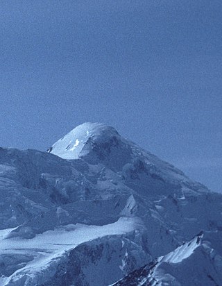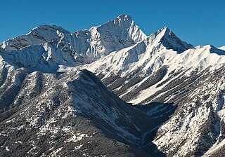
Mount Waddington, once known as Mystery Mountain, is the highest peak in the Coast Mountains of British Columbia, Canada. Although it is lower than Mount Fairweather and Mount Quincy Adams, which straddle the United States border between Alaska and British Columbia, Mount Waddington is the highest peak that lies entirely within British Columbia. It and the subrange which surround it, known as the Waddington Range, stand at the heart of the Pacific Ranges, a remote and extremely rugged set of mountains and river valleys.

Mount Robson is the most prominent mountain in North America's Rocky Mountain range; it is also the highest point in the Canadian Rockies. The mountain is located entirely within Mount Robson Provincial Park of British Columbia, and is part of the Rainbow Range. Mount Robson is the second highest peak entirely in British Columbia, behind Mount Waddington in the Coast Range. The south face of Mount Robson is clearly visible from the Yellowhead Highway, and is commonly photographed along this route.

Mount Assiniboine, also known as Assiniboine Mountain, is a pyramidal peak mountain on the Great Divide, on the British Columbia/Alberta border in Canada.

Mount Columbia is a mountain located in the Winston Churchill Range of the Rocky Mountains. It is the highest point in Alberta, Canada, and is second only to Mount Robson for height and topographical prominence in the Canadian Rockies. It is located on the border between Alberta and British Columbia on the northern edge of the Columbia Icefield. Its highest point, however, lies within Jasper National Park in Alberta.

Mount Alberta is a mountain located in the upper Athabasca River Valley of Jasper National Park, Alberta, Canada. J. Norman Collie named the mountain in 1898 after Princess Louise Caroline Alberta. It is the most difficult of the 11,000ers from a climbing point of view.

Mount Edith Cavell is a mountain in the Athabasca River and Astoria River valleys of Jasper National Park, and the most prominent peak entirely within Alberta.

Mount Temple is a mountain in Banff National Park of the Canadian Rockies of Alberta, Canada.

Mount Saint Elias, the second-highest mountain in both Canada and the United States, stands on the Yukon and Alaska border about 26 miles (42 km) southwest of Mount Logan, the highest mountain in Canada. The Canadian side of Mount Saint Elias forms part of Kluane National Park and Reserve, while the U.S. side of the mountain is located within Wrangell-St. Elias National Park and Preserve.

Mount Lucania in Yukon is the third-highest mountain in Canada, and the second-highest mountain located entirely within the country. A long ridge connects Mount Lucania with Mount Steele, the fifth-highest in Canada. Lucania was named by the Duke of Abruzzi, as he stood on the summit of Mount Saint Elias on July 31, 1897, having just completed the first ascent. Seeing Lucania in the far distance, beyond Mount Logan, he immediately named it "after the ship on which the expedition had sailed from Liverpool to New York," the RMS Lucania.

Mount Foraker is a 17,400-foot (5,304 m) mountain in the central Alaska Range, in Denali National Park, 14 mi (23 km) southwest of Denali. It is the second highest peak in the Alaska Range, and the third highest peak in the United States. It rises almost directly above the standard base camp for Denali, on a fork of the Kahiltna Glacier also near Mount Hunter in the Alaska Range.

Mount Kennedy is a peak in the Saint Elias Mountains within Kluane National Park, in Yukon, Canada. Its 4250-m to 4300-m (14000-foot) summit lies within 10 km of the Alaska Panhandle. Dusty Glacier lies against it to the north.

Mount Alverstone or Boundary Peak 180, is a high peak in the Saint Elias Mountains, on the border between Alaska and Yukon. It shares a large massif with the higher Mount Hubbard to the south and the slightly lower Mount Kennedy to the east. The summit of Mount Alverstone marks a sharp turn in the Alaska/Canada border; the border goes south from this point toward the Alaska panhandle and west toward Mount Saint Elias.
Mount Natazhat is a high peak of the Saint Elias Mountains, of Alaska, United States, just west of the border with the Yukon Territory of Canada. It lies on the northern edge of the range, south of the White River and north of the Klutlan Glacier. Mount Natazhat is a little-noticed peak; however it is a very large peak in terms of rise above local terrain. It rises 9,000 feet (2,743 m) in less than 7 miles (11.3 km) above the lowlands to the north, and 7,500 feet (2,286 m) in about 4 miles (6.4 km) above the Klutlan Glacier to the south.

Mount Stanley Baldwin is a mountain located in the Premier Range of the Cariboo Mountains in the east-central interior of British Columbia, Canada. The mountain is located at the head of the Gilmour Glacier. It was originally named Mount Challenger by Allen Carpé during his 1924 ascent of the mountain.

Mount Emmons is a mountain located in the Adirondack Mountains near the southern edge of Franklin County, New York, United States.
ḵ’els is a mountain located at the head of lekw’emin above the ancestral shíshálh village site of x̱enichen and within the Pacific Ranges of the Coast Mountains of British Columbia, Canada. The mountain is associated with a shíshálh legend about a great flood.

Mount Sir Donald is a 3,284-metre (10,774-foot) mountain summit located in the Rogers Pass area of Glacier National Park in the Selkirk Mountains of British Columbia, Canada. Its good rock quality and classic Matterhorn shape make it popular for alpine rock climbers, and the Northwest Arete route is included in the popular book Fifty Classic Climbs of North America.

Resplendent Mountain, or Mount Resplendent is a peak in the Canadian Rockies, located at the northern end of Mount Robson Provincial Park in British Columbia, Canada. It is a part of the Rainbow Range, and is a sister peak to the more famous Mount Robson, its nearest neighbour. Together they form a classic panorama seen by travellers on Via Rail trains and Highway 16. The mountain was named by Arthur P. Coleman, and Arthur O. Wheeler wrote, "On the east side it is clad from top to bottom in pure white snow, and presents with the sun shining upon it a spectacle of such wonderful brilliance that the aptness of the name became immediately apparent." The first ascent was achieved on the same historic 1911 trip in which Conrad Kain first scouted the climbing routes later to be used on the first ascent of Mount Robson.

Mount Nelson is a prominent 3,313-metre (10,869-foot) mountain summit located in the Purcell Mountains of southeast British Columbia, Canada. It is situated on the west side of Rocky Mountain Trench, 23 km (14 mi) west of Invermere, and 8 km (5.0 mi) west of Panorama Mountain Resort. Sitting atop the peak is a 5 foot tall aluminum cross that marks the summit and acts as a storage unit for the summit register. It was built and erected in 1986 by the Kloos family out of Invermere, BC.

Franklin Glacier is a mountain glacier in the Waddington Range of the Pacific Ranges in southwestern British Columbia, Canada. It lies at the head of the Franklin River adjacent to Mount Waddington, the highest mountain entirely within British Columbia.


