
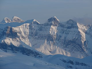
Mount Columbia is a mountain located in the Winston Churchill Range of the Rocky Mountains. It is the highest point in Alberta, Canada, and is second only to Mount Robson for height and topographical prominence in the Canadian Rockies. It is located on the border between Alberta and British Columbia on the northern edge of the Columbia Icefield. Its highest point, however, lies within Jasper National Park in Alberta.

Mount Bryce is a mountain at the southwestern corner of the Columbia Icefield, in British Columbia, Canada, near the border with Alberta. It can be seen from the Icefields Parkway.
Mount Gorman is located on the border of Alberta and British Columbia. It was named in 1925 after A.O. Gorman, a government surveyor with the Dominion Land Survey.
Mount Morkill is located on the border of Alberta and British Columbia, near McBride which is a town in British Columbia, Canada. There is a subpeak to the southwest of the main peak, at an elevation of 2,185 m (7,169 ft) named The Gazetted Peak. It was named in 1965 after D.B. Morkill, a British Columbia land surveyor.
Mount Talbot is located on the northern side of Shale Pass on the Alberta-British Columbia border. It was officially named on 4 November 1925 after Senator Peter Talbot (1854-1919), an early pioneer of the Lacombe region of central Alberta. A teacher and farmer, he turned to politics and became an elected representative of the Northwest Territories and later the province of Alberta. In 1906, Sir Wilfrid Laurier appointed him to the Senate of Canada.

Mount Phillips is a mountain located on the border of Jasper National Park (Alberta) and Mount Robson Provincial Park. It is Alberta's 61st highest peak, and British Columbia's 84th highest peak. It was named in 1923 by J. Norman Collie after Donald "Curly" Phillips, a Jasper area outfitter and guide who made the disputed first ascent of Mount Robson in 1909.

Paragon Peak is located at the southern end of Mount Robson Provincial Park on the border of Alberta and British Columbia in Canada. It was named in 1921 by Howard Palmer.

Simon Peak is located on the border of Alberta and British Columbia, at the Southern end of Mount Robson Provincial Park. It is the highest peak of Mount Fraser. It was named in 1920 by the Alberta-British Columbia Boundary Commission.
Mount Ross Cox is located north of the Hooker Icefield in Hamber Provincial Park and straddles the Continental Divide marking the Alberta-British Columbia border. It was named in 1920 after Ross Cox who traveled the area in 1817.
Mount Oates is a mountain located north of the Hooker Icefield, on the border of Alberta and British Columbia. It was named in 1913 by G.E. Howard for Captain Lawrence Oates a member of the ill-fated 1910-13 Terra Nova Expedition under command of Captain Robert F. Scott.
Mount Spring-Rice is located on the border of Alberta and British Columbia, south of Thompson Pass. It was named in 1918 by Arthur O. Wheeler after the British diplomat, Sir Cecil Spring Rice.
Mount Synge is located NE of the head of the Blaeberry River and straddles the Continental Divide marking the Alberta-British Columbia border. It was named in 1918 after Captain Millington Henry Synge (1823–1907), British Army officer and author.

Mount Pilkington is located on the border of Alberta and British Columbia, between Mount Freshfield and Waitabit Peak. It was named in 1898 after Charles Pilkington. Mount Pilkington is located on the Continental Divide between the Campbell Icefield and the Freshfield Icefield.
Mount Low is located on the border of Alberta and British Columbia. It was named in 1920 after the Canadian geologist and explorer A. P. Low
Mount Barnard is located on the border of Alberta and British Columbia, NW of the head of Waitabit Creek and North of Golden. It is the 30th highest peak in Alberta and the 42nd highest peak in British Columbia. It was named in 1917 by boundary surveyors after Sir Francis Stillman Barnard, a Lieutenant Governor of BC during the 1910s. It should not be confused with the higher Californian peak of the same name.
Mount Helmer is located on the border of Alberta and British Columbia, East of Waitabit Creek and North of Golden. It was named in 1924 after Brigadier-General Richard Alexis Helmer (1864-1920) and his son Alexis Helmer (1892-1915) were killed in battle and was part of the inspiration for In Flanders Fields through his friendship with John McCrae. It is the 194th highest mountain in Alberta and the 355th highest mountain in Canada.

Mount Olive is located N of the head of the Yoho River on the Continental Divide, on the Alberta-British Columbia border, in both Banff National Park and Yoho National Park. It lies on the eastern edge of the Wapta Icefield, and is part of the Waputik Mountains. It was named in 1898 by H.B. Dixon after his wife Dixon, Olive.
Mount Little is situated at the northern end of Kootenay National Park, and straddles the Continental Divide marking the Alberta-British Columbia border. It was named in 1916 after George F. Little, a member of the first ascent party.
A mountain formerly known as Mount Pétain, but with no current official name, is located on the border of the Canadian provinces of Alberta and British Columbia (BC) on the Continental Divide.
Mount Mangin is located on the border of Alberta and British Columbia on the Continental Divide. It was named in 1918 after French general Charles Mangin.


