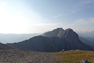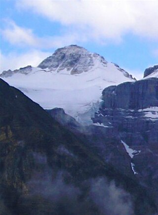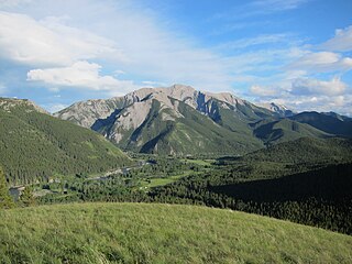
Mount Columbia is a mountain located in the Winston Churchill Range of the Rocky Mountains. It is the highest point in Alberta, Canada, and is second only to Mount Robson for height and topographical prominence in the Canadian Rockies. It is located on the border between Alberta and British Columbia on the northern edge of the Columbia Icefield. Its highest point, however, lies within Jasper National Park in Alberta.

Mount Bryce is a mountain at the southwestern corner of the Columbia Icefield, in British Columbia, Canada, near the border with Alberta. It can be seen from the Icefields Parkway.

Mount Brazeau is a mountain in Alberta, Canada.

The Sawback Range is a mountain range of the Canadian Rockies that stretches from the Bow Valley in Alberta into southeastern Banff National Park.

The Clark Range is a mountain range that forms part of the Continental Divide and also the boundary between the Canadian provinces of Alberta and British Columbia. A small portion of the range extends into the far northwestern section of Glacier National Park, Montana, United States. It is the easternmost of the Border Ranges subdivision of the Canadian Rockies. The range is named for Captain William Clark of the Lewis and Clark Expedition.
The Victoria Cross Ranges are a set of mountain ranges in the Canadian Rockies, located to the northwest of Jasper. Of the 19 peaks contained within this range, five are named after Canadian recipients of the Victoria Cross. The area of the ranges is 678 square kilometres (262 sq mi).

The Fiddle Range is a mountain range of the Canadian Rockies located south of Highway 16 on the east border of Jasper National Park, Canada.

The Jacques Range is a mountain range in the Front Ranges of the Canadian Rockies, located south of Highway 16 and Jasper Lake in Jasper National Park, Alberta, Canada.

Mount Lyell is a mountain on the Alberta–British Columbia border in western Canada. Comprising five distinct summits, Mount Lyell reaches a height of 3,498 m (11,476 ft). The mountain was named by James Hector in 1858 in recognition of Scottish geologist Sir Charles Lyell.

Mount Ishbel is a mountain peak in Banff National Park of Alberta, Canada. The peak is located in the Sawback Range in Alberta's Rockies, north of the Bow Valley Parkway and east of Johnston Canyon.

Mount Fraser is a mountain located on the border of Alberta and British Columbia. It is Alberta's 38th highest peak and Alberta's 22nd most prominent mountain. It is also British Columbia's 50th highest peak. It was named in 1917 after Simon Fraser.
Chaba Peak is located in the Chaba Icefield south of Fortress Lake in Hamber Provincial Park on the Continental Divide marking the Alberta-British Columbia border. It was named in 1920 after the Chaba River by the Interprovincial Boundary Survey. Chaba is the Stoney Indian word for beaver.

Ernest Peak - a.k.a. Lyell 3, L3 or Mt. Lyell - is the central and highest peak of five distinct subpeaks on Mount Lyell (Canada) and is located on the border of Alberta and British Columbia.. It was named in 1972 by Sydney R. Vallance after Ernest Feuz Jr.
Mount Barnard is located on the border of Alberta and British Columbia, NW of the head of Waitabit Creek and North of Golden. It is the 30th highest peak in Alberta and the 42nd highest peak in British Columbia. It was named in 1917 by boundary surveyors after Sir Francis Stillman Barnard, a Lieutenant Governor of BC during the 1910s. It should not be confused with the higher Californian peak of the same name.

Mount Little is situated at the northern end of Kootenay National Park, and straddles the Continental Divide marking the Alberta-British Columbia border. It was named in 1916 after George F. Little, a member of the first ascent party.

Wenkchemna Peak is located on the SE ridge coming off of Mount Hungabee on the border of Alberta and British Columbia. It was named in 1894 by Samuel E. S. Allen for the Stoney Indian word for ten.

The Sundance Range is a mountain range in the Canadian Rockies, south of the town of Banff. It is located on the Continental Divide, which forms the boundary between British Columbia and Alberta in this region.

The Livingstone Range is a sub-range of the Canadian Rockies in Alberta, Canada. It forms the eastern boundary of the Rockies in the south of the province. Its northern boundary is the Highwood River and it extends to Crowsnest Pass in the south. The Livingstone and Oldman Rivers bound it to the west.

Resplendent Mountain, or Mount Resplendent is a peak in the Canadian Rockies, located at the northern end of Mount Robson Provincial Park in British Columbia, Canada. It is a part of the Rainbow Range, and is a sister peak to the more famous Mount Robson, its nearest neighbour. Together they form a classic panorama seen by travellers on Via Rail trains and Highway 16. The mountain was named by Arthur P. Coleman, and Arthur O. Wheeler wrote, "On the east side it is clad from top to bottom in pure white snow, and presents with the sun shining upon it a spectacle of such wonderful brilliance that the aptness of the name became immediately apparent." The first ascent was achieved on the same historic 1911 trip in which Conrad Kain first scouted the climbing routes later to be used on the first ascent of Mount Robson.

The Flathead Range is a mountain range of the Canadian Rockies in Alberta and British Columbia, Canada. It is located on the Continental Divide, east of Fernie, in the Kootenay Land District. It stretches 27 km (17 mi) lengthwise north–south from Crowsnest Pass to North Kootenay Pass. The range's toponym was officially adopted on 30 June 1912 by the Geographic Board of Canada, and was named in association with the Flathead River.


