The Appalachian Trail, also called the A.T., is a hiking trail in the Eastern United States, extending almost 2,200 miles (3,540 km) between Springer Mountain in Georgia and Mount Katahdin in Maine, and passing through 14 states. The Appalachian Trail Conservancy claims the Appalachian Trail to be the world's longest hiking-only trail. More than three million people hike segments of it each year.

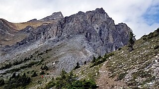
Mount Temple is a mountain in Banff National Park of the Canadian Rockies of Alberta, Canada.

The Hoosier National Forest is a property managed by the United States Forest Service in the hills of southern Indiana. Composed of four separate sections, it has a total area of 204,303 acres. Hoosier National Forest's headquarters are located in Bedford, with a regional office in Tell City. Prominent places within the Forest include the Lick Creek Settlement, Potts Creek Rockshelter Archeological Site, and Jacob Rickenbaugh House.

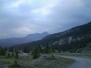
Mount Cory is a mountain located in the Bow River Valley in southeast Banff National Park, just north of Banff, Alberta, Canada. The mountain was named in 1923 after William Wallace Cory, deputy minister of the Interior from 1905 to 1930.

Kowloon Peak, also known as Fei Ngo Shan, is a 1,975-foot-tall (602 m) mountain in the northeast corner of New Kowloon, Hong Kong, situated in Ma On Shan Country Park. With the summit located just to the east of the border between Wong Tai Sin and Sai Kung districts, it is the tallest mountain in Kowloon, and is crossed by both the Wilson Trail and the MacLehose Trail.

Sheyenne National Grassland is a National Grassland located in southeastern North Dakota in the United States, comprising 70,446 acres (28,508 ha) of public land amid 64,769 acres (26,211 ha) of privately owned land in a region of sandy soils in the vicinity of the Sheyenne River in Ransom and Richland Counties. It is the only National Grassland in the tallgrass prairie region of the U.S. The grassland provides habitat for the largest population of greater prairie chickens in North Dakota, as well as the Dakota skipper butterfly, the western prairie fringed orchid, and numerous ferns, as well as grazing land for approximately 83 cattle ranchers.

Prairie Creek Redwoods State Park is a state park, located in Humboldt County, California, near the town of Orick and 50 miles (80 km) north of Eureka. The 14,000 acres (57 km2) park is a coastal sanctuary for old-growth Coast Redwood trees.

Blue Mountain Peak is the highest mountain in Jamaica and one of the highest peaks in the Caribbean at 2,256 metres (7,402 ft), and the highest one outside of Hispaniola. It is the home of Blue Mountain coffee. It is located on the border of the Portland and Saint Thomas parishes of Jamaica.

High West or Sai Ko Shan, is a mountain on Hong Kong Island with a height of 494 m (1,621 ft)

Black Rock Mountain is a mountain on the eastern fringe of the Canadian Rockies in Alberta, Canada. Black Rock Mountain was descriptively named.

Mount Major is a mountain located in Alton, New Hampshire, south of Lake Winnipesaukee and northeast of Straightback Mountain in the Belknap Range.

Indian Head Mountain is a 3,573 ft (1,089 m) mountain located in the southeast corner of Greene County, New York. The mountain, named for the appearance of its profile, is part of the Devil's Path range of the Catskill Mountains. To the northwest, Indian Head is separated from Twin Mountain by Jimmy Dolan Notch; to the southeast, Indian Head is flanked by Plattekill Mountain.
Dewdney Peak, also known unofficially as Hatzic Mountain, is the southwesternmost summit of the Douglas Ranges in the Lower Mainland of southern British Columbia, Canada. Dewdney Peak is located east of Hatzic Prairie and north of Dewdney, British Columbia, from whence it got its name.

The Ochoco Mountains are a mountain range in central Oregon in the United States, located at the western end of the Blue Mountains. They were formed when Permian, Triassic, and Jurassic rocks were slowly uplifted by volcanic eruptions to form the Clarno Formation. Today, the highest point in the range is Lookout Mountain. The dominant vegetation on the west side of the range is old-growth ponderosa pine; on the east side, western juniper is common. The western area of the mountains is administered by the Ochoco National Forest, while the southeastern section is part of the Malheur National Forest. The Ochoco Mountains draw visitors for hiking, camping, bird watching, rockhounding, and hunting, as well as cross-country skiing in the winter.
Ashokan High Point or High Point is a 3,081 feet (939 m) summit in the Catskill Mountains of New York. High Point is the loftiest part of a massif that includes the adjacent Mombaccus Mountain, Little Rocky and South Mountain. The summit can be accessed via the Kanape Brook Trail, which ascends from Ulster County Road 42 to the saddle between High Point and Mombaccus. This trail, named for 19th-century farmer John Canape, was formerly a wagon track connected to the present-day Freeman Avery Road on the south side of the mountain, providing a route between Watson Hollow and Samsonville in the days of the Catskills tanneries. The Gazetteer and Business Directory of Ulster County, N. Y. For 1871-2 referred to the peak as "Shokan Point". It was also known as "Samson," after the Catskill tannery owner for whom Samsonville was named, and is so identified on a 1942 United States Coast and Geodetic Survey benchmark at the summit. Nowadays, Samson Mountain is the name given to a nearby peak above the upper reaches of Rondout Creek.

The Soldier Mountains are a mountain range in the U.S. state of Idaho, spanning northern Camas and eastern Elmore counties. The highest point in the range is Smoky Dome at 10,095 feet (3,077 m), and the range is bounded on the west and north by the South Fork Boise River. The mountains are located within Sawtooth National Forest north of Fairfield, Idaho. The Soldier Mountain Ski Area is located within the range to the east of Smoky Dome.

Ross Prairie State Forest is a 3,527-acre state forest in Marion County, Florida. The conservation land was acquired in 1995 through the Conservation and Recreation Lands (CARL) with funds from the Preservation 2000 Act. It includes hiking and horseback trails. There is also a trailhead for the Cross Florida Greenway.

West Buffalo Hill or Wong Ngau Shan (黃牛山) is a 604-metre-high (1982-ft) hill within Ma On Shan Country Park, New Territories, Hong Kong. It lies directly west of Buffalo Hill, thus receiving its name. Stage 4 of the MacLehose Trail passes through the hill.

The Twins, also officially known as Ma Kong Shan, are a pair of mountains in southern Hong Kong. They are a popular destination for hikers and fitness enthusiasts as part of the rigorous Violet Hill-The Twins Hike on Hong Kong Island. Hiking up The Twins involves walking up a long steep set of stairs featuring more than 1000 steps straight up.

Lake Arrowhead State Park is a state park located in Clay County, Texas, near Wichita Falls. The park is 524 acres (212 ha).


